 collection: flickr2
num_gcps: 16
center: 72.463827,-89.644939
user_name: elya, [Will Bermingham]
date_time: 03/28/2015 07:20
View this map in ...

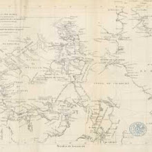
Architecture diagram for Genoan cathedral? [user-supplied]
collection: flickr2num_gcps: 8
center: 44.402047,8.934967
user_name: Sarah Shepherd, Ian Pritchard, [Ian Pritchard]
date_time: 01/17/2016 14:14
View this map in ...

Plan of the Mosque el Aksah [Al-Aqsa Mosque] at Jerusalem - publ.1865 [user-supplied]
collection: flickr2num_gcps: 7
center: 31.776128,35.235936
user_name: Ruth O'Leary, Chris Austin, [Chris Austin]
date_time: 08/04/2015 11:56
View this map in ...

England and Wales map [user-supplied]
collection: flickr2num_gcps: 27
center: 53.225348,-1.546067
user_name: mauricen, Ian Pritchard, [Ian Pritchard]
date_time: 01/10/2016 15:11
View this map in ...

The lake reservoir of Settons [user-supplied]
collection: flickr2num_gcps: 17
center: 47.190643,4.040936
user_name: Ruth O'Leary, Ian Pritchard, [Ian Pritchard]
date_time: 01/17/2016 16:29
View this map in ...

Llandudno and region, Wales [user-supplied]
collection: flickr2num_gcps: 17
center: 53.316615,-3.824284
user_name: Sarah Shepherd, Benjamin G, Ian Pritchard, [Will Bermingham]
date_time: 01/07/2016 08:39
View this map in ...
 collection: flickr2
num_gcps: 4
center: -27.366445,23.436551
user_name: Sarah Shepherd, [Will Bermingham]
date_time: 03/27/2015 21:22
View this map in ...

Drainage Map of East Fen, Mid-Lincolnshire c.1825 - publ. 1882 [user-supplied]
collection: flickr2num_gcps: 9
center: 53.106713,0.088914
user_name: imeikle, Chris Austin, [Chris Austin]
date_time: 11/18/2015 14:56
View this map in ...

Quarre-les-Tombes, 1700 [user-supplied]
collection: flickr2num_gcps: 9
center: 47.368982,3.996753
user_name: Sarah Shepherd, Henry Faire, Ian Pritchard, Benjamin Guichard, James Ball, Nigel Slack, Benjamin G, [Ian Pritchard]
date_time: 02/24/2016 21:09
View this map in ...

The north part of Turkey in Europe. Slavonia &c 1715 [user-supplied]
collection: flickr2num_gcps: 17
center: 44.393294,22.306192
user_name: Ruth O'Leary, Benjamin G, Ian Pritchard, [Ian Pritchard]
date_time: 01/17/2016 12:01
View this map in ...
 collection: flickr2
num_gcps: 8
center: 42.394956,44.026761
user_name: Colin Ridley, [Will Bermingham]
date_time: 03/28/2015 08:32
View this map in ...

Map of the delta of the Ganges and Brahmapootra [Brahmaputra River] [user-supplied]
collection: flickr2num_gcps: 8
center: 24.331072,86.898587
user_name: Ruth O'Leary, [Ian Pritchard]
date_time: 03/27/2015 21:17
View this map in ...

Pommiers Castle, Guienne, France [user-supplied]
collection: flickr2num_gcps: 8
center: 44.682212,-0.085668
user_name: Ruth O'Leary, Ian Pritchard, [Ian Pritchard]
date_time: 01/16/2016 12:01
View this map in ...
 collection: flickr2
num_gcps: 18
center: 51.185717,3.574496
user_name: Benjamin G, Ian Pritchard, [Ian Pritchard]
date_time: 01/10/2016 13:20
View this map in ...

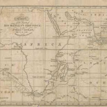
Cape of Good Hope map [user-supplied]
collection: flickr2num_gcps: 5
center: -34.070364,18.509933
user_name: mauricen, [Ian Pritchard]
date_time: 03/30/2015 11:46
View this map in ...

wine map of Hungary [user-supplied]
collection: flickr2num_gcps: 13
center: 46.972903,20.718528
user_name: mauricen, Becky Shorter, Ian Pritchard, [Ian Pritchard]
date_time: 02/20/2016 12:44
View this map in ...

South Carolina map [user-supplied]
collection: flickr2num_gcps: 7
center: 34.177080,-79.907135
user_name: mauricen, Sally, Ian Pritchard, [Ian Pritchard]
date_time: 02/20/2016 12:40
View this map in ...

The Cape Verde Islands [user-supplied]
collection: flickr2num_gcps: 6
center: 15.979664,-24.012288
user_name: Astha Devra, [Ian Pritchard]
date_time: 03/30/2015 12:14
View this map in ...

Lake Garda [user-supplied]
collection: flickr2num_gcps: 6
center: 45.638748,10.702428
user_name: Astha Devra, [Ian Pritchard]
date_time: 03/30/2015 12:01
View this map in ...

[Map of Africa, Europe and the Middle East] [user-supplied]
collection: flickr2num_gcps: 36
center: 1.481134,13.811233
user_name: Susan Major, Ian Pritchard, Becky Shorter, Benjamin G, [Ian Pritchard]
date_time: 02/24/2016 07:59
View this map in ...

Map to illustrate the State of the East when Rome began to interfere [user-supplied]
collection: flickr2num_gcps: 28
center: 35.749632,33.514701
user_name: Susan Major, [Ian Pritchard]
date_time: 03/30/2015 12:12
View this map in ...
 collection: flickr2
num_gcps: 22
center: -3.990790,36.305184
user_name: relet, Ian Pritchard, [Ian Pritchard]
date_time: 02/14/2016 21:05
View this map in ...
 collection: flickr2
num_gcps: 4
center: 50.927488,6.959506
user_name: relet, Benjamin G, [Ian Pritchard]
date_time: 02/24/2016 21:09
View this map in ...
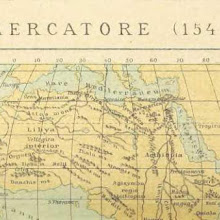
Mercatore (1541) [Map of North Africa] [user-supplied]
collection: flickr2num_gcps: 18
center: 19.505877,16.840342
user_name: Susan Major, Ian Pritchard, [Ian Pritchard]
date_time: 02/15/2016 22:08
View this map in ...
 collection: flickr2
num_gcps:
center:
user_name:
date_time:
View this map in ...
 collection: flickr2
num_gcps: 9
center: 43.552554,64.140079
user_name: Michael Ammon, Benjamin G, Henry Faire, [Ian Pritchard]
date_time: 03/15/2016 09:08
View this map in ...
 collection: flickr2
num_gcps: 35
center: 20.950528,79.726151
user_name: mauricen, [Ian Pritchard]
date_time: 03/31/2015 21:40
View this map in ...

A NEW PLAN OF LONDON AND WESTMINSTER WITH THE BOROUGH OF SOUTHWARK 222
collection: phase2num_gcps: 5
center: 51.511604,-0.105351
user_name: Dan Karran, Ian Pritchard, [Ian Pritchard]
date_time: 10/19/2013 22:51
View this map in ...

Djibouti & Gulf of Tadjoura 1889 [user-supplied]
collection: flickr2num_gcps: 9
center: 11.662765,42.805147
user_name: loverofchaos, Ian Pritchard, [Ian Pritchard]
date_time: 03/15/2016 07:55
View this map in ...

Dalmacija - Dalmazia - Dalmatien [user-supplied]
collection: flickr2num_gcps: 51
center: 44.744289,14.450304
user_name: Michael Ammon, Ian Pritchard, [Ian Pritchard]
date_time: 03/11/2016 21:52
View this map in ...

The Lake Region of Africa [user-supplied]
collection: flickr2num_gcps: 12
center: -8.375979,26.191983
user_name: Michael Ammon, [Ian Pritchard]
date_time: 03/31/2015 21:54
View this map in ...
 collection: flickr2
num_gcps: 21
center: 39.631106,-78.970606
user_name: Benjamin G, Nigel Slack, [Ian Pritchard]
date_time: 03/22/2016 19:41
View this map in ...
 collection: flickr2
num_gcps: 4
center: 46.797805,-71.232071
user_name: April B., Ian Pritchard, [Ian Pritchard]
date_time: 03/19/2016 11:59
View this map in ...
 collection: flickr2
num_gcps: 22
center: 2.001728,20.325619
user_name: mauricen, [Ian Pritchard]
date_time: 03/31/2015 21:26
View this map in ...

Map of the Route through the Yefren, Ghurian,Tahona & Mesellata Mts [user-supplied]
collection: flickr2num_gcps: 10
center: 32.445242,13.314497
user_name: Michael Wallace, Ian Pritchard, Benjamin G, [Ian Pritchard]
date_time: 03/15/2016 08:24
View this map in ...

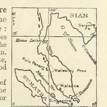
H.M. Naval Base, Singapore. Dockyard area as at January 1942.
collection: worldwidenum_gcps: 9
center: 1.463419,103.828720
user_name: Eric Sehr, Ian Pritchard, [Ian Pritchard]
date_time: 10/19/2013 08:21
View this map in ...

Fort Anglais, Mirebalais, Haiti [user-supplied]
collection: flickr2num_gcps: 7
center: 18.828112,-72.098141
user_name: loverofchaos, Benjamin G, Ian Pritchard, Henry Faire, Nigel Slack
date_time: 03/22/2016 18:19
View this map in ...
 collection: flickr2
num_gcps: 4
center: 49.238568,2.884825
user_name: tonii, Will Bermingham, Henry Faire, [Ian Pritchard]
date_time: 03/15/2016 16:17
View this map in ...
 collection: flickr2
num_gcps: 30
center: 40.285876,123.452339
user_name: Michael Ammon, Ian Pritchard, Benjamin G, [Ian Pritchard]
date_time: 03/14/2016 21:51
View this map in ...

Maps and tables of chronology and genealogy; selected and translated from Monsieur Koch's “Tableau des Révolutions de l'Europe.” [By C. T. L., i.e. Charles Thomas Longley? afterwards Archbishop of York.]
collection: flickrnum_gcps: 6
center: 49.320103,15.561097
user_name: John Layt, [Chris Austin]
date_time: 07/09/2014 11:14
View this map in ...

Abbeye de Saint Gall, St Gallen, Switzerland [user-supplied]
collection: flickr2num_gcps: 5
center: 47.422951,9.376809
user_name: loverofchaos, [Ian Pritchard]
date_time: 04/01/2015 09:55
View this map in ...
 collection: flickr2
num_gcps: 28
center: 47.292905,1.961961
user_name: April B., Ian Pritchard, [Ian Pritchard]
date_time: 03/12/2016 11:29
View this map in ...
 collection: flickr2
num_gcps: 60
center: 8.776994,103.128412
user_name: meganpozzi, Ian Pritchard, [Ian Pritchard]
date_time: 03/21/2016 09:18
View this map in ...
Jamestown to Plymouth Coast, United States [user-supplied]
collection: flickr2num_gcps: 6
center: 39.755165,-73.817523
user_name: Sharyn, [Ian Pritchard]
date_time: 04/01/2015 05:26
View this map in ...

Memorials of the Old Square: being some notices of the Priory of St. Thomas in Birmingham ... also of the Square built upon the Priory Close, etc. [With illustrations.] L.P
collection: flickrnum_gcps: 7
center: 52.481984,-1.895021
user_name: Brian, Chris Austin, [Chris Austin]
date_time: 07/17/2014 16:32
View this map in ...
 collection: flickr2
num_gcps:
center:
user_name:
date_time:
View this map in ...

Barre du Coatzacoalcos [user-supplied]
collection: flickr2num_gcps: 5
center: 18.144790,-94.407892
user_name: April B., Ian Pritchard, Benjamin G, Nigel Slack, Michael Ammon, [Ian Pritchard]
date_time: 04/06/2016 06:35
View this map in ...
 collection: flickr2
num_gcps: 39
center: 57.040645,-3.288436
user_name: mauricen, [Ian Pritchard]
date_time: 03/31/2015 22:24
View this map in ...
 collection: flickr2
num_gcps: 11
center: 48.488464,14.017145
user_name: mauricen, [Ian Pritchard]
date_time: 03/31/2015 22:00
View this map in ...

[Our own country. Descriptive, historical, pictorial.]
collection: flickrnum_gcps: 8
center: 52.070097,-2.334044
user_name: James Atkinson, Chris Austin, [Chris Austin]
date_time: 07/17/2014 15:41
View this map in ...
 collection: flickr2
num_gcps: 5
center: 9.353651,-79.899034
user_name: Ruski73, Ian Pritchard
date_time: 03/19/2016 11:24
View this map in ...
 collection: flickr2
num_gcps: 13
center: 45.819070,8.829727
user_name: Sharyn, Ian Pritchard, [Ian Pritchard]
date_time: 03/12/2016 11:57
View this map in ...

Map of Swansea [user-supplied]
collection: flickr2num_gcps: 13
center: 51.592866,-3.884879
user_name: Susan Major, [Ian Pritchard]
date_time: 03/31/2015 22:06
View this map in ...

Map of Part of Belgium with French Frontiers of 1815 to Illustrate Campaign of Waterloo [user-supplied]
collection: flickr2num_gcps: 80
center: 50.524136,4.480882
user_name: Michael Ammon, Ian Pritchard, [Ian Pritchard]
date_time: 03/12/2016 12:13
View this map in ...

Departement des Vosges (West) 1887 [user-supplied]
collection: flickr2num_gcps: 7
center: 48.181638,5.859547
user_name: loverofchaos, Ian Pritchard, [Ian Pritchard]
date_time: 03/19/2016 11:36
View this map in ...
 collection: flickr2
num_gcps:
center:
user_name:
date_time:
View this map in ...
 collection: flickr2
num_gcps:
center:
user_name:
date_time:
View this map in ...
 collection: flickr2
num_gcps: 5
center: 49.105833,0.216838
user_name: April B., mlayzell, [Ian Pritchard]
date_time: 03/22/2016 08:07
View this map in ...

Germany 1:25,000, Geldern
collection: worldwidenum_gcps: 8
center: 51.548693,6.249130
user_name: Chris Austin, Ian Pritchard, mauricen, [mauricen]
date_time: 10/23/2013 11:16
View this map in ...

Tekes River, Zhaosu Xian, China 1878 [user-supplied]
collection: flickr2num_gcps: 6
center: 42.951951,80.798414
user_name: loverofchaos, [Ian Pritchard]
date_time: 04/01/2015 09:42
View this map in ...

Kalamazoo County, Michigan 1830 [user-supplied]
collection: flickr2num_gcps: 9
center: 42.245841,-85.526626
user_name: loverofchaos, [Ian Pritchard]
date_time: 04/01/2015 10:04
View this map in ...
Inhabitants of Kwangtung [user-supplied]
collection: flickr2num_gcps: 10
center: 22.629916,113.730509
user_name: Michael Ammon, Ian Pritchard, [Ian Pritchard]
date_time: 04/04/2016 07:27
View this map in ...
 collection: flickr2
num_gcps: 43
center: 45.150238,0.690827
user_name: mauricen, Ian Pritchard, [Ian Pritchard]
date_time: 03/23/2016 21:31
View this map in ...

A System of Modern Geography, or the natural and political history of the present state of the world, etc
collection: flickrnum_gcps: 7
center: 50.505818,4.787117
user_name: Ian Delaney, Chris Austin, [Chris Austin]
date_time: 07/19/2014 14:33
View this map in ...

Insurance Plan of City of London Vol. II: sheet 28
collection: goadnum_gcps: 10
center: 51.511680,-0.107718
user_name: John Layt, Ian Pritchard, Chris Austin, [Chris Austin]
date_time: 04/24/2014 13:12
View this map in ...
Principal Lakes of the World (Africa) [user-supplied]
collection: flickr2num_gcps: 9
center: 0.706997,16.416869
user_name: Jenny, Ian Pritchard, [Ian Pritchard]
date_time: 03/21/2016 09:23
View this map in ...
 collection: flickr2
num_gcps: 17
center: 40.682213,15.019114
user_name: Paul Redfern, Ian Pritchard, [Ian Pritchard]
date_time: 03/21/2016 09:38
View this map in ...

Report of the Improvements and Town Planning Committee to the Right Honourable the Lord Mayor, Aldermen and Commons of the City of London, in Common Council assembled on the preliminary draft proposals for post-war reconstruction in the City of London.
collection: phase2num_gcps: 12
center: 51.514454,-0.092558
user_name: Ian Pritchard, [Ian Pritchard]
date_time: 10/20/2013 08:38
View this map in ...

A Plan of the Town of Sandwich 1787 [user-supplied]
collection: flickr2num_gcps: 11
center: 51.274911,1.339959
user_name: loverofchaos, Ian Pritchard, [Ian Pritchard]
date_time: 04/04/2016 07:32
View this map in ...

Insurance Plan of Glasgow Vol. II: sheet 25-2
collection: goadnum_gcps: 7
center: 55.854562,-4.264736
user_name: John Layt, Chris Austin, [Chris Austin]
date_time: 03/07/2014 11:37
View this map in ...

[Our Earth and its Story: a popular treatise on physical geography. Edited by R. Brown. With ... coloured plates and maps, etc.]
collection: flickrnum_gcps: 8
center: 61.335485,-30.315019
user_name: Geert Janssen Msc, Chris Austin, [Chris Austin]
date_time: 07/17/2014 16:19
View this map in ...
 collection: flickr2
num_gcps: 8
center: 55.787400,49.088044
user_name: mauricen
date_time: 04/02/2015 11:33
View this map in ...
num_gcps: 13
center: 48.928278,2.434212
user_name: Susan Major
date_time: 04/01/2015 22:18
View this map in ...

каретной части [user-supplied]
collection: flickr2num_gcps: 9
center: 59.906208,30.370667
user_name: Benjamin G
date_time: 04/02/2015 08:06
View this map in ...
 collection: flickr2
num_gcps:
center:
user_name:
date_time:
View this map in ...

PADDINGTON Estate Design. Letting Ground on Building Leases opposite to HYDE PARK
collection: cracenum_gcps: 16
center: 51.515337,-0.170940
user_name: Václav Klusák, Ian Pritchard, [Ian Pritchard]
date_time: 10/19/2013 14:07
View this map in ...
 collection: flickr2
num_gcps: 6
center: 40.607515,-87.822803
user_name: Kate Harbison
date_time: 04/02/2015 00:07
View this map in ...

Insurance Plan of London Western District Vol. A: sheet 41-2
collection: goadnum_gcps: 6
center: 51.488888,-0.166306
user_name: John Layt, Chris Austin, [Chris Austin]
date_time: 12/06/2013 09:29
View this map in ...

Campagne de 1796-1797 [user-supplied]
collection: flickr2num_gcps: 15
center: 45.661721,10.396061
user_name: Susan Major
date_time: 04/01/2015 22:28
View this map in ...
 collection: flickr2
num_gcps: 28
center: 52.625871,38.649123
user_name: mauricen
date_time: 04/02/2015 17:54
View this map in ...

A Wörthi (Fröschwilleri) csata 1870. Augusztus 6-án. Harczászati tanulmány
collection: flickrnum_gcps: 6
center: 48.930245,7.754457
user_name: Sebastian, [Chris Austin]
date_time: 07/09/2014 13:41
View this map in ...

map of English Channel crossings [user-supplied]
collection: flickr2num_gcps: 42
center: 50.104076,1.043333
user_name: mauricen
date_time: 04/02/2015 11:42
View this map in ...
Map of Coastline of Carolina [user-supplied]
collection: flickr2num_gcps: 6
center: 34.719461,-78.142209
user_name: Susan Major
date_time: 04/02/2015 13:05
View this map in ...

Halifax [user-supplied]
collection: flickr2num_gcps: 56
center: 53.720359,-1.867660
user_name: Benjamin G, mauricen
date_time: 04/05/2015 19:27
View this map in ...

Breaksea and Dusky Sounds, South Island, New Zealand 1878 [user-supplied]
collection: flickr2num_gcps: 15
center: -45.634926,166.655880
user_name: loverofchaos
date_time: 04/05/2015 11:46
View this map in ...

Southern Japan 1893 [user-supplied]
collection: flickr2num_gcps: 35
center: 33.920380,134.814632
user_name: loverofchaos
date_time: 04/05/2015 13:09
View this map in ...

Western Virginia [user-supplied]
collection: flickr2num_gcps: 11
center: 38.352401,-80.864551
user_name: mauricen
date_time: 04/05/2015 12:54
View this map in ...
 collection: flickr2
num_gcps: 9
center: 47.480133,5.043288
user_name: J Bruce
date_time: 04/05/2015 14:55
View this map in ...

Map showing what parts of the British Islands would remain above water after a subsidence of the area to the extent of 600 feet [user-supplied]
collection: flickr2num_gcps: 18
center: 54.530638,-4.243872
user_name: Michael Ammon
date_time: 04/05/2015 14:02
View this map in ...

PLAN of CARMARTHEN SQUARE
collection: cracenum_gcps: 8
center: 51.524567,-0.134735
user_name: Alice Goudie, Mark Setrem, [Mark Setrem]
date_time: 10/24/2013 18:19
View this map in ...

[Map of Palestine] [user-supplied]
collection: flickr2num_gcps: 14
center: 32.745248,35.580902
user_name: Susan Major
date_time: 04/05/2015 12:37
View this map in ...

[Map of Troyes and surrounding area of France] [user-supplied]
collection: flickr2num_gcps: 27
center: 48.308806,4.113982
user_name: Susan Major
date_time: 04/05/2015 13:31
View this map in ...

Maldives [user-supplied]
collection: flickr2num_gcps: 16
center: 3.222736,72.949721
user_name: Michael Ammon
date_time: 04/05/2015 15:19
View this map in ...

Map of the Western Atlantic - publ.1871 [user-supplied]
collection: flickr2num_gcps: 21
center: 24.790909,-65.452067
user_name: Michael Ammon, Chris Austin, [Chris Austin]
date_time: 04/27/2015 05:49
View this map in ...

Delta of the Mississippi [user-supplied]
collection: flickr2num_gcps: 15
center: 29.827893,-90.342802
user_name: Geoff de Burca
date_time: 04/05/2015 19:29
View this map in ...
 collection: flickr2
num_gcps: 16
center: 47.845879,6.853185
user_name: mauricen
date_time: 04/05/2015 13:15
View this map in ...
 collection: flickr2
num_gcps: 30
center: 46.459679,16.978855
user_name: mauricen
date_time: 04/05/2015 14:36
View this map in ...
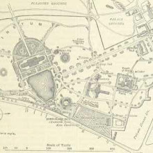
[Map of Kew Gardens] [user-supplied]
collection: flickr2num_gcps: 14
center: 51.480664,-0.291526
user_name: Susan Major
date_time: 04/05/2015 15:07
View this map in ...

[The River Nile] [user-supplied]
collection: flickr2num_gcps: 14
center: 25.314719,32.495946
user_name: Susan Major
date_time: 04/05/2015 14:13
View this map in ...

Histoire de l'unité politique et territoriale de la France
collection: flickrnum_gcps: 11
center: 46.799627,1.465595
user_name: Jorge, [Chris Austin]
date_time: 07/09/2014 12:46
View this map in ...

Sinai [user-supplied]
collection: flickr2num_gcps: 7
center: 28.565070,33.961206
user_name: Michael Ammon
date_time: 04/05/2015 15:44
View this map in ...

Wellington and Port Nicholson [user-supplied]
collection: flickr2num_gcps: 11
center: -41.300346,174.829724
user_name: Michael Ammon
date_time: 04/05/2015 17:31
View this map in ...
 collection: flickr2
num_gcps: 90
center: 46.700500,1.656224
user_name: mauricen
date_time: 04/05/2015 19:57
View this map in ...

Plan of the Haram Area at the present day [user-supplied]
collection: flickr2num_gcps: 12
center: 31.777407,35.235724
user_name: Michael Ammon
date_time: 04/05/2015 14:48
View this map in ...
 collection: flickr2
num_gcps:
center:
user_name:
date_time:
View this map in ...

Interchapter for the Traveller [Brussels] [user-supplied]
collection: flickr2num_gcps: 22
center: 50.845174,4.352237
user_name: Michael Ammon
date_time: 04/05/2015 17:26
View this map in ...
 collection: flickr2
num_gcps: 16
center: 34.917329,-85.261930
user_name: Benjamin G
date_time: 04/05/2015 18:55
View this map in ...

Maine et Loire map [user-supplied]
collection: flickr2num_gcps: 45
center: 47.390383,-0.552016
user_name: mauricen
date_time: 04/05/2015 14:49
View this map in ...

Matabelle and Mashona Lands [user-supplied]
collection: flickr2num_gcps: 13
center: -19.204859,28.137254
user_name: Michael Ammon
date_time: 04/05/2015 15:13
View this map in ...
 collection: flickr2
num_gcps: 5
center: 22.556795,88.337689
user_name: Benjamin G
date_time: 04/05/2015 18:29
View this map in ...

Karte der See- und Land-Communication in Syrien [user-supplied]
collection: flickr2num_gcps: 41
center: 32.111572,38.696108
user_name: Michael Ammon
date_time: 04/05/2015 15:02
View this map in ...

Map of the United States, Mexico, etc. [user-supplied]
collection: flickr2num_gcps: 30
center: 33.316081,-95.162448
user_name: Michael Ammon
date_time: 04/05/2015 15:56
View this map in ...

Half of map of Battle of Balaklava, Ukraine, 1854 Crimean War [user-supplied]
collection: flickr2num_gcps: 6
center: 44.527921,33.631111
user_name: Sarah Shepherd
date_time: 04/06/2015 23:43
View this map in ...

San Francisco [user-supplied]
collection: flickr2num_gcps: 10
center: 37.669697,-122.419817
user_name: Michael Ammon
date_time: 04/05/2015 15:47
View this map in ...

IV. Periodo 1750-1849 [Italy] [user-supplied]
collection: flickr2num_gcps: 16
center: 41.495895,12.078205
user_name: Michael Ammon
date_time: 04/05/2015 16:04
View this map in ...

[Map of the Far East] [user-supplied]
collection: flickr2num_gcps: 35
center: 12.845020,102.302375
user_name: Susan Major
date_time: 04/07/2015 10:57
View this map in ...
 collection: flickr2
num_gcps: 6
center: 60.582762,8.517433
user_name: relet
date_time: 04/07/2015 09:00
View this map in ...
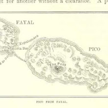
Map of Pico & Fayal (Faial), Azore Islands - publ. 1878 [user-supplied]
collection: flickr2num_gcps: 8
center: 38.509239,-28.429883
user_name: Benjamin G, Chris Austin, [Chris Austin]
date_time: 04/08/2015 09:48
View this map in ...
 collection: flickr2
num_gcps: 8
center: 19.047578,-65.891087
user_name: relet
date_time: 04/07/2015 09:02
View this map in ...

The history, topography and antiquities of the parish of St. Mary Islington, in the county of Middlesex
collection: flickrnum_gcps: 5
center: 51.545032,-0.103094
user_name: Simon Younger, [Chris Austin]
date_time: 07/09/2014 17:12
View this map in ...

Kingdoms of the West Goths [user-supplied]
collection: flickr2num_gcps: 7
center: 41.621109,4.049349
user_name: girlwithtrowel
date_time: 04/07/2015 12:03
View this map in ...
Bamburgh Castle f.2
collection: phase2num_gcps: 8
center: 55.609393,-1.710426
user_name: Chris Austin, [Chris Austin]
date_time: 11/04/2013 11:15
View this map in ...
 collection: flickr2
num_gcps: 8
center: 51.271774,3.445565
user_name: relet
date_time: 04/07/2015 10:42
View this map in ...

Monterrey District 1850 [user-supplied]
collection: flickr2num_gcps: 8
center: 36.119374,-121.049515
user_name: fred127
date_time: 04/07/2015 17:49
View this map in ...

La Palma 1894 - Madeira and the Canary Islands [user-supplied]
collection: flickr2num_gcps: 10
center: 28.653572,-17.863340
user_name: Adina Puscasu
date_time: 04/07/2015 17:15
View this map in ...
 collection: flickr2
num_gcps: 8
center: 31.776127,35.233438
user_name: girlwithtrowel
date_time: 04/07/2015 11:45
View this map in ...
 collection: flickr2
num_gcps: 15
center: 53.379694,15.269655
user_name: Gavin Inglis
date_time: 04/07/2015 11:17
View this map in ...
 collection: flickr2
num_gcps:
center:
user_name:
date_time:
View this map in ...
 collection: flickr2
num_gcps:
center:
user_name:
date_time:
View this map in ...
 collection: flickr2
num_gcps: 8
center: 75.118622,100.255446
user_name: Benjamin G
date_time: 05/10/2015 10:53
View this map in ...
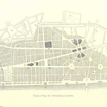
Wren's plan for rebuilding London [user-supplied]
collection: flickr2num_gcps: 12
center: 51.514282,-0.092600
user_name: Andrew Gray
date_time: 04/13/2015 12:11
View this map in ...

Battle Plans of Emperor Nicholas I [user-supplied]
collection: flickr2num_gcps: 12
center: 43.207444,27.917580
user_name: Deborah
date_time: 04/15/2015 19:01
View this map in ...
 collection: flickr2
num_gcps: 35
center: 63.619988,-76.127133
user_name: Geoff de Burca
date_time: 04/14/2015 21:44
View this map in ...
 collection: flickr2
num_gcps: 7
center: 39.186709,-74.631730
user_name: April B.
date_time: 04/14/2015 20:33
View this map in ...
 collection: flickr2
num_gcps: 12
center: 14.298430,78.675981
user_name: Geoff de Burca
date_time: 04/14/2015 21:07
View this map in ...
 collection: flickr2
num_gcps: 22
center: 38.445719,23.076373
user_name: April B.
date_time: 04/14/2015 22:51
View this map in ...

Wisconsin in the War of the Rebellion; a history of all regiments and batteries the State has sent into the field, etc. [With portraits.]
collection: flickrnum_gcps: 6
center: 38.829750,-77.472552
user_name: Kessira, Chris Austin, [Chris Austin]
date_time: 07/24/2014 13:52
View this map in ...
 collection: flickr2
num_gcps:
center:
user_name:
date_time:
View this map in ...

Insurance Plan of London Vol. xi: sheet 409-2
collection: goadnum_gcps: 5
center: 51.519735,-0.168837
user_name: Ian Pickavance, Chris Austin, [Chris Austin]
date_time: 12/10/2013 06:52
View this map in ...

Lee's Right Wing at Gettysburg [user-supplied]
collection: flickr2num_gcps: 16
center: 39.819073,-77.232042
user_name: Michael Ammon
date_time: 04/14/2015 21:31
View this map in ...
 collection: flickr2
num_gcps: 6
center: 31.772135,35.235817
user_name: Thaddeus Breen
date_time: 04/15/2015 00:28
View this map in ...
 collection: flickr2
num_gcps: 8
center: 33.631896,36.380334
user_name: April B.
date_time: 04/14/2015 20:59
View this map in ...

Plan Proposed for WIDENING THE STRAND in the Vicinity of EXETER 'CHANGE.
collection: cracenum_gcps: 6
center: 51.510679,-0.121542
user_name: Andrea Marchesetti, Mark Setrem, [Mark Setrem]
date_time: 10/25/2013 11:02
View this map in ...

Insurance Plan of Glasgow Vol. IV: sheet 129
collection: goadnum_gcps: 7
center: 55.851710,-4.231218
user_name: Susannah, Chris Austin, [Chris Austin]
date_time: 02/04/2014 11:55
View this map in ...
Defence of Hindenburg line no.3
collection: militarynum_gcps: 16
center: 49.875106,3.311820
user_name: georeferencer.org, mauricen, [mauricen]
date_time: 11/20/2013 23:47
View this map in ...
 collection: flickr2
num_gcps: 7
center: 52.374201,4.896649
user_name: Thaddeus Breen
date_time: 04/15/2015 19:28
View this map in ...

Atlas et Géographie de la France, etc
collection: flickrnum_gcps: 11
center: 44.026855,-0.759258
user_name: Max Friedrich Hartmann, Chris Austin, [Chris Austin]
date_time: 07/21/2014 17:20
View this map in ...
Sutton Coldfield
collection: osdrawingsnum_gcps: 78
center: 52.555965,-1.697274
user_name: Chris Austin, Mark Setrem, [Chris Austin]
date_time: 11/20/2013 12:57
View this map in ...
 collection: flickr2
num_gcps: 3
center: -8.093673,19.005239
user_name: loverofchaos
date_time: 04/15/2015 07:46
View this map in ...

Fort and Settlements of Detroit circa 1763 [user-supplied]
collection: flickr2num_gcps: 22
center: 42.225734,-83.056609
user_name: loverofchaos
date_time: 04/15/2015 08:22
View this map in ...
 collection: flickr2
num_gcps: 5
center: -22.524570,-58.089798
user_name: Thaddeus Breen
date_time: 04/15/2015 12:27
View this map in ...

Insurance Plan of Cork: sheet 9-2
collection: goadnum_gcps: 9
center: 51.899469,-8.462631
user_name: Susannah, Chris Austin, [Chris Austin]
date_time: 12/10/2013 13:33
View this map in ...

Northern Palestine, or Galilee [user-supplied]
collection: flickr2num_gcps: 11
center: 32.979376,35.342538
user_name: Jessica Anne Rahardjo
date_time: 04/15/2015 09:31
View this map in ...

Groningen, Netherlands, 1568-1577 [user-supplied]
collection: flickr2num_gcps: 11
center: 53.216785,6.566006
user_name: loverofchaos
date_time: 04/15/2015 08:30
View this map in ...
 collection: flickr2
num_gcps: 11
center: 19.343600,-99.037454
user_name: Geoff de Burca
date_time: 04/15/2015 12:29
View this map in ...
 collection: flickr2
num_gcps: 37
center: 49.699223,4.952971
user_name: Geoff de Burca
date_time: 04/15/2015 13:44
View this map in ...
 collection: flickr2
num_gcps: 12
center: 37.809096,-80.334204
user_name: Jessica Anne Rahardjo
date_time: 04/15/2015 08:59
View this map in ...

Insurance Plan of London Vol. xi: sheet 388-3
collection: goadnum_gcps: 9
center: 51.535560,-0.077471
user_name: Susannah, Chris Austin, [Chris Austin]
date_time: 01/13/2014 09:49
View this map in ...
 collection: flickr2
num_gcps: 7
center: 19.149638,-98.257579
user_name: Andrew Gray
date_time: 04/15/2015 11:40
View this map in ...

Earls Court Terrace showing Holland House
collection: phase2num_gcps: 3
center: 51.498524,-0.200457
user_name: Martyn Atkins, Chris Austin, Max Friedrich Hartmann
date_time: 01/06/2014 16:32
View this map in ...
 collection: flickr2
num_gcps: 75
center: 74.611092,-101.172547
user_name: Thaddeus Breen
date_time: 04/15/2015 09:41
View this map in ...

EBORACENSIS Comitatus f. 27
collection: phase2num_gcps: 34
center: 53.968736,-1.169078
user_name: Robert Halstead, Mark Setrem, Chris Austin, [Chris Austin]
date_time: 11/11/2013 09:54
View this map in ...
 collection: flickr2
num_gcps: 55
center: 43.604163,-70.195673
user_name: Thaddeus Breen
date_time: 04/15/2015 09:53
View this map in ...
 collection: flickr2
num_gcps: 7
center: 39.769478,101.414204
user_name: tonii
date_time: 04/15/2015 11:54
View this map in ...

The narrative of Captain D. W. and four seamen, who lost their ship while in a boat at sea, and surrendered themselves up to the Malays, in the Island of Celebes; ... Together with an introduction, and an Appendix, containing narratives of various escapes from shipwrecks, etc. [Edited by W. Vaughen.]
collection: flickrnum_gcps: 15
center: -1.530525,120.618877
user_name: Max Friedrich Hartmann, Rusteze, Karina
date_time: 08/08/2014 17:56
View this map in ...
Chesapeake Bay, USA, 1841 [user-supplied]
collection: flickr2num_gcps: 23
center: 37.095687,-76.216129
user_name: Sarah Shepherd
date_time: 04/15/2015 12:18
View this map in ...

Battle of Trafalgar [user-supplied]
collection: flickr2num_gcps:
center:
user_name:
date_time:
View this map in ...

Versailles, France, 1789 [user-supplied]
collection: flickr2num_gcps: 19
center: 48.807558,2.116112
user_name: Sarah Shepherd
date_time: 04/15/2015 19:02
View this map in ...
 collection: flickr2
num_gcps: 3
center: 35.553794,129.339440
user_name: tonii
date_time: 04/15/2015 11:48
View this map in ...
 collection: flickr2
num_gcps: 48
center: -1.558667,-58.979744
user_name: Geoff de Burca
date_time: 04/15/2015 19:10
View this map in ...
 collection: flickr2
num_gcps:
center:
user_name:
date_time:
View this map in ...
 collection: flickr2
num_gcps: 19
center: -28.808817,24.781766
user_name: Geoff de Burca
date_time: 04/15/2015 12:37
View this map in ...
 collection: flickr2
num_gcps:
center:
user_name:
date_time:
View this map in ...

Paris, Sorbonne district [user-supplied]
collection: flickr2num_gcps: 8
center: 48.849835,2.348661
user_name: loverofchaos
date_time: 04/20/2015 22:07
View this map in ...
 collection: flickr2
num_gcps: 16
center: 37.182877,-76.742141
user_name: Thaddeus Breen
date_time: 04/20/2015 20:35
View this map in ...

March of Edward III through France 1346 [user-supplied]
collection: flickr2num_gcps: 5
center: 49.887969,1.038701
user_name: Deborah
date_time: 04/20/2015 13:54
View this map in ...

Temperature map, South America, 1878 [user-supplied]
collection: flickr2num_gcps: 15
center: -21.250612,-58.577161
user_name: loverofchaos
date_time: 04/20/2015 22:29
View this map in ...
 collection: flickr2
num_gcps: 6
center: 20.223396,83.545114
user_name: Chris Page
date_time: 04/20/2015 20:55
View this map in ...
 collection: flickr2
num_gcps:
center:
user_name:
date_time:
View this map in ...
 collection: flickr2
num_gcps:
center:
user_name:
date_time:
View this map in ...
 collection: flickr2
num_gcps:
center:
user_name:
date_time:
View this map in ...
 collection: flickr2
num_gcps: 68
center: 39.146466,69.432646
user_name: Thaddeus Breen
date_time: 04/20/2015 21:23
View this map in ...
 collection: flickr2
num_gcps: 5
center: 50.524606,4.244839
user_name: Chris Page
date_time: 04/20/2015 21:11
View this map in ...

Commercial geography of Europe 1892 [user-supplied]
collection: flickr2num_gcps: 66
center: 52.782589,20.412715
user_name: loverofchaos
date_time: 04/20/2015 22:25
View this map in ...
 collection: flickr2
num_gcps: 67
center: 53.476548,16.731124
user_name: April B.
date_time: 04/21/2015 08:49
View this map in ...

Caesar's and Pompey's camps, Durrës, Albania [user-supplied]
collection: flickr2num_gcps: 6
center: 41.267755,19.498207
user_name: loverofchaos
date_time: 04/21/2015 08:01
View this map in ...
 collection: flickr2
num_gcps: 11
center: 62.919052,-149.340055
user_name: relet
date_time: 04/22/2015 12:16
View this map in ...

Lac Saint-Jean, Canada 1878 [user-supplied]
collection: flickr2num_gcps: 18
center: 48.487550,-71.682818
user_name: loverofchaos
date_time: 04/21/2015 22:26
View this map in ...
 collection: flickr2
num_gcps: 9
center: 32.736511,67.089375
user_name: Andrew Gray
date_time: 04/21/2015 21:53
View this map in ...

Atlas et Géographie de la France, etc
collection: flickrnum_gcps: 12
center: 49.098694,-1.402274
user_name: mauricen, [Chris Austin]
date_time: 07/09/2014 14:07
View this map in ...

A NEW and Complete PLAN of LONDON WESTMINSTER and SOUTHWARK, with the Additional Buildings to the Year 1777.
collection: phase2num_gcps: 15
center: 51.512943,-0.105546
user_name: Liam Lewis, Mark Setrem, [Mark Setrem]
date_time: 10/25/2013 12:59
View this map in ...
 collection: flickr2
num_gcps: 10
center: 44.577444,33.607480
user_name: relet
date_time: 04/22/2015 11:59
View this map in ...
 collection: flickr2
num_gcps: 32
center: 45.612834,10.497198
user_name: Andrew Gray
date_time: 04/21/2015 22:10
View this map in ...
 collection: flickr2
num_gcps: 9
center: 12.021787,32.543123
user_name: relet
date_time: 04/22/2015 10:39
View this map in ...

Limits of cereals and the vine in Russia 1878 [user-supplied]
collection: flickr2num_gcps: 49
center: 54.836408,39.095876
user_name: loverofchaos
date_time: 04/22/2015 06:36
View this map in ...
 collection: flickr2
num_gcps: 5
center: 47.549452,21.485191
user_name: Colin Ridley
date_time: 04/22/2015 06:31
View this map in ...

Approximate position of Fort Mardyck, Dunquerque, France (constructed 1622) [user-supplied]
collection: flickr2num_gcps: 7
center: 51.039902,2.299360
user_name: loverofchaos
date_time: 04/22/2015 08:13
View this map in ...

Lake Victoria and Lake Albert, Uganda [user-supplied]
collection: flickr2num_gcps: 5
center: 0.796563,31.094926
user_name: Deborah
date_time: 04/22/2015 11:24
View this map in ...

L'enseignement pratique de la géographie. Atlas, cartes, textes & questionnaires ... Cours élémentaire
collection: flickrnum_gcps: 11
center: 46.689738,1.504727
user_name: Max Friedrich Hartmann, [Chris Austin]
date_time: 07/09/2014 14:06
View this map in ...
 collection: flickr2
num_gcps: 8
center: 46.689099,7.812954
user_name: relet
date_time: 04/22/2015 12:40
View this map in ...

Harbour of Annis Squam in Ipswich Bay [user-supplied]
collection: flickr2num_gcps: 3
center: 42.654799,-70.694908
user_name: loverofchaos
date_time: 04/22/2015 08:54
View this map in ...
 collection: flickr2
num_gcps: 9
center: 10.609612,-74.988995
user_name: relet
date_time: 04/22/2015 12:37
View this map in ...

Pennsylvania, USA, Battle of the Clouds location [user-supplied]
collection: flickr2num_gcps: 4
center: 40.047553,-75.560876
user_name: Sarah Shepherd
date_time: 04/24/2015 17:59
View this map in ...

Island Number Ten and its Defenders [user-supplied]
collection: flickr2num_gcps: 5
center: 36.455108,-89.459935
user_name: Michael Ammon
date_time: 04/23/2015 20:40
View this map in ...

[History of the Russian Empire from its foundation by Ruric the Pirate to the accession of the Emperor Alexander II ... With ... engravings.]
collection: flickrnum_gcps: 32
center: 55.052056,37.160012
user_name: Leon Deutsch, [Leon Deutsch]
date_time: 07/09/2014 20:44
View this map in ...

The Scenery of Scotland viewed in connexion with its physical Geology. ... With a geological map by Sir R. I. Murchison ... and A. Geikie ... and illustrations
collection: flickrnum_gcps: 34
center: 56.667656,-4.635919
user_name: David Drexler, [Chris Austin]
date_time: 07/09/2014 19:06
View this map in ...

Insurance Plan of Leeds: sheet 27-1
collection: goadnum_gcps: 5
center: 53.802070,-1.548604
user_name: Nick Booth, Chris Austin, [Chris Austin]
date_time: 12/11/2013 07:54
View this map in ...

Itinéraire des cinq voyages accomplis dans l'intérieur du Brésil [user-supplied]
collection: flickr2num_gcps: 14
center: -23.941709,-49.052091
user_name: Michael Ammon
date_time: 04/23/2015 20:24
View this map in ...
 collection: flickr2
num_gcps:
center:
user_name:
date_time:
View this map in ...

[Our own country. Descriptive, historical, pictorial.]
collection: flickrnum_gcps: 12
center: 51.879678,-8.403197
user_name: Max Friedrich Hartmann, [Chris Austin]
date_time: 07/09/2014 14:35
View this map in ...

Die Königlichen Justizgebäude [user-supplied]
collection: flickr2num_gcps: 18
center: 51.333514,12.372459
user_name: Michael Ammon
date_time: 04/23/2015 20:11
View this map in ...

Malmo, Sweden, from Den Danske Hærs Historie til Nutiden og den Norske Hærs Historie, Vaupell, 1870 [user-supplied]
collection: flickr2num_gcps: 6
center: 55.602097,13.002729
user_name: Peter Free
date_time: 04/23/2015 20:14
View this map in ...

Kort over Nørrebro [user-supplied]
collection: flickr2num_gcps: 7
center: 55.684464,12.554445
user_name: Benjamin G
date_time: 04/26/2015 14:45
View this map in ...
 collection: flickr2
num_gcps: 13
center: 48.799721,9.224866
user_name: relet
date_time: 04/24/2015 07:09
View this map in ...

Map of Belgravia, 1814 [user-supplied]
collection: flickr2num_gcps: 5
center: 51.497989,-0.152861
user_name: Michael Ammon
date_time: 04/23/2015 21:51
View this map in ...
 collection: flickr2
num_gcps:
center:
user_name:
date_time:
View this map in ...

The Topographical, Statistical, and Historical Gazetteer of Scotland
collection: flickrnum_gcps: 5
center: 55.955972,-3.188343
user_name: Imogen Christodoulou, Chris Austin, [Chris Austin]
date_time: 07/25/2014 15:22
View this map in ...
 collection: flickr2
num_gcps: 12
center: -24.359344,120.871212
user_name: Dan Lipcan
date_time: 04/23/2015 21:02
View this map in ...

Depth of North Atlantic Ocean [user-supplied]
collection: flickr2num_gcps: 8
center: 24.179043,-52.489963
user_name: Deborah
date_time: 04/25/2015 13:52
View this map in ...
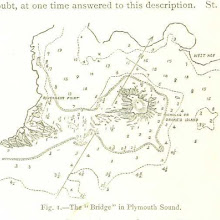
Plymouth Sound, UK [user-supplied]
collection: flickr2num_gcps: 6
center: 50.354082,-4.157171
user_name: Deborah
date_time: 04/25/2015 13:50
View this map in ...

Hanmer Parish, Flintshire, 1872 [user-supplied]
collection: flickr2num_gcps: 8
center: 52.951493,-2.806852
user_name: Peter Free
date_time: 04/24/2015 18:44
View this map in ...
 collection: flickr2
num_gcps: 8
center: -25.317437,25.377807
user_name: relet
date_time: 04/24/2015 07:13
View this map in ...
 collection: flickr2
num_gcps: 6
center: 38.879461,1.425580
user_name: relet
date_time: 04/24/2015 07:42
View this map in ...

Map of the State of Rhode Island 1878 [user-supplied]
collection: flickr2num_gcps: 71
center: 41.587285,-71.498690
user_name: Geoff de Burca
date_time: 04/24/2015 14:52
View this map in ...
 collection: flickr2
num_gcps:
center:
user_name:
date_time:
View this map in ...

Ground plan of the Alamo, Texas [user-supplied]
collection: flickr2num_gcps:
center:
user_name:
date_time:
View this map in ...
 collection: flickr2
num_gcps:
center:
user_name:
date_time:
View this map in ...
 collection: flickr2
num_gcps: 11
center: 46.735794,13.893917
user_name: mauricen
date_time: 04/21/2015 22:57
View this map in ...
 collection: flickr2
num_gcps: 9
center: 55.861221,12.628319
user_name: relet
date_time: 04/24/2015 07:52
View this map in ...

American Civil War battle site near Hampton, Virginia, USA [user-supplied]
collection: flickr2num_gcps:
center:
user_name:
date_time:
View this map in ...
 collection: flickr2
num_gcps: 11
center: 38.813412,20.709044
user_name: Geoff de Burca
date_time: 04/24/2015 15:12
View this map in ...

Turkey, Koniah vilayet, 1890 [user-supplied]
collection: flickr2num_gcps: 30
center: 37.729589,32.605777
user_name: Sarah Shepherd
date_time: 04/24/2015 13:24
View this map in ...
 collection: flickr2
num_gcps: 3
center: 21.110098,22.966560
user_name: iainagray
date_time: 04/24/2015 13:34
View this map in ...
 collection: flickr2
num_gcps:
center:
user_name:
date_time:
View this map in ...

Sketch of a skirmish between General Lacret and the Spanish near Havana, Cuba, 1896 [user-supplied]
collection: flickr2num_gcps:
center:
user_name:
date_time:
View this map in ...
 collection: flickr2
num_gcps: 3
center: 38.972288,-78.558022
user_name: April B.
date_time: 04/25/2015 11:45
View this map in ...

The Earth and its Inhabitants. The European section of the Universal Geography by E. Reclus. Edited by E. G. Ravenstein. Illustrated by ... engravings and maps
collection: flickrnum_gcps: 6
center: 35.139760,79.618431
user_name: Max Friedrich Hartmann, Chris Austin, [Chris Austin]
date_time: 07/25/2014 06:46
View this map in ...

Imperial Austria [user-supplied]
collection: flickr2num_gcps: 62
center: 46.799451,18.884352
user_name: Leon Deutsch, [Leon Deutsch]
date_time: 04/24/2015 15:44
View this map in ...

Florida [user-supplied]
collection: flickr2num_gcps: 10
center: 28.035699,-81.182365
user_name: Leon Deutsch, [Leon Deutsch]
date_time: 04/24/2015 15:51
View this map in ...
 collection: flickr2
num_gcps: 29
center: 11.870260,124.336022
user_name: Geoff de Burca
date_time: 04/24/2015 17:30
View this map in ...

Situations Plan von der Koenigl. Bergstadt Reichenstein und dem dazu gehoerenden Terrain [user-supplied]
collection: flickr2num_gcps: 6
center: 50.447092,16.870658
user_name: Michael Ammon
date_time: 04/26/2015 09:29
View this map in ...

Plan von Frankfurt am Main [user-supplied]
collection: flickr2num_gcps: 65
center: 50.111004,8.682652
user_name: Ruth O'Leary
date_time: 04/24/2015 20:10
View this map in ...

Il Castello di Milano [user-supplied]
collection: flickr2num_gcps: 15
center: 45.470616,9.179254
user_name: Ruth O'Leary
date_time: 04/25/2015 13:56
View this map in ...

Vidurine Europa [user-supplied]
collection: flickr2num_gcps: 48
center: 45.027732,18.463915
user_name: Ruth O'Leary
date_time: 04/24/2015 19:48
View this map in ...
 collection: flickr2
num_gcps: 10
center: 52.682807,-1.122950
user_name: Michael Ammon
date_time: 04/24/2015 20:39
View this map in ...
 collection: flickr2
num_gcps: 5
center: 1.453609,15.519609
user_name: edumardo
date_time: 04/27/2015 16:48
View this map in ...

Map of the Bennachie District [user-supplied]
collection: flickr2num_gcps: 381
center: 57.278274,-2.533140
user_name: Geoff de Burca
date_time: 04/27/2015 20:24
View this map in ...
 collection: flickr2
num_gcps: 5
center: 46.631198,21.454923
user_name: edumardo
date_time: 04/27/2015 17:03
View this map in ...
 collection: flickr2
num_gcps: 5
center: 47.573712,15.213973
user_name: edumardo
date_time: 04/27/2015 17:18
View this map in ...
 collection: flickr2
num_gcps: 23
center: 47.628398,6.849760
user_name: iainagray
date_time: 04/27/2015 15:35
View this map in ...

Sebastian Cabot's map of Africa, from Die deutsche Emin-Pascha-Expedition, Peters, 1891 [user-supplied]
collection: flickr2num_gcps: 6
center: 3.422262,23.165972
user_name: Peter Free
date_time: 04/27/2015 20:36
View this map in ...

Southern California, 1895 [user-supplied]
collection: flickr2num_gcps: 4
center: 33.590507,-117.590739
user_name: Sarah Shepherd
date_time: 04/27/2015 15:43
View this map in ...
 collection: flickr2
num_gcps: 11
center: 35.588402,-79.333184
user_name: iainagray
date_time: 04/27/2015 14:28
View this map in ...

Cambrai
collection: militarynum_gcps: 24
center: 50.136482,3.184022
user_name: Leon Deutsch, Max Heikenfeld
date_time: 03/23/2016 10:05
View this map in ...
 collection: flickr2
num_gcps: 6
center: 50.926797,10.991768
user_name: relet
date_time: 04/30/2015 13:27
View this map in ...
 collection: flickr2
num_gcps: 5
center: 55.721560,-2.151053
user_name: edumardo
date_time: 04/27/2015 16:58
View this map in ...
 collection: flickr2
num_gcps: 14
center: 48.855160,2.371131
user_name: tonii
date_time: 04/27/2015 22:02
View this map in ...

Altop Boliviano [user-supplied]
collection: flickr2num_gcps: 14
center: -16.659267,-68.784980
user_name: Benjamin G
date_time: 04/27/2015 20:31
View this map in ...
 collection: flickr2
num_gcps: 5
center: -6.692216,150.872539
user_name: edumardo
date_time: 04/27/2015 16:42
View this map in ...
 collection: flickr2
num_gcps: 5
center: 48.448510,7.104888
user_name: edumardo
date_time: 04/27/2015 17:21
View this map in ...
 collection: flickr2
num_gcps: 3
center: 29.932832,-1.354339
user_name: Geoff de Burca
date_time: 04/28/2015 22:18
View this map in ...
 collection: flickr2
num_gcps: 28
center: 54.306551,13.070967
user_name: Geoff de Burca
date_time: 04/27/2015 20:49
View this map in ...

Plan-guide [de Londres] [user-supplied]
collection: flickr2num_gcps: 20
center: 51.509741,-0.131455
user_name: Benjamin G
date_time: 04/27/2015 20:09
View this map in ...
 collection: flickr2
num_gcps: 5
center: 49.556033,3.633107
user_name: edumardo
date_time: 04/27/2015 17:07
View this map in ...

Voyage en traîneau vers le Nord sous les ordres du Commandant Markham [user-supplied]
collection: flickr2num_gcps: 20
center: 82.891006,-63.133940
user_name: Benjamin G
date_time: 04/27/2015 20:26
View this map in ...

Confluence of the Hudson and Mohawk rivers [United States], from Nouvelle Géographie Universelle, Reclus, 1876 [user-supplied]
collection: flickr2num_gcps: 9
center: 42.765443,-73.749614
user_name: Peter Free
date_time: 04/27/2015 20:28
View this map in ...
 collection: flickr2
num_gcps: 3
center: 38.512325,-110.664645
user_name: edumardo
date_time: 04/27/2015 17:30
View this map in ...

Western Libya, Aerodrome Map
collection: worldwidenum_gcps: 13
center: 31.037279,13.041286
user_name: Chris Austin, Mark Setrem, [Mark Setrem]
date_time: 10/25/2013 17:11
View this map in ...

Siege of Yorktown [user-supplied]
collection: flickr2num_gcps: 5
center: 37.228638,-76.516061
user_name: Benjamin G
date_time: 04/27/2015 20:36
View this map in ...

Mirebalais, Haiti [user-supplied]
collection: flickr2num_gcps: 7
center: 18.835310,-72.103987
user_name: Deborah Kyle
date_time: 05/04/2015 05:19
View this map in ...

Chartley Park
collection: osdrawingsnum_gcps: 73
center: 52.873590,-2.043903
user_name: BeckyBecky Ladley-Jones, Mark Setrem, Chris Austin, Peter Free
date_time: 01/31/2014 19:35
View this map in ...
 collection: flickr2
num_gcps: 5
center: 34.825167,-108.121944
user_name: James David Smith (NeoShady)
date_time: 04/28/2015 09:10
View this map in ...
 collection: flickr2
num_gcps: 5
center: 39.362197,81.317053
user_name: Marta Afonso
date_time: 04/28/2015 00:21
View this map in ...
 collection: flickr2
num_gcps: 8
center: 59.944921,30.409873
user_name: Benjamin G
date_time: 04/27/2015 20:47
View this map in ...

St. Thomas Island [user-supplied]
collection: flickr2num_gcps: 18
center: 18.336271,-64.942397
user_name: Benjamin G
date_time: 04/28/2015 21:41
View this map in ...
 collection: flickr2
num_gcps:
center:
user_name:
date_time:
View this map in ...
 collection: flickr2
num_gcps: 17
center: -40.682487,146.032425
user_name: Benjamin G
date_time: 04/28/2015 21:50
View this map in ...
 collection: flickr2
num_gcps: 11
center: 62.093974,-158.317572
user_name: Benjamin G
date_time: 04/29/2015 19:42
View this map in ...
 collection: flickr2
num_gcps: 3
center: 56.264737,12.633593
user_name: iainagray
date_time: 04/29/2015 10:21
View this map in ...

Appomattox River Amelia County Virginia [user-supplied]
collection: flickr2num_gcps: 7
center: 37.331784,-78.253340
user_name: Mary Brawley Fuat
date_time: 04/29/2015 23:58
View this map in ...

Plan de Moscou [user-supplied]
collection: flickr2num_gcps: 28
center: 55.750745,37.638937
user_name: Benjamin G
date_time: 04/29/2015 20:34
View this map in ...
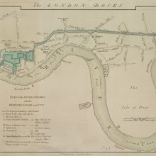
The LONDON DOCKS
collection: cracenum_gcps: 9
center: 51.501078,-0.037919
user_name: Peter Owen, Mark Setrem, [Mark Setrem]
date_time: 10/25/2013 13:15
View this map in ...
 collection: flickr2
num_gcps: 81
center: 37.858561,63.069996
user_name: Thaddeus Breen
date_time: 04/30/2015 00:34
View this map in ...


France pittoresque, ou description ... des départements et colonies de la France, etc. [With plates.]
collection: flickrnum_gcps: 16
center: 49.085781,-0.332971
user_name: Tony Atkin, Chris Austin, Peter Free, mauricen, [mauricen]
date_time: 08/10/2014 20:52
View this map in ...

Géognosie et orographie de la France [user-supplied]
collection: flickr2num_gcps: 21
center: 46.638145,1.785556
user_name: Benjamin G
date_time: 04/29/2015 19:43
View this map in ...

Jung St.Peter [St.Pierre le Jeune], Strasbourg, from Strassburg und seine Bauten, 1894 [user-supplied]
collection: flickr2num_gcps: 6
center: 48.585606,7.746548
user_name: Peter Free
date_time: 04/29/2015 19:12
View this map in ...

Southern United States, Central America and the Caribbean [user-supplied]
collection: flickr2num_gcps: 71
center: 21.152593,-98.599881
user_name: Ruth O'Leary
date_time: 04/29/2015 12:59
View this map in ...

Unser Wissen von der Erde. Allgemeine Erdkunde und Länderkunde, herausgegeben unter fachmännischer Mitwirkung von A. Kirchhoff
collection: flickrnum_gcps: 14
center: 54.181708,-4.175640
user_name: Stiliyana Simeonova, Chris Austin, [Chris Austin]
date_time: 07/25/2014 15:25
View this map in ...

Spain at about the beginning of the ninth century [user-supplied]
collection: flickr2num_gcps: 49
center: 39.736182,-3.117273
user_name: Michael Ammon
date_time: 05/03/2015 16:04
View this map in ...

Iles Canaries et Madere [user-supplied]
collection: flickr2num_gcps: 20
center: 30.012052,-15.875051
user_name: Geoff de Burca
date_time: 05/03/2015 19:26
View this map in ...
Chartres, France, from The Earth and its Inhabitants, Reclus, 1878 [user-supplied]
collection: flickr2num_gcps: 9
center: 48.447129,1.488413
user_name: Peter Free
date_time: 05/03/2015 16:46
View this map in ...
Empire of the Saracens about A. D. 750 [user-supplied]
collection: flickr2num_gcps: 62
center: 29.201460,10.767011
user_name: Michael Ammon
date_time: 05/03/2015 16:19
View this map in ...

Cary's Improved Map of England and Wales
collection: phase2num_gcps: 22
center: 51.332587,-2.073068
user_name: Peter F, Chris Austin, [Chris Austin]
date_time: 10/25/2013 16:52
View this map in ...

Soudan français. Kahel. Carnet de voyage ... Avec 50 gravures dessinées par Fiorillo Fournier et 5 cartes
collection: flickrnum_gcps: 14
center: 23.978161,15.715840
user_name: Nicola Bingham, Chris Austin, [Chris Austin]
date_time: 07/25/2014 15:59
View this map in ...

Der Dramburger Kreiss 1897 [user-supplied]
collection: flickr2num_gcps: 62
center: 53.436396,15.998441
user_name: Michael Ammon
date_time: 05/03/2015 18:16
View this map in ...

A New and Exact Plan of Ye City of London and Westminster, the Borough of Southwark, 1735
collection: phase2num_gcps: 14
center: 51.512060,-0.102010
user_name: Dan Karran, Mark Setrem, [Mark Setrem]
date_time: 10/25/2013 13:27
View this map in ...

Dijon, from Cassell's Illustrated History of the War between France and Germany, Ollier, 1873 [user-supplied]
collection: flickr2num_gcps: 10
center: 47.220982,5.027661
user_name: Peter Free
date_time: 05/03/2015 17:12
View this map in ...
 collection: flickr2
num_gcps:
center:
user_name:
date_time:
View this map in ...

The History of Columbia County, Wisconsin, containing ... biographical sketches ... The whole preceded by a history of Wisconsin [by C. W. Butterfield] ... Illustrated
collection: flickrnum_gcps: 8
center: 43.475621,-89.587879
user_name: Träsel, Chris Austin, [Chris Austin]
date_time: 07/26/2014 14:29
View this map in ...

Ruins of Soli or Pompeiopolis [user-supplied]
collection: flickr2num_gcps: 7
center: 36.742400,34.539558
user_name: Benjamin G
date_time: 05/03/2015 17:20
View this map in ...

Plan of Philadelphia [user-supplied]
collection: flickr2num_gcps: 22
center: 39.981492,-75.161502
user_name: Benjamin G
date_time: 05/03/2015 17:26
View this map in ...
 collection: flickr2
num_gcps: 32
center: 51.559163,-120.173540
user_name: Geoff de Burca
date_time: 05/03/2015 20:55
View this map in ...

Angeles [user-supplied]
collection: flickr2num_gcps: 9
center: 15.662397,-96.491703
user_name: Michael Ammon
date_time: 05/03/2015 18:37
View this map in ...
Map of Straits Settlements [user-supplied]
collection: flickr2num_gcps: 22
center: 6.561160,100.914400
user_name: Geoff de Burca
date_time: 05/03/2015 19:44
View this map in ...
 collection: flickr2
num_gcps:
center:
user_name:
date_time:
View this map in ...
 collection: flickr2
num_gcps:
center:
user_name:
date_time:
View this map in ...
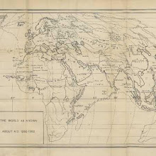
The world as known about A.D. 1260-1360 [user-supplied]
collection: flickr2num_gcps: 32
center: 16.444059,46.589048
user_name: Michael Ammon
date_time: 05/03/2015 19:52
View this map in ...
 collection: flickr2
num_gcps: 27
center: 20.827280,-158.197376
user_name: Geoff de Burca
date_time: 05/03/2015 20:36
View this map in ...

Range of Vegetation in Turkestan [user-supplied]
collection: flickr2num_gcps: 8
center: 45.107111,57.194002
user_name: Michael Ammon
date_time: 05/03/2015 20:17
View this map in ...

The Mediterranean and adjacent countries [user-supplied]
collection: flickr2num_gcps: 79
center: 35.956352,12.745632
user_name: Benjamin G
date_time: 05/03/2015 22:18
View this map in ...

Map to illustrate Mr. G. Campbell's Paper [user-supplied]
collection: flickr2num_gcps: 17
center: 22.435787,77.485217
user_name: Michael Ammon
date_time: 05/03/2015 20:27
View this map in ...

Château de Dieulivolt [user-supplied]
collection: flickr2num_gcps: 7
center: 44.673433,0.110404
user_name: Benjamin G
date_time: 05/09/2015 11:53
View this map in ...

Senegal River, Mali, between Kayes and Bangassi [user-supplied]
collection: flickr2num_gcps: 6
center: 14.378206,-11.361709
user_name: Deborah Kyle
date_time: 05/04/2015 06:09
View this map in ...

The Geography of Africa
collection: flickrnum_gcps: 55
center: 6.414797,33.067057
user_name: Ben O'Steen, Chris Austin, [Chris Austin]
date_time: 07/25/2014 16:16
View this map in ...

Sill of the lock canal [user-supplied]
collection: flickr2num_gcps: 10
center: 9.047135,-79.642685
user_name: Benjamin G
date_time: 05/04/2015 18:20
View this map in ...

Zanzibar [user-supplied]
collection: flickr2num_gcps: 14
center: -6.872938,39.868520
user_name: Michael Ammon, Mark Hurd
date_time: 05/08/2015 06:06
View this map in ...

Plan of Cadiz [user-supplied]
collection: flickr2num_gcps: 14
center: 36.527219,-6.261675
user_name: Geoff de Burca
date_time: 05/03/2015 21:48
View this map in ...
Insurance Plan of London Vol. XI: sheet 333
collection: goadnum_gcps: 8
center: 51.522004,-0.050998
user_name: Tim Noble, Chris Austin, [Chris Austin]
date_time: 12/13/2013 07:53
View this map in ...
 collection: flickr2
num_gcps: 8
center: 41.011951,28.983260
user_name: Benjamin G
date_time: 05/07/2015 20:24
View this map in ...
 collection: flickr2
num_gcps: 3
center: -18.473375,-70.324433
user_name: Benjamin G
date_time: 05/05/2015 18:50
View this map in ...
 collection: flickr2
num_gcps: 5
center: 19.446489,-99.019171
user_name: Deborah Kyle
date_time: 05/07/2015 04:16
View this map in ...
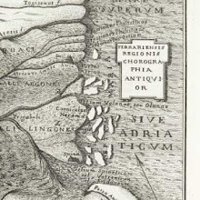
Ferrariensis Regionis Chorographia Antiquior [user-supplied]
collection: flickr2num_gcps: 5
center: 44.753321,12.127226
user_name: Michael Ammon
date_time: 05/05/2015 20:43
View this map in ...

To India and Back by the Cape [user-supplied]
collection: flickr2num_gcps: 21
center: 34.513040,80.666892
user_name: Michael Ammon
date_time: 05/05/2015 21:11
View this map in ...

John Whitby & Son's Street Map of Bridgwater [user-supplied]
collection: flickr2num_gcps: 50
center: 51.128806,-3.002532
user_name: Geoff de Burca
date_time: 05/05/2015 20:31
View this map in ...
 collection: flickr2
num_gcps: 6
center: 54.472929,9.447165
user_name: tonii
date_time: 05/05/2015 21:20
View this map in ...

Handbook Map of Jerusalem [user-supplied]
collection: flickr2num_gcps: 33
center: 31.777018,35.233926
user_name: Michael Ammon
date_time: 05/05/2015 20:31
View this map in ...

Fig. 35 Akhnur & Jammu [user-supplied]
collection: flickr2num_gcps: 28
center: 32.860069,74.804112
user_name: Geoff de Burca
date_time: 05/05/2015 20:49
View this map in ...
 collection: flickr2
num_gcps: 13
center: 33.486218,-116.194957
user_name: Michael Ammon
date_time: 05/05/2015 21:19
View this map in ...
 collection: flickr2
num_gcps: 3
center: 51.505386,-0.214074
user_name: Michael Ammon
date_time: 05/06/2015 19:02
View this map in ...

[Cuba] [user-supplied]
collection: flickr2num_gcps: 6
center: 21.226780,-79.290229
user_name: Michael Ammon
date_time: 05/05/2015 21:31
View this map in ...

Map of part of Pennsylvania, showing the coal areas [user-supplied]
collection: flickr2num_gcps: 12
center: 40.854118,-76.804595
user_name: Geoff de Burca
date_time: 05/05/2015 21:10
View this map in ...
 collection: flickr2
num_gcps: 264
center: 40.203307,-82.671121
user_name: Geoff de Burca
date_time: 05/13/2015 11:51
View this map in ...

Strait of Rio (Canary islands) [user-supplied]
collection: flickr2num_gcps: 14
center: 29.238388,-13.489467
user_name: Benjamin G
date_time: 05/14/2015 08:47
View this map in ...
 collection: flickr2
num_gcps: 9
center: 41.635275,11.252061
user_name: tonii
date_time: 05/13/2015 22:57
View this map in ...

Rainham reverse
collection: osdrawingsnum_gcps: 9
center: 51.052876,-0.609214
user_name: carlosg, Mark Setrem, [Mark Setrem]
date_time: 10/26/2013 11:36
View this map in ...
 collection: flickr2
num_gcps: 5
center: 27.401428,88.066596
user_name: tonii
date_time: 05/13/2015 23:10
View this map in ...

Paulus 1st and 2d Tours [user-supplied]
collection: flickr2num_gcps: 13
center: 38.551657,29.981125
user_name: Michael Ammon
date_time: 05/13/2015 21:58
View this map in ...

Guadeloupe [user-supplied]
collection: flickr2num_gcps: 34
center: 16.176675,-61.641302
user_name: Benjamin G
date_time: 05/14/2015 09:04
View this map in ...

Map of Skye [user-supplied]
collection: flickr2num_gcps: 14
center: 57.345039,-6.219939
user_name: Michael Ammon
date_time: 05/13/2015 21:29
View this map in ...
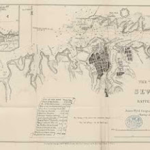
The town and harbour of Sevastopol [user-supplied]
collection: flickr2num_gcps: 35
center: 44.600290,33.502695
user_name: Benjamin G
date_time: 05/13/2015 20:52
View this map in ...
 collection: flickr2
num_gcps:
center:
user_name:
date_time:
View this map in ...
 collection: flickr2
num_gcps: 5
center: 71.044375,25.835883
user_name: tonii
date_time: 05/13/2015 22:52
View this map in ...

Chart for A Tour Thro the Atlantic [user-supplied]
collection: flickr2num_gcps: 37
center: 41.348497,-26.082855
user_name: Michael Ammon
date_time: 05/14/2015 11:47
View this map in ...

Plan of Ranger's House in Green Park
collection: cracenum_gcps: 4
center: 51.502835,-0.139420
user_name: Tommaso Catalucci, Chris Austin, [Chris Austin]
date_time: 10/31/2013 17:29
View this map in ...

East River soundings and pier line [user-supplied]
collection: flickr2num_gcps: 10
center: 40.707081,-73.985608
user_name: Benjamin G
date_time: 05/14/2015 09:09
View this map in ...

A hand-book of Dorking ... Second edition. [By John Dennis.]
collection: flickrnum_gcps: 16
center: 51.235725,-0.369513
user_name: Susan Major, Chris Austin, [Chris Austin]
date_time: 07/28/2014 12:37
View this map in ...

A PLAN of HYDE-PARK with the CITY and LIBERTIES of WESTMINSTER &c. Shewing the several IMPROVEMENTS propos'd
collection: cracenum_gcps: 25
center: 51.506223,-0.155795
user_name: Daniel Harrison, Mark Setrem, [Mark Setrem]
date_time: 10/26/2013 11:41
View this map in ...
 collection: flickr2
num_gcps:
center:
user_name:
date_time:
View this map in ...
 collection: flickr2
num_gcps:
center:
user_name:
date_time:
View this map in ...

Insurance Plan of City of London Vol. II: sheet 42
collection: goadnum_gcps: 14
center: 51.517897,-0.103384
user_name: Tim Noble, Chris Austin, Myra Mohnen
date_time: 03/11/2016 16:33
View this map in ...

Pesmes [user-supplied]
collection: flickr2num_gcps: 21
center: 47.278291,5.565350
user_name: Benjamin G
date_time: 05/17/2015 07:16
View this map in ...

Bay of Funchal, Madeira, from Atlantic Ocean Pilot, Imray, 1884 [user-supplied]
collection: flickr2num_gcps: 8
center: 32.639491,-16.917307
user_name: Peter Free
date_time: 05/16/2015 21:01
View this map in ...

Marion and Wareham, Massachusetts, USA, 1888 [user-supplied]
collection: flickr2num_gcps: 34
center: 41.737724,-70.697086
user_name: Sarah Shepherd
date_time: 05/17/2015 01:06
View this map in ...
 collection: flickr2
num_gcps:
center:
user_name:
date_time:
View this map in ...
 collection: flickr2
num_gcps: 3
center: 44.855504,-0.011164
user_name: Benjamin G
date_time: 06/02/2015 18:27
View this map in ...
 collection: flickr2
num_gcps: 9
center: -11.617925,45.311107
user_name: relet
date_time: 05/18/2015 06:02
View this map in ...

Lenkoran (Lankaran) [user-supplied]
collection: flickr2num_gcps: 4
center: 38.704320,48.855727
user_name: Benjamin G
date_time: 05/23/2015 09:53
View this map in ...

Amsterdam (East) [user-supplied]
collection: flickr2num_gcps: 37
center: 52.366175,4.909612
user_name: Benjamin G
date_time: 05/17/2015 07:40
View this map in ...

Formosa or Taiwan [user-supplied]
collection: flickr2num_gcps: 14
center: 23.595062,120.731414
user_name: Benjamin G
date_time: 05/17/2015 08:22
View this map in ...
 collection: flickr2
num_gcps: 58
center: 48.631869,4.289314
user_name: Geoff de Burca
date_time: 05/17/2015 20:21
View this map in ...

Map of the Southern States of North America, with the Forts, Harbours, and Military Positions
collection: militarynum_gcps: 19
center: 35.228330,-84.896029
user_name: mauricen, [Mark Setrem]
date_time: 12/14/2013 22:25
View this map in ...
 collection: flickr2
num_gcps: 10
center: 44.303943,17.352502
user_name: Chris Page
date_time: 05/17/2015 12:45
View this map in ...
 collection: flickr2
num_gcps: 16
center: 47.512369,13.881215
user_name: Benjamin G
date_time: 05/17/2015 13:34
View this map in ...

Spotslyvania, Virginia, USA, Civil War battle [user-supplied]
collection: flickr2num_gcps: 6
center: 38.259879,-77.681253
user_name: Sarah Shepherd
date_time: 05/25/2015 00:46
View this map in ...
 collection: flickr2
num_gcps: 5
center: 36.914622,22.071984
user_name: Andrew McIlwraith
date_time: 05/25/2015 17:26
View this map in ...
 collection: flickr2
num_gcps: 10
center: 44.597818,33.535498
user_name: Thaddeus Breen
date_time: 05/27/2015 09:16
View this map in ...
 collection: flickr2
num_gcps:
center:
user_name:
date_time:
View this map in ...
 collection: flickr2
num_gcps: 12
center: 45.158103,6.836776
user_name: Benjamin G
date_time: 05/24/2015 19:31
View this map in ...
 collection: flickr2
num_gcps: 14
center: 49.252986,17.309196
user_name: Peter Free
date_time: 05/24/2015 20:40
View this map in ...
 collection: flickr2
num_gcps: 7
center: -54.334713,-37.114439
user_name: Flip van Rijn
date_time: 05/24/2015 19:54
View this map in ...

Plan duVieux Bourg (Bruges) [user-supplied]
collection: flickr2num_gcps: 11
center: 51.210252,3.227913
user_name: Benjamin G
date_time: 05/25/2015 12:32
View this map in ...
 collection: flickr2
num_gcps: 20
center: 38.306061,14.509534
user_name: Benjamin G
date_time: 05/25/2015 12:53
View this map in ...

Environs de Constantinople [user-supplied]
collection: flickr2num_gcps: 22
center: 40.806309,28.004954
user_name: Benjamin G
date_time: 05/25/2015 12:49
View this map in ...
 collection: flickr2
num_gcps: 14
center: 37.499936,-120.603331
user_name: Benjamin G
date_time: 05/25/2015 20:14
View this map in ...
 collection: flickr2
num_gcps: 266
center: 42.981479,7.549142
user_name: Geoff de Burca
date_time: 05/26/2015 22:47
View this map in ...

[Modern Geography ... Abridged from the larger work.]
collection: flickrnum_gcps: 7
center: 57.328910,39.418099
user_name: lunrwolf, [Chris Austin]
date_time: 07/09/2014 23:08
View this map in ...
 collection: flickr2
num_gcps: 9
center: 31.678367,-90.990061
user_name: Benjamin G
date_time: 05/25/2015 20:47
View this map in ...
 collection: flickr2
num_gcps: 5
center: 40.342674,-76.412514
user_name: relet
date_time: 06/02/2015 12:33
View this map in ...
 collection: flickr2
num_gcps: 6
center: 8.216963,-74.285375
user_name: relet
date_time: 06/02/2015 07:11
View this map in ...

Hvar (Lesina), Croatia, 1878 [user-supplied]
collection: flickr2num_gcps: 19
center: 43.166068,16.379294
user_name: Sarah Shepherd
date_time: 06/02/2015 01:23
View this map in ...
 collection: flickr2
num_gcps: 6
center: 43.129980,5.915391
user_name: JoaJoch
date_time: 06/02/2015 08:49
View this map in ...
 collection: flickr2
num_gcps: 5
center: 48.970666,37.783160
user_name: SootyandSweep
date_time: 06/02/2015 15:37
View this map in ...

Murzuk, Libya [user-supplied]
collection: flickr2num_gcps: 9
center: 25.912470,13.913258
user_name: relet, Benjamin G
date_time: 06/02/2015 18:32
View this map in ...
 collection: flickr2
num_gcps: 4
center: -5.300844,24.501403
user_name: relet
date_time: 06/02/2015 10:30
View this map in ...
 collection: flickr2
num_gcps: 5
center: 29.549183,33.917294
user_name: JoaJoch
date_time: 06/02/2015 11:27
View this map in ...
 collection: flickr2
num_gcps: 10
center: 48.120559,-0.008156
user_name: relet
date_time: 06/02/2015 12:23
View this map in ...
 collection: flickr2
num_gcps: 5
center: 61.229825,-104.820923
user_name: relet
date_time: 06/02/2015 11:21
View this map in ...

St. Pancras [user-supplied]
collection: flickr2num_gcps: 12
center: 51.527038,-0.137788
user_name: Benjamin G
date_time: 06/02/2015 20:17
View this map in ...
 collection: flickr2
num_gcps: 5
center: 41.273387,-72.925745
user_name: relet
date_time: 06/02/2015 12:25
View this map in ...
 collection: flickr2
num_gcps: 6
center: 49.818504,142.688866
user_name: relet
date_time: 06/02/2015 12:19
View this map in ...
 collection: flickr2
num_gcps:
center:
user_name:
date_time:
View this map in ...
 collection: flickr2
num_gcps: 3
center: -27.235576,30.613875
user_name: JoaJoch
date_time: 06/03/2015 09:36
View this map in ...

Insurance Plan of the City of Liverpool Vol. I: sheet 9
collection: goadnum_gcps: 19
center: 53.401962,-2.987478
user_name: Ian Pickavance, Chris Austin, [Chris Austin]
date_time: 03/26/2014 14:06
View this map in ...
 collection: flickr2
num_gcps: 6
center: 49.093448,1.466786
user_name: relet
date_time: 06/03/2015 13:04
View this map in ...
 collection: flickr2
num_gcps: 6
center: 52.551730,14.136288
user_name: relet
date_time: 06/03/2015 13:13
View this map in ...

Europe 1:1,000,000, Bourdeaux-Limoges
collection: worldwidenum_gcps: 483
center: 46.050419,-0.915337
user_name: Leon Deutsch, Chris Austin, [Chris Austin]
date_time: 10/25/2013 16:35
View this map in ...
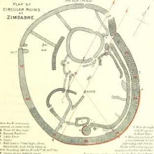 collection: flickr2
num_gcps: 9
center: -20.272997,30.934401
user_name: Thaddeus Breen
date_time: 06/05/2015 22:52
View this map in ...

Leeds Carriers' Warehouse District: sheet 113-3
collection: goadnum_gcps: 6
center: 53.805035,-1.664751
user_name: Tim Noble, Chris Austin, [Chris Austin]
date_time: 12/17/2013 08:06
View this map in ...

A PROPOSED PLAN FOR WET DOCKS IN WAPPING &c.
collection: cracenum_gcps: 12
center: 51.499755,-0.036343
user_name: Andrea Marchesetti, Mark Setrem, [Mark Setrem]
date_time: 10/26/2013 14:05
View this map in ...
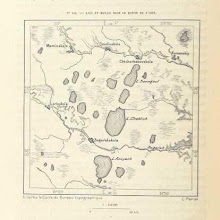
Lakes ESE of Kamensk-Uralsky, Russia [user-supplied]
collection: flickr2num_gcps: 7
center: 56.289735,61.596751
user_name: gdsanso
date_time: 06/03/2015 14:43
View this map in ...

Battle of Memphis (naval action), 1862 [user-supplied]
collection: flickr2num_gcps: 5
center: 35.142657,-90.057922
user_name: gdsanso
date_time: 06/03/2015 17:32
View this map in ...
Syracuse, Italy, 1846 with ancient sites included [user-supplied]
collection: flickr2num_gcps: 8
center: 37.064681,15.240951
user_name: Sarah Shepherd
date_time: 06/04/2015 00:05
View this map in ...
 collection: flickr2
num_gcps:
center:
user_name:
date_time:
View this map in ...
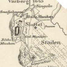
Varberg 1645 [user-supplied]
collection: flickr2num_gcps: 7
center: 57.105208,12.243008
user_name: Esteban Arevalo
date_time: 06/04/2015 12:21
View this map in ...
 collection: flickr2
num_gcps: 10
center: 45.135759,9.889018
user_name: JoaJoch
date_time: 06/04/2015 12:18
View this map in ...

Young Street, Kensingon, England, 1847 [user-supplied]
collection: flickr2num_gcps: 4
center: 51.501426,-0.189911
user_name: Sarah Shepherd
date_time: 06/04/2015 01:39
View this map in ...
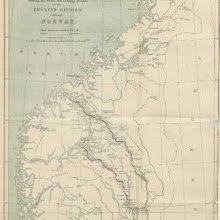
Map showing the route and camping grounds of the English gispies through Norway [user-supplied]
collection: flickr2num_gcps: 26
center: 61.653956,9.516118
user_name: Ruth O'Leary
date_time: 06/04/2015 13:12
View this map in ...

La Cité à travers les âges ... 64 illustrations de E. Coppin
collection: flickrnum_gcps: 6
center: 48.858546,2.348246
user_name: Ian Pickavance, Chris Austin, [Chris Austin]
date_time: 07/29/2014 15:51
View this map in ...

Plan du château de Villarnout [user-supplied]
collection: flickr2num_gcps: 3
center: 47.430145,4.033461
user_name: Benjamin G
date_time: 06/05/2015 18:15
View this map in ...

Insurance Plan of Nottingham Vol. II: sheet 28-1
collection: goadnum_gcps: 3
center: 52.960940,-1.168879
user_name: Nick Booth, Mark Setrem, [Mark Setrem]
date_time: 12/14/2013 20:27
View this map in ...

Insurance Plan of City of London Vol. IV: sheet 88-1
collection: goadnum_gcps: 9
center: 51.500677,-0.067036
user_name: Nick Booth, mauricen, Chris Austin, [Chris Austin]
date_time: 04/11/2014 12:01
View this map in ...

South Orkney Islands, Southern Ocean [user-supplied]
collection: flickr2num_gcps: 8
center: -60.622049,-45.213677
user_name: gdsanso
date_time: 06/04/2015 15:18
View this map in ...
 collection: flickr2
num_gcps: 9
center: -28.895101,148.285670
user_name: Benjamin G
date_time: 06/06/2015 17:57
View this map in ...
 collection: flickr2
num_gcps: 4
center: 55.875556,26.542063
user_name: JoaJoch
date_time: 06/04/2015 14:20
View this map in ...

Bradgate House, Bradgate Park, Leicestershire [user-supplied]
collection: flickr2num_gcps: 10
center: 52.686746,-1.211296
user_name: gdsanso
date_time: 06/04/2015 14:52
View this map in ...

Russian empire boundaries, 15th and 18th centuries, 1874 [user-supplied]
collection: flickr2num_gcps: 69
center: 57.569740,42.007091
user_name: Sarah Shepherd
date_time: 06/04/2015 19:32
View this map in ...
 collection: flickr2
num_gcps: 5
center: 51.333564,12.371497
user_name: JoaJoch
date_time: 06/05/2015 09:09
View this map in ...
 collection: flickr2
num_gcps: 5
center: 45.536041,-118.225161
user_name: JoaJoch
date_time: 06/05/2015 09:53
View this map in ...

Arden, Warwick, England, 1863 [user-supplied]
collection: flickr2num_gcps: 33
center: 52.342096,-1.791938
user_name: Sarah Shepherd
date_time: 06/04/2015 23:44
View this map in ...
 collection: flickr2
num_gcps: 5
center: 46.062786,3.787991
user_name: JoaJoch
date_time: 06/05/2015 08:15
View this map in ...
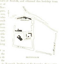
Mettigham castle [user-supplied]
collection: flickr2num_gcps: 10
center: 52.445121,1.471817
user_name: Benjamin G
date_time: 06/05/2015 20:35
View this map in ...
 collection: flickr2
num_gcps: 5
center: 43.067937,-78.987680
user_name: JoaJoch
date_time: 06/05/2015 08:23
View this map in ...

[The Hastings Guide; or, a description of that ancient town and port and its environs ... To which is added some account of the Cinque Ports and a minute detail of the famous Battle of Hastings.]
collection: flickrnum_gcps: 7
center: 50.891809,0.604124
user_name: Leon Deutsch, Chris Austin, [Chris Austin]
date_time: 07/29/2014 16:05
View this map in ...
 collection: flickr2
num_gcps: 5
center: 5.664547,117.021836
user_name: JoaJoch
date_time: 06/11/2015 13:55
View this map in ...

Skelleftea [user-supplied]
collection: flickr2num_gcps: 14
center: 64.748209,20.955231
user_name: Benjamin G
date_time: 06/11/2015 22:06
View this map in ...

Fort Donelson, Tennessee, USA 1867 [user-supplied]
collection: flickr2num_gcps: 3
center: 36.487472,-87.866539
user_name: Sarah Shepherd
date_time: 06/10/2015 22:57
View this map in ...
 collection: flickr2
num_gcps: 4
center: 31.778274,35.230026
user_name: Benjamin G
date_time: 06/13/2015 21:42
View this map in ...

Benton County, Iowa [user-supplied]
collection: flickr2num_gcps: 25
center: 42.199181,-92.066226
user_name: mauricen
date_time: 06/11/2015 13:28
View this map in ...

[Map of Castle at York] [user-supplied]
collection: flickr2num_gcps: 8
center: 53.953801,-1.081970
user_name: Susan Major
date_time: 04/13/2015 20:16
View this map in ...
 collection: flickr2
num_gcps: 3
center: 62.669763,-149.125452
user_name: JoaJoch
date_time: 06/11/2015 14:06
View this map in ...
 collection: flickr2
num_gcps: 9
center: 65.912386,-165.347967
user_name: Dexter Edge
date_time: 06/13/2015 00:16
View this map in ...

Broughton's Archipeligo, British Colombia [user-supplied]
collection: flickr2num_gcps: 14
center: 50.514208,-125.648625
user_name: NEIL TAYLOR
date_time: 06/18/2015 10:58
View this map in ...

Belford village - Holy Island 1878 [user-supplied]
collection: flickr2num_gcps: 9
center: 55.666344,-1.773687
user_name: Esteban Arevalo
date_time: 06/12/2015 18:50
View this map in ...
 collection: flickr2
num_gcps: 5
center: 35.435372,-83.825997
user_name: JoaJoch
date_time: 06/11/2015 14:42
View this map in ...
 collection: flickr2
num_gcps: 3
center: 37.165260,-77.401378
user_name: tonii
date_time: 06/12/2015 22:05
View this map in ...

The Vegetable Products of Canada, from The British Empire, Meiklejohn, 1891 [user-supplied]
collection: flickr2num_gcps: 8
center: 57.202513,-93.298592
user_name: Peter Free
date_time: 06/12/2015 20:36
View this map in ...

San José del Cabo Bay [user-supplied]
collection: flickr2num_gcps: 6
center: 23.032258,-109.692160
user_name: Benjamin G
date_time: 06/20/2015 20:58
View this map in ...
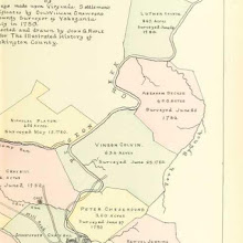
Land surveys near Williamson, West Virginia, 1780 [user-supplied]
collection: flickr2num_gcps: 6
center: 40.159586,-79.969841
user_name: Deborah
date_time: 06/28/2015 14:33
View this map in ...

Insurance Plan of City of London Vol. III: sheet 53
collection: goadnum_gcps: 19
center: 51.510473,-0.076623
user_name: Ian Pickavance, Chris Austin, [Chris Austin]
date_time: 04/16/2014 13:41
View this map in ...

Madagascar, côte sud-ouest et côte sud-est [user-supplied]
collection: flickr2num_gcps: 11
center: -23.933824,46.029505
user_name: Benjamin G
date_time: 06/17/2015 20:07
View this map in ...

Baranya multja és jelenje. [With illustrations and a map.]
collection: flickrnum_gcps: 5
center: 46.077759,18.230256
user_name: Spxtz, Max Friedrich Hartmann, Chris Austin, [Chris Austin]
date_time: 08/06/2014 06:07
View this map in ...

New England [user-supplied]
collection: flickr2num_gcps: 11
center: 42.454854,-71.027955
user_name: Benjamin G
date_time: 06/17/2015 19:42
View this map in ...
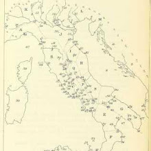 collection: flickr2
num_gcps: 16
center: 40.725421,13.483535
user_name: Benjamin G
date_time: 06/17/2015 21:16
View this map in ...
 collection: flickr2
num_gcps: 11
center: 44.580584,33.589337
user_name: Benjamin G
date_time: 06/17/2015 20:59
View this map in ...

Ireland [user-supplied]
collection: flickr2num_gcps: 15
center: 53.277523,-8.120388
user_name: Benjamin G
date_time: 06/17/2015 20:34
View this map in ...

Saint-Diez des Vosges [user-supplied]
collection: flickr2num_gcps: 22
center: 48.311377,7.037870
user_name: Benjamin G
date_time: 06/17/2015 20:53
View this map in ...

Bokhara [user-supplied]
collection: flickr2num_gcps: 5
center: 39.755600,64.426338
user_name: NEIL TAYLOR
date_time: 06/18/2015 19:13
View this map in ...
 collection: flickr2
num_gcps: 6
center: 49.127293,8.067238
user_name: Benjamin G
date_time: 06/17/2015 20:38
View this map in ...
Islas Canarias [user-supplied]
collection: flickr2num_gcps: 12
center: 28.551728,-15.783780
user_name: Benjamin G
date_time: 06/17/2015 21:09
View this map in ...
 collection: flickr2
num_gcps: 4
center: 22.817701,89.455638
user_name: Margaret Dennehy
date_time: 06/17/2015 22:51
View this map in ...
 collection: flickr2
num_gcps: 10
center: -20.999846,55.396711
user_name: Benjamin G
date_time: 06/18/2015 20:46
View this map in ...

Goderich, Upper Canada [user-supplied]
collection: flickr2num_gcps: 6
center: 43.746114,-81.713676
user_name: Margaret Dennehy
date_time: 06/22/2015 19:59
View this map in ...
Ireland [user-supplied]
collection: flickr2num_gcps: 8
center: 53.552590,-8.086562
user_name: Margaret Dennehy
date_time: 06/22/2015 20:04
View this map in ...

The North Atlantic summer winds [user-supplied]
collection: flickr2num_gcps: 8
center: 27.290712,-37.852215
user_name: Margaret Dennehy
date_time: 06/22/2015 19:33
View this map in ...

Worcestershire [user-supplied]
collection: flickr2num_gcps: 8
center: 52.213943,-2.146356
user_name: Margaret Dennehy
date_time: 06/22/2015 19:41
View this map in ...

Louisiana [user-supplied]
collection: flickr2num_gcps: 6
center: 31.004348,-91.512663
user_name: Margaret Dennehy
date_time: 06/22/2015 20:36
View this map in ...

Concord Village [user-supplied]
collection: flickr2num_gcps: 16
center: 42.455966,-71.395849
user_name: Margaret Dennehy, NEIL TAYLOR
date_time: 06/24/2015 03:57
View this map in ...

Shropshire [user-supplied]
collection: flickr2num_gcps: 9
center: 52.634062,-2.725312
user_name: Margaret Dennehy
date_time: 06/22/2015 21:00
View this map in ...

Barbadoes [user-supplied]
collection: flickr2num_gcps: 4
center: 13.185541,-59.536821
user_name: Margaret Dennehy
date_time: 06/22/2015 20:19
View this map in ...

Cape Town [user-supplied]
collection: flickr2num_gcps: 7
center: -33.923850,18.421457
user_name: Margaret Dennehy
date_time: 06/22/2015 20:54
View this map in ...

Greece & Turkey [user-supplied]
collection: flickr2num_gcps: 6
center: 38.387021,23.916648
user_name: Margaret Dennehy
date_time: 06/22/2015 21:10
View this map in ...

Aleth [user-supplied]
collection: flickr2num_gcps: 3
center: 48.636170,-2.027460
user_name: Margaret Dennehy
date_time: 06/23/2015 08:14
View this map in ...
 collection: flickr2
num_gcps: 3
center: 29.151980,21.480816
user_name: tonii
date_time: 06/24/2015 13:51
View this map in ...

Angouleme [user-supplied]
collection: flickr2num_gcps: 5
center: 45.657367,0.194596
user_name: Margaret Dennehy
date_time: 06/22/2015 21:33
View this map in ...
 collection: flickr2
num_gcps: 5
center: 42.422346,-73.381701
user_name: tonii
date_time: 06/27/2015 19:39
View this map in ...

United States [user-supplied]
collection: flickr2num_gcps: 8
center: 38.005495,-87.632520
user_name: Margaret Dennehy
date_time: 06/22/2015 22:00
View this map in ...

Sargans area , Switzerland [user-supplied]
collection: flickr2num_gcps: 6
center: 47.064426,9.438877
user_name: NEIL TAYLOR
date_time: 06/24/2015 10:31
View this map in ...

Belgium under Roman Rule [user-supplied]
collection: flickr2num_gcps: 8
center: 50.401221,4.546564
user_name: Margaret Dennehy, Deborah
date_time: 06/24/2015 22:16
View this map in ...

The Battlefield of Murfreesboro [user-supplied]
collection: flickr2num_gcps: 4
center: 35.925251,-86.475079
user_name: Margaret Dennehy
date_time: 06/23/2015 23:28
View this map in ...

Caucase Central [user-supplied]
collection: flickr2num_gcps: 6
center: 42.501176,43.237280
user_name: Margaret Dennehy
date_time: 06/24/2015 08:42
View this map in ...

Cape Town and Table Bay [user-supplied]
collection: flickr2num_gcps: 5
center: -33.932851,18.431700
user_name: Margaret Dennehy
date_time: 06/23/2015 23:39
View this map in ...
 collection: flickr2
num_gcps: 7
center: 46.602948,2.713377
user_name: JoaJoch
date_time: 06/24/2015 08:23
View this map in ...

Jerusalem [user-supplied]
collection: flickr2num_gcps: 14
center: 31.777620,35.233267
user_name: NEIL TAYLOR
date_time: 06/24/2015 05:06
View this map in ...

Switzerland [user-supplied]
collection: flickr2num_gcps: 6
center: 46.580431,7.221178
user_name: Margaret Dennehy
date_time: 06/24/2015 14:09
View this map in ...
Insurance Plan of Nottingham Vol. II: sheet 30-1
collection: goadnum_gcps: 5
center: 52.956788,-1.173347
user_name: Ian Pickavance, [Mark Setrem]
date_time: 11/22/2013 17:27
View this map in ...

Onondaga [user-supplied]
collection: flickr2num_gcps:
center:
user_name:
date_time:
View this map in ...

Tennessee: the Tullahoma Campaign [user-supplied]
collection: flickr2num_gcps: 5
center: 35.742459,-85.040440
user_name: Margaret Dennehy
date_time: 06/24/2015 16:21
View this map in ...

Sutton Park [user-supplied]
collection: flickr2num_gcps: 49
center: 52.569746,-1.847672
user_name: mauricen
date_time: 05/10/2015 22:29
View this map in ...

Sketch of Goolas the Ancient Olas [user-supplied]
collection: flickr2num_gcps:
center:
user_name:
date_time:
View this map in ...

The Outer Hebrides [user-supplied]
collection: flickr2num_gcps: 6
center: 57.692904,-6.702715
user_name: Margaret Dennehy
date_time: 06/24/2015 09:25
View this map in ...

North Missouri: Trees and Shrubs [user-supplied]
collection: flickr2num_gcps: 5
center: 39.613240,-93.354206
user_name: Margaret Dennehy
date_time: 06/24/2015 08:58
View this map in ...
 collection: flickr2
num_gcps: 27
center: 25.026712,-9.083676
user_name: Flo Schmiede
date_time: 06/24/2015 10:59
View this map in ...
 collection: flickr2
num_gcps: 9
center: 40.750090,14.483820
user_name: tonii
date_time: 06/24/2015 13:25
View this map in ...

Africa [user-supplied]
collection: flickr2num_gcps: 13
center: 5.412171,16.557174
user_name: Margaret Dennehy
date_time: 06/24/2015 15:50
View this map in ...

Baie de Smyrne [user-supplied]
collection: flickr2num_gcps: 7
center: 38.629146,26.772300
user_name: Margaret Dennehy, Deborah
date_time: 06/24/2015 17:00
View this map in ...

Gulf of Mexico [user-supplied]
collection: flickr2num_gcps: 5
center: 29.127880,-89.053769
user_name: Margaret Dennehy, Deborah
date_time: 07/07/2015 16:55
View this map in ...
 collection: flickr2
num_gcps: 6
center: 47.935369,13.773614
user_name: Vladimir Menkov
date_time: 06/26/2015 04:39
View this map in ...

Colony of the Cape of Good Hope [user-supplied]
collection: flickr2num_gcps: 3
center: -32.173629,24.976729
user_name: Margaret Dennehy
date_time: 06/24/2015 20:42
View this map in ...

Dieulacresse Abbey [user-supplied]
collection: flickr2num_gcps: 5
center: 53.117769,-2.026691
user_name: Margaret Dennehy, Vladimir Menkov
date_time: 06/26/2015 03:44
View this map in ...

Chatsworth House, Derbyshire ,England . Floor plan [user-supplied]
collection: flickr2num_gcps: 5
center: 53.227192,-1.611660
user_name: NEIL TAYLOR
date_time: 06/25/2015 05:35
View this map in ...

Insurance Plan of London North West District Vol. C: sheet 18-2
collection: goadnum_gcps: 11
center: 51.553219,-0.140955
user_name: Ian Pickavance, Chris Austin, [Chris Austin]
date_time: 02/19/2014 10:36
View this map in ...
 collection: flickr2
num_gcps:
center:
user_name:
date_time:
View this map in ...

England [user-supplied]
collection: flickr2num_gcps: 4
center: 52.593160,-2.043701
user_name: Margaret Dennehy
date_time: 06/24/2015 09:57
View this map in ...

Reiderland [user-supplied]
collection: flickr2num_gcps: 6
center: 53.259773,7.037318
user_name: Margaret Dennehy
date_time: 06/24/2015 17:12
View this map in ...

Durham, Australia [user-supplied]
collection: flickr2num_gcps: 6
center: -32.410020,151.331845
user_name: Margaret Dennehy
date_time: 06/24/2015 17:25
View this map in ...

South Eastern Asia [user-supplied]
collection: flickr2num_gcps: 10
center: 15.580523,112.386413
user_name: Margaret Dennehy
date_time: 06/24/2015 09:53
View this map in ...

Railway Map of Southern Italy [user-supplied]
collection: flickr2num_gcps: 4
center: 39.238436,10.859140
user_name: Margaret Dennehy
date_time: 06/24/2015 16:51
View this map in ...
 collection: flickr2
num_gcps: 8
center: 41.000651,-92.397699
user_name: Thaddeus Breen
date_time: 06/25/2015 23:23
View this map in ...

Spain [user-supplied]
collection: flickr2num_gcps: 9
center: 39.199098,-2.016566
user_name: Margaret Dennehy
date_time: 06/24/2015 09:45
View this map in ...

Honduras [user-supplied]
collection: flickr2num_gcps: 5
center: 14.628265,-87.781671
user_name: Margaret Dennehy
date_time: 06/29/2015 22:12
View this map in ...

France & Switzerland [user-supplied]
collection: flickr2num_gcps: 6
center: 45.617612,5.910688
user_name: Margaret Dennehy
date_time: 06/30/2015 19:55
View this map in ...

Balaklava [user-supplied]
collection: flickr2num_gcps: 6
center: 44.527408,33.578029
user_name: Margaret Dennehy, NEIL TAYLOR
date_time: 06/30/2015 23:31
View this map in ...
Turkey in Asia & Arabia [user-supplied]
collection: flickr2num_gcps: 7
center: 36.065006,37.440670
user_name: Margaret Dennehy
date_time: 06/30/2015 19:49
View this map in ...

Plan of St. Gregory's Church, Caelius hill, Rome [user-supplied]
collection: flickr2num_gcps: 5
center: 41.885478,12.490636
user_name: NEIL TAYLOR
date_time: 07/01/2015 16:57
View this map in ...
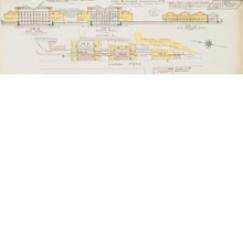
Leeds Carriers' Warehouse District: sheet 108-1
collection: goadnum_gcps: 5
center: 53.801484,-1.750789
user_name: Peter Free, Susan Major, [Chris Austin]
date_time: 12/26/2013 15:02
View this map in ...

Duren [user-supplied]
collection: flickr2num_gcps: 7
center: 50.801676,6.483044
user_name: Margaret Dennehy, NEIL TAYLOR
date_time: 06/30/2015 22:19
View this map in ...
 collection: flickr2
num_gcps:
center:
user_name:
date_time:
View this map in ...

Aegean Sea [user-supplied]
collection: flickr2num_gcps: 4
center: 37.933363,25.332919
user_name: Margaret Dennehy
date_time: 06/30/2015 20:09
View this map in ...

South Wales & Bristol Channel [user-supplied]
collection: flickr2num_gcps: 6
center: 51.452597,-3.200459
user_name: Margaret Dennehy
date_time: 06/30/2015 20:24
View this map in ...

Earls Court and Old Brompton Road, London [user-supplied]
collection: flickr2num_gcps: 8
center: 51.490765,-0.191205
user_name: NEIL TAYLOR
date_time: 06/30/2015 23:43
View this map in ...

Bering Strait and Alaska [user-supplied]
collection: flickr2num_gcps: 8
center: 62.020034,-159.036212
user_name: NEIL TAYLOR
date_time: 07/01/2015 17:46
View this map in ...

Africa [user-supplied]
collection: flickr2num_gcps: 5
center: 0.832661,0.560052
user_name: Margaret Dennehy
date_time: 06/30/2015 21:14
View this map in ...
Netherlands [user-supplied]
collection: flickr2num_gcps: 7
center: 51.468183,4.970546
user_name: Margaret Dennehy
date_time: 06/30/2015 20:30
View this map in ...

Les Pyrenees [user-supplied]
collection: flickr2num_gcps: 6
center: 42.714879,-0.010315
user_name: Margaret Dennehy, NEIL TAYLOR
date_time: 07/01/2015 16:04
View this map in ...

Insurance Plan of the City of Liverpool Vol. II: sheet 27
collection: goadnum_gcps: 5
center: 53.410195,-2.998158
user_name: mauricen, Mark Setrem, [Mark Setrem]
date_time: 12/16/2013 14:24
View this map in ...

Battle of Lesnoi [user-supplied]
collection: flickr2num_gcps: 5
center: 58.591707,59.812931
user_name: Deborah
date_time: 07/25/2015 13:58
View this map in ...
 collection: flickr2
num_gcps: 9
center: 38.625883,23.294484
user_name: NEIL TAYLOR
date_time: 07/02/2015 00:12
View this map in ...
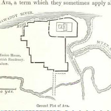
Ava, Burma [user-supplied]
collection: flickr2num_gcps: 7
center: 21.842574,95.980374
user_name: Margaret Dennehy, Deborah
date_time: 07/01/2015 22:31
View this map in ...

Bradford [user-supplied]
collection: flickr2num_gcps: 6
center: 53.790809,-1.761903
user_name: Deborah
date_time: 07/01/2015 19:52
View this map in ...

Vicinity of St Louis [user-supplied]
collection: flickr2num_gcps: 5
center: 38.830894,-90.329440
user_name: NEIL TAYLOR
date_time: 07/01/2015 18:32
View this map in ...

Map of the coast between Cambay and Surat
collection: mootnum_gcps: 5
center: 21.966903,72.979294
user_name: mauricen, Mark Setrem, [Mark Setrem]
date_time: 10/26/2013 19:13
View this map in ...

Shippegan Peninsula & Island [user-supplied]
collection: flickr2num_gcps: 8
center: 47.742699,-64.653478
user_name: Margaret Dennehy, NEIL TAYLOR
date_time: 07/02/2015 12:24
View this map in ...

Insurance Plan of the City of Liverpool Vol. III: sheet 46-1
collection: goadnum_gcps: 27
center: 53.422162,-2.996154
user_name: Ian Pickavance, Chris Austin, [Chris Austin]
date_time: 03/28/2014 13:45
View this map in ...

Gulf of Calafornia and North West Mexico [user-supplied]
collection: flickr2num_gcps: 12
center: 28.685548,-108.599205
user_name: NEIL TAYLOR
date_time: 07/01/2015 18:56
View this map in ...

Christinehamn [user-supplied]
collection: flickr2num_gcps: 9
center: 59.309209,14.108357
user_name: Margaret Dennehy, NEIL TAYLOR
date_time: 07/02/2015 11:05
View this map in ...
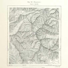
Darjiling [user-supplied]
collection: flickr2num_gcps: 4
center: 26.980160,88.281229
user_name: Margaret Dennehy, Benjamin G
date_time: 07/01/2015 21:40
View this map in ...

Netherlands [user-supplied]
collection: flickr2num_gcps: 8
center: 52.442542,5.345816
user_name: Margaret Dennehy
date_time: 07/01/2015 19:53
View this map in ...
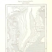
Greenland Floe-Ice [user-supplied]
collection: flickr2num_gcps: 7
center: 71.697650,-46.435368
user_name: Margaret Dennehy, Benjamin G
date_time: 07/01/2015 21:44
View this map in ...
 collection: flickr2
num_gcps: 5
center: 42.378474,-72.586473
user_name: Deborah
date_time: 07/05/2015 13:20
View this map in ...

Waringstown, Ulster [user-supplied]
collection: flickr2num_gcps: 5
center: 54.432449,-6.299504
user_name: Margaret Dennehy, Benjamin G, NEIL TAYLOR
date_time: 07/02/2015 11:35
View this map in ...

Orkney and Shetland Islands [user-supplied]
collection: flickr2num_gcps: 14
center: 59.768567,-2.101217
user_name: NEIL TAYLOR
date_time: 07/02/2015 18:31
View this map in ...

Philippeville a Alger [user-supplied]
collection: flickr2num_gcps: 5
center: 36.582534,4.991770
user_name: Margaret Dennehy
date_time: 07/02/2015 11:20
View this map in ...
 collection: flickr2
num_gcps: 5
center: 30.559013,85.153231
user_name: tonii
date_time: 07/02/2015 19:07
View this map in ...

Southern Europe and North Africa [user-supplied]
collection: flickr2num_gcps: 30
center: 38.603598,17.260327
user_name: NEIL TAYLOR
date_time: 07/02/2015 18:50
View this map in ...
 collection: flickr2
num_gcps:
center:
user_name:
date_time:
View this map in ...

Tibet, Tartary, and Mongolia, their social and political condition, and the religion of Boodh as there existing, etc
collection: flickrnum_gcps: 6
center: 39.070242,97.328930
user_name: James Atkinson, Chris Austin, [Chris Austin]
date_time: 07/30/2014 10:27
View this map in ...
 collection: flickr2
num_gcps: 7
center: -10.747121,166.798105
user_name: tonii
date_time: 07/02/2015 18:37
View this map in ...

Africa [user-supplied]
collection: flickr2num_gcps: 16
center: -1.094282,19.038767
user_name: NEIL TAYLOR
date_time: 07/02/2015 19:00
View this map in ...
 collection: flickr2
num_gcps: 3
center: -8.109303,114.834881
user_name: Deborah
date_time: 07/04/2015 23:29
View this map in ...
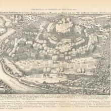 collection: flickr2
num_gcps: 4
center: 49.234846,9.175036
user_name: tonii
date_time: 07/02/2015 19:19
View this map in ...

Egypt, from A Visit to Egypt in 1872, Armstrong, 1874 [user-supplied]
collection: flickr2num_gcps: 10
center: 27.749789,31.774197
user_name: Peter Free
date_time: 07/02/2015 19:59
View this map in ...
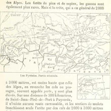 collection: flickr2
num_gcps: 3
center: 42.777099,1.795909
user_name: tonii
date_time: 07/02/2015 19:30
View this map in ...

Ingleborough, Yorkshire [user-supplied]
collection: flickr2num_gcps: 5
center: 54.166475,-2.395960
user_name: Margaret Dennehy, Hunter
date_time: 07/06/2015 04:46
View this map in ...

Ancient Bridge of the Guillotiere, Lyon, France, from Nouvelle Histoire de Lyon et des provinces de Lyonnais, Steyert, 1895 [user-supplied]
collection: flickr2num_gcps: 8
center: 45.756367,4.839409
user_name: Peter Free
date_time: 07/02/2015 20:18
View this map in ...

Sydney [user-supplied]
collection: flickr2num_gcps: 5
center: -33.846256,151.190804
user_name: Margaret Dennehy
date_time: 07/02/2015 21:12
View this map in ...

Gaule Cisalpine [user-supplied]
collection: flickr2num_gcps: 3
center: 43.771030,11.387571
user_name: Margaret Dennehy
date_time: 07/04/2015 14:19
View this map in ...

Lake of Trasimeno [user-supplied]
collection: flickr2num_gcps: 4
center: 43.111726,12.076134
user_name: Margaret Dennehy
date_time: 07/04/2015 15:02
View this map in ...

Rivages de la Mediterranee Occidentale [user-supplied]
collection: flickr2num_gcps: 5
center: 37.941859,-0.908354
user_name: Margaret Dennehy
date_time: 07/04/2015 14:50
View this map in ...
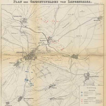
Battle field of Langensalza [user-supplied]
collection: flickr2num_gcps: 11
center: 51.108583,10.678599
user_name: Deborah
date_time: 07/04/2015 13:24
View this map in ...

Chatel et ses Environs [user-supplied]
collection: flickr2num_gcps: 8
center: 48.388522,6.398604
user_name: Margaret Dennehy
date_time: 07/04/2015 14:47
View this map in ...

Third Battle of Plevna [user-supplied]
collection: flickr2num_gcps: 7
center: 43.422039,24.646508
user_name: Margaret Dennehy, tonii
date_time: 07/05/2015 16:22
View this map in ...

US-Canada Border [user-supplied]
collection: flickr2num_gcps: 5
center: 44.653053,-75.060862
user_name: Margaret Dennehy
date_time: 07/04/2015 14:37
View this map in ...
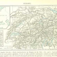
Suisse [user-supplied]
collection: flickr2num_gcps: 5
center: 46.763866,8.360672
user_name: Margaret Dennehy
date_time: 07/04/2015 15:06
View this map in ...

Battle of Albuera [user-supplied]
collection: flickr2num_gcps: 4
center: 38.687166,-6.812106
user_name: Margaret Dennehy, Benjamin G
date_time: 07/05/2015 10:17
View this map in ...

The Counties of Southern California [user-supplied]
collection: flickr2num_gcps: 6
center: 33.741579,-119.368758
user_name: Margaret Dennehy
date_time: 07/04/2015 19:18
View this map in ...

Gergovia [user-supplied]
collection: flickr2num_gcps: 6
center: 45.712543,3.127835
user_name: Margaret Dennehy, tonii
date_time: 07/05/2015 20:42
View this map in ...

Southampton and Hythe [user-supplied]
collection: flickr2num_gcps: 7
center: 50.884244,-1.400775
user_name: Margaret Dennehy, tonii
date_time: 07/05/2015 20:47
View this map in ...

Insurance Plan of Kingston, Jamaica (Sheet 6)
collection: worldwidenum_gcps: 12
center: 17.964962,-76.788774
user_name: Greg Ruprecht Withnail, Mark Setrem, [Mark Setrem]
date_time: 10/28/2013 11:46
View this map in ...

Le Quartier de St Antoine [user-supplied]
collection: flickr2num_gcps: 7
center: 48.856098,2.363791
user_name: Margaret Dennehy
date_time: 07/04/2015 23:34
View this map in ...

East Dereham
collection: osdrawingsnum_gcps: 154
center: 52.676120,0.896625
user_name: Sue White, Mark Setrem, Chris Austin, [Chris Austin]
date_time: 11/11/2013 15:27
View this map in ...

Map of the Thames [user-supplied]
collection: flickr2num_gcps: 8
center: 51.600634,-0.356819
user_name: NEIL TAYLOR
date_time: 07/15/2015 13:48
View this map in ...
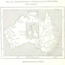
Australia [user-supplied]
collection: flickr2num_gcps: 5
center: -23.790866,131.786616
user_name: Margaret Dennehy
date_time: 07/15/2015 21:08
View this map in ...
 collection: flickr2
num_gcps:
center:
user_name:
date_time:
View this map in ...
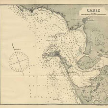
Cadiz [user-supplied]
collection: flickr2num_gcps: 5
center: 36.531097,-6.299653
user_name: Margaret Dennehy
date_time: 07/15/2015 21:15
View this map in ...

Melbourne & Port Philipp [user-supplied]
collection: flickr2num_gcps: 6
center: -38.105764,144.757656
user_name: Margaret Dennehy
date_time: 07/15/2015 21:29
View this map in ...

Austria-Hungary [user-supplied]
collection: flickr2num_gcps: 6
center: 46.922798,18.003198
user_name: Margaret Dennehy
date_time: 07/15/2015 21:38
View this map in ...

Waterbury, Connecticut [user-supplied]
collection: flickr2num_gcps: 5
center: 41.556280,-73.056507
user_name: Margaret Dennehy, NEIL TAYLOR
date_time: 07/16/2015 13:20
View this map in ...
Old and New London, etc
collection: flickrnum_gcps: 7
center: 51.518396,-0.089156
user_name: Pete_Y, [Chris Austin]
date_time: 07/10/2014 12:06
View this map in ...

Plan of the City of New York about 1804 [user-supplied]
collection: flickr2num_gcps: 10
center: 40.713535,-73.996918
user_name: NEIL TAYLOR
date_time: 07/16/2015 14:04
View this map in ...

Piccadilly London showing the Royal Academy [user-supplied]
collection: flickr2num_gcps: 7
center: 51.509786,-0.139986
user_name: NEIL TAYLOR
date_time: 07/16/2015 14:17
View this map in ...

Wayne County [user-supplied]
collection: flickr2num_gcps: 9
center: 44.166202,-83.413931
user_name: NEIL TAYLOR
date_time: 07/16/2015 15:07
View this map in ...

Eastern Mediterranian Sea [user-supplied]
collection: flickr2num_gcps: 13
center: 36.145281,32.139033
user_name: NEIL TAYLOR
date_time: 07/16/2015 15:39
View this map in ...

Rain map of Germany [user-supplied]
collection: flickr2num_gcps: 11
center: 51.251009,13.895561
user_name: NEIL TAYLOR
date_time: 07/16/2015 14:31
View this map in ...

Gefechte Hunyady's in der Umgebung von Nis bis zum 3. November 1443. Schlacht am Fusse des Kunoviza Gebirges. Anfangs (ungefähr den 6.) Jänner 1444. [user-supplied]
collection: flickr2num_gcps: 6
center: 43.346825,22.089640
user_name: Michael Ammon
date_time: 07/17/2015 12:45
View this map in ...

Insurance Plan of Batley and Dewsbury: sheet 2-2
collection: goadnum_gcps: 5
center: 53.717978,-1.638109
user_name: Susan Major, Chris Austin, [Chris Austin]
date_time: 12/17/2013 11:34
View this map in ...
 collection: flickr2
num_gcps: 11
center: 38.019713,23.616812
user_name: Michael Ammon
date_time: 07/17/2015 12:34
View this map in ...
 collection: flickr2
num_gcps: 30
center: 51.477874,13.186297
user_name: Chris S
date_time: 07/17/2015 14:38
View this map in ...
 collection: flickr2
num_gcps: 6
center: 31.270685,-86.259234
user_name: Michael Ammon
date_time: 07/17/2015 15:15
View this map in ...

Vinland and the North Atlantic [user-supplied]
collection: flickr2num_gcps: 17
center: 53.126357,-41.121119
user_name: NEIL TAYLOR
date_time: 07/17/2015 14:58
View this map in ...

Modern Geography, a description of the Empires, states, and colonies, with the oceans, seas and islands in all parts of the World ... The Astronomical Introduction by the Rev. S. Vince. With numerous maps
collection: flickrnum_gcps: 26
center: 41.222608,12.207365
user_name: Andrew Gray, [Chris Austin]
date_time: 07/10/2014 11:40
View this map in ...

The Lake Regions of Central Africa. A record of modern discovery ... With ... illustrations
collection: flickrnum_gcps: 13
center: -11.440074,24.581258
user_name: mauricen, [Chris Austin]
date_time: 07/10/2014 10:34
View this map in ...

La Loire [user-supplied]
collection: flickr2num_gcps: 5
center: 48.082924,1.491943
user_name: Margaret Dennehy
date_time: 07/17/2015 18:12
View this map in ...
 collection: flickr2
num_gcps: 32
center: 46.104092,6.695946
user_name: mauricen
date_time: 04/16/2015 21:48
View this map in ...

Essex forests [user-supplied]
collection: flickr2num_gcps: 8
center: 51.630946,0.108737
user_name: mauricen
date_time: 05/10/2015 22:05
View this map in ...

Alabama as it is; or, The Immigrant's and Capitalist's Guide Book to Alabama, etc
collection: flickrnum_gcps: 7
center: 36.896552,-95.080552
user_name: mauricen, [Chris Austin]
date_time: 07/10/2014 10:09
View this map in ...

Insurance Plan of London North East District Vol. F: sheet 18
collection: goadnum_gcps: 5
center: 51.527981,0.000536
user_name: Stiliyana Simeonova, Mark Setrem, Chris Austin, [Chris Austin]
date_time: 02/07/2014 13:07
View this map in ...

Jerusalem [user-supplied]
collection: flickr2num_gcps: 8
center: 31.771699,35.235740
user_name: Margaret Dennehy, Benjamin G
date_time: 07/18/2015 09:13
View this map in ...

Puerto Metalanin [user-supplied]
collection: flickr2num_gcps: 10
center: 6.868613,158.329710
user_name: Deborah
date_time: 07/17/2015 19:06
View this map in ...

Argentoratum nach v. Apell [user-supplied]
collection: flickr2num_gcps: 15
center: 48.583033,7.752037
user_name: Michael Ammon
date_time: 07/17/2015 15:02
View this map in ...

Europe [user-supplied]
collection: flickr2num_gcps: 7
center: 54.194606,20.934399
user_name: Margaret Dennehy
date_time: 07/23/2015 10:55
View this map in ...

Java [user-supplied]
collection: flickr2num_gcps: 3
center: -7.148357,109.962777
user_name: Margaret Dennehy
date_time: 07/23/2015 11:31
View this map in ...
Magna Britannia; being a concise topographical account of the several counties of Great Britain. [With copious illustrations.] vol. 1-6. L.P
collection: flickrnum_gcps:
center:
user_name:
date_time:
View this map in ...
 collection: flickr2
num_gcps: 5
center: 43.434114,-76.440820
user_name: Karina
date_time: 07/23/2015 17:30
View this map in ...

Big Bethel, Virginia [user-supplied]
collection: flickr2num_gcps: 5
center: 37.130714,-76.453557
user_name: Margaret Dennehy, Karina
date_time: 07/23/2015 17:57
View this map in ...

Wolseley Agency, Saskatchewan, Canada [user-supplied]
collection: flickr2num_gcps: 7
center: 50.485670,-103.380246
user_name: NEIL TAYLOR
date_time: 07/23/2015 13:25
View this map in ...

St Stephen's, Vienna, AUstria [user-supplied]
collection: flickr2num_gcps: 5
center: 48.208478,16.373210
user_name: NEIL TAYLOR
date_time: 07/23/2015 18:37
View this map in ...

Gold, copper and lead in Chota Nagpore
collection: worldwidenum_gcps: 7
center: 22.951550,85.054986
user_name: Chris Austin, Mark Setrem, [Chris Austin]
date_time: 10/28/2013 18:10
View this map in ...

North Africa [user-supplied]
collection: flickr2num_gcps: 15
center: 21.114474,15.986098
user_name: NEIL TAYLOR
date_time: 07/23/2015 12:25
View this map in ...

BOWLES'S NEW PLAN OF LONDON, WESTMINSTER AND SOUTHWARK, WITH THEIR ENVIRONS TO THE EXTENT OF THREE MILES ROUND ST. PAUL'S
collection: phase2num_gcps: 25
center: 51.513400,-0.097749
user_name: Owain, Mark Setrem, [Mark Setrem]
date_time: 10/28/2013 15:02
View this map in ...

Histoire d'Angleterre ... Nouvelle édition, augmentée de plus d'un tiers, et enrichie ... de gravures, etc
collection: flickrnum_gcps: 8
center: 56.027430,-1.346311
user_name: Mark Setrem, Chris Austin, [Chris Austin]
date_time: 07/30/2014 15:23
View this map in ...

England and Wales Counties [user-supplied]
collection: flickr2num_gcps: 11
center: 52.707465,-2.133662
user_name: NEIL TAYLOR
date_time: 07/23/2015 18:52
View this map in ...

General Lee and Pope's Campaign in Virginia [user-supplied]
collection: flickr2num_gcps: 10
center: 38.516820,-77.527453
user_name: NEIL TAYLOR
date_time: 07/23/2015 18:47
View this map in ...

Crick, Derbyshire and area [user-supplied]
collection: flickr2num_gcps: 5
center: 53.071004,-1.506397
user_name: NEIL TAYLOR
date_time: 07/23/2015 19:16
View this map in ...
 collection: flickr2
num_gcps: 5
center: 50.191630,-121.745511
user_name: Martin Greggor
date_time: 08/03/2015 18:45
View this map in ...

Northern part of New Jersey, 1781, from The News' History of Passaic, PAPE, 1899 [user-supplied]
collection: flickr2num_gcps: 9
center: 40.863741,-74.176718
user_name: Margaret Dennehy, Peter Free
date_time: 08/04/2015 20:39
View this map in ...

Mexico [user-supplied]
collection: flickr2num_gcps: 5
center: 25.819121,-98.889457
user_name: Margaret Dennehy, Sarah Shepherd
date_time: 08/04/2015 00:35
View this map in ...
 collection: flickr2
num_gcps: 7
center: 21.005908,-103.622845
user_name: Martin Greggor
date_time: 08/03/2015 19:14
View this map in ...

Forests of the Western United States [user-supplied]
collection: flickr2num_gcps: 6
center: 40.041913,-115.589103
user_name: NEIL TAYLOR
date_time: 08/03/2015 19:10
View this map in ...
 collection: flickr2
num_gcps:
center:
user_name:
date_time:
View this map in ...

Syria [user-supplied]
collection: flickr2num_gcps: 4
center: 35.799361,38.662060
user_name: NEIL TAYLOR
date_time: 08/03/2015 19:20
View this map in ...
 collection: flickr2
num_gcps: 12
center: 67.202569,-53.581107
user_name: NEIL TAYLOR
date_time: 08/03/2015 19:42
View this map in ...

Copenhagen [user-supplied]
collection: flickr2num_gcps: 9
center: 55.696892,12.561802
user_name: NEIL TAYLOR
date_time: 08/04/2015 06:32
View this map in ...

Map of St Kilda [user-supplied]
collection: flickr2num_gcps: 9
center: 57.810634,-8.584034
user_name: Susan Major
date_time: 04/19/2015 10:19
View this map in ...
 collection: flickr2
num_gcps:
center:
user_name:
date_time:
View this map in ...

Washington [user-supplied]
collection: flickr2num_gcps: 3
center: 38.786151,-76.707879
user_name: Margaret Dennehy
date_time: 08/03/2015 21:30
View this map in ...

Russo-Turkish Asiatic Campaigns [user-supplied]
collection: flickr2num_gcps: 12
center: 40.787437,42.632200
user_name: NEIL TAYLOR
date_time: 08/04/2015 06:51
View this map in ...
 collection: flickr2
num_gcps: 17
center: 32.558839,-100.177015
user_name: Thaddeus Breen
date_time: 08/10/2015 23:07
View this map in ...
Insurance Plan of City of London Vol. III: sheet 51
collection: goadnum_gcps: 17
center: 51.509382,-0.082686
user_name: fpattman, Chris Austin, [Chris Austin]
date_time: 04/16/2014 13:52
View this map in ...

Scarpanto, Mediterranean Sea, Messocorio
collection: worldwidenum_gcps: 13
center: 35.613799,27.131284
user_name: mauricen, Chris Austin, [Chris Austin]
date_time: 10/25/2013 13:07
View this map in ...

The Nika Riot [user-supplied]
collection: flickr2num_gcps: 8
center: 41.007038,28.975641
user_name: NEIL TAYLOR
date_time: 08/10/2015 17:34
View this map in ...

La Belgique a la XVIIIme Siecle [user-supplied]
collection: flickr2num_gcps: 18
center: 50.894435,4.069393
user_name: NEIL TAYLOR
date_time: 08/10/2015 13:47
View this map in ...

South America [user-supplied]
collection: flickr2num_gcps: 20
center: -21.908346,-57.850370
user_name: NEIL TAYLOR
date_time: 08/10/2015 16:58
View this map in ...
 collection: flickr2
num_gcps:
center:
user_name:
date_time:
View this map in ...

Cavan, Westmeath and Meath [user-supplied]
collection: flickr2num_gcps: 15
center: 53.819399,-7.115906
user_name: NEIL TAYLOR
date_time: 08/10/2015 14:44
View this map in ...

Allgemeine Kriegsgeschichte aller Völker und Zeiten. Herausgegeben von Fürst N. S. Galitzin. (I., II., IV. Abth. Aus dem Russischen ins Deutsche übersetzt von Streccius. II Abth. ... ins Deutsche übersetzt von Eichwald.)
collection: flickrnum_gcps: 6
center: 49.758668,17.263260
user_name: A. Schulz-Dieterich, Chris Austin, [Chris Austin]
date_time: 08/01/2014 17:02
View this map in ...
 collection: flickr2
num_gcps:
center:
user_name:
date_time:
View this map in ...

Russie d' Europe [user-supplied]
collection: flickr2num_gcps: 22
center: 55.236649,37.890550
user_name: NEIL TAYLOR
date_time: 08/10/2015 14:31
View this map in ...

The Russian Acquisitions in Asia [user-supplied]
collection: flickr2num_gcps: 11
center: 40.097126,42.283473
user_name: NEIL TAYLOR
date_time: 08/10/2015 17:23
View this map in ...

Barnard Castle [user-supplied]
collection: flickr2num_gcps: 18
center: 54.542845,-1.925665
user_name: mauricen
date_time: 06/17/2015 22:03
View this map in ...
 collection: flickr2
num_gcps: 54
center: -22.305697,142.997176
user_name: Thaddeus Breen
date_time: 08/10/2015 23:40
View this map in ...
 collection: flickr2
num_gcps: 7
center: 18.640046,-69.784964
user_name: History_Librarian
date_time: 08/12/2015 13:10
View this map in ...
 collection: flickr2
num_gcps:
center:
user_name:
date_time:
View this map in ...
 collection: flickr2
num_gcps: 5
center: -27.410454,117.900982
user_name: Tracey Bassett
date_time: 08/13/2015 11:36
View this map in ...

Colored plan of Bellegarde or Seurre
collection: worldwidenum_gcps: 5
center: 46.997821,5.145966
user_name: ayoung@calacademy.org, Mark Setrem, [Mark Setrem]
date_time: 10/29/2013 17:54
View this map in ...

Yellowstone Park, Wyoming, USA, from 'Fifth Avenue to Alaska', PIERREPONT, 1884 [user-supplied]
collection: flickr2num_gcps: 7
center: 44.587667,-110.455525
user_name: Peter Free
date_time: 08/12/2015 20:54
View this map in ...

Israel [user-supplied]
collection: flickr2num_gcps: 15
center: 32.036838,35.044861
user_name: mauricen
date_time: 08/12/2015 22:19
View this map in ...

Chaumont au XVIe Siecle [user-supplied]
collection: flickr2num_gcps: 5
center: 48.111598,5.130385
user_name: Margaret Dennehy, Deborah
date_time: 08/16/2015 15:51
View this map in ...
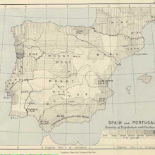
Spain & Portugal [user-supplied]
collection: flickr2num_gcps: 4
center: 39.742221,-3.053929
user_name: Margaret Dennehy
date_time: 08/12/2015 15:01
View this map in ...
 collection: flickr2
num_gcps: 4
center: 48.258230,15.236478
user_name: Margaret Dennehy
date_time: 08/13/2015 07:15
View this map in ...
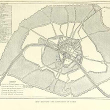
Extension of Paris, France 1860 [user-supplied]
collection: flickr2num_gcps: 29
center: 48.858541,2.333291
user_name: Sarah Shepherd
date_time: 08/12/2015 23:35
View this map in ...

Operations at Roanoke Island [user-supplied]
collection: flickr2num_gcps: 13
center: 35.882387,-75.675063
user_name: NEIL TAYLOR
date_time: 08/13/2015 07:11
View this map in ...

Increase and Decrease in the Natives of each County 1861 -1871 for British Isles [user-supplied]
collection: flickr2num_gcps: 16
center: 54.244377,-4.430623
user_name: NEIL TAYLOR
date_time: 08/13/2015 08:06
View this map in ...

Plan of the attack on the Malakoff, Sevastopol [user-supplied]
collection: flickr2num_gcps: 11
center: 44.606177,33.545772
user_name: NEIL TAYLOR
date_time: 08/13/2015 07:47
View this map in ...

Antwerp [user-supplied]
collection: flickr2num_gcps: 12
center: 51.220876,4.409146
user_name: Margaret Dennehy, NEIL TAYLOR
date_time: 08/13/2015 09:39
View this map in ...

The Lake District [user-supplied]
collection: flickr2num_gcps: 5
center: 54.443649,-3.182456
user_name: Margaret Dennehy
date_time: 08/13/2015 07:30
View this map in ...
 collection: flickr2
num_gcps:
center:
user_name:
date_time:
View this map in ...

Insurance Plan of London Western District Vol. A: sheet 38-3
collection: goadnum_gcps: 4
center: 51.493931,-0.132782
user_name: jimmccusker, [Mark Setrem]
date_time: 11/23/2013 12:48
View this map in ...

France [user-supplied]
collection: flickr2num_gcps: 7
center: 46.523177,-1.156071
user_name: Margaret Dennehy
date_time: 08/14/2015 09:09
View this map in ...

Charleston [user-supplied]
collection: flickr2num_gcps:
center:
user_name:
date_time:
View this map in ...

Flanders [user-supplied]
collection: flickr2num_gcps: 7
center: 51.190364,2.797154
user_name: NEIL TAYLOR
date_time: 08/14/2015 09:18
View this map in ...

Wijhe - Diepenveen [user-supplied]
collection: flickr2num_gcps: 8
center: 52.349222,6.152525
user_name: NEIL TAYLOR
date_time: 08/14/2015 19:20
View this map in ...

Korea and the Sacred White Mountain ... with an account of an ascent of the White Mountain by Captain H. E. Goold-Adams. With ... illustrations and ... maps
collection: flickrnum_gcps: 16
center: 38.131203,127.435978
user_name: Susan Major, Chris Austin, [Chris Austin]
date_time: 08/01/2014 16:57
View this map in ...
 collection: flickr2
num_gcps: 7
center: 58.983087,12.687106
user_name: Tracey B
date_time: 08/14/2015 12:45
View this map in ...

Rome [user-supplied]
collection: flickr2num_gcps: 6
center: 41.887866,12.463224
user_name: NEIL TAYLOR
date_time: 08/14/2015 18:34
View this map in ...

The Liverpool Water Works [user-supplied]
collection: flickr2num_gcps: 7
center: 53.546257,-2.729760
user_name: Deborah
date_time: 08/14/2015 13:38
View this map in ...
 collection: flickr2
num_gcps: 7
center: 45.992106,7.671768
user_name: Deborah
date_time: 08/16/2015 19:33
View this map in ...

New Hampshire [user-supplied]
collection: flickr2num_gcps: 6
center: 43.193461,-72.421268
user_name: Margaret Dennehy, NEIL TAYLOR
date_time: 08/15/2015 18:36
View this map in ...
 collection: flickr2
num_gcps: 8
center: 9.173493,29.804341
user_name: Deborah
date_time: 08/15/2015 19:32
View this map in ...

Florence [user-supplied]
collection: flickr2num_gcps: 9
center: 43.772470,11.256595
user_name: NEIL TAYLOR
date_time: 08/14/2015 19:06
View this map in ...

Kattegat [user-supplied]
collection: flickr2num_gcps: 9
center: 56.433604,12.599344
user_name: NEIL TAYLOR
date_time: 08/27/2015 19:33
View this map in ...

Relief Map of Europe [user-supplied]
collection: flickr2num_gcps: 25
center: 53.289551,20.147085
user_name: NEIL TAYLOR
date_time: 08/27/2015 16:59
View this map in ...

Schelde [user-supplied]
collection: flickr2num_gcps: 17
center: 51.407712,3.913418
user_name: NEIL TAYLOR
date_time: 08/27/2015 18:54
View this map in ...

Pantheon at Abydos [user-supplied]
collection: flickr2num_gcps: 4
center: 26.184502,31.919052
user_name: Benjamin G
date_time: 09/09/2015 19:20
View this map in ...

Insurance Plan of Hull (Yorkshire) Vol. II: sheet 35-2
collection: goadnum_gcps: 8
center: 53.729361,-0.366408
user_name: mauricen, [mauricen]
date_time: 11/23/2013 20:29
View this map in ...

Germany [user-supplied]
collection: flickr2num_gcps: 23
center: 48.609163,11.880799
user_name: NEIL TAYLOR
date_time: 08/27/2015 17:14
View this map in ...

Egypt and the Nile [user-supplied]
collection: flickr2num_gcps: 11
center: 15.050544,33.672733
user_name: NEIL TAYLOR
date_time: 08/27/2015 19:02
View this map in ...

LONDON WESTMINSTER AND SOUTHWARK
collection: phase2num_gcps: 8
center: 51.512813,-0.106672
user_name: mauricen, Mark Setrem, [Mark Setrem]
date_time: 10/29/2013 18:09
View this map in ...

Black Forest - Southern Portion [user-supplied]
collection: flickr2num_gcps: 8
center: 47.752468,8.143018
user_name: NEIL TAYLOR
date_time: 08/27/2015 17:53
View this map in ...

Drome [user-supplied]
collection: flickr2num_gcps: 9
center: 44.712626,5.243428
user_name: NEIL TAYLOR
date_time: 08/27/2015 18:32
View this map in ...

Quadrangle [user-supplied]
collection: flickr2num_gcps:
center:
user_name:
date_time:
View this map in ...

North China & Corea [user-supplied]
collection: flickr2num_gcps: 12
center: 37.942540,116.327476
user_name: Margaret Dennehy, NEIL TAYLOR
date_time: 08/29/2015 00:19
View this map in ...

Ancient Gulf of Poitou, France, from The Earth and its Inhabitants, RECLUS, 1878 [user-supplied]
collection: flickr2num_gcps: 7
center: 46.304849,-1.025525
user_name: Peter Free
date_time: 08/27/2015 19:27
View this map in ...

Italy [user-supplied]
collection: flickr2num_gcps: 5
center: 41.646681,12.532956
user_name: Margaret Dennehy
date_time: 08/28/2015 11:56
View this map in ...

Fragment of map of Chittagong (Bengal), 23 January, 1818, by John Cheape, Bengal Engineers.
collection: mootnum_gcps: 14
center: 22.344518,91.799512
user_name: mauricen, Mark Setrem, [Mark Setrem]
date_time: 10/29/2013 18:24
View this map in ...

Western Pyrenees, from La France Illustrée, 1889 [user-supplied]
collection: flickr2num_gcps: 12
center: 43.027815,-0.595300
user_name: Peter Free
date_time: 08/29/2015 20:50
View this map in ...

Derbyshire [user-supplied]
collection: flickr2num_gcps: 32
center: 53.083275,-1.607615
user_name: NEIL TAYLOR
date_time: 08/31/2015 17:40
View this map in ...

Agrigento, Sicily, from The Earth and its Inhabitants, RECLUS, 1878 [user-supplied]
collection: flickr2num_gcps: 8
center: 37.340343,13.595980
user_name: Peter Free
date_time: 08/29/2015 20:57
View this map in ...

The Western Mediterranean [user-supplied]
collection: flickr2num_gcps: 7
center: 38.917004,-0.542269
user_name: Margaret Dennehy
date_time: 08/29/2015 21:43
View this map in ...

Rupnarayan and Hoogli river junction, India [user-supplied]
collection: flickr2num_gcps: 3
center: 22.255493,87.961501
user_name: Margaret Dennehy, Sarah Shepherd
date_time: 08/31/2015 20:09
View this map in ...
 collection: flickr2
num_gcps: 5
center: 52.299516,-104.529256
user_name: NEIL TAYLOR
date_time: 08/31/2015 11:36
View this map in ...
 collection: flickr2
num_gcps:
center:
user_name:
date_time:
View this map in ...

Oberland [user-supplied]
collection: flickr2num_gcps: 8
center: 46.513489,8.162617
user_name: Margaret Dennehy
date_time: 08/30/2015 09:24
View this map in ...

Loveday's L. Waterside Surveys, for the use of Fire Insurance Companies, merchants, brokers, agents, wharfingers, Granary Keepers
collection: phase2num_gcps: 4
center: 51.503467,-0.048912
user_name: Ben Harris, Mark Setrem, [Mark Setrem]
date_time: 10/29/2013 21:08
View this map in ...
 collection: flickr2
num_gcps: 3
center: 39.736138,20.693966
user_name: tonii
date_time: 09/01/2015 20:01
View this map in ...
 collection: flickr2
num_gcps:
center:
user_name:
date_time:
View this map in ...

St Cuthbert's Church, Edinburgh [user-supplied]
collection: flickr2num_gcps: 6
center: 55.949171,-3.205764
user_name: NEIL TAYLOR
date_time: 09/01/2015 11:19
View this map in ...

Fredricksburg [user-supplied]
collection: flickr2num_gcps: 9
center: 38.249704,-77.455858
user_name: NEIL TAYLOR
date_time: 08/31/2015 18:36
View this map in ...

Mount Sumbing [user-supplied]
collection: flickr2num_gcps: 5
center: -7.336138,110.137325
user_name: NEIL TAYLOR
date_time: 08/31/2015 18:26
View this map in ...
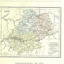
Lot [user-supplied]
collection: flickr2num_gcps: 18
center: 44.618981,1.610674
user_name: NEIL TAYLOR
date_time: 08/31/2015 18:17
View this map in ...

Insurance Plan of London South West District Vol. K: sheet 21
collection: goadnum_gcps: 8
center: 51.469232,-0.177871
user_name: Stiliyana Simeonova, Chris Austin, [Chris Austin]
date_time: 02/17/2014 07:40
View this map in ...

Insurance Plan of the City of Dublin Vol. 1: sheet 10-1
collection: goadnum_gcps: 5
center: 53.350784,-6.249976
user_name: Thaddeus Breen, Chris Austin, [Chris Austin]
date_time: 12/19/2013 07:35
View this map in ...
Pembroke Square [user-supplied]
collection: flickr2num_gcps: 6
center: 51.496507,-0.198059
user_name: NEIL TAYLOR
date_time: 09/06/2015 03:47
View this map in ...

Redan [user-supplied]
collection: flickr2num_gcps:
center:
user_name:
date_time:
View this map in ...
 collection: flickr2
num_gcps:
center:
user_name:
date_time:
View this map in ...
 collection: flickr2
num_gcps: 20
center: 45.418460,20.290275
user_name: Benjamin G
date_time: 09/07/2015 08:34
View this map in ...
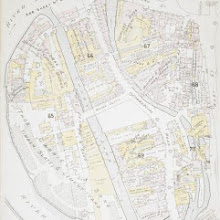
Insurance Plan of Exeter: sheet 6
collection: goadnum_gcps: 11
center: 50.718363,-3.533851
user_name: Stiliyana Simeonova, Chris Austin, Karina
date_time: 01/03/2014 17:44
View this map in ...

Montenegro [user-supplied]
collection: flickr2num_gcps: 10
center: 42.604060,19.509983
user_name: Margaret Dennehy, Marca Acme
date_time: 09/06/2015 08:07
View this map in ...

Vaucluse & the Sorgues [user-supplied]
collection: flickr2num_gcps: 3
center: 43.946177,5.159104
user_name: Margaret Dennehy
date_time: 09/06/2015 03:38
View this map in ...

Dijon [user-supplied]
collection: flickr2num_gcps: 9
center: 47.222825,5.032913
user_name: NEIL TAYLOR
date_time: 09/07/2015 09:02
View this map in ...

Georgia [user-supplied]
collection: flickr2num_gcps: 5
center: 31.636891,-83.043914
user_name: Margaret Dennehy
date_time: 09/06/2015 19:12
View this map in ...

Glasllyn
collection: osdrawingsnum_gcps: 9
center: 52.528061,-3.651492
user_name: Chris Austin, mauricen, [Chris Austin]
date_time: 11/20/2013 12:09
View this map in ...

Map of Russia showing the author's route [user-supplied]
collection: flickr2num_gcps: 40
center: 52.056565,34.200468
user_name: Benjamin G
date_time: 09/06/2015 09:46
View this map in ...
 collection: flickr2
num_gcps: 4
center: 48.804766,2.120498
user_name: Benjamin G
date_time: 09/06/2015 14:16
View this map in ...
 collection: flickr2
num_gcps: 19
center: -0.960630,-89.811012
user_name: Marca Acme
date_time: 09/06/2015 09:34
View this map in ...

Ligny-Waterloo [user-supplied]
collection: flickr2num_gcps: 25
center: 50.642850,4.596225
user_name: Benjamin G
date_time: 09/06/2015 14:08
View this map in ...

Persia [user-supplied]
collection: flickr2num_gcps: 24
center: 34.108695,57.528701
user_name: Benjamin G
date_time: 09/06/2015 09:24
View this map in ...
 collection: flickr2
num_gcps:
center:
user_name:
date_time:
View this map in ...

A New and Plaine Mapp of the CITTY of LONDON Shewing the Streets, Lanes, Allies, Courts, Churches Halls and other remarkable places as they are now rebuilt
collection: phase2num_gcps: 7
center: 51.514711,-0.093687
user_name: jasonmarkwebber, Chris Austin, [Chris Austin]
date_time: 10/31/2013 16:27
View this map in ...

Australia [user-supplied]
collection: flickr2num_gcps: 4
center: -24.103635,129.133856
user_name: Margaret Dennehy
date_time: 09/09/2015 17:10
View this map in ...

Les Alpes [user-supplied]
collection: flickr2num_gcps: 7
center: 45.026164,7.308617
user_name: Margaret Dennehy, Deborah
date_time: 09/10/2015 16:11
View this map in ...

Cocos Island [user-supplied]
collection: flickr2num_gcps: 9
center: -12.134560,96.877243
user_name: NEIL TAYLOR
date_time: 09/12/2015 09:24
View this map in ...

Basses Alpes [user-supplied]
collection: flickr2num_gcps: 27
center: 44.174665,6.236198
user_name: mauricen
date_time: 04/20/2015 12:00
View this map in ...

Leipzig Station 1892 [user-supplied]
collection: flickr2num_gcps: 5
center: 51.348416,12.385794
user_name: loverofchaos
date_time: 09/12/2015 08:59
View this map in ...
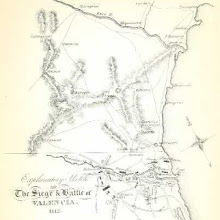
History of the War in the Peninsula and in the South of France, from the Year 1807 to the Year 1814 ... From the fourth edition ... With ... engravings
collection: flickrnum_gcps: 10
center: 39.979561,-1.025569
user_name: mauricen, Chris Austin, [Chris Austin]
date_time: 08/02/2014 17:09
View this map in ...

From Atlanta to the Sea [user-supplied]
collection: flickr2num_gcps: 8
center: 33.754462,-82.819077
user_name: Deborah
date_time: 09/10/2015 16:21
View this map in ...

Bouches du Mississippi [user-supplied]
collection: flickr2num_gcps: 3
center: 29.103855,-89.228947
user_name: Benjamin G
date_time: 09/10/2015 18:51
View this map in ...
Insurance Plan of Glasgow Vol. IV: sheet 138
collection: goadnum_gcps: 11
center: 55.860480,-4.230381
user_name: Ian Pritchard, Chris Austin, [Chris Austin]
date_time: 02/05/2014 13:32
View this map in ...

Sea of Galilee (Lake of Hooleh), 1870 [user-supplied]
collection: flickr2num_gcps: 5
center: 32.816673,35.582279
user_name: Margaret Dennehy, loverofchaos
date_time: 09/12/2015 22:35
View this map in ...
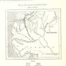
The Cunene and Etosha Lagoon [user-supplied]
collection: flickr2num_gcps: 8
center: -16.713444,14.132912
user_name: NEIL TAYLOR
date_time: 09/10/2015 16:28
View this map in ...

Belgium [user-supplied]
collection: flickr2num_gcps: 23
center: 50.486310,4.488276
user_name: NEIL TAYLOR
date_time: 09/10/2015 17:02
View this map in ...

Hogsby [user-supplied]
collection: flickr2num_gcps: 10
center: 57.173238,16.090102
user_name: NEIL TAYLOR
date_time: 09/10/2015 17:50
View this map in ...

Iceland, 1852 [user-supplied]
collection: flickr2num_gcps: 10
center: 64.761417,-18.872783
user_name: loverofchaos
date_time: 09/13/2015 14:49
View this map in ...

Africa, 1459 [user-supplied]
collection: flickr2num_gcps: 8
center: 24.797058,21.136264
user_name: Deborah
date_time: 09/13/2015 11:04
View this map in ...

The delta of the Ganges [user-supplied]
collection: flickr2num_gcps: 14
center: 22.891949,89.672912
user_name: Benjamin G
date_time: 09/13/2015 12:00
View this map in ...
 collection: flickr2
num_gcps:
center:
user_name:
date_time:
View this map in ...

Schleswig [user-supplied]
collection: flickr2num_gcps: 12
center: 54.865982,9.284705
user_name: Deborah
date_time: 09/13/2015 11:18
View this map in ...

Kilkenny [user-supplied]
collection: flickr2num_gcps: 8
center: 52.651621,-7.252721
user_name: Benjamin G
date_time: 09/13/2015 14:58
View this map in ...

France & Switzerland [user-supplied]
collection: flickr2num_gcps: 19
center: 46.266933,2.470615
user_name: Margaret Dennehy, Benjamin G
date_time: 09/13/2015 15:16
View this map in ...

NW Ontario and Manitoba, David Thompson, 1792-1812 [user-supplied]
collection: flickr2num_gcps: 13
center: 48.916503,-95.627623
user_name: Sarah Shepherd
date_time: 09/13/2015 16:10
View this map in ...

The Happy Valley: sketches of Kashmir and the Kashmiris ... With maps and illustrations
collection: flickrnum_gcps: 16
center: 33.774126,74.510915
user_name: mauricen, [Chris Austin]
date_time: 07/10/2014 16:38
View this map in ...

Asia 1889 [user-supplied]
collection: flickr2num_gcps: 26
center: 32.956662,82.201842
user_name: loverofchaos
date_time: 09/13/2015 12:50
View this map in ...

Insurance Plan of London Vol. X: sheet 247
collection: goadnum_gcps: 21
center: 51.504921,-0.099973
user_name: Stiliyana Simeonova, Chris Austin, [Chris Austin]
date_time: 04/03/2014 12:55
View this map in ...

Leeds Carriers' Warehouse District: sheet 115-3
collection: goadnum_gcps: 5
center: 53.704324,-1.674278
user_name: Adrian Bailey, Chris Austin, [Chris Austin]
date_time: 12/19/2013 08:51
View this map in ...

Neuer Market, Vienna, 1874 [user-supplied]
collection: flickr2num_gcps: 5
center: 48.206105,16.370830
user_name: loverofchaos
date_time: 09/13/2015 14:14
View this map in ...
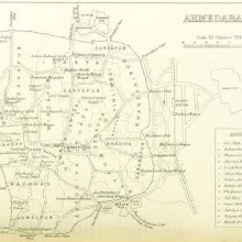
Ahmedabad, India [user-supplied]
collection: flickr2num_gcps: 18
center: 23.026904,72.592789
user_name: loverofchaos
date_time: 09/13/2015 15:05
View this map in ...

Pontiac's War & the Campaigns of Gen.s Clarke, Wayne & Harrison, Chicago area [user-supplied]
collection: flickr2num_gcps: 10
center: 41.627505,-88.414248
user_name: loverofchaos
date_time: 09/13/2015 14:34
View this map in ...
 collection: flickr2
num_gcps: 39
center: 52.480599,-1.894342
user_name: Jheald
date_time: 04/25/2015 15:51
View this map in ...

Panorama of the Seat of War. Bird's-eye View of Louisiana, Mississippi, Alabama and part of Florida. Drawn from nature by J. Bachmann.
collection: militarynum_gcps: 74
center: 30.286607,-89.181247
user_name: Max Friedrich Hartmann, [Chris Austin]
date_time: 11/24/2013 06:14
View this map in ...

Oud Leeuwarden and Middlezee, Netherlands, circa 1200 [user-supplied]
collection: flickr2num_gcps: 7
center: 53.202292,5.796419
user_name: loverofchaos
date_time: 09/14/2015 06:13
View this map in ...

Dacre Castle, Penrirth, Cumbria, England [user-supplied]
collection: flickr2num_gcps: 4
center: 54.630657,-2.836858
user_name: loverofchaos
date_time: 09/14/2015 12:57
View this map in ...

Rotterdam (right-hand page) 1876 [user-supplied]
collection: flickr2num_gcps: 8
center: 51.922847,4.492138
user_name: loverofchaos
date_time: 09/13/2015 15:31
View this map in ...

A History of Greece, from the earliest times to the Roman conquest, etc. [With a map.]
collection: flickrnum_gcps: 22
center: 39.317545,21.969587
user_name: mauricen, [Chris Austin]
date_time: 07/10/2014 19:27
View this map in ...

Indian Reservations, Utah-Arizona-New Mexico-Colorado, 1888 [user-supplied]
collection: flickr2num_gcps: 5
center: 34.854251,-109.626654
user_name: loverofchaos
date_time: 09/14/2015 11:43
View this map in ...

Torbay, Devon
collection: osdrawingsnum_gcps: 20
center: 50.485673,-3.577565
user_name: George MacKerron, Mark Setrem, [Mark Setrem]
date_time: 10/29/2013 21:14
View this map in ...
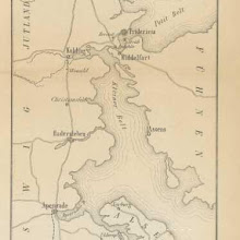 collection: flickr2
num_gcps: 13
center: 55.012126,9.732693
user_name: Stiliyana Simeonova
date_time: 09/13/2015 16:08
View this map in ...
 collection: flickr2
num_gcps: 11
center: 42.593243,129.912188
user_name: Thaddeus Breen
date_time: 09/13/2015 16:19
View this map in ...

Early map of New England, USA [user-supplied]
collection: flickr2num_gcps: 28
center: 41.798987,-71.408372
user_name: Margaret Dennehy, loverofchaos
date_time: 09/14/2015 07:52
View this map in ...

Peru-Bolivia-Chile (border area) [user-supplied]
collection: flickr2num_gcps: 11
center: -16.561160,-69.631942
user_name: loverofchaos
date_time: 09/13/2015 22:33
View this map in ...

Insurance Plan of London Vol. xi: sheet 398-1
collection: goadnum_gcps: 19
center: 51.533316,-0.119107
user_name: Tim Noble, [Mark Setrem]
date_time: 11/24/2013 10:32
View this map in ...
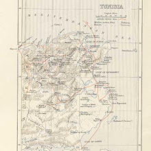 collection: flickr2
num_gcps: 18
center: 35.651984,10.006453
user_name: Stiliyana Simeonova
date_time: 09/13/2015 16:45
View this map in ...
 collection: flickr2
num_gcps: 14
center: 50.178875,1.804155
user_name: Stiliyana Simeonova
date_time: 09/13/2015 17:05
View this map in ...

Central Germany 1892 [user-supplied]
collection: flickr2num_gcps: 5
center: 51.565387,10.822543
user_name: loverofchaos
date_time: 09/16/2015 09:21
View this map in ...

[An Account of the English Colony in New South Wales ... To which are added, some particulars of New Zealand; compiled ... from the MSS. of Lieutenant-Governor King ... Illustrated by engravings.]
collection: flickrnum_gcps: 6
center: -33.815859,151.002638
user_name: Leon Deutsch, Chris Austin, Rusteze, Stiliyana Simeonova, Peter Free, Susan Major, [Chris Austin]
date_time: 08/16/2014 22:51
View this map in ...
 collection: flickr2
num_gcps:
center:
user_name:
date_time:
View this map in ...
 collection: flickr2
num_gcps:
center:
user_name:
date_time:
View this map in ...
 collection: flickr2
num_gcps: 10
center: 30.428536,30.272625
user_name: ireland
date_time: 09/16/2015 09:17
View this map in ...

Cairo [Provisional map of the country North-west ] (1915)
collection: worldwidenum_gcps: 7
center: 30.257356,30.580706
user_name: Mark Setrem, Chris Austin, [Chris Austin]
date_time: 10/22/2013 15:52
View this map in ...
 collection: flickr2
num_gcps:
center:
user_name:
date_time:
View this map in ...

Isola di Scarpanto, M. Cimara
collection: worldwidenum_gcps: 5
center: 35.697394,27.170036
user_name: Will Bermingham, Chris Austin, [Chris Austin]
date_time: 11/01/2013 15:44
View this map in ...
 collection: flickr2
num_gcps: 14
center: 51.686132,5.314688
user_name: loverofchaos
date_time: 09/16/2015 11:17
View this map in ...
 collection: flickr2
num_gcps: 3
center: 31.476716,35.351944
user_name: ireland
date_time: 09/16/2015 09:38
View this map in ...

North West New Guinea [user-supplied]
collection: flickr2num_gcps: 5
center: -7.589168,137.070061
user_name: NEIL TAYLOR
date_time: 09/16/2015 10:27
View this map in ...
 collection: flickr2
num_gcps: 14
center: 22.018220,-106.779427
user_name: ireland
date_time: 09/16/2015 10:06
View this map in ...

Dunnalong and Coolmore Forts (Dunnalong georeferenced) [user-supplied]
collection: flickr2num_gcps: 6
center: 54.937526,-7.407021
user_name: loverofchaos
date_time: 09/16/2015 14:18
View this map in ...
 collection: flickr2
num_gcps: 15
center: 31.247165,4.967375
user_name: ireland
date_time: 09/16/2015 12:27
View this map in ...
 collection: flickr2
num_gcps: 17
center: 48.862589,2.379964
user_name: ireland
date_time: 09/16/2015 12:50
View this map in ...

Dijon & Bourgogne, France 1887 [user-supplied]
collection: flickr2num_gcps: 4
center: 47.232945,4.791701
user_name: loverofchaos
date_time: 09/16/2015 14:25
View this map in ...
 collection: flickr2
num_gcps: 16
center: 63.001842,17.423439
user_name: ireland
date_time: 09/16/2015 13:47
View this map in ...
 collection: flickr2
num_gcps: 6
center: 38.500904,-74.471035
user_name: ireland
date_time: 09/16/2015 15:00
View this map in ...

Rome and the Roman Empire 1878 [user-supplied]
collection: flickr2num_gcps: 39
center: 40.417574,11.646709
user_name: loverofchaos
date_time: 09/16/2015 12:58
View this map in ...

Norway 1:100,000 , Series GSGS 4090, Narvik
collection: worldwidenum_gcps: 16
center: 68.500379,17.713828
user_name: mauricen, [mauricen]
date_time: 10/24/2013 12:31
View this map in ...

Simpheropol [user-supplied]
collection: flickr2num_gcps: 17
center: 44.812042,34.243785
user_name: NEIL TAYLOR
date_time: 09/17/2015 07:45
View this map in ...

Handbuch der Erdkunde
collection: flickrnum_gcps: 8
center: 21.594950,2.040968
user_name: Andrew, Chris Austin, [Chris Austin]
date_time: 08/04/2014 17:30
View this map in ...
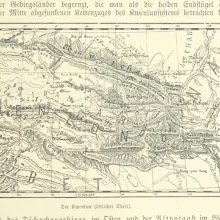 collection: flickr2
num_gcps: 7
center: 36.278433,99.174289
user_name: Deb Kyle
date_time: 09/19/2015 03:48
View this map in ...
 collection: flickr2
num_gcps: 11
center: 66.392217,14.493007
user_name: mauricen
date_time: 09/17/2015 17:34
View this map in ...

Geneva [user-supplied]
collection: flickr2num_gcps: 13
center: 46.562453,6.473293
user_name: mauricen
date_time: 09/16/2015 13:59
View this map in ...

Konig Oscar-Haven [user-supplied]
collection: flickr2num_gcps: 9
center: 65.632828,-37.551821
user_name: NEIL TAYLOR
date_time: 09/17/2015 06:49
View this map in ...

Paris Defences, The Sortie against Le Bourget 21 Dec 1870 [user-supplied]
collection: flickr2num_gcps: 46
center: 48.870163,2.443546
user_name: loverofchaos
date_time: 09/17/2015 08:09
View this map in ...
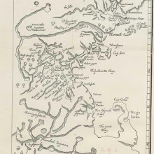 collection: flickr2
num_gcps: 11
center: 42.154532,-70.755373
user_name: ireland
date_time: 09/17/2015 12:40
View this map in ...

Laco Maggiore [user-supplied]
collection: flickr2num_gcps: 32
center: 46.001881,8.637633
user_name: NEIL TAYLOR
date_time: 09/19/2015 11:26
View this map in ...
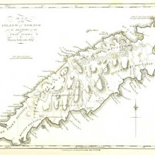
Tobago [user-supplied]
collection: flickr2num_gcps: 17
center: 11.251186,-60.674229
user_name: NEIL TAYLOR
date_time: 09/19/2015 12:08
View this map in ...

China 1:250 000, Jung-Ching
collection: worldwidenum_gcps: 9
center: 29.501714,102.748150
user_name: mauricen, Chris Austin, [Chris Austin]
date_time: 10/28/2013 16:48
View this map in ...

Pérou et Bolivie [user-supplied]
collection: flickr2num_gcps: 3
center: -12.955365,-72.783814
user_name: Margaret Dennehy, Martin Laverty
date_time: 10/29/2015 16:31
View this map in ...
 collection: flickr2
num_gcps: 14
center: -18.102326,-60.432796
user_name: Deb Kyle
date_time: 09/20/2015 03:01
View this map in ...
 collection: flickr2
num_gcps: 15
center: 13.252818,-61.199618
user_name: Basvb
date_time: 04/18/2015 16:38
View this map in ...

Isle of Man [user-supplied]
collection: flickr2num_gcps: 5
center: 54.231789,-4.560942
user_name: Adwait Sathe
date_time: 09/19/2015 17:17
View this map in ...

The Nile, Sinai and Jerusalem [user-supplied]
collection: flickr2num_gcps: 6
center: 26.801783,32.396649
user_name: Adwait Sathe
date_time: 09/19/2015 17:10
View this map in ...
 collection: flickr2
num_gcps: 15
center: 0.145627,9.914301
user_name: Deb Kyle
date_time: 09/19/2015 20:58
View this map in ...

US civil war region [user-supplied]
collection: flickr2num_gcps: 6
center: 33.605246,-90.670625
user_name: Adwait Sathe
date_time: 09/19/2015 18:43
View this map in ...
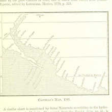
Gulf of California region, Mexico [user-supplied]
collection: flickr2num_gcps: 6
center: 23.646390,-105.355867
user_name: Adwait Sathe
date_time: 09/19/2015 18:39
View this map in ...

The Trent, from Newton Solney to the Derwent [user-supplied]
collection: flickr2num_gcps: 12
center: 52.858633,-1.456466
user_name: Susan Major
date_time: 07/19/2015 19:56
View this map in ...

Central Cuba [user-supplied]
collection: flickr2num_gcps: 6
center: 21.988217,-78.737866
user_name: Adwait Sathe
date_time: 09/19/2015 17:53
View this map in ...
 collection: flickr2
num_gcps:
center:
user_name:
date_time:
View this map in ...

Battle of Edge-Hill [user-supplied]
collection: flickr2num_gcps: 7
center: 52.133617,-1.473510
user_name: NEIL TAYLOR
date_time: 09/20/2015 11:27
View this map in ...

Isthmus of Suez [user-supplied]
collection: flickr2num_gcps: 5
center: 30.650787,32.055707
user_name: Adwait Sathe
date_time: 09/19/2015 22:03
View this map in ...

Map of the territorial growth of the eastern United States [user-supplied]
collection: flickr2num_gcps: 32
center: 35.237613,-82.394720
user_name: James Ball
date_time: 09/20/2015 10:49
View this map in ...
 collection: flickr2
num_gcps: 9
center: 66.937844,-52.364601
user_name: Deb Kyle
date_time: 09/20/2015 00:29
View this map in ...
 collection: flickr2
num_gcps: 8
center: 31.779023,35.231819
user_name: Deb Kyle
date_time: 09/20/2015 00:03
View this map in ...
 collection: flickr2
num_gcps: 9
center: 49.556074,4.963263
user_name: Deb Kyle
date_time: 09/20/2015 00:34
View this map in ...
 collection: flickr2
num_gcps: 10
center: 53.669753,7.265305
user_name: Deb Kyle
date_time: 09/20/2015 02:37
View this map in ...

Ancient Canaan [user-supplied]
collection: flickr2num_gcps: 6
center: 32.387782,35.792287
user_name: Adwait Sathe
date_time: 09/20/2015 08:11
View this map in ...
 collection: flickr2
num_gcps: 12
center: 54.819407,9.389120
user_name: Deb Kyle
date_time: 09/20/2015 02:58
View this map in ...
 collection: flickr2
num_gcps: 22
center: 45.469654,9.181212
user_name: Deb Kyle
date_time: 09/20/2015 03:11
View this map in ...

map of the Mont Blanc Massif [user-supplied]
collection: flickr2num_gcps: 13
center: 45.885873,6.947776
user_name: mauricen
date_time: 08/10/2015 14:42
View this map in ...

Madrid, Spain [user-supplied]
collection: flickr2num_gcps: 17
center: 40.414897,-3.716121
user_name: James Ball
date_time: 09/20/2015 10:36
View this map in ...

Bern, Switzerland [user-supplied]
collection: flickr2num_gcps: 8
center: 46.952731,7.449904
user_name: James Ball
date_time: 09/20/2015 10:54
View this map in ...
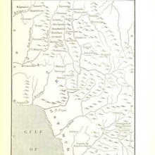
Gulf of California region, Sonora, Mexico [user-supplied]
collection: flickr2num_gcps: 7
center: 27.929629,-109.174930
user_name: Adwait Sathe
date_time: 09/20/2015 08:40
View this map in ...
 collection: flickr2
num_gcps: 4
center: 42.374391,-71.063594
user_name: Benjamin G
date_time: 09/20/2015 20:00
View this map in ...

Island of Singapore, British Settlements of the Malay Peninsula [user-supplied]
collection: flickr2num_gcps: 8
center: 1.365511,103.836639
user_name: James Ball
date_time: 09/20/2015 10:41
View this map in ...
 collection: flickr2
num_gcps: 5
center: -18.241876,27.448931
user_name: Benjamin G
date_time: 09/22/2015 20:25
View this map in ...
 collection: flickr2
num_gcps: 13
center: 52.313158,5.018008
user_name: Benjamin G
date_time: 09/20/2015 17:14
View this map in ...

Massachusetts Connecticut and Rhode Island [user-supplied]
collection: flickr2num_gcps: 18
center: 41.876782,-71.972736
user_name: NEIL TAYLOR
date_time: 09/21/2015 17:46
View this map in ...
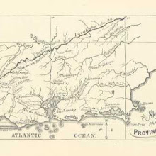
Part of the Province of Rio [user-supplied]
collection: flickr2num_gcps: 13
center: -22.457817,-42.775771
user_name: NEIL TAYLOR
date_time: 09/20/2015 11:17
View this map in ...
 collection: flickr2
num_gcps: 7
center: -18.029471,142.430284
user_name: Benjamin G
date_time: 09/20/2015 20:02
View this map in ...

Germany 1:25,000, Hunteburg
collection: worldwidenum_gcps: 21
center: 52.448496,8.249183
user_name: Chris Austin, mauricen, [mauricen]
date_time: 10/23/2013 12:40
View this map in ...

Scotland [user-supplied]
collection: flickr2num_gcps: 6
center: 56.629241,-4.835976
user_name: Margaret Dennehy
date_time: 09/20/2015 20:07
View this map in ...

The Basques on the French Slope of the Pyrenees [user-supplied]
collection: flickr2num_gcps: 13
center: 43.246321,-1.188685
user_name: NEIL TAYLOR
date_time: 09/20/2015 22:03
View this map in ...

Great Wheal Fortune Mine at approx 50° 8'7.53"N, 5°22'56.84"W [user-supplied]
collection: flickr2num_gcps:
center:
user_name:
date_time:
View this map in ...

Insurance Plan of London Vol. xi: sheet 365-3
collection: goadnum_gcps: 5
center: 51.508404,0.030745
user_name: Tim Noble, [Mark Setrem]
date_time: 11/25/2013 21:19
View this map in ...
 collection: flickr2
num_gcps: 17
center: 49.627002,1.067865
user_name: Benjamin G
date_time: 09/20/2015 17:01
View this map in ...
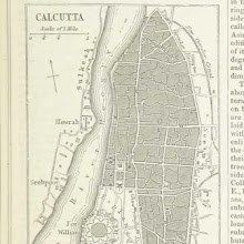
Calcutta [user-supplied]
collection: flickr2num_gcps: 10
center: 22.572987,88.349153
user_name: Benjamin G
date_time: 09/20/2015 17:56
View this map in ...

Bay of Naples [user-supplied]
collection: flickr2num_gcps: 22
center: 40.732680,14.428264
user_name: Benjamin G
date_time: 09/20/2015 20:08
View this map in ...

Persia [user-supplied]
collection: flickr2num_gcps: 23
center: 32.588105,54.045377
user_name: Benjamin G
date_time: 09/23/2015 20:29
View this map in ...

Lettres sur le Congo. Récit d'un voyage scientifique entre l'embouchure du fleuve et le confluent du Kassaï. [With Maps, etc.]
collection: flickrnum_gcps: 6
center: -5.939467,12.886337
user_name: mauricen, Chris Austin, [Chris Austin]
date_time: 08/08/2014 06:23
View this map in ...
 collection: flickr2
num_gcps:
center:
user_name:
date_time:
View this map in ...

Finages de Pierrefaite et de Montesson [user-supplied]
collection: flickr2num_gcps: 22
center: 47.796144,5.658766
user_name: Benjamin G
date_time: 09/23/2015 20:41
View this map in ...

Insurance Plan of Sheffield (1896): sheet 4
collection: goadnum_gcps: 15
center: 53.382095,-1.470813
user_name: Tim Noble, Chris Austin, [Chris Austin]
date_time: 03/17/2014 13:55
View this map in ...

Boulogne [user-supplied]
collection: flickr2num_gcps: 19
center: 50.725604,1.597072
user_name: Benjamin G
date_time: 09/24/2015 20:48
View this map in ...

Cary's Traveller's Companion, or, a Delineation of the Turnpike Roads of England and Wales
collection: phase2num_gcps: 13
center: 51.187914,-2.894790
user_name: Ben Harris, Chris Austin, [Chris Austin]
date_time: 10/31/2013 17:06
View this map in ...

Communes De Gognies-Chaussée, Bettigines et Mairieux [user-supplied]
collection: flickr2num_gcps: 6
center: 50.327640,3.981440
user_name: NEIL TAYLOR
date_time: 09/24/2015 10:01
View this map in ...

History of the People of the Netherlands ... Translated by O. A. Bierstadt and Ruth Putnam
collection: flickrnum_gcps: 6
center: 51.518602,4.728246
user_name: Will Bermingham, [Will Bermingham]
date_time: 07/10/2014 21:09
View this map in ...

The Nile Soudan [user-supplied]
collection: flickr2num_gcps: 30
center: 18.866826,37.062870
user_name: Benjamin G
date_time: 09/23/2015 21:57
View this map in ...

Greece [user-supplied]
collection: flickr2num_gcps: 49
center: 38.575956,26.008111
user_name: Benjamin G
date_time: 09/23/2015 21:09
View this map in ...
 collection: flickr2
num_gcps: 4
center: 31.778110,35.235400
user_name: Nick Savage
date_time: 09/26/2015 09:05
View this map in ...

Golfe De Guinée [user-supplied]
collection: flickr2num_gcps: 6
center: 3.475077,4.731641
user_name: NEIL TAYLOR
date_time: 09/24/2015 10:09
View this map in ...

Insurance Plan of the City of Manchester Vol. IV: sheet 102
collection: goadnum_gcps: 8
center: 53.467810,-2.278025
user_name: Max Friedrich Hartmann, Chris Austin, [Chris Austin]
date_time: 03/20/2014 12:13
View this map in ...
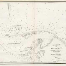
San Juan De Nicaragua [user-supplied]
collection: flickr2num_gcps: 5
center: 10.953251,-83.684270
user_name: NEIL TAYLOR
date_time: 09/24/2015 12:34
View this map in ...

Jerusalem [user-supplied]
collection: flickr2num_gcps: 8
center: 31.778051,35.234062
user_name: Benjamin G
date_time: 10/01/2015 20:25
View this map in ...
 collection: flickr2
num_gcps: 13
center: 32.720506,-79.894639
user_name: Benjamin G
date_time: 10/03/2015 07:38
View this map in ...

Lærebog i Nordens Historie ... Med 10 ... Kort, etc
collection: flickrnum_gcps: 26
center: 56.793829,12.139620
user_name: Susan Major, Chris Austin, [Chris Austin]
date_time: 08/08/2014 06:35
View this map in ...
 collection: flickr2
num_gcps: 18
center: 53.065719,-4.576367
user_name: Benjamin G
date_time: 10/01/2015 19:10
View this map in ...

Ethnographical map of Austria-Hungary [user-supplied]
collection: flickr2num_gcps: 11
center: 46.518787,17.793026
user_name: Benjamin G
date_time: 10/02/2015 19:42
View this map in ...
 collection: flickr2
num_gcps: 11
center: 55.503638,9.422028
user_name: Benjamin G
date_time: 10/03/2015 08:27
View this map in ...

Mundus tripartitus [user-supplied]
collection: flickr2num_gcps: 12
center: 38.847054,24.492018
user_name: NEIL TAYLOR
date_time: 10/03/2015 12:40
View this map in ...
Kort over Hoie Moen [user-supplied]
collection: flickr2num_gcps: 12
center: 54.982994,12.506683
user_name: NEIL TAYLOR
date_time: 10/03/2015 11:05
View this map in ...
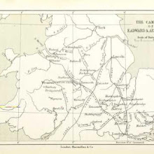 collection: flickr2
num_gcps: 14
center: 52.783325,-1.822834
user_name: Benjamin G
date_time: 10/03/2015 11:59
View this map in ...
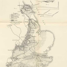
Geological Map of the Iron-Ore-Bearing Secondary Rocks [of England] [user-supplied]
collection: flickr2num_gcps: 26
center: 52.573818,-0.706391
user_name: Susan Major
date_time: 07/16/2015 22:25
View this map in ...

Dellys [user-supplied]
collection: flickr2num_gcps: 5
center: 36.915306,3.919449
user_name: NEIL TAYLOR
date_time: 10/03/2015 11:18
View this map in ...

Eastern Mediterranean [user-supplied]
collection: flickr2num_gcps: 17
center: 36.932814,26.685038
user_name: NEIL TAYLOR
date_time: 10/03/2015 13:39
View this map in ...
 collection: flickr2
num_gcps:
center:
user_name:
date_time:
View this map in ...

Map of Montgomery County, Iowa [user-supplied]
collection: flickr2num_gcps: 3
center: 41.033300,-95.159592
user_name: Franziska Delling
date_time: 10/03/2015 12:57
View this map in ...

Insurance Plan of London Vol. xi: sheet 358
collection: goadnum_gcps: 5
center: 51.505636,-0.008639
user_name: Tim Noble, [Mark Setrem]
date_time: 11/24/2013 11:45
View this map in ...

De fortificatiën te Hellevoetsluis [user-supplied]
collection: flickr2num_gcps: 9
center: 51.825073,4.128568
user_name: NEIL TAYLOR
date_time: 10/03/2015 12:25
View this map in ...

Nijni-Novgorod [user-supplied]
collection: flickr2num_gcps: 14
center: 56.323464,43.986101
user_name: NEIL TAYLOR
date_time: 10/03/2015 12:16
View this map in ...
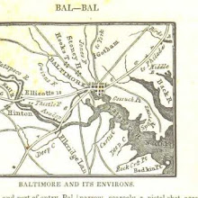
Baltimore and its environs [user-supplied]
collection: flickr2num_gcps: 8
center: 39.261584,-76.635613
user_name: NEIL TAYLOR
date_time: 10/03/2015 12:33
View this map in ...
 collection: flickr2
num_gcps:
center:
user_name:
date_time:
View this map in ...

Insurance Plan of Nottingham Vol. I: sheet 9
collection: goadnum_gcps: 24
center: 52.951422,-1.142333
user_name: Simon Dixon, [Mark Setrem]
date_time: 11/24/2013 14:26
View this map in ...

Insurance Plan of Sheffield (1896): sheet 25
collection: goadnum_gcps: 15
center: 53.378497,-1.475556
user_name: Tim Noble, Chris Austin, [Chris Austin]
date_time: 03/17/2014 14:01
View this map in ...
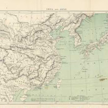
Missionary Stations in China and Japan [user-supplied]
collection: flickr2num_gcps: 12
center: 31.126759,120.560883
user_name: NEIL TAYLOR
date_time: 10/04/2015 05:26
View this map in ...
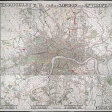
CRUCHLEY'S New Plan of LONDON and its ENVIRONS
collection: phase2num_gcps: 14
center: 51.512823,-0.109312
user_name: Susannah , mauricen, Chris Austin, [Chris Austin]
date_time: 11/01/2013 15:38
View this map in ...

Islands in the Paciific Ocean [user-supplied]
collection: flickr2num_gcps: 20
center: 1.846150,162.891292
user_name: Benjamin G
date_time: 10/04/2015 08:25
View this map in ...

Map of Little Parke
collection: phase2num_gcps: 5
center: 51.482418,-0.598762
user_name: mikeewen101, Chris Austin, [Chris Austin]
date_time: 11/01/2013 12:11
View this map in ...

METROPOLITAN BOROUGHS
collection: phase2num_gcps: 11
center: 51.500500,-0.100601
user_name: Martyn Atkins, Chris Austin, [Chris Austin]
date_time: 11/01/2013 10:54
View this map in ...

Siege of Tarifa [user-supplied]
collection: flickr2num_gcps: 7
center: 36.011472,-5.602821
user_name: NEIL TAYLOR
date_time: 10/03/2015 13:06
View this map in ...

Courmayeur and environs [user-supplied]
collection: flickr2num_gcps: 6
center: 45.824915,6.952341
user_name: NEIL TAYLOR
date_time: 10/03/2015 13:19
View this map in ...
 collection: flickr2
num_gcps: 14
center: 35.152821,27.316792
user_name: Benjamin G
date_time: 10/03/2015 16:33
View this map in ...
 collection: flickr2
num_gcps:
center:
user_name:
date_time:
View this map in ...
 collection: flickr2
num_gcps:
center:
user_name:
date_time:
View this map in ...

Littleport
collection: osdrawingsnum_gcps: 31
center: 52.478623,0.179738
user_name: Sue White, mauricen, [mauricen]
date_time: 10/28/2013 13:30
View this map in ...

Yosemite valley [user-supplied]
collection: flickr2num_gcps: 9
center: 37.734136,-119.586515
user_name: Benjamin G
date_time: 10/04/2015 18:11
View this map in ...
 collection: flickr2
num_gcps:
center:
user_name:
date_time:
View this map in ...
A MAP OF ST. GILES CRIPPLE GATE. WITHOUT. With Large Additions and Corrections 1-A
collection: cracenum_gcps: 7
center: 51.523467,-0.092575
user_name: Nick King, Chris Austin, Alex Smith
date_time: 01/18/2016 12:24
View this map in ...
 collection: flickr2
num_gcps: 6
center: 31.326021,-91.602175
user_name: Kathryn_0
date_time: 10/06/2015 10:28
View this map in ...

New Zealand - South Island [user-supplied]
collection: flickr2num_gcps: 16
center: -44.195156,172.825239
user_name: NEIL TAYLOR
date_time: 10/05/2015 14:52
View this map in ...
 collection: flickr2
num_gcps: 11
center: 33.186178,-7.037009
user_name: Benjamin G
date_time: 10/04/2015 18:39
View this map in ...

Newport 27A
collection: osdrawingsnum_gcps: 13
center: 50.676000,-1.337212
user_name: Paul Theobald, mauricen, [mauricen]
date_time: 10/26/2013 10:00
View this map in ...

Sydney [user-supplied]
collection: flickr2num_gcps: 16
center: -33.871690,151.208883
user_name: Benjamin G, Rachell Estrada
date_time: 05/26/2016 05:17
View this map in ...

Military Map of Italy 150 B.C. [user-supplied]
collection: flickr2num_gcps: 21
center: 41.947006,13.760132
user_name: NEIL TAYLOR
date_time: 10/05/2015 15:04
View this map in ...

Magna Britannia; being a concise topographical account of the several counties of Great Britain. [With copious illustrations.] vol. 1-6. L.P
collection: flickrnum_gcps: 5
center: 53.193819,-1.650093
user_name: Dennis, [Chris Austin]
date_time: 07/11/2014 04:23
View this map in ...

Rio de la Plata [user-supplied]
collection: flickr2num_gcps: 7
center: -35.550555,-56.088887
user_name: NEIL TAYLOR
date_time: 10/05/2015 17:44
View this map in ...

Westchester [user-supplied]
collection: flickr2num_gcps: 9
center: 41.071006,-73.729681
user_name: NEIL TAYLOR
date_time: 10/05/2015 16:38
View this map in ...

Lancashire [user-supplied]
collection: flickr2num_gcps: 26
center: 53.871700,-2.607347
user_name: NEIL TAYLOR
date_time: 10/05/2015 16:30
View this map in ...

[Incidents of travel in Central America, Chiapas, and Yucatan ... Illustrated by numerous engravings ... Twelfth edition.]
collection: flickrnum_gcps: 6
center: 17.483393,-92.046439
user_name: Dennis, Chris Austin, [Chris Austin]
date_time: 08/08/2014 06:56
View this map in ...

Karte von dem wichtigsten Theil der Provinz Begemder, trigonometrisch aufgenommen von W. Schimper, 1864, 1865.
collection: worldwidenum_gcps: 10
center: 11.990109,37.638698
user_name: Tony Betts, Chris Austin, [Chris Austin]
date_time: 11/01/2013 10:30
View this map in ...

Lisbon [user-supplied]
collection: flickr2num_gcps: 8
center: 38.721135,-9.131860
user_name: NEIL TAYLOR
date_time: 10/05/2015 16:07
View this map in ...

Map of Lake Itasca, Minnesota - publ. 1886 [user-supplied]
collection: flickr2num_gcps: 6
center: 47.211515,-95.208580
user_name: Emily Wheeler, Chris Austin, [Chris Austin]
date_time: 03/30/2015 10:31
View this map in ...
Map of Williamsburg, Yorktown and Newport News - 1862 [user-supplied]
collection: flickr2num_gcps: 8
center: 37.193759,-76.579973
user_name: Kat Petersen, Chris Austin, [Chris Austin]
date_time: 03/27/2015 11:56
View this map in ...

Map of Nyköping before 1665 [user-supplied]
collection: flickr2num_gcps: 23
center: 58.751818,17.010723
user_name: Susannah, [edgemoto]
date_time: 03/25/2015 15:52
View this map in ...
 collection: flickr2
num_gcps: 37
center: 44.660055,-7.763228
user_name: Owain, [KC Kowal]
date_time: 03/25/2015 12:26
View this map in ...
France militaire. Histoire des armées françaises de terre et de mer de 1792 à 1833. Ouvrage rédigé par une société de militaires et de gens de lettres, d'après les bulletins des armées, le Moniteur, les documents officiels, ... revu et publié par A. H. [With illustrations.]
collection: flickrnum_gcps: 10
center: 45.607938,10.801089
user_name: mauricen, [Chris Austin]
date_time: 07/09/2014 10:50
View this map in ...

Map of the Arosa Region, Switzerland - 1897 [user-supplied]
collection: flickr2num_gcps: 5
center: 46.782809,9.675919
user_name: Kat Petersen, Chris Austin, [Chris Austin]
date_time: 03/27/2015 11:34
View this map in ...

Map of Turkey - publ. 1835 [user-supplied]
collection: flickr2num_gcps: 11
center: 37.723824,44.059395
user_name: Robert, edgemoto, Chris Austin, [Chris Austin]
date_time: 04/01/2015 12:12
View this map in ...

Map of Vienna - publ. 1857 [user-supplied]
collection: flickr2num_gcps: 8
center: 48.208800,16.372869
user_name: Astha Devra, Chris Austin, [Chris Austin]
date_time: 03/27/2015 13:05
View this map in ...

Map of Central Romania - publ. 1871 [user-supplied]
collection: flickr2num_gcps: 7
center: 45.601952,24.991277
user_name: Michael Day, Chris Austin, [Chris Austin]
date_time: 03/27/2015 12:46
View this map in ...

Insurance Plan of London West North-West District Vol. B: sheet 21-1
collection: goadnum_gcps: 17
center: 51.515219,-0.176201
user_name: benosteen, jimmccusker, [Ian Pritchard]
date_time: 11/23/2013 13:50
View this map in ...

Map of Djibouti - publ. 1871 [user-supplied]
collection: flickr2num_gcps: 8
center: 11.798054,42.930015
user_name: tristanf, Chris Austin, [Chris Austin]
date_time: 03/30/2015 12:17
View this map in ...

Map of the North End of Manhattan Island, New York [user-supplied]
collection: flickr2num_gcps: 10
center: 40.857566,-73.926682
user_name: Tim_C, Chris Austin, [Chris Austin]
date_time: 03/30/2015 10:06
View this map in ...

Map of the Evacuation of New Madrid, Missouri - 1862 [user-supplied]
collection: flickr2num_gcps: 6
center: 36.141930,-89.448089
user_name: Robert, Chris Austin, [Chris Austin]
date_time: 03/27/2015 12:28
View this map in ...

Eynsford (Kent)
collection: osdrawingsnum_gcps: 96
center: 51.365353,0.149528
user_name: Petr Pridal, Ian Pritchard, Chris Austin, [Chris Austin]
date_time: 11/12/2013 15:44
View this map in ...

Map of Dublin, Ireland A.D.1610 - publ. 1885 [user-supplied]
collection: flickr2num_gcps: 9
center: 53.343977,-6.270002
user_name: Stuart Lowe, Chris Austin, [Chris Austin]
date_time: 04/02/2015 11:54
View this map in ...

Battleground at Bladensburg, Maryland, August 24 1814 - publ.1857 [user-supplied]
collection: flickr2num_gcps: 7
center: 38.935527,-76.955847
user_name: RQuinnT, loverofchaos, Chris Austin, [Chris Austin]
date_time: 04/10/2015 10:41
View this map in ...

Western Russia (Imperial) [user-supplied]
collection: flickr2num_gcps: 54
center: 52.001626,34.218953
user_name: Leon Deutsch
date_time: 03/25/2015 15:17
View this map in ...

Map of U.S.A. - publ. 1899 [user-supplied]
collection: flickr2num_gcps: 5
center: 37.043025,-98.645446
user_name: Ian Pickavance, Chris Austin, [Chris Austin]
date_time: 04/01/2015 11:59
View this map in ...
Map of the Battle of Torgau, Saxony, 1760 - publ. 1884 [user-supplied]
collection: flickr2num_gcps: 9
center: 51.574674,12.932705
user_name: Astha Devra, Chris Austin, [Chris Austin]
date_time: 04/01/2015 11:54
View this map in ...

Africa (topographic) [user-supplied]
collection: flickr2num_gcps: 17
center: 0.591138,18.673817
user_name: Leon Deutsch
date_time: 03/25/2015 14:40
View this map in ...

Map of Mexico - publ.1882 [user-supplied]
collection: flickr2num_gcps: 10
center: 20.492932,-98.744657
user_name: Kat Petersen, Chris Austin, [Chris Austin]
date_time: 04/03/2015 10:23
View this map in ...

Map of Virginia, U.S.A. - publ.1896 [user-supplied]
collection: flickr2num_gcps: 19
center: 38.746736,-79.109140
user_name: Rallish, Chris Austin, [Chris Austin]
date_time: 04/18/2015 06:06
View this map in ...

Map of the Campaign for Chattanooga 1863 - publ. 1895 [user-supplied]
collection: flickr2num_gcps: 18
center: 34.967117,-85.625935
user_name: Magnus Manske, Chris Austin, [Chris Austin]
date_time: 04/08/2015 10:38
View this map in ...

Map of France - publ. 1899 [user-supplied]
collection: flickr2num_gcps: 8
center: 46.641460,1.843018
user_name: Kat Petersen, Chris Austin, [Chris Austin]
date_time: 04/01/2015 12:07
View this map in ...

Map of Malaccan Peninsula & Singapore - publ. 1878 [user-supplied]
collection: flickr2num_gcps: 5
center: 1.786175,103.097721
user_name: Astha Devra, Chris Austin, [Chris Austin]
date_time: 04/01/2015 12:34
View this map in ...

Map of Northern Italy - publ. 1869 [user-supplied]
collection: flickr2num_gcps: 12
center: 45.148661,10.195489
user_name: Magnus Manske, Chris Austin, [Chris Austin]
date_time: 04/02/2015 12:40
View this map in ...

The Pilots' Handbook for the English Channel; containing concise directions for entering and navigating the Channel ... Illustrated by plates
collection: flickrnum_gcps: 7
center: 50.705770,-0.836192
user_name: mauricen, [Mark Setrem]
date_time: 07/09/2014 10:54
View this map in ...

Map of Rotterdam - publ.1881 [user-supplied]
collection: flickr2num_gcps: 5
center: 51.917252,4.492945
user_name: Susannah, Chris Austin, [Chris Austin]
date_time: 04/18/2015 06:04
View this map in ...

South Wales and the border in the 14th century
collection: phase2num_gcps: 18
center: 51.721983,-3.023298
user_name: Ian Pritchard, Martyn Atkins, [Martyn Atkins]
date_time: 10/16/2013 16:13
View this map in ...

Map of Danish Rail & Sea Routes - publ.1899 [user-supplied]
collection: flickr2num_gcps: 22
center: 55.925251,11.470710
user_name: Gregory of LivingWithDragons.com, Chris Austin, [Chris Austin]
date_time: 04/28/2015 11:23
View this map in ...

Map of the Indian Ocean - publ.1870 [user-supplied]
collection: flickr2num_gcps: 27
center: 4.948742,85.197636
user_name: Magnus Manske, Chris Austin, [Chris Austin]
date_time: 04/24/2015 10:23
View this map in ...

Map of Sevastopol, Crimea 1854 - publ.1863 [user-supplied]
collection: flickr2num_gcps: 8
center: 44.598625,33.517518
user_name: Nathan Edwards, Chris Austin, [Chris Austin]
date_time: 04/18/2015 06:18
View this map in ...

Map of France c.1807 - publ.1814 [user-supplied]
collection: flickr2num_gcps: 9
center: 46.884198,2.032695
user_name: Karina, Chris Austin, [Chris Austin]
date_time: 04/18/2015 06:50
View this map in ...
 collection: flickr2
num_gcps:
center:
user_name:
date_time:
View this map in ...
Map of New York c.1776 - publ.1887 [user-supplied]
collection: flickr2num_gcps: 7
center: 40.699032,-73.961384
user_name: Susannah, Chris Austin, [Chris Austin]
date_time: 04/18/2015 06:36
View this map in ...

Map of Eastern USA in the 18c - publ.1878 [user-supplied]
collection: flickr2num_gcps: 8
center: 37.442508,-82.852399
user_name: Astha Devra, Chris Austin, [Chris Austin]
date_time: 04/24/2015 11:23
View this map in ...

Map of North Wales - publ.1869 [user-supplied]
collection: flickr2num_gcps: 11
center: 53.095663,-3.732251
user_name: Jonny, Chris Austin, [Chris Austin]
date_time: 04/27/2015 06:41
View this map in ...

Map of Southern Sevastopol during the Crimean War - publ.1895 [user-supplied]
collection: flickr2num_gcps: 7
center: 44.533805,33.583004
user_name: Tim Noble, Chris Austin, [Chris Austin]
date_time: 04/24/2015 11:56
View this map in ...

Prado Museum, Madrid - publ.1895 [user-supplied]
collection: flickr2num_gcps: 8
center: 40.413794,-3.692291
user_name: mauricen, Chris Austin, [Chris Austin]
date_time: 04/27/2015 06:28
View this map in ...

Map of Ethiopia c.1866 - publ.1873 [user-supplied]
collection: flickr2num_gcps: 6
center: 12.463500,37.976954
user_name: Jonny, Chris Austin, [Chris Austin]
date_time: 04/24/2015 11:04
View this map in ...

Peter Martyr's map of the Bahamas c.1511 - publ.1882 [user-supplied]
collection: flickr2num_gcps: 5
center: 14.937114,-72.461960
user_name: creynders, Chris Austin, [Chris Austin]
date_time: 04/27/2015 09:44
View this map in ...

Plan of the Eastern Reach of the Mississippi River c.1825 - publ.1876 [user-supplied]
collection: flickr2num_gcps: 6
center: 29.150746,-89.207673
user_name: Karina, Chris Austin, [Chris Austin]
date_time: 04/29/2015 10:04
View this map in ...

Map of South Africa Showing Tribal Areas - publ.1884 [user-supplied]
collection: flickr2num_gcps: 7
center: -24.819382,26.345188
user_name: Kat Petersen, Chris Austin, [Chris Austin]
date_time: 05/04/2015 10:34
View this map in ...

Map of Gloucestershire - publ.1825 [user-supplied]
collection: flickr2num_gcps: 8
center: 51.794844,-2.109756
user_name: Kat Petersen, Chris Austin, [Chris Austin]
date_time: 05/04/2015 10:28
View this map in ...
Map of North America - publ.1888 [user-supplied]
collection: flickr2num_gcps: 16
center: 42.885494,-105.979165
user_name: Jessica Anne Rahardjo, Chris Austin, [Chris Austin]
date_time: 05/04/2015 11:27
View this map in ...

Map of the Parish of St.Mary Abbotts, Kensington London - publ.1847 [user-supplied]
collection: flickr2num_gcps: 5
center: 51.507007,-0.197484
user_name: Kat Petersen, Chris Austin, [Chris Austin]
date_time: 05/05/2015 11:03
View this map in ...

Map of Central India - publ.1887 [user-supplied]
collection: flickr2num_gcps: 8
center: 18.536548,78.003970
user_name: Kat Petersen, Chris Austin, [Chris Austin]
date_time: 05/06/2015 09:14
View this map in ...
Map of the Borders of Kenya, Ethiopia & S.Sudan - publ.1899 [user-supplied]
collection: flickr2num_gcps: 6
center: 4.960636,36.138827
user_name: Susannah, Chris Austin, [Chris Austin]
date_time: 05/04/2015 10:42
View this map in ...

Map of Racine and Kenosha Counties, Wisconsin - publ.1879 [user-supplied]
collection: flickr2num_gcps: 26
center: 42.667969,-88.007232
user_name: andreengels, Chris Austin, [Chris Austin]
date_time: 05/08/2015 11:40
View this map in ...

Map of Mt. Lédaic, Lyon, France in the 10th Century - publ.1895 [user-supplied]
collection: flickr2num_gcps: 9
center: 45.868177,4.609210
user_name: andreengels, Chris Austin, [Chris Austin]
date_time: 05/04/2015 11:54
View this map in ...

Plan of Jerusalem - publ.1856 [user-supplied]
collection: flickr2num_gcps: 13
center: 31.778989,35.231889
user_name: Susannah, Chris Austin, [Chris Austin]
date_time: 05/05/2015 09:51
View this map in ...

[Our own country. Descriptive, historical, pictorial.]
collection: flickrnum_gcps: 7
center: 52.600100,1.726314
user_name: jgleeson, [Mark Setrem]
date_time: 07/09/2014 11:16
View this map in ...

Plan of Wellington Barracks, Nilgari Hills, India - publ.1877 [user-supplied]
collection: flickr2num_gcps: 7
center: 11.366744,76.785858
user_name: Benjamin G, Chris Austin, GwenK
date_time: 04/30/2016 09:47
View this map in ...

Map of the Nile Delta, Egypt - publ.1860 [user-supplied]
collection: flickr2num_gcps: 8
center: 30.762125,31.082184
user_name: carlosg, Chris Austin, [Chris Austin]
date_time: 05/05/2015 11:13
View this map in ...

Map of the attack on San Sebastian, 1813 - publ.1895 [user-supplied]
collection: flickr2num_gcps: 6
center: 43.320958,-1.981635
user_name: andreengels, Chris Austin, [Chris Austin]
date_time: 05/04/2015 12:19
View this map in ...

Map of the San Francisco River at Paulo Afonso, Brazil - publ.1895 [user-supplied]
collection: flickr2num_gcps: 5
center: -9.305663,-38.251208
user_name: akosma, Chris Austin, [Chris Austin]
date_time: 05/06/2015 12:22
View this map in ...

Map of Eastern Santa Catarina State, Brazil - publ.1899 [user-supplied]
collection: flickr2num_gcps: 21
center: -26.791874,-48.966598
user_name: Nathan Edwards, Chris Austin, [Chris Austin]
date_time: 05/05/2015 12:09
View this map in ...

A Map of the Parish of St. Dunstans Stepney, als. Stebunheath.
collection: phase2num_gcps: 14
center: 51.522618,-0.070586
user_name: David, Ian Pritchard, Mark Smith
date_time: 08/08/2014 09:55
View this map in ...

Map showing the Distribution of Petroleum and Natural Gas in the Petroleum Zone of Emilia (Italy) [user-supplied]
collection: flickr2num_gcps: 27
center: 44.580066,11.065314
user_name: Susan Major, [Ian Pritchard]
date_time: 03/29/2015 19:50
View this map in ...

Chart of the West Indian Hurricanes [user-supplied]
collection: flickr2num_gcps: 18
center: 28.239684,-75.691654
user_name: Michael Ammon, Ian Pritchard, [Ian Pritchard]
date_time: 02/13/2016 19:33
View this map in ...
 collection: flickr2
num_gcps: 10
center: 30.753008,30.464009
user_name: Colin Ridley, Ian Pritchard, [Ian Pritchard]
date_time: 02/13/2016 12:18
View this map in ...
 collection: flickr2
num_gcps: 37
center: 45.337170,8.333755
user_name: Michael Ammon, [Ian Pritchard]
date_time: 03/29/2015 21:40
View this map in ...
 collection: flickr2
num_gcps: 16
center: 5.936718,-1.196365
user_name: elya, Ian Pritchard, [Ian Pritchard]
date_time: 02/13/2016 12:48
View this map in ...

Map of Lucas County, Iowa [user-supplied]
collection: flickr2num_gcps: 34
center: 41.028347,-93.326234
user_name: Michael Ammon, Ian Pritchard, [Ian Pritchard]
date_time: 02/13/2016 15:32
View this map in ...

Peru at time of conquest [user-supplied]
collection: flickr2num_gcps: 25
center: -5.808536,-73.176665
user_name: Sarah Shepherd, Ian Pritchard, [Ian Pritchard]
date_time: 02/13/2016 12:11
View this map in ...
 collection: flickr2
num_gcps: 20
center: -24.970943,28.441938
user_name: Colin Ridley, Ian Pritchard, [Ian Pritchard]
date_time: 02/13/2016 13:49
View this map in ...

Palace Chimu [user-supplied]
collection: flickr2num_gcps: 3
center: -8.098608,-79.065611
user_name: Michael Ammon, Nigel Slack, jbolmarcich, Benjamin G, Henry Faire, Nathan Straub, [Ian Pritchard]
date_time: 03/13/2016 19:32
View this map in ...

Map of Boston, Mass & Surroundings - publ. 1882 [user-supplied]
collection: flickr2num_gcps: 6
center: 42.288126,-70.921293
user_name: Will Bermingham, Chris Austin, [Chris Austin]
date_time: 03/30/2015 10:54
View this map in ...

San Pedro and Wilmington [user-supplied]
collection: flickr2num_gcps: 5
center: 33.744711,-118.254147
user_name: Michael Ammon, Ian Pritchard, Benjamin Guichard, [Ian Pritchard]
date_time: 02/13/2016 21:40
View this map in ...
 collection: flickr2
num_gcps:
center:
user_name:
date_time:
View this map in ...
 collection: flickr2
num_gcps: 17
center: 34.831750,-88.265636
user_name: elya, Ian Pritchard, [Ian Pritchard]
date_time: 02/13/2016 13:08
View this map in ...

[Battle of Ostrołęka (1831)] [user-supplied]
collection: flickr2num_gcps: 3
center: 53.079788,21.558632
user_name: Jheald, [Ian Pritchard]
date_time: 03/30/2015 19:14
View this map in ...
A PLAN of Part of the Ancient City of Westminster
collection: cracenum_gcps: 12
center: 51.500999,-0.127392
user_name: KC Kowal, Ian Pritchard, [Ian Pritchard]
date_time: 10/16/2013 23:34
View this map in ...

Information relative to New Zealand, for the use of Colonists. [With maps.]
collection: flickrnum_gcps: 9
center: 10.940887,23.130424
user_name: Martyn Atkins, [Martyn Atkins]
date_time: 07/09/2014 11:13
View this map in ...

Map to accompany Thos W. Knox's "Overland through Asia" [user-supplied]
collection: flickr2num_gcps: 31
center: 47.129600,64.298078
user_name: Susan Major, Ian Pritchard, [Ian Pritchard]
date_time: 02/17/2016 08:25
View this map in ...
 collection: flickr2
num_gcps: 23
center: 62.908739,27.705886
user_name: Geoff de Burca, Ian Pritchard, [Ian Pritchard]
date_time: 02/17/2016 08:09
View this map in ...

Insurance Plan of the City of Manchester Vol. IV: sheet 134
collection: goadnum_gcps: 7
center: 53.464402,-2.303374
user_name: John Layt, Chris Austin, [Chris Austin]
date_time: 03/19/2014 14:14
View this map in ...
 collection: flickr2
num_gcps:
center:
user_name:
date_time:
View this map in ...
 collection: flickr2
num_gcps: 30
center: 42.819394,-74.437116
user_name: Michael Ammon, [Ian Pritchard]
date_time: 03/30/2015 16:31
View this map in ...

Map of Banstead Downs and Vicinity [user-supplied]
collection: flickr2num_gcps: 30
center: 51.328427,-0.223218
user_name: Michael Ammon, Ian Pritchard, [Ian Pritchard]
date_time: 02/16/2016 22:33
View this map in ...

Easy Lessons in General Geography, with maps and illustrations, etc
collection: flickrnum_gcps: 21
center: 46.510877,-66.078093
user_name: Max Friedrich Hartmann, [Chris Austin]
date_time: 07/09/2014 10:06
View this map in ...

Tippecanoe, Indiana, USA [user-supplied]
collection: flickr2num_gcps: 14
center: 41.223232,-86.104284
user_name: Ruth O'Leary, Ian Pritchard, [Ian Pritchard]
date_time: 02/20/2016 12:33
View this map in ...

map of the Mont Blanc Massif [user-supplied]
collection: flickr2num_gcps: 12
center: 45.853646,6.812726
user_name: mauricen, [Ian Pritchard]
date_time: 03/30/2015 17:32
View this map in ...

Map of Szent-Tamás (Srbobran), c. 1848 [user-supplied]
collection: flickr2num_gcps: 14
center: 45.508311,19.745451
user_name: Andrew Gray, Ian Pritchard, [Ian Pritchard]
date_time: 02/17/2016 08:22
View this map in ...
 collection: flickr2
num_gcps: 8
center: 34.800090,-85.447826
user_name: GeoSpark, [Ian Pritchard]
date_time: 03/30/2015 17:31
View this map in ...

Etats Romains et Toscane [user-supplied]
collection: flickr2num_gcps: 39
center: 43.002182,12.265573
user_name: Michael Ammon, [Ian Pritchard]
date_time: 03/30/2015 16:54
View this map in ...

Map of Japan Showing the Track of Total Solar Eclipse August 9th 1896 [user-supplied]
collection: flickr2num_gcps: 41
center: 38.356354,137.126932
user_name: Michael Ammon, Ian Pritchard, [Ian Pritchard]
date_time: 02/17/2016 08:13
View this map in ...

Plan of Landau with its fortifications [user-supplied]
collection: flickr2num_gcps: 19
center: 49.196968,8.114729
user_name: Susan Major, [Ian Pritchard]
date_time: 03/30/2015 17:29
View this map in ...

map of area around Pisa [user-supplied]
collection: flickr2num_gcps: 14
center: 43.683603,10.387802
user_name: mauricen, [Ian Pritchard]
date_time: 03/30/2015 17:39
View this map in ...

Fort Pitt, Pittsburgh, Pennsylvania, USA [user-supplied]
collection: flickr2num_gcps: 6
center: 40.441013,-80.009355
user_name: Ruth O'Leary, [Ian Pritchard]
date_time: 03/30/2015 17:45
View this map in ...

Держава Само [Samo's Empire] [user-supplied]
collection: flickr2num_gcps: 8
center: 49.430849,16.160106
user_name: Michael Ammon, [Ian Pritchard]
date_time: 04/05/2015 21:57
View this map in ...

Chief Universities and Colleges in the United States [user-supplied]
collection: flickr2num_gcps: 22
center: 35.891887,-96.403871
user_name: Michael Ammon, [Ian Pritchard]
date_time: 03/30/2015 17:50
View this map in ...
 collection: flickr2
num_gcps: 6
center: 49.247377,4.031527
user_name: Sarah Shepherd, Ian Pritchard, Benjamin G, James Heald, Will Bermingham, [Will Bermingham]
date_time: 02/24/2016 19:45
View this map in ...

The Polar Limits of Seven Trees and Shrubs in Europe [user-supplied]
collection: flickr2num_gcps: 25
center: 50.104820,22.218817
user_name: Michael Ammon, [Ian Pritchard]
date_time: 03/30/2015 18:59
View this map in ...

Rotz map, 1542 [user-supplied]
collection: flickr2num_gcps: 6
center: 47.139597,-61.198606
user_name: Benjamin G, Adina Puscasu, Nathan Straub, Seif El Rashidi, Henry Faire, Nigel Slack
date_time: 03/19/2016 16:38
View this map in ...
 collection: flickr2
num_gcps: 7
center: 35.435487,44.102838
user_name: Michael Ammon, Benjamin G, Will Bermingham, [Will Bermingham]
date_time: 02/24/2016 16:46
View this map in ...

Map of the Manor of Stepney [user-supplied]
collection: flickr2num_gcps: 32
center: 51.540733,-0.041371
user_name: Susan Major, Ian Pritchard, [Ian Pritchard]
date_time: 02/20/2016 15:31
View this map in ...

map of Congo river [user-supplied]
collection: flickr2num_gcps: 15
center: -1.495541,21.417346
user_name: mauricen, [Ian Pritchard]
date_time: 03/30/2015 18:09
View this map in ...

Netherlands [user-supplied]
collection: flickr2num_gcps: 66
center: 50.539848,4.637266
user_name: Michael Ammon, Ian Pritchard, [Ian Pritchard]
date_time: 02/20/2016 12:52
View this map in ...

Mapa de Correos de España [user-supplied]
collection: flickr2num_gcps: 48
center: 39.451849,1.027995
user_name: Michael Ammon, Ian Pritchard, [Ian Pritchard]
date_time: 02/24/2016 08:20
View this map in ...

Timbuktu, Sokoto, Kano (Mali; Nigeria) [user-supplied]
collection: flickr2num_gcps: 8
center: 13.192438,3.338571
user_name: loverofchaos, Henry Faire, Susannah, Sarah Humphreys, Will Bermingham, [Will Bermingham]
date_time: 03/04/2016 23:09
View this map in ...
Modern Geography, a description of the Empires, states, and colonies, with the oceans, seas and islands in all parts of the World ... The Astronomical Introduction by the Rev. S. Vince. With numerous maps
collection: flickrnum_gcps: 8
center: 51.298332,23.075677
user_name: mauricen, [Chris Austin]
date_time: 07/09/2014 15:21
View this map in ...

Karte vom Westdeutschen Kriegschauplatz= Map of West German Battlefield [user-supplied]
collection: flickr2num_gcps: 32
center: 51.121516,9.890791
user_name: Susan Major, Ian Pritchard, [Ian Pritchard]
date_time: 03/07/2016 08:11
View this map in ...
 collection: flickr2
num_gcps: 6
center: 45.890981,6.914468
user_name: iainagray, [Ian Pritchard]
date_time: 03/31/2015 14:12
View this map in ...

Ware 2
collection: osdrawingsnum_gcps: 10
center: 51.845344,0.017982
user_name: Chris Austin, Ian Pritchard, [Chris Austin]
date_time: 11/12/2013 12:10
View this map in ...

Spain and Portugal in the Middle Ages [user-supplied]
collection: flickr2num_gcps: 44
center: 39.434664,-2.736130
user_name: Ruth O'Leary, [Ian Pritchard]
date_time: 03/31/2015 13:02
View this map in ...
 collection: flickr2
num_gcps: 38
center: 55.988931,11.925465
user_name: iainagray, Ian Pritchard, [Ian Pritchard]
date_time: 03/07/2016 07:56
View this map in ...

Harideva Temple, Govardhan, India [user-supplied]
collection: flickr2num_gcps: 4
center: 27.496903,77.464275
user_name: Ruth O'Leary, Benjamin G, [Ian Pritchard]
date_time: 03/12/2016 17:26
View this map in ...
 collection: flickr2
num_gcps: 18
center: -33.848667,151.240438
user_name: iainagray, Ian Pritchard, [Ian Pritchard]
date_time: 03/09/2016 22:14
View this map in ...

Maymana, Afghanistan [user-supplied]
collection: flickr2num_gcps: 3
center: 35.878768,64.718508
user_name: Sarah Shepherd, [Ian Pritchard]
date_time: 03/31/2015 15:12
View this map in ...

Карта местности между крепостью-лагерем Карсом и р. Арпачаем [user-supplied]
collection: flickr2num_gcps: 30
center: 40.571111,43.397605
user_name: Benjamin G, Michael Ammon, Ian Pritchard, Nigel Slack, [Ian Pritchard]
date_time: 03/12/2016 14:47
View this map in ...

План Иерихона [user-supplied]
collection: flickr2num_gcps: 9
center: 31.864855,35.440866
user_name: Benjamin G, Henry Faire, Ian Pritchard, [Ian Pritchard]
date_time: 03/21/2016 08:30
View this map in ...

Western Europe [user-supplied]
collection: flickr2num_gcps: 49
center: 48.922843,7.028262
user_name: Ruth O'Leary, Ian Pritchard, [Ian Pritchard]
date_time: 03/10/2016 07:33
View this map in ...
 collection: flickr2
num_gcps: 14
center: 54.302262,9.660578
user_name: Benjamin G, [Ian Pritchard]
date_time: 03/31/2015 19:02