
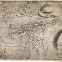
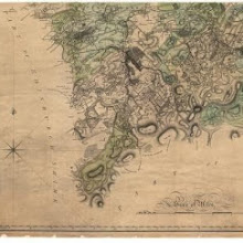
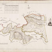
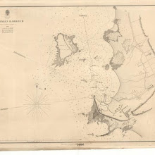
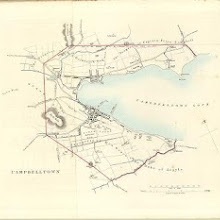
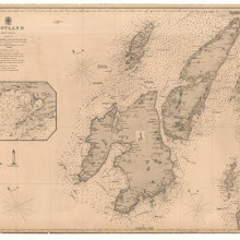
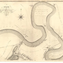
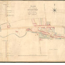
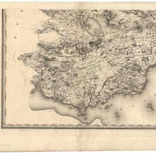
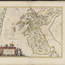
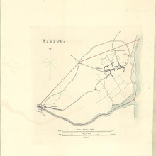
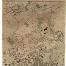
Lochmaben
collection: pilotnum_gcps: 5
center: 55.127781,-3.443426
user_name: georeferencer.org, Zviad
date_time: 10/04/2013 08:08
View this map in ...
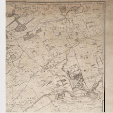
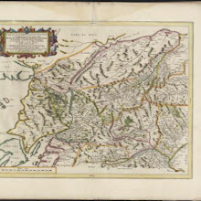
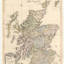
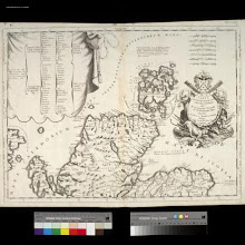
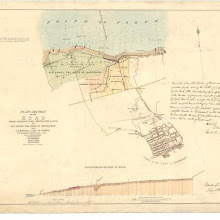
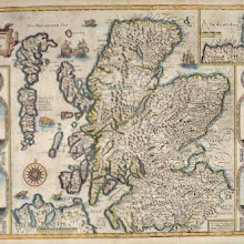
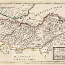
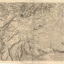
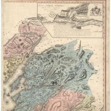
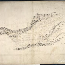
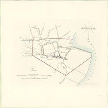
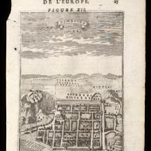
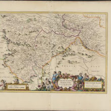
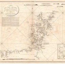
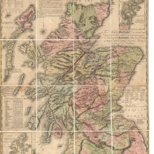
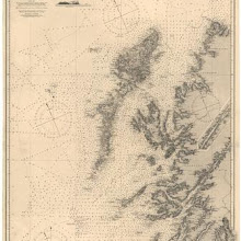
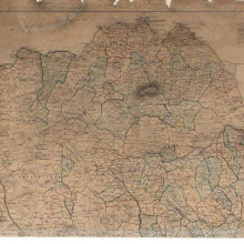
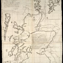
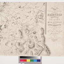
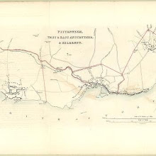
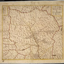
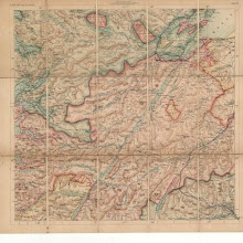
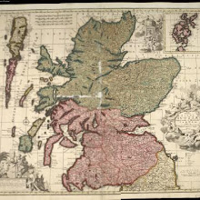
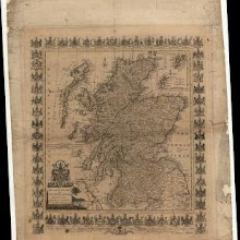
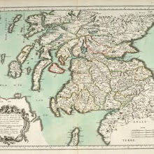
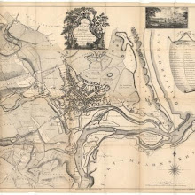
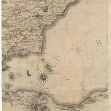
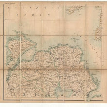
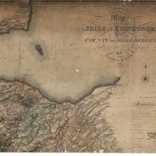
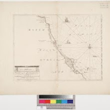
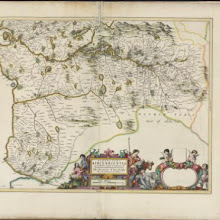
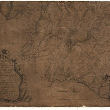
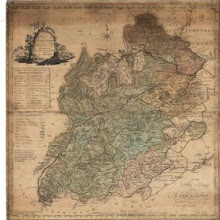
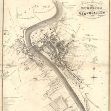
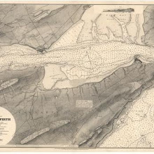
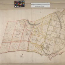
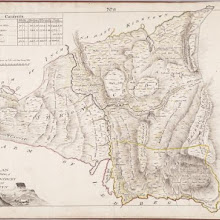
Map embracing extensive portions of the Counties of Roxburgh, Berwick, Selkirk & Midlothian and Part of Northumberland. Minutely & accurately surveyed… by Crawford and Brooke
collection: pilotnum_gcps: 53
center: 55.690344,-2.335094
user_name: dmgroom, yeryry
date_time: 03/13/2015 15:26
View this map in ...
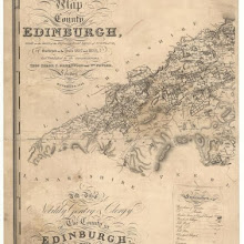
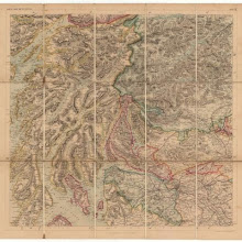
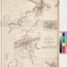
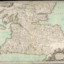
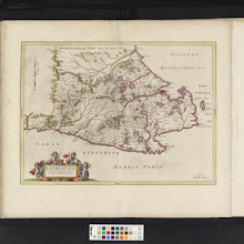
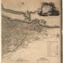
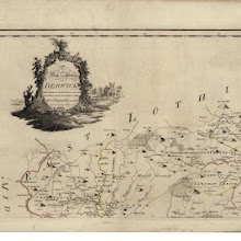
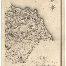
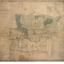
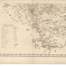
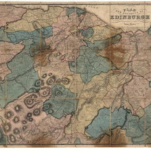
Map of the county of Edinburgh.
collection: pilotnum_gcps: 30
center: 55.867747,-3.518088
user_name: David McElroy, Martin MacGregor
date_time: 03/03/2016 11:19
View this map in ...
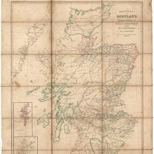
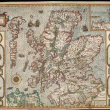
Ecclesiastical map of Scotland.
collection: pilotnum_gcps: 105
center: 54.973146,-4.519461
user_name: Chris Langley
date_time: 06/17/2013 13:12
View this map in ...

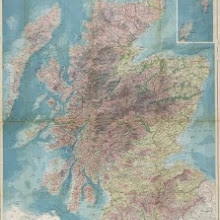
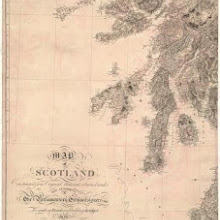
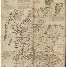
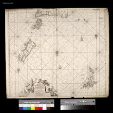
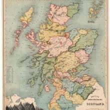
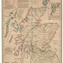
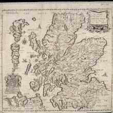
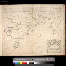
A general map of Scotland and islands thereto belonging.
collection: pilotnum_gcps: 28
center: 58.132567,-2.847012
user_name: ChrisFleet, Toni Rhian Henwood
date_time: 09/22/2013 00:23
View this map in ...
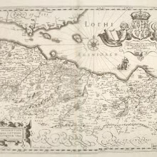
A new description of the shyres Lothian and Linlitquo / T. Pont ; Henricus Hondius excudit.
collection: pilotnum_gcps: 132
center: 55.944713,-3.080069
user_name: Neville Kingdon, Andy Arthur
date_time: 06/21/2015 19:24
View this map in ...

Strath-navernia, Strath-navern / Auct. Timotheo Pont.
collection: pilotnum_gcps: 34
center: 58.418476,-4.296390
user_name: michael_cairns@lineone.net, yeryry
date_time: 03/13/2015 13:52
View this map in ...
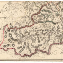
Scotiae provinciae mediterraneae inter Taum flumen et Vararis aestuarium : Sunt autem Braid-Allaban, Atholia, Marria Superior, Badenocha, Strath-Spea, Lochabria, cum Chersoneso qui ei ad occasum pra
collection: pilotnum_gcps: 64
center: 56.984301,-4.591693
user_name: michael_cairns@lineone.net, Andy Arthur
date_time: 02/01/2016 14:35
View this map in ...
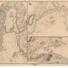
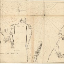
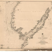
Loch Gilp; Sketch of Millport; East Loch Tarbert
collection: pilotnum_gcps: 7
center: 56.021045,-5.413994
user_name: dmgroom
date_time: 06/06/2012 22:44
View this map in ...

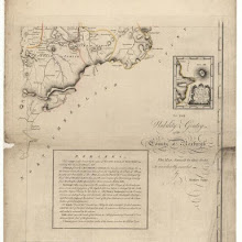
A plan of the county of Mid-Lothian…
collection: pilotnum_gcps: 26
center: 55.908235,-3.403754
user_name: michael_cairns@lineone.net, Andy Arthur
date_time: 06/24/2015 14:38
View this map in ...
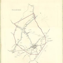
Falkirk
collection: pilotnum_gcps: 6
center: 56.006118,-3.780242
user_name: georeferencer.org
date_time: 05/22/2012 15:31
View this map in ...
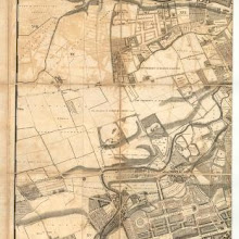
A plan of the city and suburbs of Edinburgh.
collection: pilotnum_gcps: 16
center: 55.948075,-3.189499
user_name: Andy A
date_time: 03/01/2016 10:51
View this map in ...
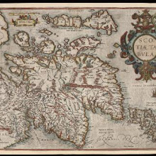
Ascozia.
collection: pilotnum_gcps: 13
center: 56.899876,-4.710921
user_name: centechtv
date_time: 08/28/2013 15:38
View this map in ...
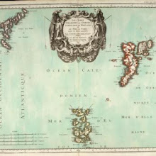
L' Escosse delà le Taý, divisée en ses Provinces &c. tirées de toutes les Cartes particulieres de Timot Pont, de R. Gordon a Straloch / par Sanson d'Abbev[ille].
collection: pilotnum_gcps: 124
center: 57.584392,-4.525487
user_name: Andy Arthur
date_time: 03/12/2016 15:42
View this map in ...
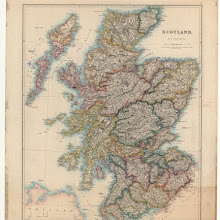
Map of Scotland from the latest surveys.
collection: pilotnum_gcps: 10
center: 57.590558,-1.894497
user_name: georeferencer.org
date_time: 05/22/2012 15:27
View this map in ...
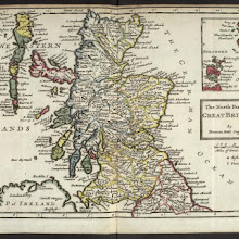
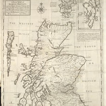
The north part of Great Britain called Scotland : with considerable inprovements [sic] and many remarks not extant in any map. / According to the newest and exact observations by Hermann Moll.
collection: pilotnum_gcps: 105
center: 56.739255,-4.133174
user_name: michael_cairns@lineone.net, ChrisFleet, Andy Arthur
date_time: 02/06/2016 12:15
View this map in ...
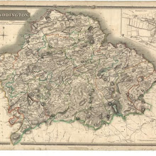
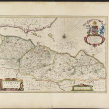
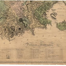
Map of Haddingtonshire.
collection: pilotnum_gcps: 6
center: 55.836788,-2.867875
user_name: bkerr
date_time: 09/22/2012 11:02
View this map in ...
Scotia : parte settentrionale ; parte meridionale / descritta, e dedicata dal P. Cosmgrafo Coronelli, Al Reuereudissimo Padre Maestro Tomaso Maria Peire Teo logo di S.A.R. dela Duca di Sauoia.
collection: pilotnum_gcps: 49
center: 58.460380,-3.957534
user_name: Andy Arthur
date_time: 02/05/2016 21:48
View this map in ...
Black's new large map of Scotland.
collection: pilotnum_gcps: 12
center: 56.176702,-4.749836
user_name: bkerr
date_time: 09/22/2012 11:10
View this map in ...
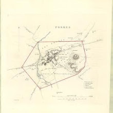
Forres
collection: pilotnum_gcps: 5
center: 57.609913,-3.610299
user_name: georeferencer.org
date_time: 05/22/2012 15:04
View this map in ...

A Mapp of Scotland : made by R. Gordon, Author of Blaeu's Atlas of Scotland / corrected and Improved by Rob. Morden. To which is added Alphabetical Tables For the Ready finding out any Place in the Ma
collection: pilotnum_gcps: 293
center: 57.054281,-4.641964
user_name: Daniel del Rey, Andy Arthur
date_time: 03/24/2016 13:10
View this map in ...
The North Part of Great Britain / by Hermann Moll.
collection: pilotnum_gcps: 99
center: 56.776144,-3.950321
user_name: Daniel del Rey, Andy Arthur
date_time: 01/26/2016 13:48
View this map in ...
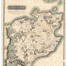
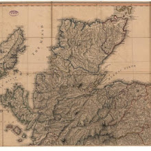
Caithness Shire.
collection: pilotnum_gcps: 5
center: 58.444956,-3.421967
user_name: georeferencer.org
date_time: 05/22/2012 15:48
View this map in ...
East Lothian / authore Johanne Adair.
collection: pilotnum_gcps: 65
center: 55.964041,-2.702773
user_name: bkerr, Andy Arthur
date_time: 02/01/2016 13:35
View this map in ...
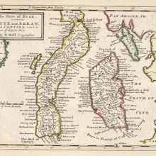
The Shire of Bute : contains Bute and Arran with Cantire [i.e. Kintyre] which is Part of Argyle Shire / by H. Moll.
collection: pilotnum_gcps: 8
center: 55.605701,-5.375564
user_name: Daniel Hodge
date_time: 02/03/2016 15:34
View this map in ...
Plan & section of the road from Granton Pier through the lands of His Grace The Duke of Buccleuch.
collection: pilotnum_gcps: 12
center: 55.971416,-3.222399
user_name: John Hadden, Andy A
date_time: 03/29/2016 09:55
View this map in ...
Scotia regnum cum insulis adjacentibus / Robertus Gordonius a Straloch descripsit.
collection: pilotnum_gcps: 5
center: 56.818222,-4.607798
user_name: Matthew Horton
date_time: 02/21/2016 20:25
View this map in ...
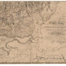
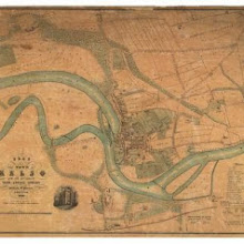
Map of the Basin of the Tay, including the greater part of Perth Shire, Strathmore and the Braes of Angus or Forfar.
collection: pilotnum_gcps: 4
center: 56.582542,-3.512514
user_name: bkerr
date_time: 09/22/2012 11:25
View this map in ...
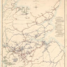
Scotland.
collection: pilotnum_gcps: 90
center: 57.715008,-4.692620
user_name: Toby Speight
date_time: 10/08/2012 14:34
View this map in ...
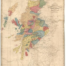
Map of the Highlands of Scotland denoting the districts or counties inhabited by the Highland Clans.
collection: pilotnum_gcps: 144
center: 56.583171,-4.534939
user_name: Toby Speight
date_time: 10/08/2012 14:40
View this map in ...
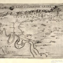
A Mapp of Clakmanan Shire. A map of Clackmannanshire.
collection: pilotnum_gcps: 36
center: 56.127391,-3.780006
user_name: Andy Arthur
date_time: 02/02/2016 09:43
View this map in ...
The Stewartry of Kirkcudbright.
collection: pilotnum_gcps: 9
center: 55.166270,-3.849294
user_name: bkerr
date_time: 09/25/2012 11:06
View this map in ...
Haddington.
collection: pilotnum_gcps: 4
center: 55.929096,-2.681116
user_name: georeferencer.org
date_time: 05/22/2012 15:45
View this map in ...
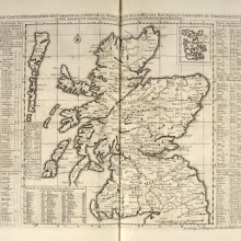
The Kingdome of Scotland / performed by Iohn Speed.
collection: pilotnum_gcps: 109
center: 56.868534,-4.820340
user_name: Andy A
date_time: 02/22/2016 20:25
View this map in ...

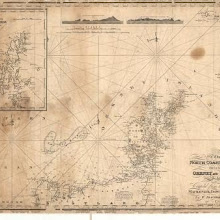
A Map of the North Coast of Britain, from Row Stoir of Assynt, to Wick in Caithness : By a Geometrical Survey with the Harbours, Rocks, & an Account of the Tides in the Pentland Firth, done at the
collection: pilotnum_gcps: 40
center: 58.537475,-4.144432
user_name: Andy Arthur
date_time: 02/02/2016 12:47
View this map in ...

A map of the environs of Edinburgh.
collection: pilotnum_gcps: 15
center: 55.835621,-3.249915
user_name: georeferencer.org
date_time: 05/22/2012 15:08
View this map in ...
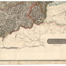
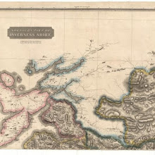
Southern Part of Inverness Shire.
collection: pilotnum_gcps: 4
center: 56.834098,-3.941632
user_name: georeferencer.org
date_time: 05/22/2012 16:14
View this map in ...
Linlithgowshire.
collection: pilotnum_gcps: 5
center: 55.936343,-3.572482
user_name: georeferencer.org
date_time: 05/22/2012 15:09
View this map in ...
No. 6 - A Plan of the Farms of Glenlirag and Ardvare [Ardvar].
collection: pilotnum_gcps: 10
center: 58.236117,-5.105951
user_name: Daniel del Rey
date_time: 10/16/2012 12:35
View this map in ...

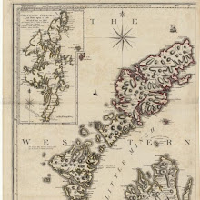
Western Isles.
collection: pilotnum_gcps: 4
center: 57.101017,-7.575218
user_name: georeferencer.org
date_time: 05/22/2012 15:43
View this map in ...
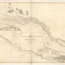
River Clyde from Dumbarton to Glasgow.
collection: pilotnum_gcps: 11
center: 55.914295,-4.486074
user_name: Daniel del Rey
date_time: 10/15/2012 12:43
View this map in ...

Plan of the Town of Linlithgow.
collection: pilotnum_gcps: 3
center: 55.976724,-3.599964
user_name: georeferencer.org
date_time: 05/22/2012 15:51
View this map in ...
A correct map of Scotland from new surveys.
collection: pilotnum_gcps: 21
center: 56.827546,-4.666979
user_name: ChrisFleet
date_time: 11/27/2012 12:50
View this map in ...
Extimae Scotiae pars septentrionalis in qua provinciae Rossia, Sutherlandia, Cathenesia, et Strath-Naverniae.
collection: pilotnum_gcps: 7
center: 58.328610,-4.273031
user_name: Daniel del Rey, Daniel Hodge
date_time: 02/03/2016 15:38
View this map in ...
Carte particuliere de la cote orientale d'Ecosse, depuis St Abb's Head jusqu'a Duncansby Head.
collection: pilotnum_gcps: 13
center: 57.233518,-2.288366
user_name: georeferencer.org
date_time: 05/22/2012 16:01
View this map in ...

The Shire of Angus or Forfar / by H. Moll.
collection: pilotnum_gcps: 27
center: 56.741576,-2.888972
user_name: michael_cairns@lineone.net, Andy Arthur
date_time: 02/05/2016 21:17
View this map in ...
Lothian : contains The Shire of Linlithgow or West Lothian. The Shire of Edinburgh or Midlothian. and Haddington or East Lothian / by H. Moll.
collection: pilotnum_gcps: 45
center: 55.899119,-3.084281
user_name: PeterMan, Andy Arthur
date_time: 02/02/2016 22:14
View this map in ...
An Ancient Plan of the City of Edinburgh and its Environs... Intended as an accompaniment to Kirkwood's New Plan of Edinburgh.
collection: pilotnum_gcps: 46
center: 55.953436,-3.187641
user_name: Andy Arthur
date_time: 02/02/2016 20:42
View this map in ...
Map of the City of Glasgow and suburbs.
collection: pilotnum_gcps: 3
center: 55.867417,-4.254880
user_name: georeferencer.org
date_time: 05/22/2012 16:35
View this map in ...
The North Part of ye Shire of Roxburgh and the Shire of Selkirk called also Etterick Forrest / by H. Moll.
collection: pilotnum_gcps: 40
center: 55.421780,-2.756523
user_name: Andy Arthur
date_time: 02/21/2016 22:56
View this map in ...
Topographical and military map of the counties of Aberdeen, Banff and Kincardine.
collection: pilotnum_gcps: 4
center: 57.487167,-2.828146
user_name: michael_cairns@lineone.net
date_time: 12/16/2012 19:09
View this map in ...
Sutherlandshire.
collection: pilotnum_gcps: 8
center: 58.198970,-4.442651
user_name: irvann
date_time: 11/14/2012 13:49
View this map in ...
A new and correct map of Scotland or North Britain, with all the post and military roads.
collection: pilotnum_gcps: 4
center: 58.174490,-4.754140
user_name: michael_cairns@lineone.net
date_time: 12/22/2012 16:13
View this map in ...
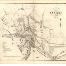
Plan of the City of Brechin.
collection: pilotnum_gcps: 4
center: 56.730758,-2.658378
user_name: georeferencer.org
date_time: 05/22/2012 16:04
View this map in ...
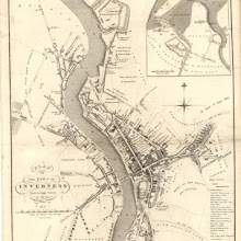
Plan of the Town of Inverness from actual survey.
collection: pilotnum_gcps: 4
center: 57.479009,-4.228289
user_name: georeferencer.org
date_time: 05/22/2012 15:41
View this map in ...

The Plan of Edinburgh, exactly done…
collection: pilotnum_gcps: 30
center: 55.950281,-3.185952
user_name: ChrisFleet, Andy Arthur
date_time: 03/14/2016 10:34
View this map in ...
Angusia Provincia Scotiae sive The Shire of Angus. Shire of Angus.
collection: pilotnum_gcps: 41
center: 56.674904,-2.934882
user_name: Joe nunn, Andy Arthur
date_time: 02/12/2016 09:59
View this map in ...
Map of Scotland from the latest surveys.
collection: pilotnum_gcps: 4
center: 58.827518,-6.942271
user_name: michael_cairns@lineone.net
date_time: 12/18/2012 19:06
View this map in ...
A new chart of the north coast of Scotland with… the Orkney Islands.
collection: pilotnum_gcps: 4
center: 58.970379,-3.291808
user_name: michael_cairns@lineone.net
date_time: 12/17/2012 20:12
View this map in ...

Topographical and military map of the counties of Aberdeen, Banff and Kincardine.
collection: pilotnum_gcps: 38
center: 56.976353,-2.838320
user_name: ChrisFleet
date_time: 01/15/2014 10:42
View this map in ...
Library or travelling map of Scotland.
collection: pilotnum_gcps: 9
center: 56.954441,-4.706771
user_name: michael_cairns@lineone.net
date_time: 12/25/2012 14:32
View this map in ...
Map of Scotland from the latest surveys.
collection: pilotnum_gcps: 5
center: 56.436561,-4.528213
user_name: michael_cairns@lineone.net
date_time: 12/23/2012 20:13
View this map in ...
The north part of Sky island and the adjacent main of Scotland.
collection: pilotnum_gcps: 4
center: 57.631350,-6.169325
user_name: michael_cairns@lineone.net
date_time: 12/24/2012 16:20
View this map in ...
Sound of Iona
collection: pilotnum_gcps: 10
center: 56.285613,-6.456896
user_name: Jamesks
date_time: 01/31/2013 23:02
View this map in ...
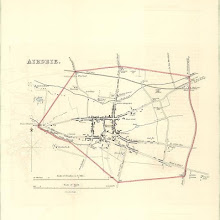
Airdrie
collection: pilotnum_gcps: 9
center: 55.867886,-3.981362
user_name: Andy Arthur
date_time: 04/04/2016 08:24
View this map in ...
Northern part of the Sound of Raasay and Inner Sound
collection: pilotnum_gcps: 4
center: 57.527824,-5.991191
user_name: michael_cairns@lineone.net
date_time: 04/02/2013 19:26
View this map in ...
A new and complete map of Scotland and islands thereto belonging.
collection: pilotnum_gcps: 32
center: 55.826951,-2.924200
user_name: bkerr, Craig, nkingdon
date_time: 10/01/2014 22:16
View this map in ...
Plan of the City of Perth from actual survey.
collection: pilotnum_gcps: 3
center: 56.396700,-3.428936
user_name: georeferencer.org
date_time: 05/22/2012 14:44
View this map in ...
Map shewing…estate of Milton.
collection: pilotnum_gcps: 5
center: 55.878995,-4.254207
user_name: David McElroy
date_time: 06/25/2012 09:44
View this map in ...
This map of Argyllshire…
collection: pilotnum_gcps: 10
center: 56.601815,-5.030282
user_name: michael_cairns@lineone.net
date_time: 03/24/2013 14:28
View this map in ...
De Custen van Engelandt en Schotlandt tusschen Tinbij en Donde.
collection: pilotnum_gcps: 7
center: 55.825131,-1.733276
user_name: michael_cairns@lineone.net
date_time: 03/23/2013 17:53
View this map in ...
Scotiae provintiae inter Taum Fluvium, et Septentrionales oras Angliae.
collection: pilotnum_gcps: 80
center: 55.742360,-3.578872
user_name: Petr Pridal, Andy A
date_time: 02/28/2016 20:25
View this map in ...
Lothian and Linlitquo / Joh. et Cornelius Blaeu exc.
collection: pilotnum_gcps: 63
center: 55.958636,-3.098826
user_name: Andy Arthur
date_time: 02/15/2016 11:14
View this map in ...
The Mappe of Straithern, Stormont, & Cars of Gourie with the rivers Tay and Ern / surveighed & designed [by] John Adair.
collection: pilotnum_gcps: 79
center: 56.450403,-3.642124
user_name: Andy Arthur
date_time: 02/10/2016 11:07
View this map in ...

Plan of Dalkeith.
collection: pilotnum_gcps: 18
center: 55.897204,-3.066535
user_name: Neville Kingdon, Craig, nkingdon
date_time: 10/01/2014 22:23
View this map in ...

Tvedia cum vicecomitatu Etterico Forestae etiam Selkirkae dictus, [vulgo], Twee-dail with the Sherifdome of Etterik-Forest called also Selkirk / auct. Timotheo Pont.
collection: pilotnum_gcps: 45
center: 55.621823,-3.199347
user_name: Marco van Egmond, Andy Arthur
date_time: 03/06/2016 17:01
View this map in ...

Skye Island, &c.
collection: pilotnum_gcps: 12
center: 57.321798,-6.138008
user_name: georeferencer.org
date_time: 05/22/2012 14:54
View this map in ...
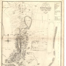
Plan of the Town of Montrose.
collection: pilotnum_gcps: 5
center: 56.713188,-2.460809
user_name: georeferencer.org
date_time: 05/22/2012 15:01
View this map in ...
Nouvelle Carte d'Ecosse, où l'on fait observer l'Etat de la Noblesse : les Villes, et les Bourgs qui deputent au Parlement, et Diverses autres remarques propres à Conduire à l'Inteligence de l'Histoir
collection: pilotnum_gcps: 6
center: 56.598529,-4.607712
user_name: Wisse ten Bosch
date_time: 02/29/2016 13:55
View this map in ...
Inverie Bay and Approach
collection: pilotnum_gcps: 9
center: 57.034148,-5.729666
user_name: georeferencer.org
date_time: 05/22/2012 16:36
View this map in ...
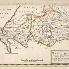
Galloway : Contains The Shires of Wigton and Kirkcudbright / Her. Moll.
collection: pilotnum_gcps: 30
center: 54.916539,-4.403843
user_name: Andy A
date_time: 03/01/2016 13:16
View this map in ...
A mape of the west of Scotland containing Clydsdail, Nithsdail, Ranfrew, Shyre of Ayre, & Galloway / authore Jo. Adair.
collection: pilotnum_gcps: 54
center: 55.343955,-4.159189
user_name: Andy Arthur
date_time: 02/21/2016 23:19
View this map in ...
Scotland.
collection: pilotnum_gcps: 17
center: 56.665613,-4.618356
user_name: Elger Heere
date_time: 05/08/2013 13:11
View this map in ...
A plan of the county of Mid-Lothian…
collection: pilotnum_gcps: 8
center: 55.762891,-3.028963
user_name: michael_cairns@lineone.net
date_time: 06/09/2013 21:02
View this map in ...
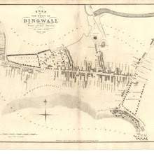
Dingwall
collection: pilotnum_gcps: 4
center: 57.596154,-4.431429
user_name: georeferencer.org
date_time: 05/22/2012 16:31
View this map in ...
The Hydrographicall mappe of Forth from the entry to ye Queens-ferry / authore Jo. Adair.
collection: pilotnum_gcps: 27
center: 56.127945,-2.754301
user_name: Andy Arthur
date_time: 02/14/2016 17:55
View this map in ...
No. 9 - Plan of the Farms of Ederahalda [Eadar a Chalda] and Kirktown [Kirkton].
collection: pilotnum_gcps: 9
center: 58.157488,-4.939519
user_name: georeferencer.org
date_time: 05/22/2012 15:45
View this map in ...

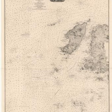
Hebrides or Western Isles from Barra Head to Scarpa Id.
collection: pilotnum_gcps: 25
center: 57.354014,-7.771572
user_name: Elger Heere
date_time: 05/13/2013 12:38
View this map in ...
Caricta Borealis, vulgo, The northpart of Carrick / Opus Timothei Pont.
collection: pilotnum_gcps: 65
center: 55.306380,-4.609441
user_name: Neville Kingdon, Andy Arthur
date_time: 03/10/2016 00:05
View this map in ...
Naturalist's Map of Scotland. By J.A. Harvie-Brown... and J.G. Bartholomew
collection: pilotnum_gcps: 8
center: 56.624629,-4.653382
user_name: Laura
date_time: 09/05/2012 15:01
View this map in ...
Northern Part of Inverness Shire.
collection: pilotnum_gcps: 6
center: 57.339342,-5.509268
user_name: Leander Bouwman
date_time: 05/15/2013 07:30
View this map in ...
Inner Channel: Sound of Seil to the Sound of Mull
collection: pilotnum_gcps: 5
center: 56.373473,-5.585258
user_name: Tiemen
date_time: 05/15/2013 07:47
View this map in ...
A map of Scotland drawn chiefly from the topographical surveys of John Ainslie…
collection: pilotnum_gcps: 9
center: 57.806607,-4.614126
user_name: georeferencer.org
date_time: 05/22/2012 15:45
View this map in ...
Edimbourg.
collection: pilotnum_gcps: 4
center: 55.951410,-3.191096
user_name: Andy Arthur
date_time: 02/14/2016 17:46
View this map in ...
Plan of the lands of Braehead Mains.
collection: pilotnum_gcps: 4
center: 55.960887,-3.313007
user_name: georeferencer.org
date_time: 05/22/2012 15:27
View this map in ...
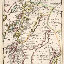
Argyle : Lorn, Knapdale, and Cowal. All parts of Argyle Shire / by H. Moll.
collection: pilotnum_gcps: 68
center: 56.213219,-5.251243
user_name: Andy A
date_time: 03/04/2016 20:55
View this map in ...
Northern Part of Ayrshire. Southern Part.
collection: pilotnum_gcps: 5
center: 55.687503,-4.833398
user_name: georeferencer.org
date_time: 05/22/2012 15:56
View this map in ...
Scotland.
collection: pilotnum_gcps: 3
center: 56.567947,-4.812213
user_name: georeferencer.org
date_time: 05/22/2012 16:04
View this map in ...

A new hydrographical survey of the islands of Shetland.
collection: pilotnum_gcps: 8
center: 60.218078,-1.407970
user_name: John Williamson
date_time: 07/22/2013 13:33
View this map in ...
No. 15 - Plan of the Farms of Ledmore and Ailfin [Elphin].
collection: pilotnum_gcps: 6
center: 58.060043,-4.986567
user_name: Kevin van der Weij
date_time: 05/15/2013 08:08
View this map in ...
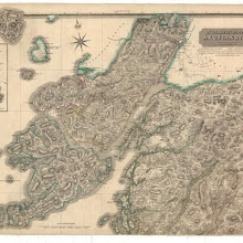
A general map of Scotland and islands thereto belonging.
collection: pilotnum_gcps: 8
center: 58.062806,-6.041562
user_name: michael_cairns@lineone.net
date_time: 05/22/2013 18:11
View this map in ...
Map of Scotland from the latest surveys.
collection: pilotnum_gcps: 6
center: 57.580671,-4.558959
user_name: Marc Mamut
date_time: 06/02/2013 17:54
View this map in ...
To the Noblemen and Gentlemen of the County of Stirling…
collection: pilotnum_gcps: 5
center: 56.208098,-4.448649
user_name: Marald Kornet
date_time: 05/15/2013 08:31
View this map in ...

Ainslie's travelling map of Scotland shewing the distances from one stage to another.
collection: pilotnum_gcps: 6
center: 56.661832,-4.495427
user_name: michael_cairns@lineone.net
date_time: 05/29/2013 19:44
View this map in ...
Mercia, vulgo vicecomitatus, Bervicensis / auct. Timothei Pont. Merce or Shirrefdome of Berwick.
collection: pilotnum_gcps: 23
center: 55.773525,-2.403959
user_name: michael_cairns@lineone.net, Andy A
date_time: 03/04/2016 11:22
View this map in ...
Scotland, drawn from a series of angles and astronomical observations…
collection: pilotnum_gcps: 7
center: 56.762009,-4.647924
user_name: michael_cairns@lineone.net
date_time: 05/29/2013 19:49
View this map in ...

Beschrijvinge van een deel vann Schottlandt van Bambourg tot Aberdein : daer Edenburg de princepaele Coepstat in is, So hem tlant daer 'bthoont, beneffens 2 eÿlende / door Lucas Ianss Wagenaer ; Ioann
collection: pilotnum_gcps: 19
center: 56.259395,-2.462510
user_name: Jamesks, ChrisFleet, Andy Arthur
date_time: 03/27/2016 22:30
View this map in ...
Plan of the lands of Newington and Bellville.
collection: pilotnum_gcps: 10
center: 55.935466,-3.181292
user_name: ChrisFleet
date_time: 07/05/2013 11:47
View this map in ...
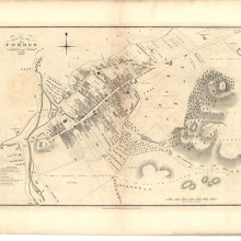
Plan of the Town of Forres from actual survey.
collection: pilotnum_gcps: 3
center: 57.609614,-3.610578
user_name: georeferencer.org
date_time: 05/22/2012 14:39
View this map in ...

A Map of the North West part of the Western Islands / by H. Moll.
collection: pilotnum_gcps: 57
center: 57.564108,-6.523982
user_name: Petr Pridal, Andy A
date_time: 03/02/2016 15:11
View this map in ...
Plan of the crossroads from Linton to Queensferry.
collection: pilotnum_gcps: 12
center: 55.892645,-3.442436
user_name: Jamesks, Martin MacGregor
date_time: 03/03/2016 11:12
View this map in ...
Scotia. Regno di Scotia.
collection: pilotnum_gcps: 33
center: 57.382924,-4.209834
user_name: Mihael, Heikki Vesanto, Andy A
date_time: 02/28/2016 21:26
View this map in ...
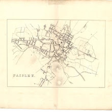
Paisley.
collection: pilotnum_gcps: 7
center: 55.842067,-4.423055
user_name: georeferencer.org, michael_cairns@lineone.net
date_time: 11/15/2013 19:35
View this map in ...
Glottiana Praefectura Superior, [vel], The Upper Ward of Clyds-dayl / Auct. Timoth. Pont.
collection: pilotnum_gcps: 24
center: 55.505281,-3.552325
user_name: michael_cairns@lineone.net, nbridgland
date_time: 12/03/2015 12:51
View this map in ...
The Frith of Forth from the Entry to the Queen's ferry, with all the Islands, Rocks, Sands, &c.
collection: pilotnum_gcps: 9
center: 56.038177,-2.756061
user_name: Xuigh
date_time: 05/03/2013 20:44
View this map in ...
The Kingdome of Scotland / performed by Iohn Speed.
collection: pilotnum_gcps: 27
center: 56.854232,-4.802547
user_name: michael_cairns@lineone.net, annaserafini, Andy Arthur
date_time: 01/21/2016 11:43
View this map in ...

Northern Part of Ayrshire.
collection: pilotnum_gcps: 5
center: 55.687534,-4.221647
user_name: georeferencer.org, michael_cairns@lineone.net
date_time: 11/10/2013 19:01
View this map in ...
Carte des principaux ports des Isles Orcades…
collection: pilotnum_gcps: 3
center: 59.116030,-2.900308
user_name: georeferencer.org, michael_cairns@lineone.net
date_time: 11/10/2013 19:01
View this map in ...
Carte des Isles Orcades.
collection: pilotnum_gcps: 3
center: 58.993905,-3.290910
user_name: georeferencer.org
date_time: 05/22/2012 16:12
View this map in ...
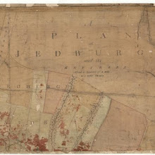
Jedburgh and its environs.
collection: pilotnum_gcps: 5
center: 55.488428,-2.570527
user_name: georeferencer.org
date_time: 05/22/2012 16:26
View this map in ...
Cathenesia / Auct. Timotheo Pont. Caithness.
collection: pilotnum_gcps: 18
center: 58.419552,-3.539390
user_name: Andy Arthur
date_time: 02/02/2016 12:27
View this map in ...
No. 1 - Plan of the Farm of Oldernay [Oldany]
collection: pilotnum_gcps: 4
center: 58.234730,-5.253490
user_name: georeferencer.org
date_time: 05/22/2012 14:53
View this map in ...
Scotiae Regnum [north sheet] / per Gerardum Mercatorem.
collection: pilotnum_gcps: 3
center: 58.969914,-2.975562
user_name: michael_cairns@lineone.net, Scott Lussier
date_time: 02/12/2015 02:12
View this map in ...
Nieuwe Caart van de Rivier van Glasgow in 't Groot.
collection: pilotnum_gcps: 3
center: 55.942727,-5.999974
user_name: georeferencer.org
date_time: 05/22/2012 16:36
View this map in ...

A Map of Midlothian / survey'd by Mr. J. Adair.
collection: pilotnum_gcps: 3
center: 55.886508,-3.361006
user_name: michael_cairns@lineone.net, arbster
date_time: 01/22/2015 09:53
View this map in ...
Plan of the Cities of Aberdeen.
collection: pilotnum_gcps: 6
center: 57.151863,-2.095046
user_name: georeferencer.org
date_time: 05/22/2012 15:30
View this map in ...
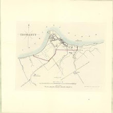
Cromarty
collection: pilotnum_gcps: 19
center: 57.675778,-4.034046
user_name: McVitele Charly
date_time: 06/12/2013 08:58
View this map in ...
Ardrossan Harbour
collection: pilotnum_gcps: 3
center: 55.642102,-4.834329
user_name: Brigitte Clements
date_time: 09/19/2012 16:25
View this map in ...
This map of Scotland, constructed and engraved from the best authorities…
collection: pilotnum_gcps: 12
center: 56.695018,-4.473122
user_name: Nigel Davies
date_time: 06/17/2012 18:51
View this map in ...

Lorna, Knapdalia, Cantire, Jura, Ila, Glota, et Buthe insulae.
collection: pilotnum_gcps: 6
center: 56.040182,-5.381976
user_name: edward smith, ChrisFleet, donone
date_time: 02/23/2015 20:39
View this map in ...
Map of Scotland constructed from original materials.
collection: pilotnum_gcps: 57
center: 55.616355,-6.261412
user_name: David McElroy
date_time: 06/22/2012 16:12
View this map in ...

A new chart of the sea coast of Scotland with the islands thereof.
collection: pilotnum_gcps: 21
center: 57.669508,-4.751054
user_name: David McElroy
date_time: 06/22/2012 16:23
View this map in ...
Southern Part of Aberdeen & Banff Shires.
collection: pilotnum_gcps: 18
center: 57.073123,-3.307701
user_name: ChrisFleet
date_time: 07/14/2013 10:31
View this map in ...

Kay's plan of Edinburgh.
collection: pilotnum_gcps: 21
center: 55.951459,-3.196056
user_name: georeferencer.org
date_time: 05/22/2012 15:28
View this map in ...

A new & correct map of North Britain.
collection: pilotnum_gcps: 5
center: 56.904166,-4.594061
user_name: michael_cairns@lineone.net
date_time: 06/22/2012 19:23
View this map in ...
Afteekening van de Noord Oost hoek van Schotland, Vertoonende The Firth of Murray, en daar in de Riviere Invernness, Cromertie, Tarbet of Tayne : t'vervolg van de Kust by Ord Head met de Letter 'A' ge
collection: pilotnum_gcps: 17
center: 57.838982,-3.740497
user_name: David McElroy
date_time: 06/22/2012 22:28
View this map in ...
Plan of the Town and Environs of Jedburgh.
collection: pilotnum_gcps: 3
center: 55.478406,-2.553247
user_name: georeferencer.org
date_time: 05/22/2012 14:43
View this map in ...

Scotland, drawn from a series of angles and astronomical observations…
collection: pilotnum_gcps: 4
center: 56.711907,-6.898695
user_name: michael_cairns@lineone.net
date_time: 06/23/2012 18:45
View this map in ...
No. 4 - A Plan of the Farms of Brackloch, Inver, Torbreck, Baddedaroch [Baddidarach] and Batachrianan [Bad a' Ghrianan]
collection: pilotnum_gcps: 4
center: 58.167362,-5.244886
user_name: Petr Pridal
date_time: 06/23/2012 20:32
View this map in ...
A new chart of the West coast of Scotland from the point of Ardnamurchan to Cape Wrath.
collection: pilotnum_gcps: 3
center: 57.697554,-6.449225
user_name: georeferencer.org
date_time: 05/22/2012 15:22
View this map in ...
Loch Tuadh and the Isles
collection: pilotnum_gcps: 6
center: 56.475355,-6.319081
user_name: michael_cairns@lineone.net
date_time: 06/24/2012 18:19
View this map in ...

Plan of the Town of Forfar from actual survey.
collection: pilotnum_gcps: 3
center: 56.644481,-2.888536
user_name: georeferencer.org
date_time: 05/22/2012 15:49
View this map in ...
Map of the City of Glasgow and suburbs.
collection: pilotnum_gcps: 8
center: 55.852311,-4.249880
user_name: georeferencer.org
date_time: 05/22/2012 15:35
View this map in ...
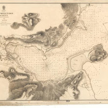
Campbelltown
collection: pilotnum_gcps: 5
center: 55.423907,-5.601022
user_name: georeferencer.org
date_time: 05/22/2012 15:27
View this map in ...
A Chart Describing the Coast of Scotland from Berwick to Dungsby Head wth the Isles of Orkney Shetland & ye Western Islands.
collection: pilotnum_gcps: 3
center: 57.443792,-4.056176
user_name: Menno
date_time: 07/06/2012 07:16
View this map in ...

The Shires of Ross, and Cromartie / by Her. Moll.
collection: pilotnum_gcps: 3
center: 57.824455,-4.548813
user_name: Einion
date_time: 10/20/2015 16:19
View this map in ...
Islay, Jura, Colonsay &c.
collection: pilotnum_gcps: 4
center: 55.853204,-6.313462
user_name: michael_cairns@lineone.net
date_time: 07/21/2012 18:47
View this map in ...

Scotia Provinciae intra Flumen Taum, et Murra fyrth sitae, utpote Moravia, Badenocha, Atholia, Aberdonia, Baneia, et Mernis.
collection: pilotnum_gcps: 51
center: 57.203129,-3.436801
user_name: yeryry, Tillmann Tegeler
date_time: 05/12/2016 10:53
View this map in ...
Plan of Galashiels.
collection: pilotnum_gcps: 4
center: 55.616465,-2.809327
user_name: georeferencer.org
date_time: 05/22/2012 15:52
View this map in ...
A Plan of that Part of the Parish of Golspie Lying betwixt the Policy of Dunrobin and the Bay of the Little Ferry The Property of the Right Honourable Elizabeth, Countess of Sutherland / Made out from
collection: pilotnum_gcps: 3
center: 57.961580,-4.002448
user_name: georeferencer.org
date_time: 05/22/2012 15:42
View this map in ...
Johnston's plan of Edinburgh & Leith.
collection: pilotnum_gcps: 24
center: 55.959087,-3.210643
user_name: Andy A
date_time: 03/01/2016 11:15
View this map in ...

Scotland, drawn from a series of angles and astronomical observations…
collection: pilotnum_gcps: 4
center: 55.185561,-6.704246
user_name: michael_cairns@lineone.net
date_time: 07/27/2012 19:18
View this map in ...
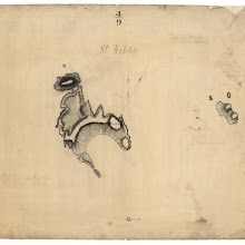
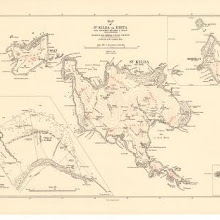
St Kilda.
collection: pilotnum_gcps: 8
center: 57.831065,-8.542142
user_name: michael_cairns@lineone.net, Andy A
date_time: 03/01/2016 11:52
View this map in ...
Dumbartonshire.
collection: pilotnum_gcps: 22
center: 56.089996,-4.411752
user_name: georeferencer.org
date_time: 05/22/2012 16:32
View this map in ...
Lochs Laxford and Inchard with Scourie Bay.
collection: pilotnum_gcps: 34
center: 58.420346,-5.166085
user_name: Martin Robinson
date_time: 07/25/2012 13:08
View this map in ...
Counties of Fife and Kinross with the Rivers Forth and Tay
collection: pilotnum_gcps: 4
center: 56.337835,-3.103006
user_name: michael_cairns@lineone.net
date_time: 08/04/2012 19:45
View this map in ...

Black's new large map of Scotland.
collection: pilotnum_gcps: 3
center: 57.173023,-6.697432
user_name: georeferencer.org
date_time: 05/22/2012 15:43
View this map in ...
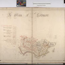
A Plan of Lothmore
collection: pilotnum_gcps: 4
center: 58.085410,-3.780358
user_name: michael_cairns@lineone.net
date_time: 07/30/2012 19:07
View this map in ...
A general chart of the west coast and western islands of Scotland from Cantire to Cape Wrath and Butt of the Lewis.
collection: pilotnum_gcps: 4
center: 56.848289,-6.164526
user_name: michael_cairns@lineone.net
date_time: 07/28/2012 19:05
View this map in ...
Southern Part of Aberdeen & Banff Shires.
collection: pilotnum_gcps: 17
center: 57.074905,-2.257953
user_name: ChrisFleet
date_time: 07/14/2013 10:15
View this map in ...
A new chart of the sea coast of Scotland with the islands thereof.
collection: pilotnum_gcps: 10
center: 57.622668,-4.823895
user_name: Petr Sloup, vishwa
date_time: 10/26/2013 09:21
View this map in ...

The Chiefe Harbours in the Islands of Orkney.
collection: pilotnum_gcps: 4
center: 59.123393,-2.905957
user_name: michael_cairns@lineone.net
date_time: 10/19/2012 18:13
View this map in ...
A commercial map of Scotland.
collection: pilotnum_gcps: 7
center: 56.891286,-4.572077
user_name: michael_cairns@lineone.net
date_time: 12/03/2012 21:11
View this map in ...
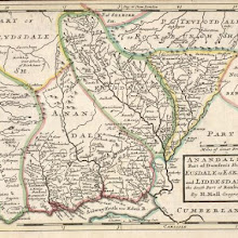
Anandale : is Part of Dumfreis Shire. Eusdale or Eskdale and Liddesdale is the South Part of Roxburgh Sh. / H. Moll.
collection: pilotnum_gcps: 41
center: 55.166873,-3.144947
user_name: Andy Arthur
date_time: 03/07/2016 23:47
View this map in ...
A chart of part of the South of Scotland, from Berwick upon Tweed to Skateraw Harbour in the County of Kincardine…
collection: pilotnum_gcps: 4
center: 56.740973,-3.361148
user_name: michael_cairns@lineone.net
date_time: 12/15/2012 17:53
View this map in ...
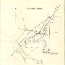
Inverkeithing
collection: pilotnum_gcps: 3
center: 56.028817,-3.399427
user_name: georeferencer.org
date_time: 05/22/2012 16:14
View this map in ...

A general map of Scotland and islands thereto belonging.
collection: pilotnum_gcps: 6
center: 55.598973,-6.020550
user_name: michael_cairns@lineone.net
date_time: 12/11/2012 19:39
View this map in ...
Map of Scotland from the latest surveys.
collection: pilotnum_gcps: 25
center: 58.734770,-1.694648
user_name: McVitele Charly
date_time: 12/10/2012 08:33
View this map in ...

A pocket companion of ye roads of ye North part of Great Britain called Scotland ... / by Herman Moll.
collection: pilotnum_gcps: 4
center: 56.926718,-4.635776
user_name: michael_cairns@lineone.net, camilla, Andrew John Miller
date_time: 03/08/2016 14:04
View this map in ...
North Berwick
collection: pilotnum_gcps: 6
center: 56.060557,-2.719631
user_name: Andy A
date_time: 03/29/2016 10:18
View this map in ...

Map of the County of Forfar or Shire of Angus.
collection: pilotnum_gcps: 4
center: 56.827259,-2.664426
user_name: michael_cairns@lineone.net
date_time: 12/12/2012 20:56
View this map in ...
A new and correct map of Scotland or North Britain, drawn from the most approved surveys.
collection: pilotnum_gcps: 94
center: 56.684841,-4.944696
user_name: georeferencer.org, annaserafini
date_time: 11/19/2013 13:03
View this map in ...
Loch Moidart
collection: pilotnum_gcps: 3
center: 56.795685,-5.849258
user_name: georeferencer.org
date_time: 05/22/2012 15:46
View this map in ...
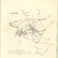
Lanark
collection: pilotnum_gcps: 6
center: 55.671937,-3.781871
user_name: georeferencer.org
date_time: 05/22/2012 14:48
View this map in ...
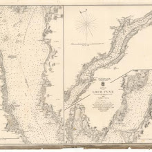
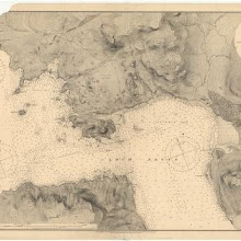
Loch Fyne
collection: pilotnum_gcps: 5
center: 55.925892,-5.277766
user_name: michael_cairns@lineone.net
date_time: 02/17/2013 18:47
View this map in ...
Le Royaume d'Escosse divisé en deux parties ... dressé par le P. Coronelli ... / corrigé et augmenté sur les Mémoires du Sr. Tillemon ... Dedié à le Prince de Galles, fils de Jacques II.
collection: pilotnum_gcps: 220
center: 56.719456,-3.884428
user_name: michael_cairns@lineone.net, camilla, Andy Arthur
date_time: 03/18/2016 22:18
View this map in ...
A map of such part of his Grace the Duke of Argyle's heritable dukedom, and justiciary territories, islands, superiorities & jurisdictions as lye contiguous upon the western Coast of North Britain
collection: pilotnum_gcps: 119
center: 56.335544,-5.670830
user_name: Andy A
date_time: 03/04/2016 21:35
View this map in ...
Scotland: West coast.
collection: pilotnum_gcps: 11
center: 57.110232,-6.993023
user_name: georeferencer.org
date_time: 05/22/2012 15:58
View this map in ...
Linlithgow Shire.
collection: pilotnum_gcps: 4
center: 55.940487,-3.371582
user_name: michael_cairns@lineone.net
date_time: 03/01/2013 19:10
View this map in ...

Carte particuliere de la cote occidentale d'Escosse, depuis la Pointe d'Ardnamurchan jusqu'au Mull de Galloway.
collection: pilotnum_gcps: 5
center: 55.812315,-5.660726
user_name: georeferencer.org
date_time: 05/22/2012 15:28
View this map in ...
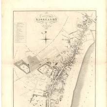
Kirkcaldy
collection: pilotnum_gcps: 3
center: 56.104269,-3.160568
user_name: georeferencer.org
date_time: 05/22/2012 15:20
View this map in ...
Paskaart vande noord cust van Schotland als mede de eylanden van Hitlandt en Fero. Naaukeuring opgestelt en van veel fouten verbetert ... / Iohannes van Keulen.
collection: pilotnum_gcps: 5
center: 60.415238,-2.837856
user_name: michael_cairns@lineone.net
date_time: 02/25/2013 09:39
View this map in ...
Ayr and suburbs
collection: pilotnum_gcps: 5
center: 55.462900,-4.625623
user_name: georeferencer.org
date_time: 05/22/2012 15:34
View this map in ...

Annandiae praefectura, Vulgo, The Stewartrie of Annandail / auct. Timotheo Pont ; excud. I. Blaeu.
collection: pilotnum_gcps: 42
center: 55.013155,-3.276488
user_name: Andy Arthur
date_time: 02/22/2016 10:38
View this map in ...
Counties of Fife and Kinross with the Rivers Forth and Tay
collection: pilotnum_gcps: 11
center: 56.331832,-2.699560
user_name: John McIntyre
date_time: 02/18/2013 09:02
View this map in ...
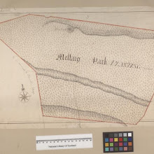
Mellaig Park
collection: pilotnum_gcps: 5
center: 58.036029,-4.169090
user_name: Marc
date_time: 12/18/2013 11:53
View this map in ...

Skia vel Skiana, [vulgo], The Yle of Skie / Auct. Timotheo Pont.
collection: pilotnum_gcps: 36
center: 57.418273,-6.111293
user_name: Andy Arthur
date_time: 02/08/2016 15:57
View this map in ...
Northern Part of Angus Shire.
collection: pilotnum_gcps: 5
center: 56.920663,-2.937688
user_name: georeferencer.org
date_time: 05/22/2012 15:28
View this map in ...
Map of the north eastern districts of Aberdeenshire.
collection: pilotnum_gcps: 5
center: 57.570786,-2.110431
user_name: georeferencer.org
date_time: 05/22/2012 15:08
View this map in ...
This plan of the City of Edinburgh and its environs.
collection: pilotnum_gcps: 43
center: 55.957316,-3.207297
user_name: Gavin, Andy Arthur
date_time: 06/12/2015 10:16
View this map in ...
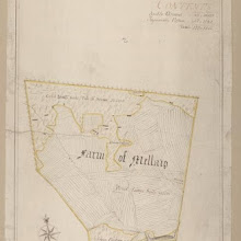
Farm of Mellaig
collection: pilotnum_gcps: 6
center: 57.988168,-3.933210
user_name: Neville Kingdon
date_time: 07/03/2013 22:57
View this map in ...
Renfrew Shire.
collection: pilotnum_gcps: 5
center: 55.836133,-4.594753
user_name: michael_cairns@lineone.net
date_time: 04/04/2013 18:08
View this map in ...
A Display of the Coasting Lines of six several maps of North Britain [Adair, Moll, Gordon of Straloch, Senex, Inselin, Sanson] / by I. Cowley.
collection: pilotnum_gcps: 6
center: 57.510600,-3.755134
user_name: Chris Lee
date_time: 03/24/2016 22:31
View this map in ...
Edinburgh Shire.
collection: pilotnum_gcps: 9
center: 55.764433,-3.502432
user_name: michael_cairns@lineone.net, Martin MacGregor
date_time: 03/03/2016 17:05
View this map in ...
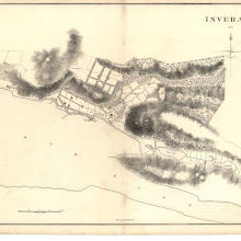
Inverness
collection: pilotnum_gcps: 5
center: 57.477787,-4.229211
user_name: georeferencer.org
date_time: 05/22/2012 15:13
View this map in ...
Plan of the Town of Kirkcaldy from actual survey.
collection: pilotnum_gcps: 3
center: 56.112544,-3.159092
user_name: georeferencer.org
date_time: 05/22/2012 15:22
View this map in ...
Fair Isle.
collection: pilotnum_gcps: 6
center: 59.530099,-1.621397
user_name: michael_cairns@lineone.net
date_time: 04/29/2013 18:06
View this map in ...
Ardnamurchan to Summer Isles, including the Inner Channel and part of the Minch.
collection: pilotnum_gcps: 5
center: 57.361852,-5.764744
user_name: michael_cairns@lineone.net
date_time: 04/18/2013 19:08
View this map in ...

De Custen van Schotlandt van Donde tot d'Eijlanden van Orcanesse. De kusten van Schotlandt van Donde tot Eijlanden Orcanesse.
collection: pilotnum_gcps: 8
center: 57.530972,-1.497632
user_name: michael_cairns@lineone.net
date_time: 04/10/2013 18:22
View this map in ...
Edinburgh Firth.
collection: pilotnum_gcps: 6
center: 56.099473,-2.945032
user_name: michael_cairns@lineone.net
date_time: 04/19/2013 19:21
View this map in ...
L' Escosse Royaume en ses deux Principales Parties ; qui sont Decà, et Del à le Taý, et Chaque Partie Subdivisée et leures Provinces qu'ils appellent Shirif-domes, Stewarties &c. / par Sanson d'Ab
collection: pilotnum_gcps: 5
center: 57.573404,-3.827685
user_name: Afsana, Petr Pridal
date_time: 02/25/2016 11:01
View this map in ...
West Loch Tarbert
collection: pilotnum_gcps: 3
center: 55.804194,-5.576183
user_name: georeferencer.org
date_time: 05/22/2012 15:29
View this map in ...
Plan of the Town of Stirling.
collection: pilotnum_gcps: 3
center: 56.128732,-3.930964
user_name: georeferencer.org
date_time: 05/22/2012 16:33
View this map in ...
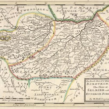
Map embracing extensive portions of the Counties of Roxburgh, Berwick, Selkirk & Midlothian and Part of Northumberland. Minutely & accurately surveyed… by Crawford and Brooke
collection: pilotnum_gcps: 15
center: 55.549446,-2.279335
user_name: michael_cairns@lineone.net, Andy Arthur
date_time: 02/18/2016 20:35
View this map in ...
Eddrachilles Bay, including the Lochs
collection: pilotnum_gcps: 6
center: 58.279365,-5.106545
user_name: Tiemen
date_time: 05/15/2013 20:47
View this map in ...
Pittenweem, West and East Anstruther, and Kilrenny
collection: pilotnum_gcps: 6
center: 56.221999,-2.709512
user_name: georeferencer.org
date_time: 05/22/2012 15:21
View this map in ...
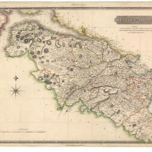
Map of Dumfries-shire.
collection: pilotnum_gcps: 5
center: 55.324483,-3.832887
user_name: michael_cairns@lineone.net
date_time: 07/01/2013 19:46
View this map in ...
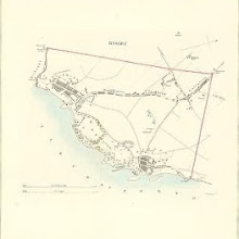
Dysart
collection: pilotnum_gcps: 4
center: 56.125095,-3.132612
user_name: georeferencer.org
date_time: 05/22/2012 14:53
View this map in ...
Lochs Erisort, Luirbost and Grimashadar.
collection: pilotnum_gcps: 3
center: 58.117823,-6.455925
user_name: georeferencer.org
date_time: 05/22/2012 14:49
View this map in ...
A Map of the forrest of Mar survey'd &c. / Done by John Farquharson of Invercald, in Anno 1703.
collection: pilotnum_gcps: 37
center: 56.990224,-3.550313
user_name: Andy A
date_time: 02/28/2016 21:41
View this map in ...
Map of the County of Berwick.
collection: pilotnum_gcps: 14
center: 55.864448,-2.748354
user_name: georeferencer.org
date_time: 05/22/2012 16:24
View this map in ...

Linlithgow Shire.
collection: pilotnum_gcps: 15
center: 55.932118,-3.750089
user_name: interzone
date_time: 06/21/2013 01:27
View this map in ...
Plan of the Town of Irvine.
collection: pilotnum_gcps: 9
center: 55.610290,-4.680015
user_name: georeferencer.org
date_time: 05/22/2012 14:56
View this map in ...
This map of Argyllshire…
collection: pilotnum_gcps: 8
center: 55.647025,-5.563065
user_name: georeferencer.org
date_time: 05/22/2012 15:59
View this map in ...
Black's new large map of Scotland.
collection: pilotnum_gcps: 6
center: 57.187790,-4.778955
user_name: Ali Abdulla
date_time: 05/15/2013 08:38
View this map in ...
The County of Berwick.
collection: pilotnum_gcps: 5
center: 55.757760,-2.166611
user_name: georeferencer.org
date_time: 05/22/2012 15:31
View this map in ...
Montrose
collection: pilotnum_gcps: 4
center: 56.717971,-2.464372
user_name: georeferencer.org
date_time: 05/22/2012 15:55
View this map in ...

The Strangers Guide, being a Plan of Edinburgh & Leith exhibiting all the streets principal buildings & late improvements…
collection: pilotnum_gcps: 47
center: 55.958684,-3.183600
user_name: Esmerelda, Andy Arthur
date_time: 02/14/2016 18:17
View this map in ...
Plan of the Town of Stirling.
collection: pilotnum_gcps: 3
center: 56.116463,-3.945342
user_name: georeferencer.org
date_time: 05/22/2012 16:04
View this map in ...
Novissima Regni Scotiae septentrionalis et meridionalis tabula, divisae in ducatus, comitatus, vice-comitatus, provincias, praefecturas, dominia et insulas / auctore Carolo Allard.
collection: pilotnum_gcps: 59
center: 56.696130,-4.182694
user_name: Lynda, Arian Doek, Andy Arthur
date_time: 03/24/2016 10:26
View this map in ...

Kirkcudbright Bay
collection: pilotnum_gcps: 8
center: 54.802323,-4.065238
user_name: Leander Bouwman
date_time: 05/15/2013 08:23
View this map in ...
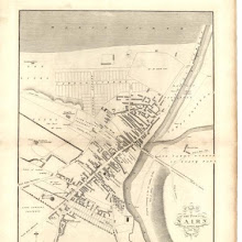
Plan of the Town of Nairn from actual survey.
collection: pilotnum_gcps: 11
center: 57.586007,-3.866872
user_name: McVitele Charly
date_time: 06/12/2013 08:48
View this map in ...
Plan of the village of Broxburn.
collection: pilotnum_gcps: 3
center: 55.933544,-3.472452
user_name: georeferencer.org
date_time: 05/22/2012 15:09
View this map in ...
Campbelltown Harbour
collection: pilotnum_gcps: 3
center: 55.424513,-5.573773
user_name: georeferencer.org
date_time: 05/22/2012 15:34
View this map in ...

Southern Part of Ayrshire.
collection: pilotnum_gcps: 4
center: 55.209406,-4.215927
user_name: georeferencer.org
date_time: 05/22/2012 16:21
View this map in ...
A new and accurate map of Scotland divided into shires from the most authentick surveys.
collection: pilotnum_gcps: 12
center: 56.449554,-4.747112
user_name: Nigel Davies
date_time: 06/17/2012 17:34
View this map in ...

A new map of Ayrshire…
collection: pilotnum_gcps: 4
center: 55.432697,-4.805058
user_name: michael_cairns@lineone.net
date_time: 06/14/2012 18:18
View this map in ...
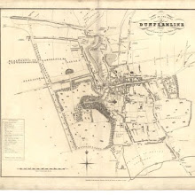
Plan of the Town of Dunfermline from actual survey.
collection: pilotnum_gcps: 12
center: 56.070610,-3.465733
user_name: ChrisFleet
date_time: 02/25/2014 10:47
View this map in ...
Map of Dumfries-shire.
collection: pilotnum_gcps: 20
center: 55.005910,-3.040788
user_name: michael_cairns@lineone.net, ChrisFleet
date_time: 10/19/2013 05:59
View this map in ...

Map of the three Lothians.
collection: pilotnum_gcps: 5
center: 55.980801,-3.598758
user_name: David McElroy
date_time: 06/22/2012 16:16
View this map in ...
Nairn
collection: pilotnum_gcps: 9
center: 57.586179,-3.860822
user_name: McVitele Charly
date_time: 06/12/2013 09:44
View this map in ...
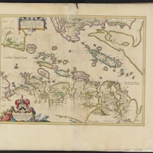
L' Escosse decà le Taý, divisée en ses Provinces &c. tirées de toutes les Cartes particulieres qu'en ont faict Timothée Pont, Robert Gordon a Straloch / par Sanson d'Abbev[ille].
collection: pilotnum_gcps:
center:
user_name:
date_time:
View this map in ...
A map of Roxburghshire or Tiviotdale.
collection: pilotnum_gcps: 23
center: 55.315699,-2.487625
user_name: David McElroy
date_time: 06/22/2012 22:05
View this map in ...

A map of the Shire of Dumbarton.
collection: pilotnum_gcps: 4
center: 56.208385,-4.637232
user_name: michael_cairns@lineone.net
date_time: 06/20/2012 18:46
View this map in ...

Loch Inver and Loch Roe
collection: pilotnum_gcps: 4
center: 58.149777,-5.281972
user_name: georeferencer.org
date_time: 05/22/2012 14:44
View this map in ...
Tobermory Harbour
collection: pilotnum_gcps: 4
center: 56.619700,-6.052581
user_name: michael_cairns@lineone.net
date_time: 06/21/2012 18:27
View this map in ...
The City of Edinburgh.
collection: pilotnum_gcps: 33
center: 55.954615,-3.189150
user_name: Andy A
date_time: 03/01/2016 11:08
View this map in ...
A plan of the City of Aberdeen with all the inclosures surrounding the town to the adjacent country, from a survey taken 1789.
collection: pilotnum_gcps: 5
center: 57.147761,-2.091493
user_name: georeferencer.org
date_time: 05/22/2012 16:13
View this map in ...

Map of the County of Selkirk and District of Melrose.
collection: pilotnum_gcps: 3
center: 55.613715,-2.976381
user_name: georeferencer.org
date_time: 05/22/2012 14:44
View this map in ...
Plan of the Estates of Ravelston and Corstorphinhill.
collection: pilotnum_gcps: 3
center: 55.949491,-3.261975
user_name: georeferencer.org
date_time: 05/22/2012 15:29
View this map in ...
Edinburgh and Leith
collection: pilotnum_gcps: 34
center: 55.955190,-3.185321
user_name: Andy Arthur
date_time: 06/13/2015 19:37
View this map in ...
Betts's improved educational maps: Scotland.
collection: pilotnum_gcps: 3
center: 56.631548,-4.667702
user_name: georeferencer.org
date_time: 05/22/2012 15:37
View this map in ...
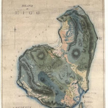
Island of Eigg.
collection: pilotnum_gcps: 5
center: 56.901599,-6.164068
user_name: georeferencer.org
date_time: 05/22/2012 15:24
View this map in ...
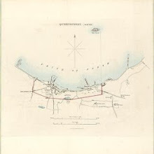
Queensferry (South)
collection: pilotnum_gcps: 7
center: 55.991845,-3.389995
user_name: georeferencer.org
date_time: 05/22/2012 16:02
View this map in ...

Kincardine Shire.
collection: pilotnum_gcps: 4
center: 56.941781,-2.412678
user_name: georeferencer.org
date_time: 05/22/2012 15:11
View this map in ...

Sleat Sound
collection: pilotnum_gcps: 3
center: 57.050522,-5.831461
user_name: georeferencer.org
date_time: 05/22/2012 15:08
View this map in ...
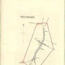
Whithorn
collection: pilotnum_gcps: 4
center: 54.733116,-4.419238
user_name: georeferencer.org
date_time: 05/22/2012 16:30
View this map in ...
The Islands of Orkney / H. Moll, sculp.
collection: pilotnum_gcps: 7
center: 58.976411,-2.815104
user_name: bkerr
date_time: 09/21/2012 09:53
View this map in ...

A new map of Ayrshire…
collection: pilotnum_gcps: 6
center: 55.115678,-4.793369
user_name: bkerr
date_time: 09/21/2012 10:37
View this map in ...
Counties of Fife and Kinross with the Rivers Forth and Tay
collection: pilotnum_gcps: 6
center: 56.038277,-3.101243
user_name: bkerr
date_time: 09/21/2012 10:03
View this map in ...
Scotland.
collection: pilotnum_gcps: 3
center: 60.321738,-2.170543
user_name: georeferencer.org
date_time: 05/22/2012 15:50
View this map in ...
Map of Scotland from the latest surveys.
collection: pilotnum_gcps: 11
center: 55.162878,-6.973586
user_name: bkerr
date_time: 09/21/2012 10:13
View this map in ...
Loch Ryan
collection: pilotnum_gcps: 39
center: 54.956192,-5.085372
user_name: georeferencer.org
date_time: 05/22/2012 16:31
View this map in ...

Forfar
collection: pilotnum_gcps: 7
center: 56.646350,-2.888898
user_name: georeferencer.org
date_time: 05/22/2012 15:48
View this map in ...
Black's new large map of Scotland.
collection: pilotnum_gcps: 10
center: 55.130337,-6.603741
user_name: Jerome Busquet
date_time: 05/15/2013 07:40
View this map in ...
Peebles-Shire.
collection: pilotnum_gcps: 5
center: 55.610872,-3.256823
user_name: michael_cairns@lineone.net
date_time: 04/08/2013 18:16
View this map in ...
Topographical and military map of the counties of Aberdeen, Banff and Kincardine.
collection: pilotnum_gcps: 10
center: 57.485096,-2.098422
user_name: bkerr
date_time: 04/22/2013 13:47
View this map in ...
A commercial map of Scotland.
collection: pilotnum_gcps: 14
center: 56.851339,-4.622298
user_name: michael_cairns@lineone.net
date_time: 04/24/2013 19:16
View this map in ...
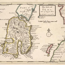
The Isle of Ila &c. Part of Argyle Shire / by H. Moll.
collection: pilotnum_gcps: 21
center: 55.770965,-5.982975
user_name: Andy Arthur
date_time: 02/14/2016 20:40
View this map in ...
A map of the county of Wigton.
collection: pilotnum_gcps: 4
center: 54.857402,-4.683554
user_name: georeferencer.org
date_time: 05/22/2012 15:24
View this map in ...
Map embracing extensive portions of the Counties of Roxburgh, Berwick, Selkirk & Midlothian and Part of Northumberland. Minutely & accurately surveyed… by Crawford and Brooke
collection: pilotnum_gcps: 17
center: 55.678514,-2.814020
user_name: Andy Arthur
date_time: 02/19/2016 10:05
View this map in ...
The west side of the island Mull with the islands Tiri and Coll.
collection: pilotnum_gcps: 3
center: 56.397010,-6.586231
user_name: georeferencer.org
date_time: 05/22/2012 16:01
View this map in ...
Map of the shire of Edinburgh.
collection: pilotnum_gcps: 5
center: 55.986786,-3.015944
user_name: michael_cairns@lineone.net
date_time: 04/11/2013 18:08
View this map in ...
Edinburgh Shire.
collection: pilotnum_gcps: 3
center: 55.966941,-3.037973
user_name: georeferencer.org
date_time: 05/22/2012 15:24
View this map in ...
The west coast of Scotland from Ila to Mull.
collection: pilotnum_gcps: 15
center: 56.243671,-5.896073
user_name: michael_cairns@lineone.net
date_time: 04/09/2013 18:24
View this map in ...
Scotland.
collection: pilotnum_gcps: 55
center: 57.055486,-4.652010
user_name: Leon Deutsch, Andy A
date_time: 03/03/2016 23:21
View this map in ...

The counties of Perth and Clackmannan.
collection: pilotnum_gcps: 4
center: 56.701372,-4.401483
user_name: michael_cairns@lineone.net
date_time: 04/12/2013 19:09
View this map in ...
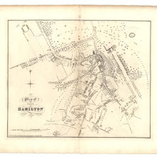
Plan of Hamilton.
collection: pilotnum_gcps: 15
center: 55.776592,-4.038781
user_name: Andy A
date_time: 03/29/2016 10:23
View this map in ...
Plan of the Town of Kelso and its environs…
collection: pilotnum_gcps: 9
center: 55.600197,-2.436932
user_name: georeferencer.org
date_time: 05/22/2012 16:06
View this map in ...

The sound of Mull.
collection: pilotnum_gcps: 3
center: 56.689924,-5.926167
user_name: georeferencer.org
date_time: 05/22/2012 16:04
View this map in ...
A Mapp of the Kingdome of Scotland / by Ric. Blome ; R. Palmer, sculp.
collection: pilotnum_gcps: 136
center: 56.855020,-4.930769
user_name: Tiemen, Andy Arthur
date_time: 03/16/2016 22:48
View this map in ...
Inverary.
collection: pilotnum_gcps: 3
center: 56.240112,-5.069172
user_name: georeferencer.org
date_time: 05/22/2012 15:36
View this map in ...

The Firth of Dornoch
collection: pilotnum_gcps: 29
center: 57.909416,-4.049779
user_name: georeferencer.org
date_time: 05/22/2012 14:38
View this map in ...
Holy-Island, Fairn Islands with the many Rocks and Hazards that lye Scatter'd in that Sea, and the Coast from Sunderland point in England to St Abbs-head in Scotland, survey'd and navigated by J[oh]n
collection: pilotnum_gcps: 3
center: 55.710955,-2.011247
user_name: georeferencer.org
date_time: 05/22/2012 15:47
View this map in ...

Plan of the City of Edinburgh, including all the latest and intended improvements.
collection: pilotnum_gcps: 4
center: 55.950605,-3.193330
user_name: georeferencer.org
date_time: 05/22/2012 15:11
View this map in ...
Scotiae tabula / Abraham Ortelius.
collection: pilotnum_gcps: 138
center: 57.409870,-4.748407
user_name: Andy Arthur
date_time: 03/07/2016 11:44
View this map in ...

Sound of Harris to Aird Bhreidhnis, including Lochs Tarbert & Resort
collection: pilotnum_gcps: 5
center: 57.951069,-7.049273
user_name: georeferencer.org
date_time: 05/22/2012 14:53
View this map in ...

Lothian's Plan of the Town of Leith and its vicinity.
collection: pilotnum_gcps: 12
center: 55.973559,-3.189604
user_name: Rebecca Renée Iacobone, Andy Arthur
date_time: 06/14/2015 12:10
View this map in ...
Map of the County of Berwick.
collection: pilotnum_gcps: 6
center: 55.633593,-2.726499
user_name: Neville Kingdon
date_time: 07/03/2013 18:00
View this map in ...
The Sherifdome of Etrik Forest.
collection: pilotnum_gcps: 35
center: 55.437336,-3.027614
user_name: Andy A
date_time: 02/29/2016 08:13
View this map in ...
Praefectura Kircubriensis quae Gallovidiae maxime orientalis pars est. The Stuartrie of Kircubright, the most easterlie part of Galloway / auct. Tim. Pont.
collection: pilotnum_gcps: 116
center: 55.087432,-3.953079
user_name: Andy Arthur
date_time: 03/14/2016 13:27
View this map in ...
Plan of the Mains of Dunrobin
collection: pilotnum_gcps: 7
center: 57.985785,-3.955441
user_name: Neville Kingdon
date_time: 07/03/2013 17:45
View this map in ...
Map of the County of Forfar or Shire of Angus.
collection: pilotnum_gcps: 22
center: 56.497563,-2.680266
user_name: Jamesks
date_time: 07/01/2013 15:11
View this map in ...
A true and exact Hydrographical description of the Sea coast and Isles of Scotland made in Voyage round the same by that great and mighty James the 5th. [First] published at Paris by Nicholay D'aulphi
collection: pilotnum_gcps: 20
center: 56.688026,-4.672706
user_name: Blair Gatehouse
date_time: 06/21/2013 05:31
View this map in ...
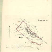
Lauder
collection: pilotnum_gcps: 29
center: 55.718811,-2.753192
user_name: georeferencer.org
date_time: 05/22/2012 16:06
View this map in ...
Map of Haddingtonshire.
collection: pilotnum_gcps: 6
center: 56.010360,-2.880938
user_name: bkerr
date_time: 06/28/2012 11:36
View this map in ...
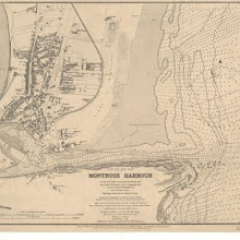
Montrose Harbour
collection: pilotnum_gcps: 3
center: 56.706930,-2.450423
user_name: georeferencer.org
date_time: 05/22/2012 15:33
View this map in ...
The Port and Vicinity of Wick
collection: pilotnum_gcps: 3
center: 58.435026,-3.065972
user_name: michael_cairns@lineone.net
date_time: 06/26/2012 18:50
View this map in ...
A plan of the county of Mid-Lothian…
collection: pilotnum_gcps: 20
center: 55.905400,-3.027150
user_name: David McElroy
date_time: 06/26/2012 10:28
View this map in ...
Plan of Dalkeith.
collection: pilotnum_gcps: 4
center: 55.896192,-3.066889
user_name: georeferencer.org
date_time: 05/22/2012 15:26
View this map in ...
Edinburgh.
collection: pilotnum_gcps: 13
center: 55.948132,-3.189559
user_name: slowcoach61, Andy Arthur
date_time: 02/08/2016 13:36
View this map in ...

The East Part of Galloway : being Part of the Shire of Kirkcudbright / by H. Moll.
collection: pilotnum_gcps: 20
center: 55.094124,-3.877360
user_name: bkerr, Andy Arthur
date_time: 06/24/2015 17:53
View this map in ...
A chart of part of the North of Scotland, from Banff to Duncansby Head.
collection: pilotnum_gcps: 4
center: 57.758152,-3.990691
user_name: michael_cairns@lineone.net
date_time: 06/27/2012 18:38
View this map in ...
Map of the counties of Fife and Kinross.
collection: pilotnum_gcps: 11
center: 56.082958,-3.414893
user_name: maria velez
date_time: 06/28/2012 11:15
View this map in ...
Map of Selkirkshire or Ettrick Forest.
collection: pilotnum_gcps: 5
center: 55.513824,-3.083878
user_name: bkerr
date_time: 06/28/2012 12:19
View this map in ...
A chart of the Orkney Islands.
collection: pilotnum_gcps: 6
center: 58.911559,-2.912376
user_name: bkerr
date_time: 06/28/2012 12:32
View this map in ...

This map of the ten parishes within the Royalty and the parishes of Gorbals Barony of Glasgow.
collection: pilotnum_gcps: 34
center: 55.865568,-4.245701
user_name: David McElroy
date_time: 06/25/2012 09:37
View this map in ...
Gigha Sound
collection: pilotnum_gcps: 6
center: 55.668874,-5.703188
user_name: bkerr
date_time: 06/28/2012 12:29
View this map in ...
Plan of the Towns of Dumfries and Maxwelltown from actual survey.
collection: pilotnum_gcps: 4
center: 55.065694,-3.610752
user_name: georeferencer.org
date_time: 05/22/2012 15:35
View this map in ...

Inverary [Inveraray]
collection: pilotnum_gcps: 5
center: 56.228678,-5.080607
user_name: georeferencer.org
date_time: 05/22/2012 15:55
View this map in ...

Irvine
collection: pilotnum_gcps: 3
center: 55.610829,-4.676476
user_name: georeferencer.org
date_time: 05/22/2012 15:06
View this map in ...

No. 12 - Plan of the Farms of Duchlash [Dubh Chlais], Polgarvier [Poll a Gharb Bhair], Drumsurdland [Druim Suardalain] and Philin [Filin].
collection: pilotnum_gcps: 3
center: 58.143400,-5.155595
user_name: michael_cairns@lineone.net
date_time: 08/03/2012 20:29
View this map in ...

A new map of Scotland, from the latest authorities.
collection: pilotnum_gcps: 6
center: 55.633688,-2.781866
user_name: ChrisFleet
date_time: 08/02/2012 14:55
View this map in ...
The North Minch
collection: pilotnum_gcps: 8
center: 58.311664,-5.777651
user_name: georeferencer.org
date_time: 05/22/2012 14:49
View this map in ...
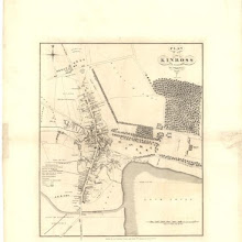
Plan of the Town of Kinross from actual survey.
collection: pilotnum_gcps: 3
center: 56.203345,-3.417965
user_name: georeferencer.org
date_time: 05/22/2012 15:33
View this map in ...
A chart of the north coast of Scotland including the Orkney and Shetland Islands.
collection: pilotnum_gcps: 5
center: 59.258830,-3.781788
user_name: michael_cairns@lineone.net
date_time: 08/11/2012 19:15
View this map in ...
Cromarty Firth
collection: pilotnum_gcps: 20
center: 57.667754,-4.118850
user_name: georeferencer.org
date_time: 05/22/2012 15:30
View this map in ...
Plan of the Town of Dingwall from actual survey.
collection: pilotnum_gcps: 3
center: 57.595323,-4.430833
user_name: georeferencer.org
date_time: 05/22/2012 16:12
View this map in ...
Carte du Golphe d'Edinburgh.
collection: pilotnum_gcps: 4
center: 56.137297,-2.969248
user_name: michael_cairns@lineone.net
date_time: 08/05/2012 16:41
View this map in ...
Lochs Broom
collection: pilotnum_gcps: 5
center: 57.898332,-5.297272
user_name: michael_cairns@lineone.net, Neville Kingdon
date_time: 05/29/2016 09:29
View this map in ...
Part of the Maine Island of Shetland / H. Moll, sculp.
collection: pilotnum_gcps: 6
center: 60.202334,-1.103983
user_name: bkerr
date_time: 08/24/2012 14:12
View this map in ...
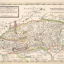
The North P. of Perth Shire containing Athol and Broadalbin / by H. Moll.
collection: pilotnum_gcps: 42
center: 56.765062,-3.999511
user_name: Andy Arthur
date_time: 02/15/2016 20:27
View this map in ...

Inverbervie
collection: pilotnum_gcps: 4
center: 56.844987,-2.278805
user_name: georeferencer.org
date_time: 05/22/2012 16:13
View this map in ...

Sound of Barra
collection: pilotnum_gcps: 5
center: 57.053847,-7.339398
user_name: michael_cairns@lineone.net
date_time: 08/19/2012 16:38
View this map in ...

Orkney Islands.
collection: pilotnum_gcps: 3
center: 59.022785,-2.851806
user_name: georeferencer.org
date_time: 05/22/2012 14:54
View this map in ...
The channel between Sky I and the Lewis.
collection: pilotnum_gcps: 4
center: 57.744300,-6.527205
user_name: michael_cairns@lineone.net
date_time: 08/15/2012 19:02
View this map in ...
Plan of the Environs of Edinburgh.
collection: pilotnum_gcps: 8
center: 55.890478,-3.194049
user_name: bkerr
date_time: 08/24/2012 10:56
View this map in ...
Rives; Golspymore; Golspytower
collection: pilotnum_gcps: 7
center: 57.977931,-3.980031
user_name: Neville Kingdon
date_time: 07/03/2013 17:26
View this map in ...

Vraye & exacte description Hydrographique des costes maritimes d'Escosse & des Isles Orchades Hebrides avec partie d'Angleterre & d'Irlande servant a la navigation / Par N. de Nicolay D'au
collection: pilotnum_gcps:
center:
user_name:
date_time:
View this map in ...
Knapdalia Provincia que sub Argathelia censetur, [vel], The Province of Knapdail which is accounted a member of Argyll. Auct. Timoth. Pont.
collection: pilotnum_gcps: 81
center: 55.948766,-5.590210
user_name: pgroen, nbridgland
date_time: 12/03/2015 17:29
View this map in ...
A new and improved chart of the Hebrides. or Lewis Islands and adjacent coast of Scotland…
collection: pilotnum_gcps: 5
center: 56.970305,-6.563241
user_name: Kenneth David Taylor
date_time: 08/20/2012 19:05
View this map in ...
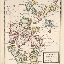
Orkney Shire / by H. Moll.
collection: pilotnum_gcps: 16
center: 58.994826,-2.926310
user_name: yeryry
date_time: 03/13/2015 14:44
View this map in ...
Map of Haddingtonshire.
collection: pilotnum_gcps: 7
center: 55.840719,-2.454617
user_name: bkerr
date_time: 08/23/2012 11:23
View this map in ...
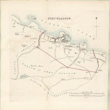
Port Glasgow
collection: pilotnum_gcps: 3
center: 55.929998,-4.692700
user_name: georeferencer.org
date_time: 05/22/2012 15:45
View this map in ...
Counties of Fife and Kinross with the Rivers Forth and Tay
collection: pilotnum_gcps: 8
center: 56.035642,-2.711988
user_name: Kenneth David Taylor
date_time: 08/20/2012 19:17
View this map in ...
A map of Scotland divided into counties shewing the principal roads, railways, rivers, canals... on a scale of five miles to an inch.
collection: pilotnum_gcps: 6
center: 58.871090,-4.688070
user_name: georeferencer.org
date_time: 05/22/2012 15:19
View this map in ...
No. 11 - Plan of the Farms of Stroncruby [Stronecrubie] and Layn [Lyne].
collection: pilotnum_gcps: 4
center: 58.114670,-4.966532
user_name: michael_cairns@lineone.net
date_time: 08/21/2012 18:37
View this map in ...
Perthshire with Clackmannan.
collection: pilotnum_gcps: 9
center: 56.157056,-4.631309
user_name: bkerr
date_time: 08/24/2012 10:27
View this map in ...

Laudelia sive Lauderdalia Scotis, vulgo, Lauderdail / Auct. Tim. Pont.
collection: pilotnum_gcps: 3
center: 55.653408,-2.661886
user_name: Petr Pridal
date_time: 07/06/2015 16:07
View this map in ...
Map of the County of Roxburgh.
collection: pilotnum_gcps: 8
center: 55.381882,-2.647848
user_name: bkerr
date_time: 08/24/2012 09:52
View this map in ...
Berwickshire.
collection: pilotnum_gcps: 35
center: 55.754902,-2.428372
user_name: Kenneth David Taylor
date_time: 08/20/2012 19:59
View this map in ...
Northern Part of Argyll Shire.
collection: pilotnum_gcps: 4
center: 56.576103,-5.488276
user_name: georeferencer.org
date_time: 05/22/2012 14:50
View this map in ...

Farm of Rives
collection: pilotnum_gcps: 3
center: 57.972250,-3.989411
user_name: bkerr
date_time: 09/20/2012 11:50
View this map in ...
Airey's Railway Map of Scotland.
collection: pilotnum_gcps: 43
center: 56.032351,-3.480432
user_name: Jim Murray, geomannie, fionnh, Andy Arthur
date_time: 02/10/2016 11:47
View this map in ...
Map of St Kilda or Hirta and adjacent islands…
collection: pilotnum_gcps: 6
center: 57.813891,-8.592811
user_name: georeferencer.org
date_time: 05/22/2012 14:56
View this map in ...
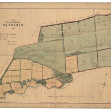
Plan of the estate of Ravelrig.
collection: pilotnum_gcps: 4
center: 55.888790,-3.358258
user_name: georeferencer.org
date_time: 05/22/2012 16:09
View this map in ...
A New Map of North Britain with the Islands thereunto belonging ; / done from some late Surveys of part of the East and West Coasts, and from Modern Accounts of the Country and other Authorities ment
collection: pilotnum_gcps: 10
center: 57.121583,-4.189218
user_name: michael_cairns@lineone.net, Alex Kerney
date_time: 02/16/2016 14:21
View this map in ...
Scotland, drawn from a series of angles and astronomical observations…
collection: pilotnum_gcps: 12
center: 57.974534,-7.154572
user_name: John McCarthy
date_time: 08/30/2012 22:18
View this map in ...

Plan of Rothesay from actual survey.
collection: pilotnum_gcps: 3
center: 55.839693,-5.050758
user_name: georeferencer.org
date_time: 05/22/2012 16:33
View this map in ...
Map of the County of Forfar or Shire of Angus.
collection: pilotnum_gcps: 4
center: 56.611216,-3.259973
user_name: georeferencer.org
date_time: 05/22/2012 16:16
View this map in ...
Wigton [Wigtown]
collection: pilotnum_gcps: 4
center: 54.863129,-4.453479
user_name: georeferencer.org
date_time: 05/22/2012 16:37
View this map in ...

Bellevue town planning scheme. No. 3. Plan of Ground and Buildings as Existing.
collection: pilotnum_gcps: 4
center: 55.961663,-3.185873
user_name: georeferencer.org
date_time: 05/22/2012 15:32
View this map in ...
Map of the City of Glasgow and suburbs.
collection: pilotnum_gcps: 3
center: 55.863256,-4.239199
user_name: georeferencer.org
date_time: 05/22/2012 16:20
View this map in ...
Lorna cum insulis vicinis et provinciis eidem conterminis. Lorn wt the Yles and provinces bordering there-upon / Auct. Timoth. Pont.
collection: pilotnum_gcps: 44
center: 56.363476,-5.547377
user_name: Andy Arthur
date_time: 06/24/2015 19:24
View this map in ...
Inverbrora
collection: pilotnum_gcps: 5
center: 58.006204,-3.852395
user_name: bkerr
date_time: 08/25/2012 15:19
View this map in ...
Les Isles Orcadney, ou Orkney ; Schetland, ou Hetland ; et de Fero, ou Farre, tirées de divers memoirs / par Sanson d'Abbev.
collection: pilotnum_gcps: 24
center: 60.190584,-3.541385
user_name: John McCarthy, Andy Arthur
date_time: 01/19/2016 09:26
View this map in ...
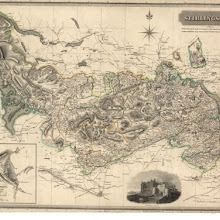
Stirlingshire.
collection: pilotnum_gcps: 4
center: 56.056041,-4.185378
user_name: georeferencer.org
date_time: 05/22/2012 15:39
View this map in ...
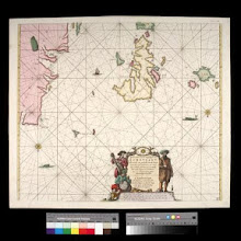
Pascaert vande westkust van Schotlant, als mede een gedeelte van de Lewys Eylanden, van S. Patricius tot Nary, Nog t'I. Roda ofte Barre en t'I. S. Kilda met al Syn diepten en droochten, dus ver naeuke
collection: pilotnum_gcps: 22
center: 58.593307,-6.537859
user_name: michael_cairns@lineone.net, John McCarthy, nkingdon
date_time: 10/01/2014 21:36
View this map in ...

Plan of the Town of Alloa from actual survey.
collection: pilotnum_gcps: 3
center: 56.111594,-3.796407
user_name: georeferencer.org
date_time: 05/22/2012 16:06
View this map in ...
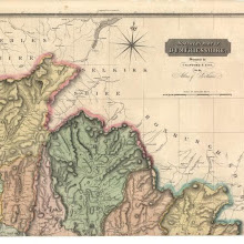
Dumfriesshire.
collection: pilotnum_gcps: 4
center: 55.364635,-3.132733
user_name: bkerr
date_time: 03/12/2013 13:12
View this map in ...

Sound of Mull
collection: pilotnum_gcps: 3
center: 56.537480,-5.907837
user_name: georeferencer.org
date_time: 05/22/2012 15:17
View this map in ...
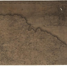
Map of the three Lothians.
collection: pilotnum_gcps: 20
center: 55.968530,-2.578633
user_name: michael_cairns@lineone.net, Craig
date_time: 07/11/2014 13:04
View this map in ...
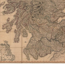
A map of Scotland drawn chiefly from the topographical surveys of John Ainslie…
collection: pilotnum_gcps: 8
center: 55.770177,-4.849520
user_name: georeferencer.org
date_time: 05/22/2012 15:48
View this map in ...
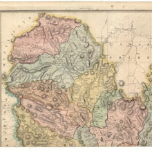
Dumfriesshire.
collection: pilotnum_gcps: 4
center: 55.332504,-3.848165
user_name: georeferencer.org
date_time: 05/22/2012 14:42
View this map in ...

Stranraer
collection: pilotnum_gcps: 4
center: 54.906970,-5.030388
user_name: georeferencer.org
date_time: 05/22/2012 16:13
View this map in ...
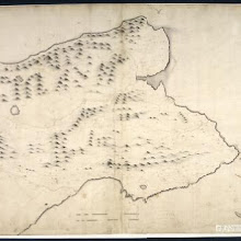
The East Part of Fife / surveyed & designed be [i.e. by] John Adair.
collection: pilotnum_gcps: 60
center: 56.300936,-2.909295
user_name: Andy Arthur
date_time: 02/09/2016 10:35
View this map in ...

The Mapp of Straithern, Stormount, and Cars of Gourie, with the Rivers Tay and Jern / surveighed and designed by J. Adair ; James Moxon sculp.
collection: pilotnum_gcps: 39
center: 56.428314,-3.647288
user_name: bkerr, Andy Arthur
date_time: 02/18/2016 09:57
View this map in ...
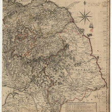
Scotland, drawn from a series of angles and astronomical observations…
collection: pilotnum_gcps: 10
center: 55.318628,-2.400986
user_name: michael_cairns@lineone.net
date_time: 03/12/2013 19:37
View this map in ...
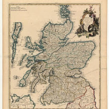
L'Eccosse suivant les nouvelles observations publies a Londres en 1735 par Bowles.
collection: pilotnum_gcps: 12
center: 56.914038,-4.435762
user_name: derekmcdm
date_time: 04/12/2013 23:43
View this map in ...

Map of Dumfries-shire.
collection: pilotnum_gcps: 8
center: 54.971303,-3.787476
user_name: bkerr
date_time: 03/15/2013 11:34
View this map in ...
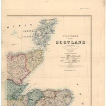
Stanford's map of Scotland.
collection: pilotnum_gcps: 5
center: 58.379656,-2.576876
user_name: michael_cairns@lineone.net
date_time: 03/14/2013 19:47
View this map in ...

Keith & Gibb's Map of the Cities of Aberdeen…
collection: pilotnum_gcps: 6
center: 57.151783,-2.101231
user_name: georeferencer.org
date_time: 05/22/2012 15:21
View this map in ...
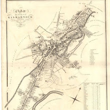
Plan of the Town of Kilmarnock.
collection: pilotnum_gcps: 3
center: 55.607407,-4.493712
user_name: georeferencer.org
date_time: 05/22/2012 15:24
View this map in ...
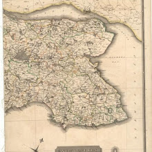
Fife with Kinross Shire.
collection: pilotnum_gcps: 15
center: 56.274610,-2.849326
user_name: ChrisFleet
date_time: 05/26/2012 13:30
View this map in ...
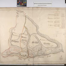
Cuilgower; Wester Garty; Middle Garty
collection: pilotnum_gcps: 5
center: 58.100395,-3.722865
user_name: derekmcdm
date_time: 04/11/2013 23:12
View this map in ...

Map embracing extensive portions of the Counties of Roxburgh, Berwick, Selkirk & Midlothian and Part of Northumberland. Minutely & accurately surveyed… by Crawford and Brooke
collection: pilotnum_gcps: 19
center: 55.410466,-2.565369
user_name: Leon Deutsch, Andy Arthur
date_time: 02/19/2016 10:14
View this map in ...
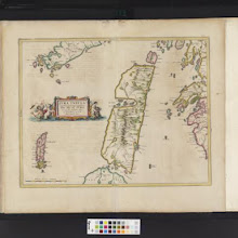
Iura Insula, The Yle of Iura one of the westerne Iles of Scotland / Auct. Timoth. Pont.
collection: pilotnum_gcps: 60
center: 56.041850,-5.965450
user_name: Andy A
date_time: 02/26/2016 20:28
View this map in ...
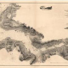
Loch Hourn
collection: pilotnum_gcps: 3
center: 57.132371,-5.531093
user_name: georeferencer.org
date_time: 05/22/2012 16:00
View this map in ...

Stonehaven
collection: pilotnum_gcps: 5
center: 56.957532,-2.179691
user_name: bkerr
date_time: 04/22/2013 13:55
View this map in ...

Brechin
collection: pilotnum_gcps: 5
center: 56.729299,-2.661290
user_name: georeferencer.org
date_time: 05/22/2012 16:24
View this map in ...
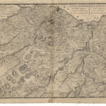
A plan of Edinburgh and places adjacent.
collection: pilotnum_gcps: 40
center: 55.892086,-3.192572
user_name: blairgate, Craig, Andy Arthur
date_time: 06/02/2015 14:58
View this map in ...
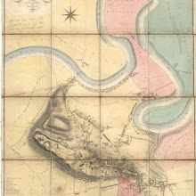
Plan of the Town of Stirling from actual survey.
collection: pilotnum_gcps: 4
center: 56.123113,-3.938666
user_name: georeferencer.org
date_time: 05/22/2012 15:21
View this map in ...
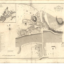
Plan of Dunkeld.
collection: pilotnum_gcps: 3
center: 56.564837,-3.587609
user_name: georeferencer.org
date_time: 05/22/2012 14:54
View this map in ...
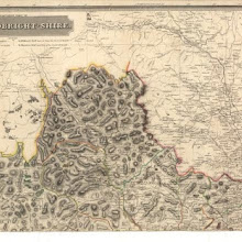
Kirkcudbright-Shire.
collection: pilotnum_gcps: 4
center: 55.215746,-4.131689
user_name: georeferencer.org
date_time: 05/22/2012 15:26
View this map in ...
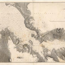
Loch Torridon and Loch Shieldag
collection: pilotnum_gcps: 5
center: 57.573059,-5.698525
user_name: michael_cairns@lineone.net
date_time: 05/05/2013 19:23
View this map in ...
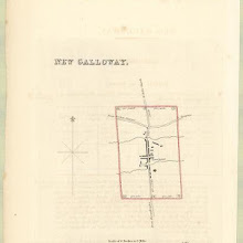
New Galloway
collection: pilotnum_gcps: 4
center: 55.071796,-4.143870
user_name: georeferencer.org
date_time: 05/22/2012 15:18
View this map in ...
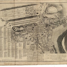
City of Edinburgh.
collection: pilotnum_gcps: 17
center: 55.948141,-3.189400
user_name: Andy A
date_time: 03/01/2016 10:37
View this map in ...
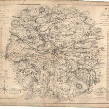
Map of the town of Glasgow & country seven miles around.
collection: pilotnum_gcps: 3
center: 55.855744,-4.231629
user_name: DonnaNicholsonArnott
date_time: 02/02/2013 13:16
View this map in ...

Survey of the Frith [sic] of Forth, by George Thomas... in 1815
collection: pilotnum_gcps: 12
center: 56.152231,-2.814014
user_name: georeferencer.org
date_time: 05/22/2012 15:38
View this map in ...
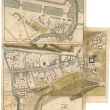
Plan of the Regality of Canongate comprising the Liberties of Pleasance, North Leith, Coal-hill and Citidal thereof. Plan of North Leith within the Regality of Canongate.
collection: pilotnum_gcps: 15
center: 55.951495,-3.177433
user_name: georeferencer.org
date_time: 05/22/2012 16:17
View this map in ...
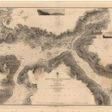
Loch Alsh and Loch Duich
collection: pilotnum_gcps: 3
center: 57.265287,-5.570727
user_name: georeferencer.org
date_time: 05/22/2012 15:30
View this map in ...
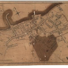
Plan of Stranraer.
collection: pilotnum_gcps: 8
center: 54.904116,-5.027330
user_name: georeferencer.org
date_time: 05/22/2012 16:11
View this map in ...
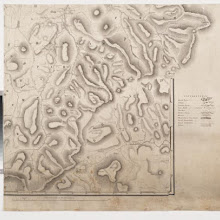
Map embracing extensive portions of the Counties of Roxburgh, Berwick, Selkirk & Midlothian and Part of Northumberland. Minutely & accurately surveyed… by Crawford and Brooke
collection: pilotnum_gcps: 17
center: 55.408631,-2.280361
user_name: Andy Arthur
date_time: 02/18/2016 20:45
View this map in ...

Crail
collection: pilotnum_gcps: 4
center: 56.257681,-2.626502
user_name: georeferencer.org
date_time: 05/22/2012 15:04
View this map in ...
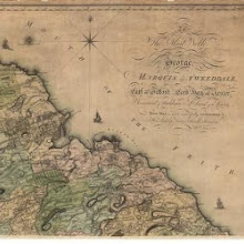
Map of Haddingtonshire.
collection: pilotnum_gcps: 19
center: 56.010385,-2.522059
user_name: Leon Deutsch, Martin MacGregor
date_time: 03/03/2016 17:15
View this map in ...
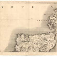
Map of Scotland from the latest surveys.
collection: pilotnum_gcps: 10
center: 58.785970,-4.435970
user_name: bkerr
date_time: 04/22/2013 13:28
View this map in ...
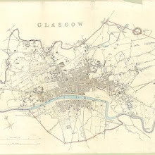
Glasgow
collection: pilotnum_gcps: 31
center: 55.857981,-4.245947
user_name: David McElroy
date_time: 06/26/2012 14:52
View this map in ...
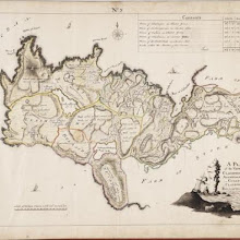
No. 2 - A Plan of the Farms of Clashnessie, Auchnagarnan [Achnacarnin], Culken [Culkein], Clashmore and Bellachlatach [Balchladich]
collection: pilotnum_gcps: 6
center: 58.229363,-5.340076
user_name: michael_cairns@lineone.net
date_time: 04/21/2013 16:27
View this map in ...
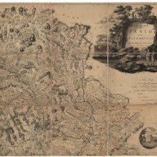
The counties of Perth and Clackmannan.
collection: pilotnum_gcps: 10
center: 56.718547,-3.427271
user_name: bkerr
date_time: 04/22/2013 13:11
View this map in ...
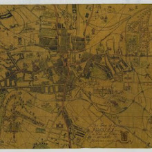
The Town of Paisley in Year of Grace - MCMXXXI - Population - 86,441
collection: pilotnum_gcps: 4
center: 55.843754,-4.421351
user_name: georeferencer.org
date_time: 05/22/2012 14:42
View this map in ...
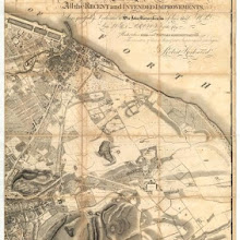
This plan of the City of Edinburgh and its environs.
collection: pilotnum_gcps: 3
center: 55.958112,-3.155376
user_name: georeferencer.org
date_time: 05/22/2012 15:02
View this map in ...

Saint Andrews
collection: pilotnum_gcps: 5
center: 56.337927,-2.794699
user_name: georeferencer.org
date_time: 05/22/2012 16:36
View this map in ...
A Plan of Edinburgh and the country adjacent.
collection: pilotnum_gcps: 91
center: 55.891480,-3.191825
user_name: Andy Arthur
date_time: 06/14/2015 10:44
View this map in ...
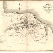
Plan of the City of St. Andrews.
collection: pilotnum_gcps: 24
center: 56.339525,-2.794520
user_name: Andy A
date_time: 03/01/2016 10:26
View this map in ...
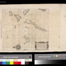
Pascaarte, verthoonende in wat ghestalte de Eylanden (Hebrides ghenaemt) achter de noordwesthoek van Schotlandt gheleghen zÿn = Carte marine de les Isles Hebrides situez vers norouest arriere l'Escoss
collection: pilotnum_gcps: 5
center: 57.940152,-7.641035
user_name: Jamesks
date_time: 07/01/2013 14:24
View this map in ...
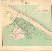
Plan of the Town of Portobello from actual survey.
collection: pilotnum_gcps: 10
center: 55.953909,-3.112279
user_name: georeferencer.org
date_time: 05/22/2012 16:19
View this map in ...
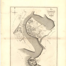
Plan of Dumbarton.
collection: pilotnum_gcps: 4
center: 55.941831,-4.568443
user_name: georeferencer.org
date_time: 05/22/2012 15:08
View this map in ...
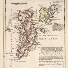
The Islands of Shetland / by H. Moll.
collection: pilotnum_gcps: 24
center: 60.186969,-1.100827
user_name: robin mank, Andy Arthur
date_time: 02/15/2016 11:58
View this map in ...
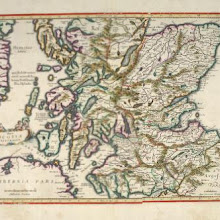
[Scotiae pars australis]
collection: pilotnum_gcps: 79
center: 56.327166,-4.792440
user_name: ChrisFleet, Andy Arthur
date_time: 03/15/2016 22:46
View this map in ...
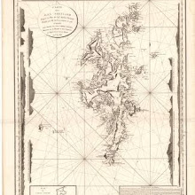
Carte des Isles Shetland.
collection: pilotnum_gcps: 8
center: 60.100241,-1.441056
user_name: John Williamson
date_time: 07/22/2013 13:43
View this map in ...

Sketch of Ravelston.
collection: pilotnum_gcps: 3
center: 55.951989,-3.259009
user_name: georeferencer.org
date_time: 05/22/2012 16:20
View this map in ...
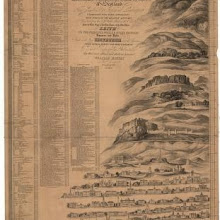
To the Noblemen and Gentlemen of the Highland and Agricultural Society of Scotland, this geometrical and geological landscape... from ... Leith to ... Edinburgh.
collection: pilotnum_gcps:
center:
user_name:
date_time:
View this map in ...
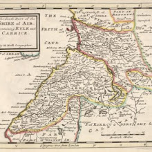
The South Part of the Shire of Air [i.e. Ayr], containing Kyle and Carrick / by H. Moll.
collection: pilotnum_gcps: 44
center: 55.317146,-4.626614
user_name: Andy A
date_time: 02/29/2016 07:34
View this map in ...
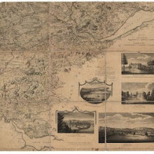
The counties of Perth and Clackmannan.
collection: pilotnum_gcps: 5
center: 56.231177,-3.417157
user_name: michael_cairns@lineone.net
date_time: 04/25/2013 18:17
View this map in ...
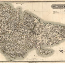
Western Isles.
collection: pilotnum_gcps: 5
center: 58.235616,-6.549621
user_name: Leon Deutsch
date_time: 04/26/2013 14:16
View this map in ...
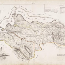
No. 7 - Plan of the Farms of Unapool and Reintraid [Rientraid].
collection: pilotnum_gcps: 8
center: 58.229436,-5.011975
user_name: Tom Pert
date_time: 08/29/2012 16:08
View this map in ...
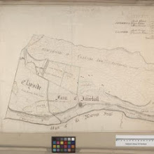
Clayside; Inverboll
collection: pilotnum_gcps: 7
center: 57.990025,-3.914270
user_name: Neville Kingdon
date_time: 07/03/2013 13:29
View this map in ...
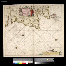
Nieuwe Pascaert van de oost cust van Schotlandt beginnende van Barwyck tot aen de Orcades Ylanden ... / by Johannes van Ceuylen.
collection: pilotnum_gcps: 22
center: 57.360623,-1.565365
user_name: Leon Deutsch
date_time: 04/26/2013 15:02
View this map in ...

Lidalia vel Lidisdalia regio, Lidisdail / Auct. Timotheo Pont.
collection: pilotnum_gcps: 40
center: 55.162858,-2.825231
user_name: michael_cairns@lineone.net, Andy Arthur
date_time: 03/07/2016 10:57
View this map in ...
Map embracing extensive portions of the Counties of Roxburgh, Berwick, Selkirk & Midlothian and Part of Northumberland. Minutely & accurately surveyed… by Crawford and Brooke
collection: pilotnum_gcps: 14
center: 55.686061,-2.581240
user_name: Andy Arthur
date_time: 02/19/2016 10:36
View this map in ...

Leatich
collection: pilotnum_gcps: 4
center: 58.022773,-3.932270
user_name: michael_cairns@lineone.net
date_time: 07/18/2012 19:57
View this map in ...

The East Part of the Shire of Inverness with Badenoch &c. / by H. Moll.
collection: pilotnum_gcps: 5
center: 57.189863,-4.567898
user_name: pgroen
date_time: 03/05/2015 14:36
View this map in ...

Cullen
collection: pilotnum_gcps: 5
center: 57.690071,-2.819732
user_name: georeferencer.org
date_time: 05/22/2012 16:09
View this map in ...
Map embracing extensive portions of the Counties of Roxburgh, Berwick, Selkirk & Midlothian and Part of Northumberland. Minutely & accurately surveyed… by Crawford and Brooke
collection: pilotnum_gcps: 6
center: 55.408511,-2.839884
user_name: slowcoach61, wangi
date_time: 12/11/2014 20:46
View this map in ...
A new and correct map of Scotland or North Britain, with all the post and military roads.
collection: pilotnum_gcps: 5
center: 55.774203,-4.823240
user_name: georeferencer.org
date_time: 05/22/2012 15:08
View this map in ...

Nairn and Elgin.
collection: pilotnum_gcps: 4
center: 57.405441,-3.547463
user_name: michael_cairns@lineone.net
date_time: 07/20/2012 20:36
View this map in ...
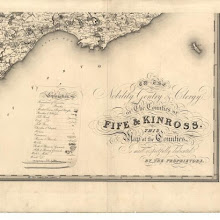
Map of the counties of Fife and Kinross.
collection: pilotnum_gcps: 9
center: 56.095400,-2.778182
user_name: bkerr
date_time: 06/28/2012 13:27
View this map in ...
Scotland East Coast, Sheet III, Aberdeen to Banff
collection: pilotnum_gcps: 7
center: 57.527208,-2.048179
user_name: bkerr
date_time: 06/28/2012 13:35
View this map in ...
Cuninghamia / ex schedis Timotheo Pont ; Ioannis Blaeu excudebat. Cunningham.
collection: pilotnum_gcps:
center:
user_name:
date_time:
View this map in ...
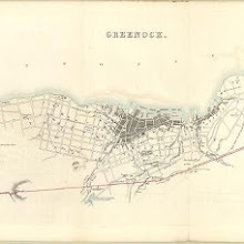
Greenock
collection: pilotnum_gcps: 5
center: 55.949797,-4.760228
user_name: georeferencer.org
date_time: 05/22/2012 15:20
View this map in ...
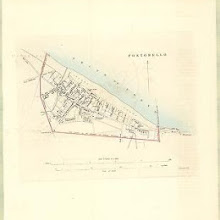
Portobello
collection: pilotnum_gcps: 10
center: 55.950899,-3.105274
user_name: georeferencer.org
date_time: 05/22/2012 15:05
View this map in ...
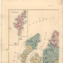
Stanford's map of Scotland.
collection: pilotnum_gcps: 41
center: 58.394432,-6.757500
user_name: ChrisFleet
date_time: 08/02/2012 14:51
View this map in ...
Map embracing extensive portions of the Counties of Roxburgh, Berwick, Selkirk & Midlothian and Part of Northumberland. Minutely & accurately surveyed… by Crawford and Brooke
collection: pilotnum_gcps: 21
center: 55.543240,-2.837427
user_name: michael_cairns@lineone.net, nbridgland
date_time: 12/03/2015 12:08
View this map in ...
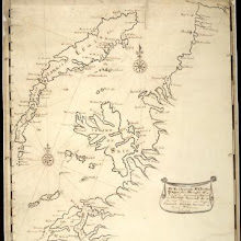
To the Honorable Sr. Charles Wager, this Draught of Part of the Highlands of Scotland / is humblely Presented by... Mark Tiddeman.
collection: pilotnum_gcps: 91
center: 57.373692,-5.827155
user_name: michael_cairns@lineone.net, Andy Arthur
date_time: 06/10/2015 22:15
View this map in ...
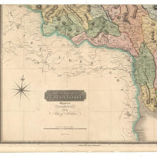
Dumfriesshire.
collection: pilotnum_gcps: 4
center: 55.027037,-3.820945
user_name: georeferencer.org
date_time: 05/22/2012 16:13
View this map in ...
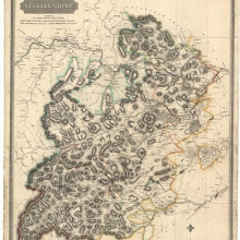
Selkirk Shire.
collection: pilotnum_gcps: 5
center: 55.499558,-3.044629
user_name: slowcoach61
date_time: 07/08/2012 20:40
View this map in ...
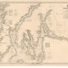
The Clyde, Loch Fyne &c.
collection: pilotnum_gcps: 3
center: 55.979600,-5.013600
user_name: georeferencer.org
date_time: 05/22/2012 15:03
View this map in ...
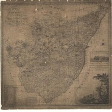
A Map of Kincardineshire.
collection: pilotnum_gcps: 3
center: 57.014272,-2.325856
user_name: georeferencer.org
date_time: 05/22/2012 15:48
View this map in ...
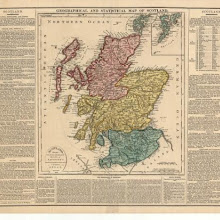
Geographical and statistical map of Scotland.
collection: pilotnum_gcps: 9
center: 56.473694,-4.640493
user_name: georeferencer.org
date_time: 05/22/2012 14:54
View this map in ...
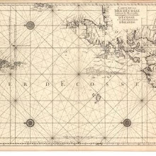
Carte de la mer d'Escosse contenant les isles et costes septentrionales et occidentales d'Escosse…
collection: pilotnum_gcps: 10
center: 58.802570,-7.846506
user_name: georeferencer.org
date_time: 05/22/2012 15:04
View this map in ...
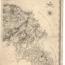
Map of the county of Edinburgh.
collection: pilotnum_gcps: 38
center: 55.818295,-3.039517
user_name: bkerr, ChrisFleet, Andy Arthur
date_time: 08/24/2015 10:12
View this map in ...
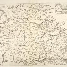
The north-part of England and the south-part of Scotland. Quartermaster's map.
collection: pilotnum_gcps: 55
center: 55.635278,-3.269410
user_name: Andy Arthur
date_time: 06/28/2015 19:56
View this map in ...
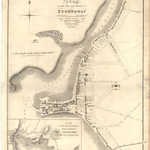
Plan of the Town and Harbour of Stornaway, Island of Lewis, from actual survey.
collection: pilotnum_gcps: 7
center: 58.209414,-6.388419
user_name: georeferencer.org
date_time: 05/22/2012 14:43
View this map in ...
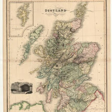
Scotland.
collection: pilotnum_gcps: 26
center: 56.879088,-5.022538
user_name: bkerr
date_time: 08/25/2012 15:09
View this map in ...
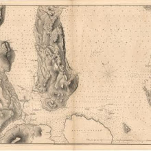
Southern part of the Sound of Raasay and Inner Sound
collection: pilotnum_gcps: 9
center: 57.367613,-5.997976
user_name: bkerr
date_time: 08/25/2012 10:43
View this map in ...
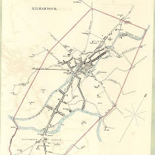
Kilmarnock
collection: pilotnum_gcps: 4
center: 55.606117,-4.494376
user_name: georeferencer.org
date_time: 05/22/2012 15:26
View this map in ...
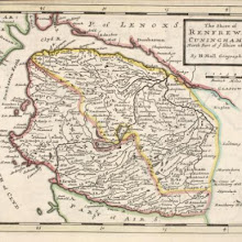
The Shire of Renfrew with Cuningham [i.e. Cunningham]. The North Part of Air [i.e. Ayr] / by H. Moll.
collection: pilotnum_gcps: 13
center: 55.787378,-4.538623
user_name: pgroen, ChrisFleet
date_time: 04/02/2015 14:25
View this map in ...
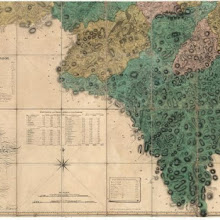
The county of Lanark from actual survey.
collection: pilotnum_gcps: 6
center: 55.433077,-3.859998
user_name: bkerr
date_time: 08/25/2012 12:39
View this map in ...

A map of the shire of Lanark.
collection: pilotnum_gcps: 66
center: 55.780356,-4.131830
user_name: bkerr, calaterium, Chris Ladds
date_time: 07/02/2016 00:15
View this map in ...

A chart of part of the South of Scotland, from Berwick upon Tweed to Skateraw Harbour in the County of Kincardine…
collection: pilotnum_gcps: 12
center: 56.020789,-3.418101
user_name: bkerr
date_time: 08/25/2012 11:09
View this map in ...

Northern Part of Lanarkshire. Southern Part.
collection: pilotnum_gcps: 7
center: 55.798301,-3.989067
user_name: bkerr
date_time: 08/25/2012 12:08
View this map in ...

A new map of Ayrshire…
collection: pilotnum_gcps: 6
center: 55.709195,-4.191137
user_name: georeferencer.org
date_time: 05/22/2012 15:09
View this map in ...
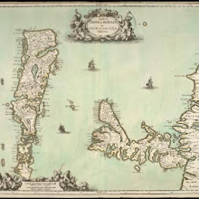
Tabula Leogi et Haraiae ac Skiae vel Skianae Insularum.
collection: pilotnum_gcps: 110
center: 57.875763,-6.200853
user_name: Andy Arthur
date_time: 03/11/2016 13:45
View this map in ...
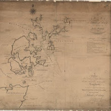
A chart of the islands of Orkney... with the coast of Scotland.
collection: pilotnum_gcps: 19
center: 58.983212,-2.729080
user_name: Michael Spencer
date_time: 11/20/2012 13:50
View this map in ...

Sketch of Melrose and Gattonside.
collection: pilotnum_gcps: 25
center: 55.601224,-2.726022
user_name: nbridgland
date_time: 12/02/2015 22:06
View this map in ...
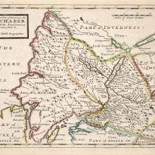
The West Part of Inverness Sh. Lochaber with all the Territories west from it / by H. Moll.
collection: pilotnum_gcps: 22
center: 56.865114,-5.354729
user_name: Andy Arthur
date_time: 02/14/2016 16:33
View this map in ...
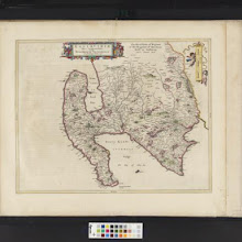
Gallovidiae, Pars Occidentalior, in qua Vicecomitatus Victoniensis cum Regalitate Glenucensi, [vulgo], The Sherifdome of Wigtoun wt the Regalitie of Glen-Luze, both in Galloway / auct. Timoth. Pont.
collection: pilotnum_gcps: 12
center: 54.899657,-4.896073
user_name: Petr Pridal, Daniel Hodge
date_time: 02/03/2016 15:43
View this map in ...
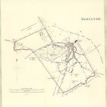
Hamilton
collection: pilotnum_gcps: 4
center: 55.776273,-4.044127
user_name: georeferencer.org
date_time: 05/22/2012 14:50
View this map in ...
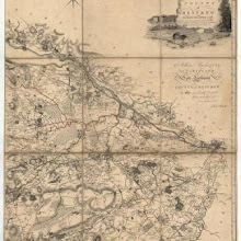
Map of the County of Renfrew.
collection: pilotnum_gcps: 3
center: 55.847085,-4.394514
user_name: eengle
date_time: 11/26/2012 18:50
View this map in ...
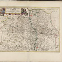
Glottiana Praefectura Inferior, cum Baronia Glascuensi, [vulgo], The nether ward of Clyds-dail and Glasco / Auct. Timoth. Pont.
collection: pilotnum_gcps: 40
center: 55.731902,-4.027873
user_name: eengle, Andy Arthur
date_time: 02/15/2016 21:30
View this map in ...
Map of Scotland from the latest surveys.
collection: pilotnum_gcps: 29
center: 56.364818,-2.059646
user_name: georeferencer.org
date_time: 05/22/2012 14:47
View this map in ...

Map of the County of Selkirk and District of Melrose.
collection: pilotnum_gcps: 4
center: 55.439084,-2.965277
user_name: michael_cairns@lineone.net
date_time: 11/25/2012 19:42
View this map in ...
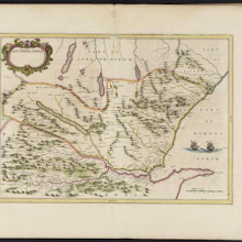
Southerlandia.
collection: pilotnum_gcps: 28
center: 58.103128,-4.229896
user_name: Andy Arthur
date_time: 02/02/2016 13:22
View this map in ...
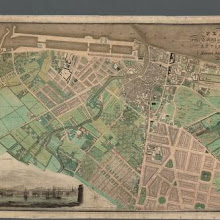
Plan of the Town of Leith and its environs.
collection: pilotnum_gcps: 38
center: 55.971695,-3.178741
user_name: Andy Arthur
date_time: 03/14/2016 09:21
View this map in ...
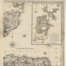
Scotland, drawn from a series of angles and astronomical observations…
collection: pilotnum_gcps: 7
center: 58.178126,-2.516964
user_name: Mark Lindeman
date_time: 11/28/2012 09:44
View this map in ...
Map of the three Lothians.
collection: pilotnum_gcps: 4
center: 55.740379,-3.072643
user_name: michael_cairns@lineone.net
date_time: 11/28/2012 19:55
View this map in ...
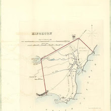
Kinghorn
collection: pilotnum_gcps: 5
center: 56.070680,-3.182486
user_name: georeferencer.org
date_time: 05/22/2012 14:58
View this map in ...
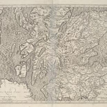
[Scotiae Regnum south sheet] / per Gerardum Mercatorem per privilegio.
collection: pilotnum_gcps: 202
center: 56.326829,-4.797026
user_name: Andy Arthur
date_time: 03/23/2016 10:28
View this map in ...

Scotia Regnum / Gule Hole sculp.
collection: pilotnum_gcps: 75
center: 57.202338,-4.266275
user_name: PeterMan, Andy Arthur
date_time: 02/18/2016 10:18
View this map in ...
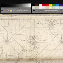
A chart of the Coast of Scotland with all its islands : drawn according to the Globular Projection.
collection: pilotnum_gcps: 34
center: 59.110388,-3.519783
user_name: Andy Arthur
date_time: 02/02/2016 21:07
View this map in ...
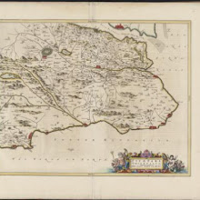
Fifae Pars Orientalis, [vulgo], The East Part of Fife.
collection: pilotnum_gcps: 40
center: 56.238091,-2.977177
user_name: Andy Arthur
date_time: 02/06/2016 20:23
View this map in ...
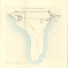
Fortrose (and Rosemarkie)
collection: pilotnum_gcps: 14
center: 57.580477,-4.109846
user_name: McVitele Charly
date_time: 06/12/2013 09:51
View this map in ...
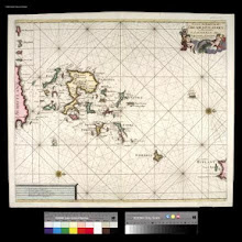
Nieuwe paskaart van de Orcades Eylanden / door Vooght geometra.
collection: pilotnum_gcps: 3
center: 59.274623,-2.667667
user_name: michael_cairns@lineone.net
date_time: 12/02/2012 17:08
View this map in ...
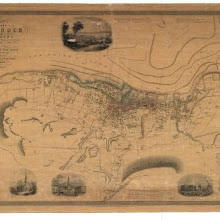
Greenock and its environs.
collection: pilotnum_gcps: 4
center: 55.948545,-4.763621
user_name: georeferencer.org
date_time: 05/22/2012 16:13
View this map in ...

To the... Earl of March and Ruglen... this map of the County of Peebles or Tweedale is… inscribed by... Mostyn Jno. Armstrong
collection: pilotnum_gcps: 23
center: 55.623284,-3.256392
user_name: Andy Arthur
date_time: 02/14/2016 00:41
View this map in ...
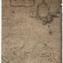
A map of the shire of Lanark.
collection: pilotnum_gcps: 4
center: 55.810434,-3.663096
user_name: michael_cairns@lineone.net
date_time: 12/06/2012 19:21
View this map in ...
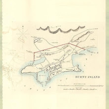
Burntisland
collection: pilotnum_gcps: 5
center: 56.060706,-3.233195
user_name: georeferencer.org
date_time: 05/22/2012 15:07
View this map in ...
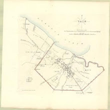
Tain
collection: pilotnum_gcps: 3
center: 57.815930,-4.061239
user_name: georeferencer.org
date_time: 05/22/2012 16:23
View this map in ...
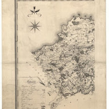
Map of the county of Haddington.
collection: pilotnum_gcps: 40
center: 55.920430,-2.863319
user_name: michael_cairns@lineone.net, Craig
date_time: 02/21/2014 11:50
View this map in ...
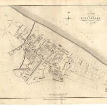
Plan of the Town of Portobello from actual survey.
collection: pilotnum_gcps: 3
center: 55.953738,-3.111879
user_name: georeferencer.org
date_time: 05/22/2012 16:18
View this map in ...
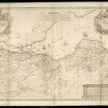
A New and Correct map of the Lothians from Mr. Adair's observations / by John Elphinstone ; Thos. Smith, Edin, sculpsit.
collection: pilotnum_gcps: 102
center: 55.985953,-3.086814
user_name: Andy Arthur
date_time: 02/08/2016 11:08
View this map in ...
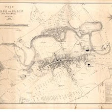
Plan of the Burgh of Elgin from actual survey.
collection: pilotnum_gcps: 3
center: 57.649606,-3.316943
user_name: georeferencer.org
date_time: 05/22/2012 15:06
View this map in ...
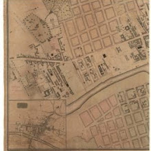
Map of the City of Glasgow and suburbs.
collection: pilotnum_gcps: 3
center: 55.857983,-4.268173
user_name: georeferencer.org
date_time: 05/22/2012 16:24
View this map in ...
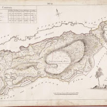
No. 10 - Plan of the Farms of Inch-na-daff [Inchnadamph] and Tubeg.
collection: pilotnum_gcps: 3
center: 58.164398,-5.033058
user_name: michael_cairns@lineone.net
date_time: 12/05/2012 20:07
View this map in ...

Perthshire with Clackmannan.
collection: pilotnum_gcps: 5
center: 56.169146,-3.140096
user_name: georeferencer.org
date_time: 05/22/2012 14:48
View this map in ...
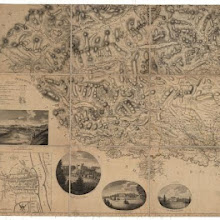
The counties of Perth and Clackmannan.
collection: pilotnum_gcps: 6
center: 56.239882,-4.378201
user_name: michael_cairns@lineone.net
date_time: 05/31/2013 18:37
View this map in ...
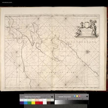
The Firth of Murry / H. Moll, sculp.
collection: pilotnum_gcps: 3
center: 57.816456,-3.878142
user_name: georeferencer.org
date_time: 05/22/2012 16:25
View this map in ...

A map of the shire of Lanark.
collection: pilotnum_gcps: 7
center: 55.467911,-3.558820
user_name: Daniel del Rey
date_time: 10/10/2012 17:51
View this map in ...

City of Edinburgh Housing and Town Planning, etc., Act 1909. Bellevue & McDonald Road Area.
collection: pilotnum_gcps: 5
center: 55.963712,-3.184938
user_name: georeferencer.org
date_time: 05/22/2012 15:10
View this map in ...
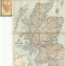
Tourist's map of Scotland... showing the new county boundaries.
collection: pilotnum_gcps: 5
center: 56.604671,-5.422479
user_name: Tiemen
date_time: 05/15/2013 08:11
View this map in ...
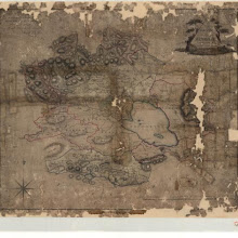
County of Kinross.
collection: pilotnum_gcps: 5
center: 56.199713,-3.428000
user_name: 1586615
date_time: 05/15/2013 08:17
View this map in ...

Scotland / by Robt. Morden.
collection: pilotnum_gcps: 262
center: 57.069673,-4.599491
user_name: Andy Arthur
date_time: 03/22/2016 20:11
View this map in ...
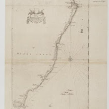
The coast of Scotland from the Red-head to Aberdeen. Survey'd by John Adair.
collection: pilotnum_gcps: 8
center: 56.980211,-2.136589
user_name: georeferencer.org
date_time: 05/22/2012 15:22
View this map in ...
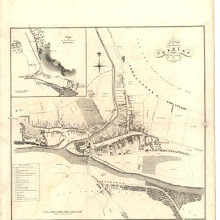
A Plan of the Town of Peebles from actual survey.
collection: pilotnum_gcps: 4
center: 55.652390,-3.190705
user_name: georeferencer.org
date_time: 05/22/2012 15:10
View this map in ...

Sketch of the the county of Sutherland showing the boundaries & divisions of the earldom of Sutherland.
collection: pilotnum_gcps: 5
center: 58.215529,-4.442599
user_name: Thijs
date_time: 05/15/2013 08:43
View this map in ...
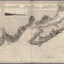
Lochs Buy and Spelve
collection: pilotnum_gcps: 3
center: 56.345926,-5.869657
user_name: georeferencer.org
date_time: 05/22/2012 15:40
View this map in ...
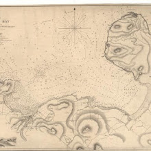
Thurso Bay Including Scrabster and Dunnet Roads
collection: pilotnum_gcps: 9
center: 58.626281,-3.453607
user_name: Neville Kingdon
date_time: 07/03/2013 17:49
View this map in ...
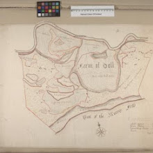
Farm of Doll
collection: pilotnum_gcps: 7
center: 58.005760,-3.872761
user_name: Jamesks
date_time: 06/19/2013 15:17
View this map in ...
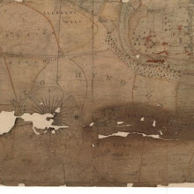
Jedburgh and its environs.
collection: pilotnum_gcps: 4
center: 55.475052,-2.549248
user_name: georeferencer.org
date_time: 05/22/2012 15:08
View this map in ...
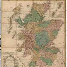
An accurate map of Scotland drawn from all the particular surveys…
collection: pilotnum_gcps: 3
center: 56.628032,-4.595379
user_name: georeferencer.org
date_time: 05/22/2012 15:12
View this map in ...
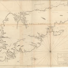
The Lewis or north part of Long Island.
collection: pilotnum_gcps: 4
center: 58.105344,-6.577421
user_name: georeferencer.org
date_time: 05/22/2012 16:18
View this map in ...
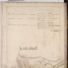
Kintradwell
collection: pilotnum_gcps: 5
center: 58.058753,-3.832998
user_name: bkerr
date_time: 08/24/2012 13:56
View this map in ...
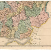
Dumfriesshire.
collection: pilotnum_gcps: 12
center: 55.052895,-3.106453
user_name: georeferencer.org, ChrisFleet
date_time: 10/19/2013 06:06
View this map in ...
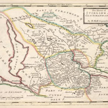
The Shires of Stirling and Clackmannan &c. / by H. Moll.
collection: pilotnum_gcps:
center:
user_name:
date_time:
View this map in ...
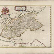
Fifae Vicecomitatus, The Sherifdome of Fyfe.
collection: pilotnum_gcps: 13
center: 56.232134,-3.045917
user_name: pgroen
date_time: 03/05/2015 15:42
View this map in ...
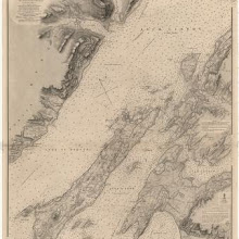
Loch Linnhe, Southern Part
collection: pilotnum_gcps: 7
center: 56.534437,-5.474518
user_name: bkerr
date_time: 08/24/2012 14:05
View this map in ...

A new map of Ayrshire…
collection: pilotnum_gcps: 5
center: 55.470957,-4.634589
user_name: georeferencer.org
date_time: 05/22/2012 16:30
View this map in ...

Kirkwood's new plan of the City of Edinburgh.
collection: pilotnum_gcps: 45
center: 55.949977,-3.187056
user_name: Andy Arthur, Christopher
date_time: 11/25/2015 12:34
View this map in ...

No. 8 - Plan of the Farms of Auchamore [Achmore] and Little Assynt.
collection: pilotnum_gcps: 6
center: 58.190488,-5.060111
user_name: bkerr
date_time: 08/24/2012 11:21
View this map in ...
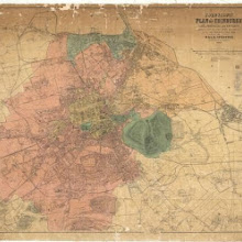
Johnstons' plan of Edinburgh, Leith, Portobello and environs, constructed from the latest surveys with additions by the local surveyors of these towns.
collection: pilotnum_gcps: 26
center: 55.951316,-3.178192
user_name: Andy Arthur
date_time: 06/02/2015 13:22
View this map in ...
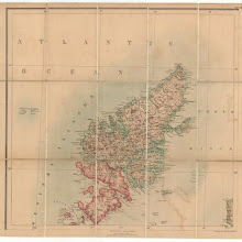
Black's new large map of Scotland.
collection: pilotnum_gcps: 7
center: 58.238679,-6.764553
user_name: bkerr
date_time: 08/24/2012 11:26
View this map in ...
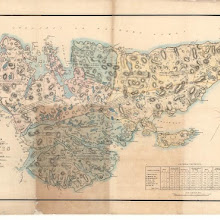
Plan of the island of Lewis reduced from Mr Chapman's survey
collection: pilotnum_gcps: 4
center: 58.194969,-6.542592
user_name: georeferencer.org
date_time: 05/22/2012 15:49
View this map in ...
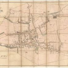
Plan of the Town of Airdrie from actual survey.
collection: pilotnum_gcps: 3
center: 55.868357,-3.980530
user_name: georeferencer.org
date_time: 05/22/2012 15:44
View this map in ...
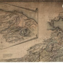
Map of the shire of Edinburgh.
collection: pilotnum_gcps: 31
center: 55.957053,-3.184132
user_name: michael_cairns@lineone.net, Andy Arthur
date_time: 06/12/2015 09:48
View this map in ...

Inverury [Inverurie]
collection: pilotnum_gcps: 4
center: 57.283701,-2.381789
user_name: georeferencer.org
date_time: 05/22/2012 16:08
View this map in ...
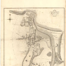
Plan of the Town of Banff from actual survey.
collection: pilotnum_gcps: 4
center: 57.664444,-2.521933
user_name: georeferencer.org
date_time: 05/22/2012 15:17
View this map in ...
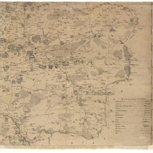
A new map of Ayrshire…
collection: pilotnum_gcps: 11
center: 55.418644,-4.189145
user_name: McVitele Charly
date_time: 01/09/2013 08:27
View this map in ...
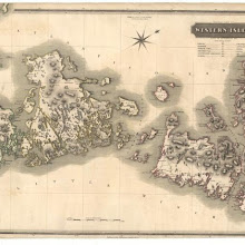
Western Isles.
collection: pilotnum_gcps: 3
center: 57.713611,-7.158702
user_name: georeferencer.org
date_time: 05/22/2012 15:54
View this map in ...
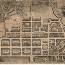
Plan & elevation of the New Town of Edinburgh.
collection: pilotnum_gcps: 7
center: 55.955966,-3.198221
user_name: georeferencer.org
date_time: 05/22/2012 15:09
View this map in ...

Dunbeath Harbour to Thurso Bay, Including the Pentland Firth
collection: pilotnum_gcps: 7
center: 58.560976,-3.112163
user_name: bkerr
date_time: 08/24/2012 14:45
View this map in ...

The Middle Part of Galloway : Contains The West P. of Kirkcudbright Shire / by H. Moll.
collection: pilotnum_gcps: 25
center: 54.982802,-4.221209
user_name: Andy Arthur
date_time: 02/18/2016 21:18
View this map in ...
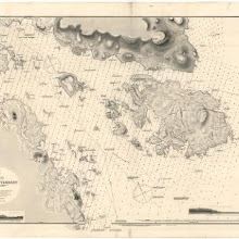
East Loch Tarbert
collection: pilotnum_gcps: 5
center: 57.863545,-6.715276
user_name: georeferencer.org
date_time: 05/22/2012 15:04
View this map in ...
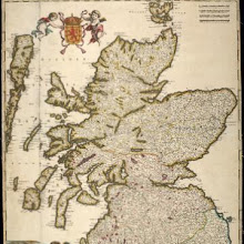
Scotia Regnum divisum in Partem Septentrionalem et Meridionalem Subdivisas in Comitatus, Vice comitatus Provincias Praefecturas Dominia et Insulas / per F. de Wit.
collection: pilotnum_gcps: 13
center: 56.886561,-4.480925
user_name: pgroen
date_time: 03/05/2015 14:32
View this map in ...
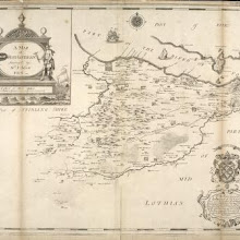
A Map of West Lothian / survey'd by Mr. J. Adair.
collection: pilotnum_gcps: 45
center: 55.937667,-3.549290
user_name: bkerr, nbridgland, Martin MacGregor
date_time: 03/03/2016 21:43
View this map in ...
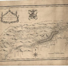
An exact map of Breadalbane in Perth Shire.
collection: pilotnum_gcps: 7
center: 56.530229,-4.371885
user_name: bkerr
date_time: 08/24/2012 14:56
View this map in ...

The Shires of Murray and Nairn / by H. Moll.
collection: pilotnum_gcps: 79
center: 57.414302,-3.752980
user_name: bkerr, Andy Arthur
date_time: 06/12/2015 22:17
View this map in ...

Plan of Warriston policies and adjoining grounds in Edinburgh.
collection: pilotnum_gcps: 3
center: 55.966262,-3.202477
user_name: georeferencer.org
date_time: 05/22/2012 15:20
View this map in ...
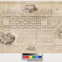
To His Sacred Majesty George III... this Plan of the new streets and squares, intended for his ancient capital of North-Britain... is inscribed by... James Craig
collection: pilotnum_gcps: 3
center: 55.951528,-3.197177
user_name: georeferencer.org
date_time: 05/22/2012 15:51
View this map in ...
Loch Skiport
collection: pilotnum_gcps: 5
center: 57.322917,-7.243573
user_name: bkerr
date_time: 08/25/2012 09:37
View this map in ...

Loch Inver to Loch Broom
collection: pilotnum_gcps: 8
center: 58.032517,-5.385897
user_name: bkerr
date_time: 08/25/2012 10:22
View this map in ...

Map of Scotland constructed from original materials.
collection: pilotnum_gcps: 11
center: 57.765146,-6.370589
user_name: bkerr
date_time: 08/25/2012 13:01
View this map in ...
Ardnamurchan Point to Loch Bhreatal, Skye, including the Small Isles and Sleat Sound
collection: pilotnum_gcps: 41
center: 56.938142,-6.079690
user_name: David McElroy
date_time: 06/22/2012 15:46
View this map in ...
Map of the County of Forfar or Shire of Angus.
collection: pilotnum_gcps: 4
center: 56.840069,-3.191073
user_name: michael_cairns@lineone.net
date_time: 09/11/2012 19:21
View this map in ...
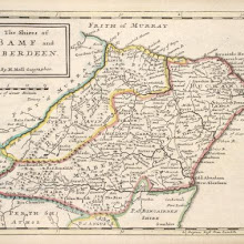
The Shires of Bamf [i.e. Banff] and Aberdeen / by H. Moll.
collection: pilotnum_gcps: 7
center: 57.490401,-2.305965
user_name: LordMasters
date_time: 11/29/2015 13:16
View this map in ...
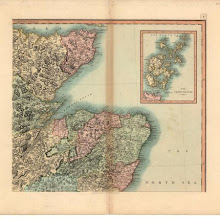
A new map of Scotland, from the latest authorities.
collection: pilotnum_gcps: 4
center: 57.736589,-2.726327
user_name: michael_cairns@lineone.net
date_time: 09/12/2012 18:57
View this map in ...
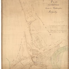
Plan of Coldstream, Earl of Haddington's Property.
collection: pilotnum_gcps: 3
center: 55.653088,-2.252713
user_name: georeferencer.org
date_time: 05/22/2012 15:52
View this map in ...
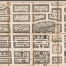
Johnston's plan of the City of Edinburgh.
collection: pilotnum_gcps: 10
center: 55.955080,-3.197805
user_name: georeferencer.org, ChrisFleet
date_time: 09/24/2013 11:17
View this map in ...
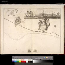
Leith / Ni Yeates fecit.
collection: pilotnum_gcps: 9
center: 55.979416,-3.177669
user_name: michael_cairns@lineone.net, ChrisFleet, Andy Arthur
date_time: 02/08/2016 14:40
View this map in ...
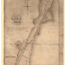
Plan of the Royal Burgh of Kirkcaldy.
collection: pilotnum_gcps: 3
center: 56.111949,-3.155205
user_name: georeferencer.org
date_time: 05/22/2012 16:03
View this map in ...

Scotland.
collection: pilotnum_gcps: 5
center: 55.581061,-4.714223
user_name: georeferencer.org
date_time: 05/22/2012 14:46
View this map in ...

A new and complete map of Scotland and islands thereto belonging.
collection: pilotnum_gcps: 30
center: 55.714105,-6.290452
user_name: georeferencer.org
date_time: 05/22/2012 16:33
View this map in ...

Golspie Tower and Rhives (Loose Sheet)
collection: pilotnum_gcps: 12
center: 57.980655,-3.981344
user_name: Neville Kingdon
date_time: 07/03/2013 14:32
View this map in ...
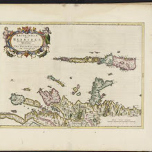
Aebudae Insulae sive Hebrides ; quae Scotiae ad occasum praetenduntur / lustratae et descriptae a Timotheo Pont. Western Isles of Scotland.
collection: pilotnum_gcps:
center:
user_name:
date_time:
View this map in ...
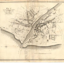
Plan of the Town and Parishes of Ayr, Newton upon Ayr & St. Quivox.
collection: pilotnum_gcps: 10
center: 55.465723,-4.633773
user_name: georeferencer.org
date_time: 05/22/2012 16:21
View this map in ...
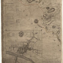
A map of the shire of Lanark.
collection: pilotnum_gcps: 4
center: 55.862304,-4.238664
user_name: michael_cairns@lineone.net
date_time: 09/14/2012 19:06
View this map in ...
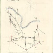
Rutherglen
collection: pilotnum_gcps: 4
center: 55.831459,-4.217593
user_name: georeferencer.org
date_time: 05/22/2012 15:57
View this map in ...
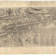
City and castle of Edinburgh.
collection: pilotnum_gcps: 35
center: 55.949768,-3.185874
user_name: Martin MacGregor
date_time: 03/03/2016 19:01
View this map in ...
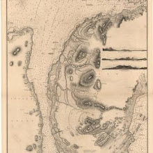
Sound of Islay
collection: pilotnum_gcps: 3
center: 55.868386,-6.042588
user_name: georeferencer.org
date_time: 05/22/2012 15:33
View this map in ...
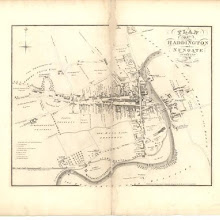
Plan of Haddington and Nungate.
collection: pilotnum_gcps: 21
center: 55.955107,-2.778433
user_name: ChrisFleet, David Connolly
date_time: 12/02/2013 09:40
View this map in ...
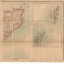
Black's new large map of Scotland.
collection: pilotnum_gcps: 5
center: 59.371093,-3.674600
user_name: michael_cairns@lineone.net
date_time: 09/03/2012 19:27
View this map in ...
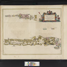
Vistus Insula, vulgo Viist, cum aliis minoribus ex Aebudarum numero ei ad meridiem adjacentibus / Auct. Timotheo Pont.
collection: pilotnum_gcps: 12
center: 57.378895,-7.326763
user_name: Christopher
date_time: 11/25/2015 12:47
View this map in ...

Map of the three Lothians.
collection: pilotnum_gcps: 3
center: 55.710870,-3.535901
user_name: michael_cairns@lineone.net
date_time: 08/31/2012 18:26
View this map in ...

Plan of the Town of Dunse.
collection: pilotnum_gcps: 3
center: 55.777968,-2.344493
user_name: georeferencer.org
date_time: 05/22/2012 15:38
View this map in ...
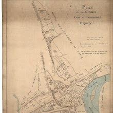
Plan of Coldstream, Earl of Haddington's Property.
collection: pilotnum_gcps: 3
center: 55.652940,-2.253246
user_name: georeferencer.org
date_time: 05/22/2012 16:01
View this map in ...
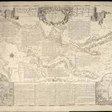
A plan of Loch Sunart … become famous by the greatest national improvement this age has produc'd / survey'd &c. by Alexr. Bruce ; R. Cooper sculp.
collection: pilotnum_gcps: 33
center: 56.738805,-5.817300
user_name: John McCarthy, Andy Arthur
date_time: 06/24/2015 18:05
View this map in ...
The Sea coast from Fiffnesse to Montros / was Survey'd by Mr. Mar, an injenious Marriner [sic] of Dundee. Sea coast from Fife Ness to Montrose.
collection: pilotnum_gcps: 6
center: 56.442655,-2.629063
user_name: michael_cairns@lineone.net
date_time: 09/04/2012 19:36
View this map in ...

Ila Insula ex Aebudarum majoribus una, The Yle of Ila being one of the biggest of the Westerne Yles. / Auct. Tim. Pont.
collection: pilotnum_gcps: 36
center: 55.825071,-6.091848
user_name: Sue Adams (Family Folk), Chris
date_time: 09/22/2015 12:16
View this map in ...
Aberbrothwick or Arbroath
collection: pilotnum_gcps: 5
center: 56.559652,-2.585709
user_name: georeferencer.org
date_time: 05/22/2012 15:40
View this map in ...
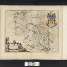
Evia et Escia Scotis, Evsdail et Eskdail / Auct. Timotheo Pont, I. Blaeu excud.
collection: pilotnum_gcps: 29
center: 55.248027,-3.116190
user_name: Andy Arthur
date_time: 11/26/2015 01:55
View this map in ...
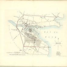
Wick
collection: pilotnum_gcps: 3
center: 58.439326,-3.086568
user_name: georeferencer.org
date_time: 05/22/2012 15:21
View this map in ...
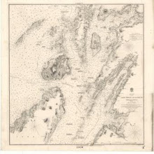
Loch Crinan to Cuan Sound
collection: pilotnum_gcps: 51
center: 56.166827,-5.654996
user_name: nbridgland
date_time: 12/02/2015 23:02
View this map in ...
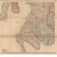
Black's new large map of Scotland.
collection: pilotnum_gcps: 5
center: 55.118644,-4.743584
user_name: michael_cairns@lineone.net
date_time: 09/06/2012 18:57
View this map in ...
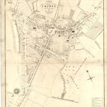
Plan of the Town of Crieff from actual survey.
collection: pilotnum_gcps: 5
center: 56.370342,-3.842314
user_name: georeferencer.org
date_time: 05/22/2012 15:32
View this map in ...
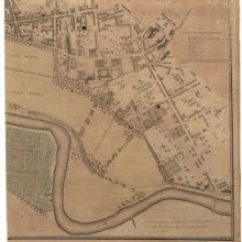
Map of the City of Glasgow and suburbs.
collection: pilotnum_gcps: 6
center: 55.846555,-4.231639
user_name: georeferencer.org
date_time: 05/22/2012 16:33
View this map in ...

River Clyde, from Greenock to Dumbarton.
collection: pilotnum_gcps: 7
center: 55.962189,-4.679524
user_name: bkerr
date_time: 09/21/2012 10:25
View this map in ...
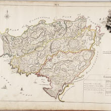
No. 3 - A Plan of the Farms of Storie [Stoer], Clachtoll, and Auchmelvich [Achmelvich]
collection: pilotnum_gcps: 3
center: 58.190675,-5.292251
user_name: georeferencer.org
date_time: 05/22/2012 14:41
View this map in ...
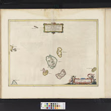
Insulae quaedam minores ex Aebudis quae Mulam et Skiam insulas interjacent. Some of the Smaller Westerne Yles, lying betweene the yles of Mule and Skye / Timotheo Pont auctor.
collection: pilotnum_gcps: 13
center: 56.978633,-6.406689
user_name: Andy Arthur
date_time: 02/01/2016 11:06
View this map in ...
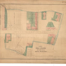
Plan of feued and unfeued grounds. Hope Parkend.
collection: pilotnum_gcps: 6
center: 55.940210,-3.180396
user_name: Andy Arthur
date_time: 02/08/2016 13:18
View this map in ...
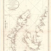
Carte particuliere de la cote occidentale d'Escosse, depuis le Cape Wrath jusqu'a la Pointe d'Ardnamurchan.
collection: pilotnum_gcps: 10
center: 57.702917,-6.480765
user_name: georeferencer.org
date_time: 05/22/2012 15:01
View this map in ...
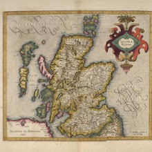
Scotia Regnum / Per Gerardum Mercatorem …
collection: pilotnum_gcps: 58
center: 57.175014,-4.058652
user_name: Andy Arthur
date_time: 02/15/2016 02:31
View this map in ...

Arbroath Harbour. Montrose Harbour
collection: pilotnum_gcps: 3
center: 56.554383,-2.563594
user_name: michael_cairns@lineone.net
date_time: 09/21/2012 18:28
View this map in ...
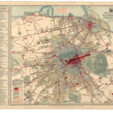
Chronological map of Edinburgh showing expansion of the City from earliest days to the present.
collection: pilotnum_gcps: 3
center: 55.951924,-3.213056
user_name: georeferencer.org
date_time: 05/22/2012 15:49
View this map in ...

Plan of the Town of Kelso.
collection: pilotnum_gcps: 30
center: 55.599133,-2.433726
user_name: georeferencer.org
date_time: 05/22/2012 15:55
View this map in ...
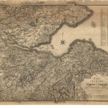
Map of the Basin of the Forth.
collection: pilotnum_gcps: 5
center: 55.973615,-3.087925
user_name: dgilmour
date_time: 03/15/2014 12:52
View this map in ...
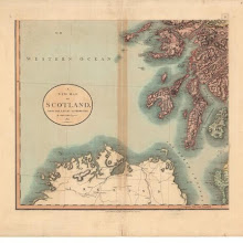
A new map of Scotland, from the latest authorities.
collection: pilotnum_gcps: 12
center: 55.605643,-7.025874
user_name: bkerr
date_time: 09/21/2012 10:44
View this map in ...
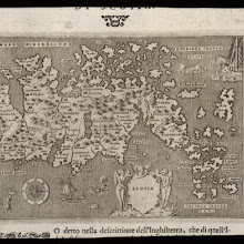
Scotia.
collection: pilotnum_gcps: 27
center: 57.170900,-3.807466
user_name: bkerr, Andy Arthur
date_time: 02/18/2016 20:06
View this map in ...
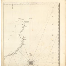
A chart of part of the North of Scotland, from Banff to Duncansby Head.
collection: pilotnum_gcps: 10
center: 58.514181,-2.872407
user_name: bkerr
date_time: 09/21/2012 14:55
View this map in ...
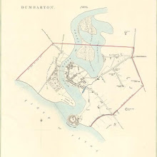
Dumbarton
collection: pilotnum_gcps: 3
center: 55.943262,-4.567749
user_name: georeferencer.org
date_time: 05/22/2012 15:05
View this map in ...
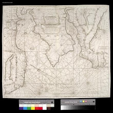
Nieuwe en seer perfecte paskaart van Schotlandt ... van Berwyk tot Bokannais = A new and pertinent map of the eastern sea-coasts of Scotland ... from the cost of Berwik till Bokaness / by John Marr of
collection: pilotnum_gcps: 3
center: 56.283172,-2.735111
user_name: georeferencer.org
date_time: 05/22/2012 15:27
View this map in ...
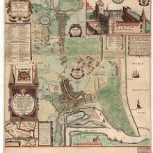
Abredoniae novae et veteris descriptio = A description of new and of old Aberdeens, with the places neerest adjacent / auctore Jacobo Gordono. Description of new and of old Aberdeens, with the pl
collection: pilotnum_gcps: 4
center: 57.151347,-2.095031
user_name: georeferencer.org
date_time: 05/22/2012 16:33
View this map in ...

Plan of the estate of Craigentinny.
collection: pilotnum_gcps: 16
center: 55.961942,-3.132297
user_name: Andy Arthur
date_time: 06/12/2015 21:19
View this map in ...
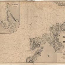
Treshnish Point to the Entrance of the Sound, including an enlarged plan of Loch Cuan
collection: pilotnum_gcps: 8
center: 56.617648,-6.310333
user_name: bkerr
date_time: 01/11/2013 16:29
View this map in ...
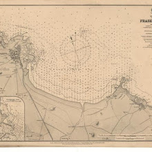
Scotland East Coast Fraserburgh
collection: pilotnum_gcps: 9
center: 57.685591,-1.969937
user_name: bkerr
date_time: 01/11/2013 17:08
View this map in ...

A new map of Scotland for ladies needlework.
collection: pilotnum_gcps: 10
center: 57.216894,-3.826641
user_name: Jamesks
date_time: 01/31/2013 22:50
View this map in ...
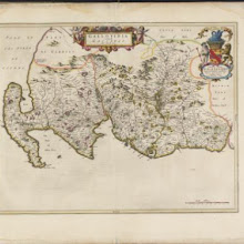
Gallovidia, vernacule Galloway / auct. Timoth. Pont.
collection: pilotnum_gcps: 54
center: 54.934054,-4.357585
user_name: ChrisFleet, Andy Arthur
date_time: 02/24/2016 21:31
View this map in ...
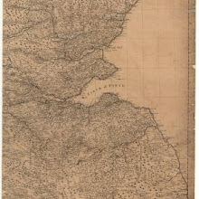
A general map of Scotland and islands thereto belonging.
collection: pilotnum_gcps: 25
center: 55.793648,-2.895700
user_name: bkerr
date_time: 01/21/2013 11:22
View this map in ...
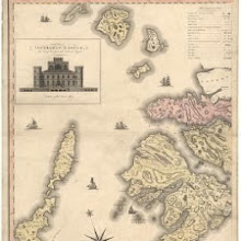
This map of Argyllshire…
collection: pilotnum_gcps: 6
center: 56.671941,-6.320520
user_name: georeferencer.org
date_time: 05/22/2012 15:06
View this map in ...
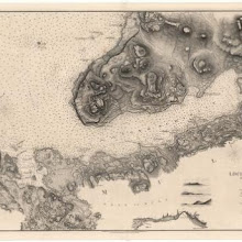
Loch Scridain
collection: pilotnum_gcps: 3
center: 56.356309,-6.153846
user_name: georeferencer.org
date_time: 05/22/2012 15:31
View this map in ...

A plan of the county of Mid-Lothian…
collection: pilotnum_gcps: 5
center: 55.763968,-3.394956
user_name: bkerr
date_time: 01/21/2013 12:20
View this map in ...

Counties of Fife and Kinross with the Rivers Forth and Tay
collection: pilotnum_gcps: 8
center: 56.333035,-3.538968
user_name: bkerr
date_time: 01/21/2013 10:47
View this map in ...

Kirkwall
collection: pilotnum_gcps: 6
center: 58.984503,-2.962284
user_name: georeferencer.org
date_time: 05/22/2012 15:22
View this map in ...
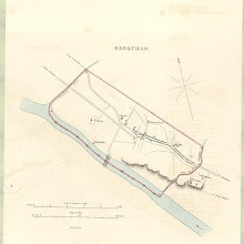
Sanquhar
collection: pilotnum_gcps: 4
center: 55.368169,-3.929356
user_name: georeferencer.org
date_time: 05/22/2012 15:12
View this map in ...
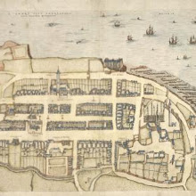
S. Andre sive Andreapolis Scotiae Universitas Metropolitana.
collection: pilotnum_gcps: 18
center: 56.340719,-2.792116
user_name: Andy Arthur
date_time: 02/02/2016 13:03
View this map in ...
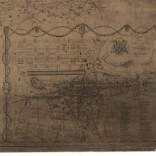
Map of the three Lothians.
collection: pilotnum_gcps: 4
center: 55.950908,-3.190352
user_name: michael_cairns@lineone.net
date_time: 01/31/2013 19:49
View this map in ...
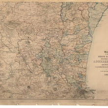
Map of the north eastern districts of Aberdeenshire.
collection: pilotnum_gcps: 12
center: 57.274806,-2.208804
user_name: Jamesks
date_time: 01/31/2013 22:36
View this map in ...

Map of the counties of Fife and Kinross.
collection: pilotnum_gcps: 10
center: 56.350182,-3.428332
user_name: PeterMan
date_time: 01/31/2013 20:41
View this map in ...

Stirling
collection: pilotnum_gcps: 5
center: 56.115349,-3.940061
user_name: georeferencer.org
date_time: 05/22/2012 16:10
View this map in ...
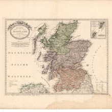
Karte von Scotland nach Dorret.
collection: pilotnum_gcps: 7
center: 56.609348,-4.982841
user_name: PeterMan
date_time: 02/06/2013 09:20
View this map in ...

Edenburck in Schottl.
collection: pilotnum_gcps: 4
center: 55.948706,-3.188109
user_name: Andy Arthur, Martin MacGregor
date_time: 03/03/2016 17:18
View this map in ...
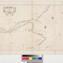
The Frith and River of Tay with all the Rocks, Sands, Shoals, &c., Survey'd by John Adair
collection: pilotnum_gcps: 5
center: 56.353382,-2.837068
user_name: Jamesks
date_time: 01/31/2013 23:17
View this map in ...
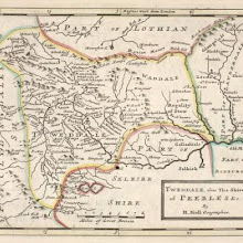
Tweddale, alias, The Shire of Peebles &c. / by H. Moll.
collection: pilotnum_gcps: 14
center: 55.638974,-3.104271
user_name: michael_cairns@lineone.net, Andy Arthur
date_time: 02/25/2016 08:12
View this map in ...
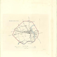
Haddington
collection: pilotnum_gcps: 6
center: 55.955862,-2.776726
user_name: georeferencer.org
date_time: 05/22/2012 14:51
View this map in ...
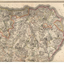
Northern Part of Aberdeen & Banff Shires.
collection: pilotnum_gcps: 4
center: 57.508953,-2.227898
user_name: georeferencer.org
date_time: 05/22/2012 15:40
View this map in ...

Teviotia, Vulgo, Tivedail / auct. Tim. Pont, Io. Blaeu excudit.
collection: pilotnum_gcps: 68
center: 55.456668,-2.702569
user_name: Andy Arthur
date_time: 02/24/2016 15:40
View this map in ...

Plan of the Town of Greenock from actual survey.
collection: pilotnum_gcps: 3
center: 55.949144,-4.767719
user_name: georeferencer.org
date_time: 05/22/2012 14:40
View this map in ...
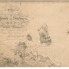
To the Noblemen and Gentlemen of the County of Stirling…
collection: pilotnum_gcps: 4
center: 56.184435,-3.857212
user_name: michael_cairns@lineone.net
date_time: 02/01/2013 19:56
View this map in ...

Colonsay and Oronsay
collection: pilotnum_gcps: 4
center: 56.055279,-6.237918
user_name: michael_cairns@lineone.net
date_time: 02/10/2013 17:27
View this map in ...
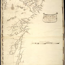
To the Honorable Sr. Charles Wager, this Draught of Part of the Highlands of Scotland / is humblely Presented by... Mark Tiddeman.
collection: pilotnum_gcps: 37
center: 56.390615,-5.376028
user_name: michael_cairns@lineone.net, Andy Arthur
date_time: 02/11/2016 23:23
View this map in ...

Kintore
collection: pilotnum_gcps: 4
center: 57.236077,-2.345030
user_name: georeferencer.org
date_time: 05/22/2012 15:51
View this map in ...
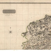
Perthshire with Clackmannan.
collection: pilotnum_gcps: 4
center: 56.778829,-4.638435
user_name: michael_cairns@lineone.net
date_time: 02/14/2013 19:46
View this map in ...
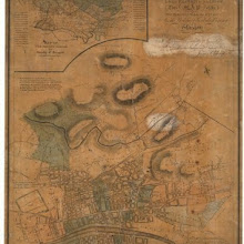
Map of the ten parishes within the Royalty... of Glasgow.
collection: pilotnum_gcps: 3
center: 55.865428,-4.242873
user_name: georeferencer.org
date_time: 05/22/2012 14:58
View this map in ...
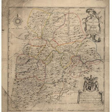
The Shire of Peebles or Tweeddale.
collection: pilotnum_gcps: 4
center: 55.600349,-3.258900
user_name: michael_cairns@lineone.net
date_time: 02/08/2013 19:29
View this map in ...

The Town and Water of Montross with the neighbouring Country & Coast from the Red-head to the North-water. Survey'd and Navigated by John Adair.
collection: pilotnum_gcps: 5
center: 56.686145,-2.454638
user_name: michael_cairns@lineone.net
date_time: 03/28/2013 19:28
View this map in ...
Lochs Etive and Creran
collection: pilotnum_gcps: 4
center: 56.534551,-5.212835
user_name: michael_cairns@lineone.net
date_time: 04/03/2013 18:30
View this map in ...
Arasaig Harbour (Loch Na'n Ceall)
collection: pilotnum_gcps: 6
center: 56.904376,-5.897828
user_name: georeferencer.org
date_time: 05/22/2012 16:09
View this map in ...
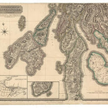
Southern Part of Argyll Shire.
collection: pilotnum_gcps: 3
center: 55.735666,-5.855878
user_name: georeferencer.org
date_time: 05/22/2012 16:24
View this map in ...
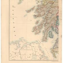
Stanford's map of Scotland.
collection: pilotnum_gcps: 12
center: 55.493917,-6.648890
user_name: michael_cairns@lineone.net
date_time: 03/16/2013 18:02
View this map in ...

Banff and Macduff
collection: pilotnum_gcps: 6
center: 57.664627,-2.506308
user_name: georeferencer.org
date_time: 05/22/2012 16:03
View this map in ...
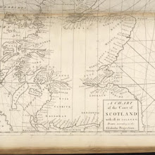
A chart of the Coast of Scotland with all its islands : drawn according to the Globular Projection.
collection: pilotnum_gcps: 103
center: 56.167812,-3.769821
user_name: Andy Arthur
date_time: 02/10/2016 11:41
View this map in ...
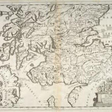
Scotia : parte settentrionale ; parte meridionale / descritta, e dedicata dal P. Cosmgrafo Coronelli, Al Reuereudissimo Padre Maestro Tomaso Maria Peire Teo logo di S.A.R. dela Duca di Sauoia.
collection: pilotnum_gcps: 151
center: 55.697419,-4.273994
user_name: Andy Arthur
date_time: 03/19/2016 23:04
View this map in ...
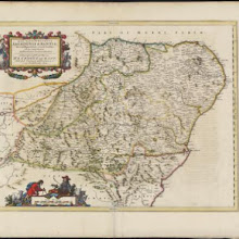
Duo Vicecomitatus Aberdonia & Banfia, una cum Regionibus & terrarum tractibus sub iis comprehensis / Auctore Roberto Gordonio à Straloch. Description of the two Shyres Aberdene and Banf,
collection: pilotnum_gcps: 89
center: 57.261022,-2.816187
user_name: Andy Arthur
date_time: 03/10/2016 13:59
View this map in ...
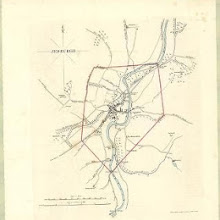
Jedburgh
collection: pilotnum_gcps: 23
center: 55.476675,-2.555924
user_name: georeferencer.org
date_time: 05/22/2012 14:55
View this map in ...

The Mappe of Orkney with the harbours and Islands.
collection: pilotnum_gcps: 38
center: 58.962583,-3.039743
user_name: Andy Arthur
date_time: 02/14/2016 17:25
View this map in ...

Scotland, entworfen und gezeichnet.
collection: pilotnum_gcps: 13
center: 57.047952,-4.928686
user_name: michael_cairns@lineone.net
date_time: 04/07/2013 09:47
View this map in ...
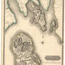
Buteshire.
collection: pilotnum_gcps: 5
center: 55.672622,-5.152496
user_name: georeferencer.org
date_time: 05/22/2012 16:21
View this map in ...
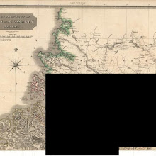
Northern Part of Ross and Cromarty Shires. Southern Part.
collection: pilotnum_gcps: 7
center: 58.093223,-4.859784
user_name: michael_cairns@lineone.net
date_time: 03/18/2013 19:59
View this map in ...
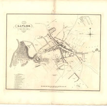
Plan of Lanark from actual survey.
collection: pilotnum_gcps: 5
center: 55.672245,-3.780574
user_name: georeferencer.org
date_time: 05/22/2012 16:22
View this map in ...
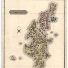
Shetland Islands.
collection: pilotnum_gcps: 4
center: 60.351977,-1.376064
user_name: georeferencer.org
date_time: 05/22/2012 15:21
View this map in ...
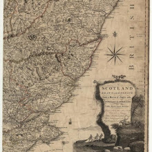
Scotland, drawn from a series of angles and astronomical observations…
collection: pilotnum_gcps: 3
center: 56.771456,-2.403874
user_name: georeferencer.org
date_time: 05/22/2012 15:06
View this map in ...

The Shires of Caithness and Sutherland. With Strath Navern which is Part of Sutherland Shire / by H. Moll.
collection: pilotnum_gcps: 38
center: 58.258991,-4.146563
user_name: michael_cairns@lineone.net, Andy Arthur
date_time: 02/25/2016 08:09
View this map in ...
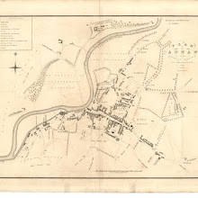
Plan of Annan from actual survey.
collection: pilotnum_gcps: 7
center: 54.988315,-3.264233
user_name: ChrisFleet
date_time: 05/27/2012 21:16
View this map in ...

Mula Insula, quae ex Aebudarum numero una est, et Lochabriae ad occasum praetenditur. The Yle of Mul whiche is one of the Westerne Yles, and lyeth ovir against Lochabyr / Auct. Timoth. Pont.
collection: pilotnum_gcps: 67
center: 56.464269,-6.239534
user_name: Andy A
date_time: 03/03/2016 15:58
View this map in ...
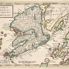
The Isle of Mull &c. Part of Argyle Shire / by H. Moll.
collection: pilotnum_gcps: 58
center: 56.443532,-5.980660
user_name: michael_cairns@lineone.net, Andy Arthur
date_time: 02/19/2016 10:56
View this map in ...
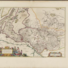
Levinia Vicecomitatus, [or],The Province of Lennox called the Shyre of Dun-Britton / Auct. Timoth. Pont.
collection: pilotnum_gcps: 80
center: 56.020610,-4.466264
user_name: Andy Arthur
date_time: 02/22/2016 15:33
View this map in ...
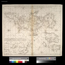
Het Eyland Hitland met Zyn onderhoorige Eylanden : Wort by de Engelsche Shetland genaamt / by Gerard van Keulen.
collection: pilotnum_gcps: 6
center: 60.338325,-1.028606
user_name: robin mank
date_time: 05/15/2013 07:45
View this map in ...
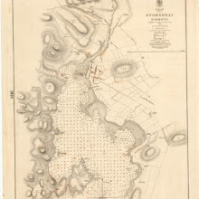
Stornoway Harbour
collection: pilotnum_gcps: 3
center: 58.202474,-6.376873
user_name: georeferencer.org
date_time: 05/22/2012 16:30
View this map in ...
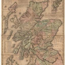
This map of Scotland, constructed and engraved from the best authorities…
collection: pilotnum_gcps: 74
center: 56.672236,-4.658093
user_name: ChrisFleet
date_time: 05/03/2013 14:35
View this map in ...
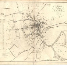
Plan of the Town of Cupar.
collection: pilotnum_gcps: 3
center: 56.318077,-3.013910
user_name: georeferencer.org
date_time: 05/22/2012 14:52
View this map in ...

Plan of the Town and Environs of Hawick from actual survey.
collection: pilotnum_gcps: 22
center: 55.423232,-2.792808
user_name: georeferencer.org
date_time: 05/22/2012 16:00
View this map in ...
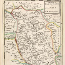
The Shire of Clydesdale or Lanerk [i.e. Lanark] / by H. Moll.
collection: pilotnum_gcps: 17
center: 55.627128,-3.865895
user_name: michael_cairns@lineone.net, Andy Arthur
date_time: 02/24/2016 18:44
View this map in ...

Topographical and military map of the counties of Aberdeen, Banff and Kincardine.
collection: pilotnum_gcps: 6
center: 56.973981,-2.103548
user_name: michael_cairns@lineone.net
date_time: 05/03/2013 18:48
View this map in ...
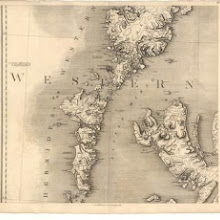
Map of Scotland from the latest surveys.
collection: pilotnum_gcps: 6
center: 57.601120,-7.059652
user_name: michael_cairns@lineone.net
date_time: 05/06/2013 17:51
View this map in ...
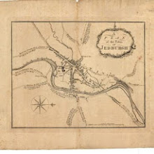
A plan of the town of Jedburgh.
collection: pilotnum_gcps: 6
center: 55.478154,-2.553755
user_name: georeferencer.org
date_time: 05/22/2012 14:45
View this map in ...
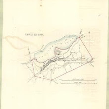
Linlithgow
collection: pilotnum_gcps: 4
center: 55.976895,-3.602468
user_name: georeferencer.org
date_time: 05/22/2012 15:30
View this map in ...
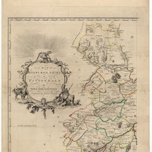
A map of Roxburghshire or Tiviotdale.
collection: pilotnum_gcps: 20
center: 55.556922,-2.865892
user_name: Glen Robson
date_time: 09/05/2012 15:25
View this map in ...
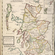
Scotland divided into its Shires / by H. Moll.
collection: pilotnum_gcps: 53
center: 56.835761,-4.816014
user_name: Glen Robson, Andy Arthur
date_time: 06/24/2015 18:13
View this map in ...
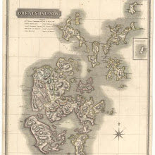
Orkney Islands.
collection: pilotnum_gcps: 4
center: 59.024011,-2.949681
user_name: georeferencer.org
date_time: 05/22/2012 15:43
View this map in ...
Topographical and military map of the counties of Aberdeen, Banff and Kincardine.
collection: pilotnum_gcps: 3
center: 56.972707,-3.568875
user_name: georeferencer.org
date_time: 05/22/2012 16:16
View this map in ...

Mappe of Wast Lothian comonly called Linlithgowshire / authore Johanne Adair.
collection: pilotnum_gcps: 42
center: 55.947989,-3.556599
user_name: Andy Arthur
date_time: 11/26/2015 01:26
View this map in ...
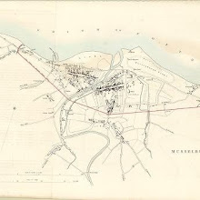
Musselburgh
collection: pilotnum_gcps: 4
center: 55.940581,-3.051369
user_name: georeferencer.org
date_time: 05/22/2012 16:14
View this map in ...
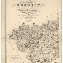
The County of Berwick.
collection: pilotnum_gcps: 4
center: 55.761687,-2.695349
user_name: michael_cairns@lineone.net
date_time: 09/09/2012 17:27
View this map in ...
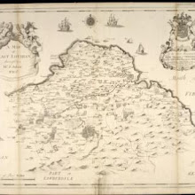
A map of East Lothian / survey'd by J. Adair.
collection: pilotnum_gcps: 45
center: 55.963008,-2.721176
user_name: Nicola Stratton, David Connolly, Andy Arthur
date_time: 06/28/2015 19:33
View this map in ...

Map of the City of Glasgow and suburbs.
collection: pilotnum_gcps: 6
center: 55.862386,-4.216629
user_name: georeferencer.org
date_time: 05/22/2012 16:25
View this map in ...

Nithia Vicecomitatus, The Shirifdome of Nidis-dail / auctore Timotheo Pont.
collection: pilotnum_gcps: 18
center: 55.219060,-3.844640
user_name: Andy Arthur
date_time: 01/21/2016 12:26
View this map in ...
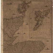
A new and complete map of Scotland and islands thereto belonging.
collection: pilotnum_gcps: 13
center: 58.144910,-2.902041
user_name: Tom Armitage
date_time: 11/20/2012 11:47
View this map in ...
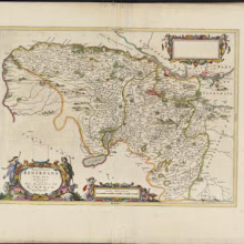
Praefectura Renfroana, vulgo, dicta Baronia. The Baronie of Renfrow / Timotheus Pont Auctor.
collection: pilotnum_gcps: 3
center: 55.876325,-4.349432
user_name: michael_cairns@lineone.net, Campbell Russell
date_time: 12/18/2015 12:24
View this map in ...
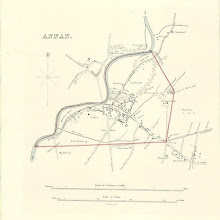
Annan
collection: pilotnum_gcps: 5
center: 54.985395,-3.261971
user_name: georeferencer.org
date_time: 05/22/2012 15:44
View this map in ...

Aberdeen
collection: pilotnum_gcps: 6
center: 57.150164,-2.117858
user_name: georeferencer.org
date_time: 05/22/2012 15:23
View this map in ...
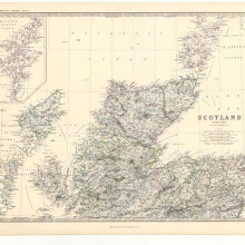
Scotland.
collection: pilotnum_gcps: 4
center: 58.130918,-4.741358
user_name: georeferencer.org
date_time: 05/22/2012 16:17
View this map in ...
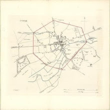
Cupar
collection: pilotnum_gcps: 5
center: 56.315745,-3.015006
user_name: georeferencer.org
date_time: 05/22/2012 16:02
View this map in ...
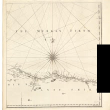
A chart of part of the North of Scotland, from Banff to Duncansby Head.
collection: pilotnum_gcps: 3
center: 57.814485,-2.915508
user_name: georeferencer.org
date_time: 05/22/2012 15:42
View this map in ...
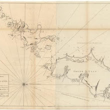
The south part of Long Island from Bara Head to Benbecula I.
collection: pilotnum_gcps: 5
center: 57.090375,-7.378150
user_name: michael_cairns@lineone.net
date_time: 09/15/2012 18:23
View this map in ...
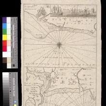
De reede van 't Leith van Edenburgh = De rivier van Edenburgh ; Afteekening van Nieuwe en Oud Aberdeene aan de oostkust van Shotland. De rivier van Edenburgh. Afteekening van Nieuwe en Oud A
collection: pilotnum_gcps: 7
center: 57.158620,-2.066458
user_name: ChrisFleet, Andy A
date_time: 03/01/2016 10:19
View this map in ...
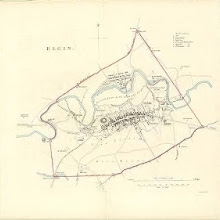
Elgin
collection: pilotnum_gcps: 4
center: 57.650103,-3.320630
user_name: georeferencer.org
date_time: 05/22/2012 16:30
View this map in ...
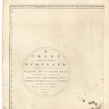
A chart of part of the North of Scotland, from Banff to Duncansby Head.
collection: pilotnum_gcps: 3
center: 58.493317,-3.936298
user_name: michael_cairns@lineone.net
date_time: 09/16/2012 16:02
View this map in ...
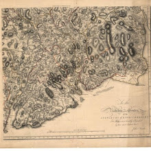
The Stewartry of Kirkcudbright.
collection: pilotnum_gcps: 9
center: 54.884489,-3.837435
user_name: bkerr
date_time: 09/19/2012 08:48
View this map in ...
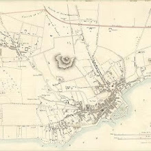
Dundee
collection: pilotnum_gcps: 4
center: 56.466833,-2.983248
user_name: georeferencer.org
date_time: 05/22/2012 16:17
View this map in ...

Driemuy
collection: pilotnum_gcps: 3
center: 57.971732,-3.988931
user_name: bkerr
date_time: 09/18/2012 16:41
View this map in ...
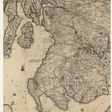
Scotland, drawn from a series of angles and astronomical observations…
collection: pilotnum_gcps: 9
center: 55.290083,-4.614322
user_name: bkerr
date_time: 09/20/2012 09:47
View this map in ...
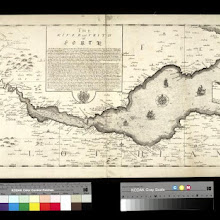
The River and Frith [sic] of Forth ... / Richard Cooper sculpt.
collection: pilotnum_gcps: 11
center: 56.057472,-3.260169
user_name: ChrisFleet
date_time: 04/17/2013 15:05
View this map in ...

Gellatly's New Map of the country 12 miles round Edinburgh.
collection: pilotnum_gcps: 9
center: 55.899360,-3.225556
user_name: ChrisFleet
date_time: 04/19/2014 09:04
View this map in ...

Craigtown; Balblair; Kirkton; Culmaily
collection: pilotnum_gcps: 5
center: 57.960213,-4.032228
user_name: bkerr
date_time: 09/20/2012 09:22
View this map in ...
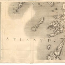
Map of Scotland from the latest surveys.
collection: pilotnum_gcps: 8
center: 56.322790,-6.986185
user_name: bkerr
date_time: 09/20/2012 10:57
View this map in ...
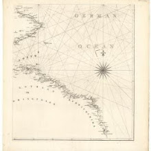
A chart of part of the South of Scotland, from Berwick upon Tweed to Skateraw Harbour in the County of Kincardine…
collection: pilotnum_gcps: 10
center: 56.021700,-2.276051
user_name: bkerr
date_time: 09/20/2012 10:16
View this map in ...
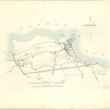
Dunbar
collection: pilotnum_gcps: 4
center: 56.000476,-2.521658
user_name: philip
date_time: 06/13/2012 22:18
View this map in ...
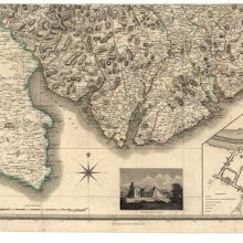
Kirkcudbright-Shire.
collection: pilotnum_gcps: 10
center: 54.801953,-4.124076
user_name: bkerr
date_time: 01/11/2013 16:18
View this map in ...

Fife with Kinross Shire.
collection: pilotnum_gcps: 4
center: 56.096418,-3.395458
user_name: georeferencer.org
date_time: 05/22/2012 15:14
View this map in ...
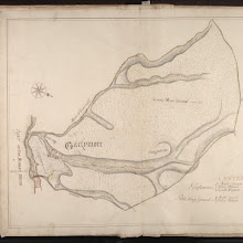
Gartymore
collection: pilotnum_gcps: 3
center: 58.112473,-3.693864
user_name: michael_cairns@lineone.net
date_time: 12/26/2012 19:57
View this map in ...

Northern Part of Aberdeen & Banff Shires.
collection: pilotnum_gcps: 22
center: 57.513481,-3.370227
user_name: McVitele Charly
date_time: 12/30/2012 18:11
View this map in ...

Black's new large map of Scotland.
collection: pilotnum_gcps: 6
center: 55.123527,-2.882576
user_name: michael_cairns@lineone.net
date_time: 12/31/2012 17:33
View this map in ...
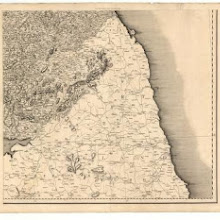
Map of Scotland from the latest surveys.
collection: pilotnum_gcps: 94
center: 55.181000,-2.091784
user_name: georeferencer.org
date_time: 05/22/2012 15:36
View this map in ...
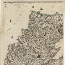
Scotland, drawn from a series of angles and astronomical observations…
collection: pilotnum_gcps: 9
center: 58.127008,-4.923336
user_name: georeferencer.org
date_time: 05/22/2012 15:27
View this map in ...
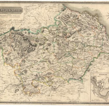
Berwick-Shire.
collection: pilotnum_gcps: 20
center: 55.738750,-2.424865
user_name: georeferencer.org
date_time: 05/22/2012 15:57
View this map in ...

Scotland.
collection: pilotnum_gcps: 6
center: 55.680189,-4.736116
user_name: michael_cairns@lineone.net
date_time: 12/30/2012 20:46
View this map in ...
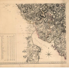
The Stewartry of Kirkcudbright.
collection: pilotnum_gcps: 6
center: 54.878628,-4.402668
user_name: michael_cairns@lineone.net
date_time: 01/02/2013 19:11
View this map in ...
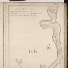
Lothbeg
collection: pilotnum_gcps: 5
center: 58.077931,-3.809567
user_name: bkerr
date_time: 01/11/2013 17:26
View this map in ...
Topographical and military map of the counties of Aberdeen, Banff and Kincardine.
collection: pilotnum_gcps: 4
center: 57.478041,-3.588311
user_name: michael_cairns@lineone.net
date_time: 01/04/2013 19:56
View this map in ...
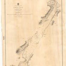
Loch Eil, leading to the Caledonian Canal
collection: pilotnum_gcps: 4
center: 56.767185,-5.213157
user_name: michael_cairns@lineone.net
date_time: 01/01/2013 20:33
View this map in ...

Map of the County of Berwick.
collection: pilotnum_gcps: 8
center: 55.867575,-2.189585
user_name: bkerr
date_time: 01/21/2013 10:14
View this map in ...
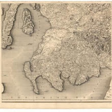
Map of Scotland from the latest surveys.
collection: pilotnum_gcps: 18
center: 55.119951,-4.512904
user_name: bkerr
date_time: 01/11/2013 16:47
View this map in ...

Dornoch
collection: pilotnum_gcps: 4
center: 57.874642,-4.027241
user_name: georeferencer.org
date_time: 05/22/2012 14:52
View this map in ...
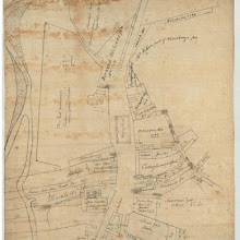
Town of Moffat.
collection: pilotnum_gcps: 3
center: 55.333131,-3.444350
user_name: georeferencer.org
date_time: 05/22/2012 16:21
View this map in ...
The Stewartry of Kirkcudbright.
collection: pilotnum_gcps: 19
center: 55.116891,-4.454096
user_name: georeferencer.org
date_time: 05/22/2012 16:01
View this map in ...
[A map of Strath Devon and the district between the Ochils and the Forth]
collection: pilotnum_gcps: 29
center: 56.130838,-3.780573
user_name: Abi Brownlee, Andy Arthur
date_time: 02/11/2016 23:32
View this map in ...
Northern Part of Inverness Shire.
collection: pilotnum_gcps: 4
center: 57.415936,-3.975176
user_name: michael_cairns@lineone.net
date_time: 02/25/2013 19:13
View this map in ...
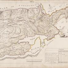
No. 14 - Plan of the Farm of Ledbeg.
collection: pilotnum_gcps: 6
center: 58.079433,-5.023667
user_name: interzone
date_time: 03/04/2013 01:01
View this map in ...
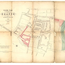
Feuing plan of the lands of Grange.
collection: pilotnum_gcps: 9
center: 55.935844,-3.187178
user_name: georeferencer.org
date_time: 05/22/2012 15:03
View this map in ...
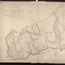
Navidale; E Helmsdale
collection: pilotnum_gcps: 4
center: 58.140609,-3.632107
user_name: michael_cairns@lineone.net
date_time: 03/06/2013 19:19
View this map in ...
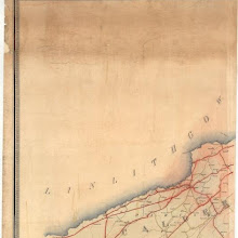
Map of the County of Edinburgh shewing the turnpike and statute labour roads... etc.
collection: pilotnum_gcps: 32
center: 55.835989,-3.629493
user_name: michael_cairns@lineone.net, Martin MacGregor
date_time: 03/03/2016 16:47
View this map in ...
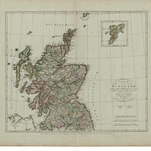
Charte von Scotland.
collection: pilotnum_gcps: 17
center: 57.248266,-2.688475
user_name: ChrisFleet
date_time: 05/29/2012 20:11
View this map in ...
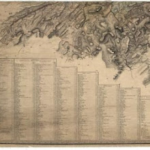
Map of the shire of Edinburgh.
collection: pilotnum_gcps: 6
center: 55.727240,-3.517547
user_name: georeferencer.org
date_time: 05/22/2012 14:44
View this map in ...

Scotland.
collection: pilotnum_gcps: 9
center: 56.664802,-4.799037
user_name: ChrisFleet
date_time: 03/07/2013 14:41
View this map in ...
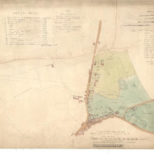
Plan of Baron Norton's Feu at Norton Place.
collection: pilotnum_gcps: 8
center: 55.958202,-3.173393
user_name: Neville Kingdon
date_time: 07/15/2014 10:27
View this map in ...
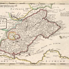
The Shires of Fife and Kinros / by H. Moll.
collection: pilotnum_gcps: 29
center: 56.222191,-3.046197
user_name: michael_cairns@lineone.net, Andy Arthur
date_time: 02/16/2016 21:53
View this map in ...
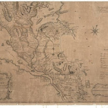
A map of the Shire of Dumbarton.
collection: pilotnum_gcps: 6
center: 55.982535,-4.484688
user_name: michael_cairns@lineone.net
date_time: 03/10/2013 17:39
View this map in ...
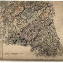
Map of the shire of Edinburgh.
collection: pilotnum_gcps: 5
center: 55.748668,-3.009669
user_name: michael_cairns@lineone.net
date_time: 03/07/2013 19:40
View this map in ...

Culross
collection: pilotnum_gcps: 4
center: 56.058389,-3.626349
user_name: georeferencer.org
date_time: 05/22/2012 16:28
View this map in ...
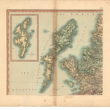
A new map of Scotland, from the latest authorities.
collection: pilotnum_gcps: 4
center: 57.671485,-7.040042
user_name: georeferencer.org
date_time: 05/22/2012 15:49
View this map in ...
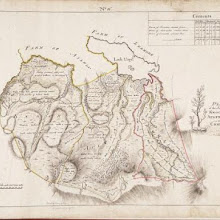
No. 16 - Plan of the Farms of Knockon, Aultnachie and Cromald [Cromalt].
collection: pilotnum_gcps: 35
center: 58.039251,-4.943244
user_name: Xuigh
date_time: 05/03/2013 22:59
View this map in ...
A Mape of the countries about Stirling / authore Jo. Adair.
collection: pilotnum_gcps: 80
center: 56.119470,-3.944855
user_name: JMVDK, Andy Arthur
date_time: 02/19/2016 15:09
View this map in ...

Carricta meridionalis, [vulgo], The South part of Carrick / auct. Timoth. Pont.
collection: pilotnum_gcps: 87
center: 55.139476,-4.796258
user_name: Jamesks, Andy Arthur
date_time: 03/14/2016 09:08
View this map in ...
Andrews's new and accurate travelling map of the roads of Scotland
collection: pilotnum_gcps: 16
center: 57.549108,-4.320988
user_name: Elger Heere
date_time: 05/13/2013 09:31
View this map in ...
Pascaart van de noortcust van Yrland als meede de westcust van Schotland / by Johannes van Keulen.
collection: pilotnum_gcps: 4
center: 56.873910,-6.497458
user_name: Tiemen
date_time: 05/15/2013 20:42
View this map in ...
Ru Ruag to Gruinard Bay, including Loch Ewe and Gairloch
collection: pilotnum_gcps: 7
center: 57.793361,-5.675843
user_name: Elger Heere
date_time: 05/08/2013 11:15
View this map in ...
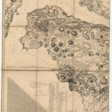
Map of the County of Renfrew.
collection: pilotnum_gcps: 5
center: 55.833770,-4.771743
user_name: Kevin van der Weij
date_time: 05/15/2013 07:44
View this map in ...

Orcadum et Shetlandiae Insularum accuratissima descriptio.
collection: pilotnum_gcps: 127
center: 60.168912,-1.171564
user_name: Jamesks, Robert Hellstrom, Andy Arthur
date_time: 03/09/2016 15:04
View this map in ...
Jedburgh and its environs.
collection: pilotnum_gcps: 3
center: 55.481895,-2.550416
user_name: georeferencer.org
date_time: 05/22/2012 15:51
View this map in ...
Plan of the Town of Stonehaven from actual survey.
collection: pilotnum_gcps: 3
center: 56.964355,-2.210140
user_name: georeferencer.org
date_time: 05/22/2012 15:33
View this map in ...
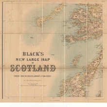
Black's new large map of Scotland.
collection: pilotnum_gcps: 20
center: 56.143639,-6.646220
user_name: Elger Heere
date_time: 05/08/2013 11:44
View this map in ...
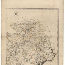
A map of Roxburghshire or Tiviotdale.
collection: pilotnum_gcps: 15
center: 55.554929,-2.397265
user_name: Elger Heere
date_time: 05/08/2013 13:29
View this map in ...
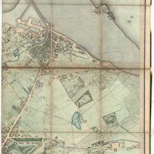
Johnston's plan of Edinburgh & Leith.
collection: pilotnum_gcps: 55
center: 55.958260,-3.161920
user_name: Andy Arthur
date_time: 02/08/2016 13:03
View this map in ...
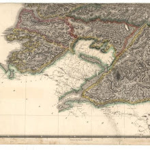
Southern Part of Inverness Shire.
collection: pilotnum_gcps: 3
center: 56.788983,-5.361852
user_name: georeferencer.org
date_time: 05/22/2012 15:29
View this map in ...
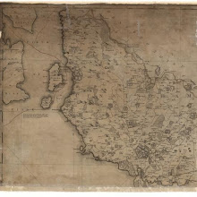
A new map of Ayrshire…
collection: pilotnum_gcps: 6
center: 55.734599,-4.805268
user_name: georeferencer.org
date_time: 05/22/2012 14:56
View this map in ...

Scotiae Regni Antiqvissimi Accvrata Descriptio / Io Leslavs, Epus Rossen. Scotiae Regni Antiquissimi Accurata Descriptio.
collection: pilotnum_gcps: 37
center: 57.141843,-4.135917
user_name: Jerome Busquet, Andy A, Martin MacGregor
date_time: 03/04/2016 15:27
View this map in ...
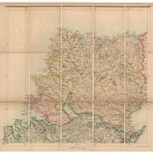
Black's new large map of Scotland.
collection: pilotnum_gcps: 6
center: 58.251680,-4.757384
user_name: Kevin van der Weij
date_time: 05/15/2013 08:28
View this map in ...
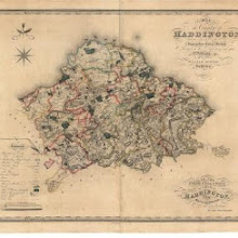
Map of the county of Haddington.
collection: pilotnum_gcps: 27
center: 55.929978,-2.687034
user_name: Leander Bouwman, Andy Arthur
date_time: 03/27/2016 22:37
View this map in ...
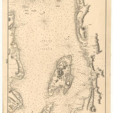
Firth of Clyde, between Little Cumbrae and Toward Point
collection: pilotnum_gcps: 20
center: 55.783967,-4.930277
user_name: Petr Pridal
date_time: 07/17/2013 07:04
View this map in ...
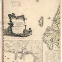
This map of Argyllshire…
collection: pilotnum_gcps: 5
center: 56.004334,-6.661666
user_name: Thijs
date_time: 05/15/2013 09:02
View this map in ...
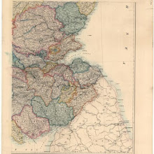
Stanford's map of Scotland.
collection: pilotnum_gcps: 8
center: 55.757361,-2.879660
user_name: Petr Pridal
date_time: 06/20/2013 20:44
View this map in ...
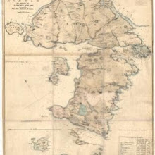
Map of Harris.
collection: pilotnum_gcps: 4
center: 57.845677,-6.986363
user_name: georeferencer.org
date_time: 05/22/2012 15:14
View this map in ...
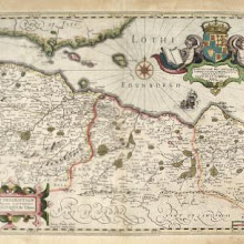
A new description of the shyres Lothian and Linlitquo / T. Pont ; Jodocus Hondius caelavit sumptibus Andrae Hart.
collection: pilotnum_gcps: 87
center: 55.947179,-3.090866
user_name: Andy Arthur
date_time: 02/21/2016 16:33
View this map in ...
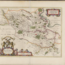
Sterlinensis praefectura, [vulgo], Sterlin-Shyr / Auct. Timoth. Pont.
collection: pilotnum_gcps: 26
center: 55.988825,-3.896588
user_name: Andy A
date_time: 03/04/2016 10:35
View this map in ...
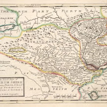
The South Part of Perth Shire Containing Perth, Strathern, Stormount and Cars of Gourie &c / by H. Moll.
collection: pilotnum_gcps: 40
center: 56.409760,-3.780294
user_name: Andy A
date_time: 03/02/2016 18:25
View this map in ...
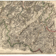
Edinburgh Shire.
collection: pilotnum_gcps: 4
center: 55.771684,-3.030488
user_name: michael_cairns@lineone.net
date_time: 05/27/2013 18:11
View this map in ...
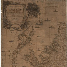
A new and complete map of Scotland and islands thereto belonging.
collection: pilotnum_gcps: 9
center: 58.103297,-6.276849
user_name: michael_cairns@lineone.net
date_time: 06/11/2013 18:17
View this map in ...
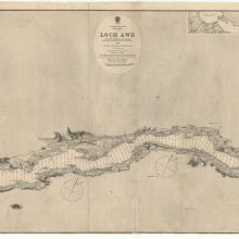
Loch Awe
collection: pilotnum_gcps: 37
center: 56.309494,-5.259839
user_name: McVitele Charly
date_time: 07/24/2013 08:46
View this map in ...
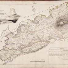
No. 13 - Plan of the Farms of Knockneach [Cnoc nan Each], Culach [Culag] and Inverchirkag [Inverkirkaig].
collection: pilotnum_gcps: 9
center: 58.126877,-5.198801
user_name: Jamesks
date_time: 07/01/2013 15:21
View this map in ...
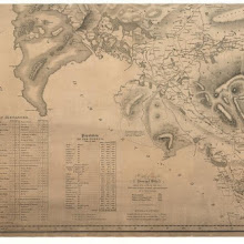
To the Noblemen and Gentlemen of the County of Stirling…
collection: pilotnum_gcps: 5
center: 56.001794,-4.479103
user_name: bkerr
date_time: 09/20/2012 09:57
View this map in ...
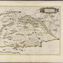
Fifae pars occidentalis, [vulgo], The West Part of Fife.
collection: pilotnum_gcps: 23
center: 56.155596,-3.301138
user_name: Andy Arthur
date_time: 02/02/2016 10:11
View this map in ...

Oban Bay; Troon Harbour
collection: pilotnum_gcps: 5
center: 55.548688,-4.666720
user_name: bkerr
date_time: 09/28/2012 10:34
View this map in ...
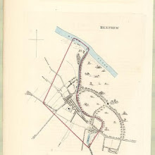
Renfrew
collection: pilotnum_gcps: 3
center: 55.879250,-4.384406
user_name: georeferencer.org
date_time: 05/22/2012 15:21
View this map in ...
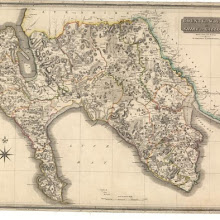
County of Wigtown or Shire of Galloway…
collection: pilotnum_gcps: 74
center: 54.850094,-4.705508
user_name: ChrisFleet
date_time: 04/18/2013 14:44
View this map in ...

To the Noblemen and Gentlemen of the County of Stirling…
collection: pilotnum_gcps: 9
center: 55.978721,-3.894651
user_name: bkerr
date_time: 09/20/2012 10:42
View this map in ...
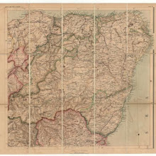
Black's new large map of Scotland.
collection: pilotnum_gcps: 13
center: 57.208070,-2.746305
user_name: bkerr, Andy Arthur
date_time: 02/01/2016 10:59
View this map in ...
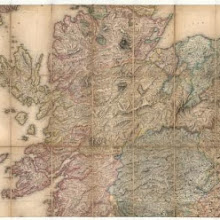
A map of Scotland divided into counties shewing the principal roads, railways, rivers, canals... on a scale of five miles to an inch.
collection: pilotnum_gcps: 4
center: 57.059769,-4.760044
user_name: michael_cairns@lineone.net
date_time: 09/20/2012 18:25
View this map in ...
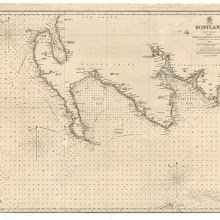
Firth of Solway to Loch Ryan.
collection: pilotnum_gcps: 15
center: 54.741449,-4.735131
user_name: bkerr
date_time: 09/20/2012 11:10
View this map in ...
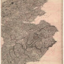
Map of Scotland constructed from original materials.
collection: pilotnum_gcps: 4
center: 55.644771,-3.236723
user_name: BMArchives
date_time: 09/21/2012 12:55
View this map in ...
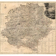
The counties of Perth and Clackmannan.
collection: pilotnum_gcps: 7
center: 56.473708,-3.907955
user_name: bkerr
date_time: 09/20/2012 12:10
View this map in ...
Firth of Forth: Fisherrow to Edgar
collection: pilotnum_gcps: 5
center: 56.012509,-3.234262
user_name: georeferencer.org
date_time: 05/22/2012 15:49
View this map in ...
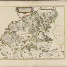
Gallovidiae pars media quae Deam et Cream fluvios interjacet, [vulgo], The Middle part of Galloway, which lyeth betweene the rivers Dee and Cree / auct. Timoth. Pont.
collection: pilotnum_gcps: 54
center: 55.011865,-4.275091
user_name: Andy A
date_time: 02/26/2016 21:04
View this map in ...

[Orkney Islands, Shetland Islands.]
collection: pilotnum_gcps: 7
center: 59.759951,-2.097379
user_name: ChrisFleet
date_time: 06/07/2013 14:51
View this map in ...
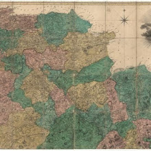
The county of Lanark from actual survey.
collection: pilotnum_gcps: 8
center: 55.782876,-3.881753
user_name: bkerr
date_time: 09/21/2012 09:47
View this map in ...
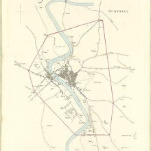
Dumfries
collection: pilotnum_gcps: 4
center: 55.065007,-3.608298
user_name: georeferencer.org
date_time: 05/22/2012 15:06
View this map in ...

Plan of the Town of Elgin from actual survey.
collection: pilotnum_gcps: 4
center: 57.650460,-3.316638
user_name: georeferencer.org
date_time: 05/22/2012 15:41
View this map in ...
Wester Helmsdale
collection: pilotnum_gcps: 5
center: 58.112774,-3.694794
user_name: bkerr
date_time: 09/21/2012 10:47
View this map in ...

No. 5 - A Plan of the Farms of Loch Beanoch [Beannach], Nedd, Drumbeg and Culkein [Culkein Drumbeg]…
collection: pilotnum_gcps: 6
center: 58.214389,-5.197375
user_name: bkerr
date_time: 09/21/2012 14:13
View this map in ...
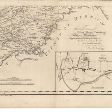
Map of the County of Berwick.
collection: pilotnum_gcps: 5
center: 55.635639,-2.147284
user_name: bkerr
date_time: 09/21/2012 14:32
View this map in ...
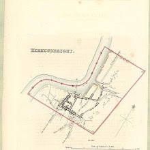
Kirkcudbright
collection: pilotnum_gcps: 4
center: 54.836541,-4.052544
user_name: georeferencer.org
date_time: 05/22/2012 15:10
View this map in ...
The Shire of Berwick alias the Mers or March and Lauderdale / by H. Moll.
collection: pilotnum_gcps: 21
center: 55.768677,-2.359390
user_name: Andy Arthur
date_time: 02/11/2016 23:14
View this map in ...
Sketch of the City of Edinburgh and Leith.
collection: pilotnum_gcps: 21
center: 55.953230,-3.175781
user_name: Andy Arthur
date_time: 06/14/2015 10:16
View this map in ...
Coila Provincia, [or], The province of Kyle / auct. Timoth. Pont.
collection: pilotnum_gcps: 76
center: 55.477116,-4.362636
user_name: bkerr, Andy Arthur
date_time: 03/07/2016 22:27
View this map in ...
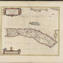
Cantyra Chersonesus, [vulgo], Cantyr, a Demie-yland / auctor Timoth. Pont.
collection: pilotnum_gcps: 27
center: 55.574101,-5.642807
user_name: Andy Arthur
date_time: 02/01/2016 15:34
View this map in ...
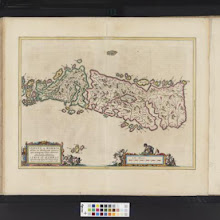
Leogus et Haraia insulae ex Aebudarum numero, quae quamquam isthmo cohaereant, pro diversis habentur. Lewis and Harray of the numbre of the Western Yles, which two although they ioyne be a necke of la
collection: pilotnum_gcps: 22
center: 58.063259,-6.600507
user_name: bkerr, Andy Arthur
date_time: 01/26/2016 13:05
View this map in ...
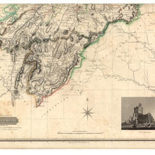
Roxburghshire.
collection: pilotnum_gcps: 11
center: 55.184999,-2.636006
user_name: georeferencer.org
date_time: 05/22/2012 14:49
View this map in ...
This draught of the town and sea coast about Peterhead, commonly call'd Buchan Ness / Jo. Jeffray Prest'r. delineavit an. 1759 ; R. Cooper fecit.
collection: pilotnum_gcps: 18
center: 57.493896,-1.784284
user_name: David Davidson, Andy Arthur
date_time: 01/26/2016 14:08
View this map in ...
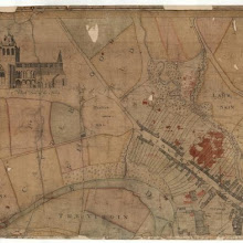
Jedburgh and its environs.
collection: pilotnum_gcps: 4
center: 55.474884,-2.558140
user_name: georeferencer.org
date_time: 05/22/2012 16:20
View this map in ...
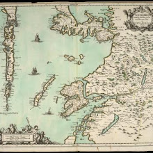
Lochabria, omnesq, Insulae versus Occidentem sitae, ut Visto, Mulla, aliaeque.
collection: pilotnum_gcps: 105
center: 56.896414,-6.106060
user_name: Andy A
date_time: 02/29/2016 21:57
View this map in ...
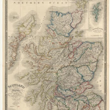
Scotland with its islands…
collection: pilotnum_gcps: 5
center: 56.826296,-4.812133
user_name: Rob Quincey
date_time: 09/26/2012 13:32
View this map in ...

Paisley
collection: pilotnum_gcps: 3
center: 55.843796,-4.426280
user_name: georeferencer.org
date_time: 05/22/2012 15:55
View this map in ...

Map of the county of Haddington.
collection: pilotnum_gcps: 7
center: 55.931896,-2.459479
user_name: bkerr
date_time: 09/25/2012 10:47
View this map in ...
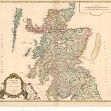
Le Royaume d'Ecosse divisé en shires ou comtes.
collection: pilotnum_gcps: 31
center: 56.519960,-4.489112
user_name: ChrisFleet
date_time: 10/25/2012 19:58
View this map in ...
Map embracing extensive portions of the Counties of Roxburgh, Berwick, Selkirk & Midlothian and Part of Northumberland. Minutely & accurately surveyed… by Crawford and Brooke
collection: pilotnum_gcps: 40
center: 55.547340,-2.569276
user_name: bkerr, Andy Arthur
date_time: 02/02/2016 19:58
View this map in ...
Plan of the Town of Arbroath from actual survey.
collection: pilotnum_gcps: 4
center: 56.558835,-2.585666
user_name: georeferencer.org
date_time: 05/22/2012 14:54
View this map in ...
The Isle of Iura &c. Part of Argyle Shire / by H. Moll.
collection: pilotnum_gcps: 37
center: 56.002271,-5.925447
user_name: Andy Arthur
date_time: 02/08/2016 10:22
View this map in ...
Plan of the Town of Selkirk from actual survey.
collection: pilotnum_gcps: 7
center: 55.546751,-2.841745
user_name: georeferencer.org
date_time: 05/22/2012 16:33
View this map in ...

The West Part of Galloway : Contains The Shire of Wigton [i.e. Wigtown] / by H. Moll.
collection: pilotnum_gcps: 28
center: 54.905621,-4.888296
user_name: bkerr, Andy Arthur
date_time: 02/03/2016 21:28
View this map in ...
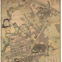
Old and New Town of Edinburgh and Leith with the proposed docks.
collection: pilotnum_gcps: 12
center: 55.960085,-3.187508
user_name: ChrisFleet
date_time: 04/29/2014 07:11
View this map in ...
The south part of Sky Island and the adjacent main of Scotland.
collection: pilotnum_gcps: 11
center: 57.230533,-6.039722
user_name: bkerr
date_time: 09/27/2012 17:38
View this map in ...
Plan of the Town of Kirkcudbright.
collection: pilotnum_gcps: 5
center: 54.836291,-4.052198
user_name: georeferencer.org
date_time: 05/22/2012 14:40
View this map in ...
A map of Roxburghshire or Tiviotdale.
collection: pilotnum_gcps: 9
center: 55.245836,-2.874726
user_name: bkerr
date_time: 09/25/2012 11:45
View this map in ...
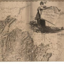
Map of Dumfries-shire.
collection: pilotnum_gcps: 22
center: 55.353152,-3.069526
user_name: Daniel del Rey
date_time: 10/17/2012 12:48
View this map in ...

Perthshire with Clackmannan.
collection: pilotnum_gcps: 4
center: 56.784252,-3.149633
user_name: georeferencer.org
date_time: 05/22/2012 14:49
View this map in ...
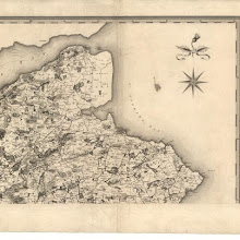
Map of the counties of Fife and Kinross.
collection: pilotnum_gcps: 19
center: 56.354542,-2.793882
user_name: georeferencer.org
date_time: 05/22/2012 14:43
View this map in ...

Arania Insula in aestuario Glottae, [vulgo], The Yle of Arren in the Fyrth of Clyd / Timotheo Pont, auctore.
collection: pilotnum_gcps: 26
center: 55.498559,-5.219700
user_name: Andy Arthur
date_time: 02/01/2016 15:58
View this map in ...
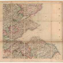
Black's new large map of Scotland.
collection: pilotnum_gcps: 31
center: 56.163856,-2.846875
user_name: Toby Speight
date_time: 10/08/2012 14:51
View this map in ...

Dunfermline
collection: pilotnum_gcps: 5
center: 56.068516,-3.469052
user_name: georeferencer.org
date_time: 05/22/2012 16:03
View this map in ...
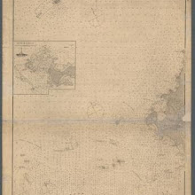
Monach and Haskeir Is. with the adjacent coast of North Uist.
collection: pilotnum_gcps: 7
center: 57.602721,-7.622812
user_name: georeferencer.org
date_time: 05/22/2012 15:53
View this map in ...
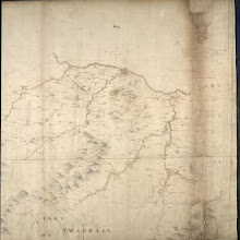
[Map of Midlothian]
collection: pilotnum_gcps: 110
center: 55.899742,-3.197419
user_name: Andy Arthur
date_time: 02/10/2016 12:35
View this map in ...

Perth
collection: pilotnum_gcps: 4
center: 56.396147,-3.440237
user_name: georeferencer.org
date_time: 05/22/2012 15:51
View this map in ...
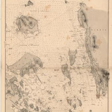
Sound of Harris
collection: pilotnum_gcps: 4
center: 57.734357,-7.106771
user_name: georeferencer.org
date_time: 05/22/2012 15:18
View this map in ...
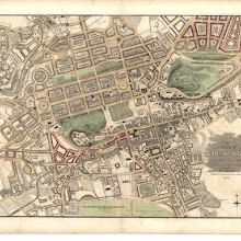
Plan of the City of Edinburgh, including all the latest and intended improvements.
collection: pilotnum_gcps: 25
center: 55.950864,-3.193357
user_name: Andy A
date_time: 03/01/2016 10:45
View this map in ...

Buthe Insula, vulgo, The Yle of Boot / Auct. Tim. Pont.
collection: pilotnum_gcps: 21
center: 55.775241,-5.081148
user_name: Andy Arthur
date_time: 02/06/2016 20:59
View this map in ...
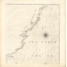
A chart of part of the South of Scotland, from Berwick upon Tweed to Skateraw Harbour in the County of Kincardine…
collection: pilotnum_gcps: 5
center: 56.729493,-2.302397
user_name: georeferencer.org
date_time: 05/22/2012 16:12
View this map in ...
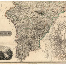
Southern Part of Lanarkshire.
collection: pilotnum_gcps: 3
center: 55.464038,-3.635211
user_name: michael_cairns@lineone.net
date_time: 02/23/2013 19:00
View this map in ...
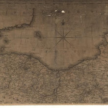
Map of the three Lothians.
collection: pilotnum_gcps: 4
center: 55.991235,-3.073806
user_name: michael_cairns@lineone.net
date_time: 02/25/2013 09:59
View this map in ...
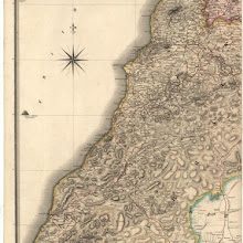
Southern Part of Ayrshire.
collection: pilotnum_gcps: 4
center: 55.206543,-4.829369
user_name: georeferencer.org
date_time: 05/22/2012 15:38
View this map in ...

Extima Scotiae septentrionalis ora, ubi Provinciae sunt Rossia, Sutherlandia, Cathenesia, Strath-Naverniae, cum vicinis regiunculis quae eis subsunt, etiamque Moravia / R. Gordonius à Strath-loch coll
collection: pilotnum_gcps: 179
center: 58.016452,-4.468752
user_name: Andy Arthur
date_time: 03/12/2016 12:16
View this map in ...
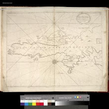
The South Part of the Isles of Shetland.
collection: pilotnum_gcps: 12
center: 60.080067,-1.195710
user_name: ChrisFleet
date_time: 03/04/2013 08:54
View this map in ...
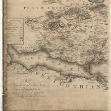
Counties of Fife and Kinross with the Rivers Forth and Tay
collection: pilotnum_gcps: 3
center: 56.024674,-3.559655
user_name: georeferencer.org
date_time: 05/22/2012 15:28
View this map in ...
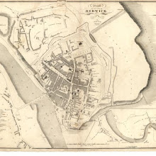
Plan of the Town of Berwick from actual survey.
collection: pilotnum_gcps: 28
center: 55.769488,-2.001613
user_name: georeferencer.org
date_time: 05/22/2012 15:41
View this map in ...

Southern Part of Ross and Cromarty Shires.
collection: pilotnum_gcps: 8
center: 58.188819,-6.646282
user_name: interzone
date_time: 04/18/2013 05:31
View this map in ...

Scotiae pars septentrionalis.
collection: pilotnum_gcps: 128
center: 58.090078,-4.563853
user_name: Jamesks, Andy Arthur
date_time: 03/09/2016 20:38
View this map in ...

Roxburghshire.
collection: pilotnum_gcps: 10
center: 55.611274,-2.654927
user_name: Thijs
date_time: 05/15/2013 08:18
View this map in ...

Loch Carron and Loch Kishorn
collection: pilotnum_gcps: 3
center: 57.372354,-5.611036
user_name: georeferencer.org
date_time: 05/22/2012 15:25
View this map in ...
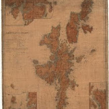
The Shetland Isles.
collection: pilotnum_gcps: 7
center: 60.350123,-1.373009
user_name: JMVDK
date_time: 05/15/2013 07:42
View this map in ...
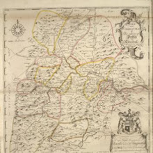
A new and correct map of the Shire of Peebles or Tweeddale / survey'd by Will. Edgar, 1741 ; R. Cooper sculp.
collection: pilotnum_gcps: 40
center: 55.611411,-3.248163
user_name: koen, Andy Arthur
date_time: 02/28/2016 11:43
View this map in ...
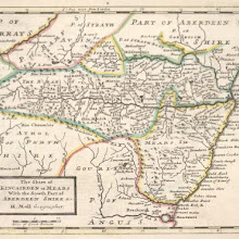
The Shire of Kincairden or Mears with the South Part of Aberdeen Shire &c. / H. Moll.
collection: pilotnum_gcps: 31
center: 56.996826,-2.885766
user_name: Andy Arthur
date_time: 02/25/2016 08:30
View this map in ...
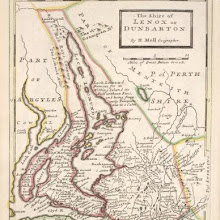
The Shire of Lenox [i.e. Lennox] or Dunbarton / by H. Moll.
collection: pilotnum_gcps: 37
center: 56.111988,-4.536998
user_name: Andy A
date_time: 02/29/2016 22:49
View this map in ...
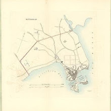
Peterhead
collection: pilotnum_gcps: 4
center: 57.505006,-1.790311
user_name: georeferencer.org
date_time: 05/22/2012 15:03
View this map in ...
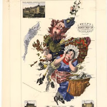
Philp's Comic Map of Scotland.
collection: pilotnum_gcps: 3
center: 56.763865,-5.084239
user_name: georeferencer.org
date_time: 05/22/2012 15:40
View this map in ...
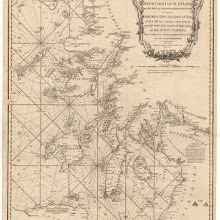
A new chart of the West coast of Scotland from the Mull of Galloway to Dunan Point in Sky.
collection: pilotnum_gcps: 6
center: 55.854865,-5.607235
user_name: 1627846
date_time: 05/15/2013 08:12
View this map in ...
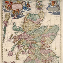
Exactissima Regni Scotiae Tabula tam in septentrionalem et meriodionalem quam in minores earundem provincias insulesq, et undique praetensas accurate divisa / per Nicolaum Visscher.
collection: pilotnum_gcps: 5
center: 56.975738,-4.817188
user_name: Chris Lee
date_time: 03/20/2016 16:58
View this map in ...
Southern Part of Angus Shire.
collection: pilotnum_gcps: 5
center: 56.503185,-2.952248
user_name: robin mank
date_time: 05/15/2013 08:29
View this map in ...
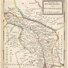
The Shire of Dumfries or Nithisdale / by H. Moll.
collection: pilotnum_gcps: 24
center: 55.206637,-3.800752
user_name: Andy A
date_time: 03/02/2016 15:49
View this map in ...

Plan of Edinburgh, Leith & suburbs, showing the division of the city into thirteen wards in terms of the Edinburgh Municipality Extension Act, 1856.
collection: pilotnum_gcps: 39
center: 55.954440,-3.184983
user_name: Andy A, Martin MacGregor, Andy Arthur
date_time: 03/09/2016 21:07
View this map in ...
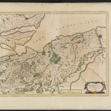
Moravia Scotiae provincia, ex Timothei Pont / scedis descripta et aucta per Robert: Gordonium a Strathloch.
collection: pilotnum_gcps: 66
center: 57.544088,-3.686949
user_name: Andy A
date_time: 02/29/2016 08:02
View this map in ...
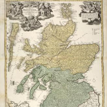
Magnae Britannia : pars septentrionalis qua regnum Scotiae in suas partes et subja centes insulas divisum / Accurata tabula ex archetypo Vischeriano desumta exhibetur imatatore Iohan. Bapt. Homanno, N
collection: pilotnum_gcps: 29
center: 57.002841,-4.444261
user_name: Max Heikenfeld, Leon Deutsch
date_time: 12/31/2016 05:43
View this map in ...
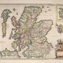
Scotia Regnum.
collection: pilotnum_gcps: 83
center: 56.869248,-6.240659
user_name: michael_cairns@lineone.net, Andy A, Leon Deutsch, Rodriguez
date_time: 03/13/2017 11:03
View this map in ...
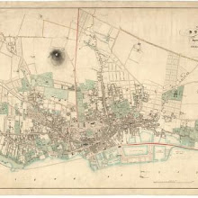
Plan of the town of Dundee, with the improvements now in progress.
collection: pilotnum_gcps: 3
center: 56.463869,-2.980986
user_name: karenc
date_time: 04/16/2017 07:44
View this map in ...
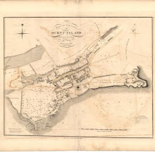
Plan of the Town of Burnt-island from actual survey.
collection: pilotnum_gcps: 13
center: 56.058925,-3.232315
user_name: McVitele Charly, ChrisFleet
date_time: 05/24/2017 06:29
View this map in ...

Sutherland Shire.
collection: pilotnum_gcps: 144
center: 58.241165,-4.456497
user_name: irvann, ChrisFleet
date_time: 06/04/2017 03:53
View this map in ...

Map of the county of Sutherland made on the basis of the trigonometrical survey of Scotland in the years 1831, 1832.
collection: pilotnum_gcps: 301
center: 58.232467,-4.507282
user_name: ChrisFleet
date_time: 06/04/2017 05:15
View this map in ...
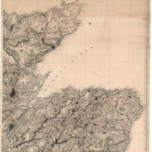
Map of Scotland constructed from original materials.
collection: pilotnum_gcps: 11
center: 57.733556,-3.234824
user_name: michael_cairns@lineone.net, ChrisFleet
date_time: 06/04/2017 05:25
View this map in ...
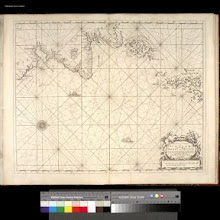
The East Coast of Scotland with the Isles of Orkney and Shetland.
collection: pilotnum_gcps: 13
center: 58.118694,-0.532262
user_name: ChrisFleet, Alexander Corcoran
date_time: 07/12/2017 09:46
View this map in ...
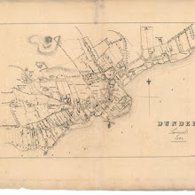
Plan of the Town of Dundee from actual survey.
collection: pilotnum_gcps: 6
center: 56.458685,-2.967157
user_name: James Livesey
date_time: 10/08/2017 14:04
View this map in ...
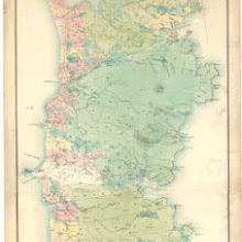
Plan of the island of South Uist.
collection: pilotnum_gcps: 5
center: 57.252272,-7.325125
user_name: michael_cairns@lineone.net, Simon
date_time: 11/16/2017 13:50
View this map in ...

A new and exact map of the River Clyde done by the late Mr. John Adair / now publish'd for the good of the publick by Geo. Scott.
collection: pilotnum_gcps: 134
center: 55.580934,-5.359055
user_name: michael_cairns@lineone.net, ChrisFleet, N Kingdon
date_time: 05/13/2018 13:20